- Goldfield, Iowa
Infobox Settlement
official_name = Goldfield, Iowa
settlement_type =City
nickname =
motto =
imagesize =
image_caption =
image_
imagesize =
image_caption =
image_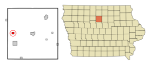
mapsize = 250x200px
map_caption = Location of Goldfield, Iowa
mapsize1 =
map_caption1 =subdivision_type = Country
subdivision_name =
subdivision_type1 = State
subdivision_name1 =
subdivision_type2 = County
subdivision_name2 = Wright
government_footnotes =
government_type =
leader_title =
leader_name =
leader_title1 =
leader_name1 =
established_title =
established_date =unit_pref = Imperial
area_footnotes =area_magnitude =
area_total_km2 = 2.6
area_land_km2 = 2.6
area_water_km2 = 0.0
area_total_sq_mi = 1.0
area_land_sq_mi = 1.0
area_water_sq_mi = 0.0population_as_of = 2000
population_footnotes =
population_total = 680
population_density_km2 = 257.1
population_density_sq_mi = 666.0timezone = Central (CST)
utc_offset = -6
timezone_DST = CDT
utc_offset_DST = -5
elevation_footnotes =
elevation_m = 344
elevation_ft = 1129
latd = 42 |latm = 44 |lats = 5 |latNS = N
longd = 93 |longm = 55 |longs = 13 |longEW = Wpostal_code_type =
ZIP code
postal_code = 50542
area_code = 515
blank_name = FIPS code
blank_info = 19-31530
blank1_name = GNIS feature ID
blank1_info = 0463548
website =
footnotes =Goldfield is a city in Wright County,
Iowa ,United States . The population was 680 at the 2000 census.Geography
Goldfield is located at coor dms|42|44|5|N|93|55|13|W|city (42.734708, -93.920163)GR|1, along the
Boone River . [DeLorme (1998). "Iowa Atlas & Gazetteer". Yarmouth, Maine: DeLorme. ISBN 0-89933-214-5.]According to the
United States Census Bureau , the city has a total area of 1.0square mile s (2.6km² ), all of it land.Demographics
As of the
census GR|2 of 2000, there were 680 people, 295 households, and 194 families residing in the city. Thepopulation density was 666.0 people per square mile (257.4/km²). There were 315 housing units at an average density of 308.5/sq mi (119.2/km²). The racial makeup of the city was 99.26% White, 0.15% Native American, 0.44% from other races, and 0.15% from two or more races. Hispanic or Latino of any race were 1.62% of the population.There were 295 households out of which 27.5% had children under the age of 18 living with them, 56.9% were married couples living together, 5.1% had a female householder with no husband present, and 34.2% were non-families. 29.5% of all households were made up of individuals and 18.0% had someone living alone who was 65 years of age or older. The average household size was 2.31 and the average family size was 2.81.
In the city the population was spread out with 22.6% under the age of 18, 7.9% from 18 to 24, 24.1% from 25 to 44, 22.4% from 45 to 64, and 22.9% who were 65 years of age or older. The median age was 42 years. For every 100 females there were 104.8 males. For every 100 females age 18 and over, there were 102.3 males.
The median income for a household in the city was $32,411, and the median income for a family was $41,250. Males had a median income of $28,409 versus $19,886 for females. The
per capita income for the city was $16,983. About 4.2% of families and 7.2% of the population were below thepoverty line , including 5.6% of those under age 18 and 9.9% of those age 65 or over.Education
Clarion-Goldfield Community Schools serve the education needs of the Goldfield community. The Goldfield Community School provided K-12 education from 1912 to 1981. In 1956 the present Goldfield school building was built. In 1981 Goldfield Community School began whole grade sharing with Clarion Community Schools, the first such arrangement in the state. Clarion is located 8 miles East of Goldfield on Highway 3. At that time Goldfield students in grades 9-12 attended Clarion High School during the morning and returned to Goldfield later for a class and extracurriculuar activities. In 1986 middle school students joined the high school students in Clarion. In 1993 the Clarion and Goldfield districts passed a merger and reorganized into the Clarion-Goldfield Community School District. The merger was passed by 89% and 99% in each district respectively. An elementary school program is maintained in Goldfield. In 2002 3rd grade for the entire district was combined in the Goldfield Elementary to greater utilize the building. In 2005 Dows Community School followed in Goldfield's footsteps and began whole grade sharing grades 6-12 to Clarion-Goldfield. Together, the Clarion-Goldfield and Dows Community Schools serve nearly 1,100 students.
Industry
In 2006 a 50 million-gallons-per-year ethanol plant was built in Goldfield by Central Iowa Renewable Energy LLC. The $86 million project brought about 40 new jobs to the community. There are plans to double the annual production capacity of the plant in 2009.Future Energy LLC is planning to build a biodiesel plant near Goldfield. That project will bring 30 new jobs to the area. Goldfield Industrial Park is a 10-acre industrial development site East of Goldfield on Highway 3. Goldfield has a great proximity to larger towns such as Clarion, Eagle Grove, and Humboldt.
External links
* [http://www.clargold.k12.ia.us Clarion-Goldfield Community School District]
* [http://www.goldfieldalumni.com Goldfield Alumni Association]
* [http://www.wrightcounty.org Wright County Website]
* [http://www.cornlp.com Central Iowa Renewable Energy LLC]References
Wikimedia Foundation. 2010.