- Dows, Iowa
-
Dows, Iowa — City — Location of Dows, Iowa
Coordinates: 42°39′25″N 93°30′8″W / 42.65694°N 93.50222°WCoordinates: 42°39′25″N 93°30′8″W / 42.65694°N 93.50222°W Country  United States
State  Iowa
IowaCounties Wright, Franklin Area – Total 0.8 sq mi (2.1 km2) – Land 0.8 sq mi (2.0 km2) – Water 0.0 sq mi (0.1 km2) Elevation 1,152 ft (351 m) Population (2000) – Total 675 – Density 867.3/sq mi (334.9/km2) Time zone Central (CST) (UTC-6) – Summer (DST) CDT (UTC-5) ZIP code 50071 Area code(s) 515 FIPS code 19-22305 GNIS feature ID 0455978 Dows is a city in Franklin and Wright Counties of the U.S. state of Iowa. The population was 675 at the 2000 census.
Contents
Geography
Dows is located at 42°39′25″N 93°30′8″W / 42.65694°N 93.50222°W (42.656882, -93.502175)[1].
According to the United States Census Bureau, the city has a total area of 0.8 square miles (2.1 km²), of which, 0.8 square miles (2.0 km²) of it is land and 0.04 square miles (0.1 km²) of it (3.75%) is water.
Demographics
As of the census[2] of 2000, there were 675 people, 290 households, and 164 families residing in the city. The population density was 867.3 people per square mile (334.1/km²). There were 320 housing units at an average density of 411.2 per square mile (158.4/km²). The racial makeup of the city was 92.30% White, 0.89% Asian, 6.37% from other races, and 0.44% from two or more races. Hispanic or Latino of any race were 9.19% of the population.
There were 290 households out of which 21.7% had children under the age of 18 living with them, 47.2% were married couples living together, 7.6% had a female householder with no husband present, and 43.4% were non-families. 40.0% of all households were made up of individuals and 23.1% had someone living alone who was 65 years of age or older. The average household size was 2.21 and the average family size was 2.97.
In the city the population was spread out with 20.0% under the age of 18, 7.4% from 18 to 24, 25.5% from 25 to 44, 20.9% from 45 to 64, and 26.2% who were 65 years of age or older. The median age was 42 years. For every 100 females there were 89.6 males. For every 100 females age 18 and over, there were 85.6 males.
The median income for a household in the city was $26,141, and the median income for a family was $35,156. Males had a median income of $22,386 versus $25,500 for females. The per capita income for the city was $15,109. About 8.1% of families and 7.7% of the population were below the poverty line, including 9.1% of those under age 18 and 7.4% of those age 65 or over.
Historical sites
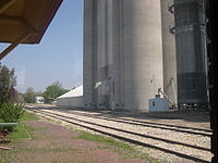
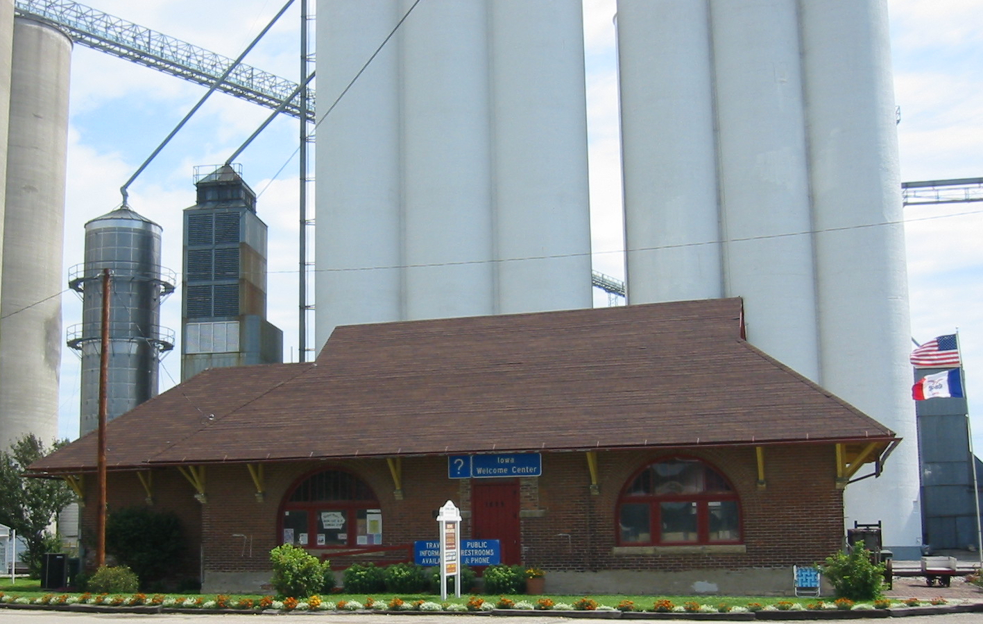
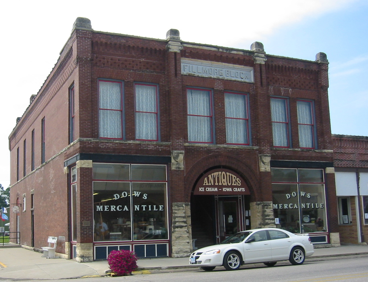
Dows was founded in 1880 and once had a population of nearly 1,500. The community, located two miles (3 km) west of Interstate 35, maintains a high quality of life with low costs and a friendly environment. The Dows Historical Society and community volunteers have restored several historical buildings, three of which are listed on the National Register of Historic Places. The Rock Island Depot in Dows was built in 1896. The historical society purchased and restored the depot in 1988 that houses an Iowa Welcome Center and historical railroad and community memorabilia. The Quasdorf Blacksmith and Wagon Museum was built in 1899 and was restored in 1990. This is one of the best equipped blacksmith shops in the Midwest. The Fillmore Building, a large cornerstone building on the south side of Main Street, was built in 1894 and has housed many businesses over the years. In 1987 the building was purchased by the historical society and restored. In 1989, the Dows Mercantile and Crème de la Crème were opened in the building. The Dows Mercantile is an antique mall covering three floors. The Crème de la Crème is a sandwich shop/ice cream parlor.
-

Burlington, Cedar Rapids & Northern Passenger Depot (later part of the Rock Island Railroad)
-
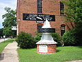
Quasdorf Blacksmith and Wagon Museum
-
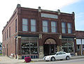
Fillmore Building
The Vernon Township Schoolhouse was built in 1887 and is a typical of what one-room, country schoolhouses were like in the 19th and early 20th centuries. The building was moved to town and was restored both inside and out. The schoolhouse is furnished with original desks, blackboards, and books. Another historical building located in the downtown area is the Evans Prairie Home, located across from the Welcome Center.
Convention Center
In 2003 the Dows Community Convention Center was built on Main Street. The building was modeled similarly to the Exchange Block that once stood as the cornerstone building to the north side of Main Street. The building includes a 4,800-square-foot (450 m2) convention room and a 360-square-foot (33 m2) meeting room. Also included is a large kitchen as well as many tables, internet hook ups, and nice restrooms. The building also houses the city offices.
Education
Dows Community School District was established in 1880. The high school was located in what is today city park. In 1914 a brick school building was built in the northwest side of town, where it stands today. The building is two stories and has a finished basement. In 1935, a two-story addition was built to the west that includes the gymnasium, offices, home economics room, and the upper level includes the library media center with two computer labs. In 1954 a one-story addition was built to the west that includes six elementary classrooms, band room, art room, ICN room, and Ag/Shop area. In 1961 an addition was built to the west of the elementary wing and includes four additional elementary classrooms. It was in the 1950s and 1960’s that enrollment reached record levels of over 530 students. In 1980 a multipurpose room was built to the north of the gym. In the 1980s and 1990’s a bond issue was passed an extensive renovations were completed to all parts of the building.
Dows maintained a K-12 elementary program, with a community funded preschool program, until 1998. The last class to graduate from Dows High School was in 1998. In the fall of that same year, the district began a whole grade sharing agreement with CAL Community School of Latimer that would last for the next seven years. Under the agreement, both Dows and CAL maintained separate elementary schools (K-5), the middle school (6-8) was housed at Dows, and the high school was at CAL.
In 2005 the district began a ten year whole grade sharing agreement with Clarion-Goldfield Community School District. Dows maintains its own separate P/K-5 elementary school and students in grades 6-12 attend school in Clarion. The districts also share a superintendent, curriculum coordinator, principal, and other staff members. In 2006, the district began the Tiger Learning Center (TLC), an after school program. In 2008, Dows Elementary School became a multi-age school that combines classrooms kindergarten and first grade, second and third grades, and fourth and fifth grades. Dows Elementary offers small class sizes that provide individualized attention and an academic program that can compete with any in the state. In 2008-09, the Dows Elementary School reported some of the highest Iowa Tests of Basic Skills results of any school in the state. The Dows district received a grant for the preschool program to be funded by the state in 2009-10.
Clarion-Goldfield Community School District covers a large area in Wright, Hancock, and Humboldt counties of 254 square miles (660 km2). The Dows Community School District covers 101 square miles (260 km2) in Wright and Franklin counties. The combined certified enrollment (2008–09) for both districts is 1,027 students in grades K-12. The Dows Elementary School has a K-5 enrollment of 66 students.
Churches
The Dows area has many churches including the First Lutheran Church, United Methodist Church, United Presbyterian Church, Abundant Life Chapel, Sovereign Grace Church (located inside the Presbyterian Church), Morgan Methodist Church, and Vernon Lutheran Church.
Dows Corn Days
The first weekend in August always marks a large celebration, the Dows Corn Days. The festivities include an impressive parade, entertainment in the park, food vendors, inflatable rides, several activities, and a community church service.
Rest Area/Travel Center
A new rest area was built near the interstate with a Civil War theme in 2003. Construction has begun on the “Dows Junction” Travel Center that will include a gas station/truck stop, convenience store, and fast food restaurant (Arby’s). It will also promote the historical sites in Dows, just two miles (3 km) away. It is hoped the two projects along with the convention center and historical sites will encourage tourism and economic development.
References
- ^ "US Gazetteer files: 2010, 2000, and 1990". United States Census Bureau. 2011-02-12. http://www.census.gov/geo/www/gazetteer/gazette.html. Retrieved 2011-04-23.
- ^ "American FactFinder". United States Census Bureau. http://factfinder.census.gov. Retrieved 2008-01-31.
External links
- Portal website Community attractions and events
- Dows Advocate
- Dows Community School District
- Clarion-Goldfield Community School District
Municipalities and communities of Franklin County, Iowa Cities 
Unincorporated
communitiesFootnotes ‡This populated place also has portions in an adjacent county or counties
Municipalities and communities of Wright County, Iowa Cities 
Footnotes ‡This populated place also has portions in an adjacent county or counties
Categories:- Cities in Iowa
- Populated places in Wright County, Iowa
- Populated places in Franklin County, Iowa
-


Wikimedia Foundation. 2010.