- North Fork American River
-
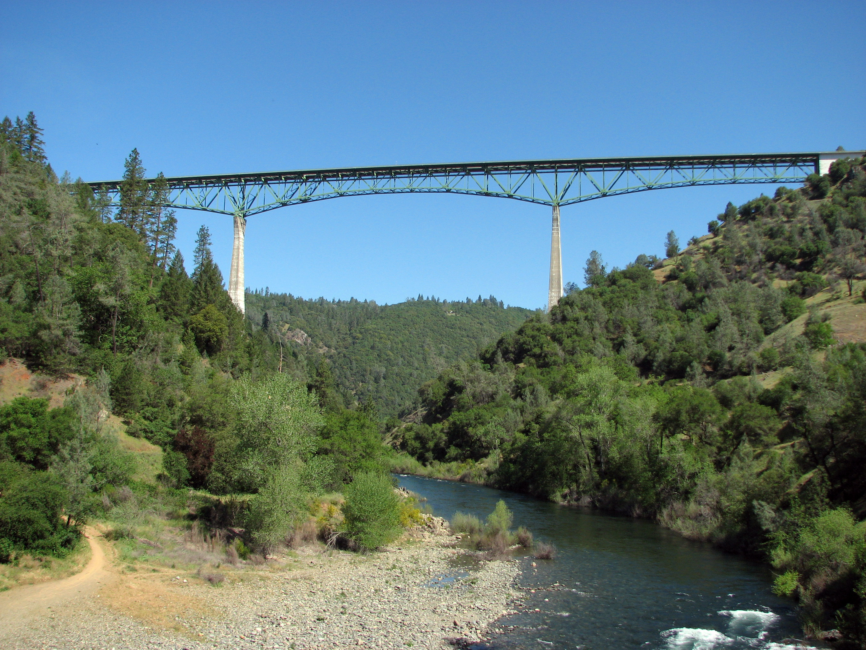
North Fork American River 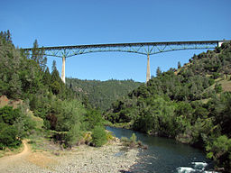 Foresthill Bridge over the North Fork
Country United States State California Source Mountain Meadow Lake - location Sierra Nevada, El Dorado County - elevation 7,935 ft (2,419 m) - coordinates 39°13′04″N 120°16′28″W / 39.21778°N 120.27444°W [1] Mouth Folsom Lake - location Auburn, Placer County - elevation 469 ft (143 m) - coordinates 38°42′42″N 121°08′44″W / 38.71167°N 121.14556°W [1] Length 88 mi (142 km) [2] Basin 996 sq mi (2,580 km2) [3] Discharge for Rattlesnake Bar - average 2,289 cu ft/s (65 m3/s) [3] - max 115,000 cu ft/s (3,256 m3/s) - min 51 cu ft/s (1 m3/s) 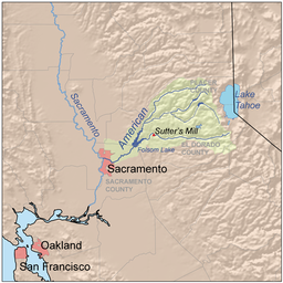 Map of the American River watershed including the North Fork
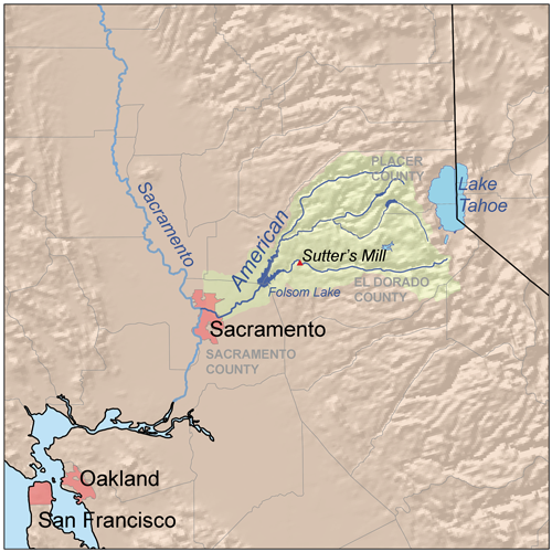
The North Fork American River is the longest branch of the American River in Northern California. It is 88 miles (142 km) long from its source at the crest of the Sierra Nevada, near Lake Tahoe, to its mouth at Folsom Lake northeast of Sacramento.[2] Prior to the construction of Folsom Dam the river was about 9 miles (14 km) longer making for a total length of 97 miles (156 km).
It rises at Mountain Meadow Lake near the 9,008 ft (2,746 m) peak of Granite Chief in the Tahoe National Forest. Flowing initially northwest, the river soon swings west into a gorge, paralleling the Forest Hill Divide on the south. Big Granite Creek then the North Fork North Fork American River come in from the right. The canyon shallows as the river turns southwest, carving through the Sierra foothills, then turning abruptly south near Colfax. About 4 miles (6.4 km) downstream, it receives Shirttail Creek from the left then is impounded in Lake Clementine (or North Fork Lake) which is formed by the North Fork Dam, built in 1939 to contain hydraulic mining debris.[4]
Below the dam, the river bends south, passing under the Foresthill Bridge, the highest bridge in California, then receives the Middle Fork American River, its largest tributary, from the left. The valley widens as the river flows south past Auburn, soon emptying into the north arm of Folsom Lake, a reservoir formed in 1955 by the Folsom Dam. Its waters mingle with that of the South Fork American River to form the American River, a tributary of the Sacramento River.[4]
See also
References
- ^ a b "North Fork American River". Geographic Names Information System, U.S. Geological Survey. 1981-01-19. http://geonames.usgs.gov/pls/gnispublic/f?p=gnispq:3:::NO::P3_FID:267066. Retrieved 2011-05-21.
- ^ a b U.S. Geological Survey. National Hydrography Dataset high-resolution flowline data. The National Map, accessed 2011-05-21
- ^ a b "USGS Gage #11434000 on the North Fork American River at Rattlesnake Bar, CA". National Water Information System. U.S. Geological Survey. 1930-1955. http://nwis.waterdata.usgs.gov/nwis/monthly/?referred_module=sw&site_no=11434000&por_11434000_1=2209785,00060,1,1930-10,1955-03&format=html_table&date_format=YYYY-MM-DD&rdb_compression=file&submitted_form=parameter_selection_list. Retrieved 2011-05-21.
- ^ a b ACME Mapper. USGS Topo Maps for United States (Map). Cartography by United States Geological Survey. http://mapper.acme.com/. Retrieved 2009-10-29.
Categories:- California geography stubs
- Rivers of California
- Tributaries of the Sacramento River
Wikimedia Foundation. 2010.