- Minturn, California
-
Minturn — Unincorporated community — Location in California
 Minturn
Coordinates: 37°08′23″N 120°16′28″W / 37.13972°N 120.27444°WCoordinates: 37°08′23″N 120°16′28″W / 37.13972°N 120.27444°W Country United States State California County Madera County Elevation[1] 236 ft (72 m) Minturn is an unincorporated community in Madera County, California.[1] It is located on the Atchison, Topeka and Santa Fe Railroad and California State Route 99 1.5 miles (2 km) north-northwest of Chowchilla,[2] at an elevation of 236 feet (72 m).[1]
A post office operated at Minturn from 1884 to 1922.[2] The name honors Jonas and Thomas Minturn, wheat farmers who had a railroad siding built at the place in 1872.[2] Jonas (April 4, 1819–August 1, 1884) and Abby West (March 8, 1820–May 19, 1899) Minturn (m. 1843), settled in the area in the 19th century and are buried nearby.[3]
The Minturn Nut Company is located nearby at 8800 S. Minturn Road, Le Grand.
Related information
Jonas Minturn was a member of the same family that ran Grinnell, Minturn & Co.
Jonas and Abby West Minturn's children were Mary, Thomas, Gertrude, Madeline, and James.[4]
References
- ^ a b c U.S. Geological Survey Geographic Names Information System: Minturn, California
- ^ a b c Durham, David L. (1998). California's Geographic Names: A Gazetteer of Historic and Modern Names of the State. Quill Driver Books. p. 804. ISBN 9781884995149.
- ^ Madera County, California, GenWeb: Minturn Burial Ground.
- ^ John Russell Bartlett, History of the Wanton family of Newport, Rhode Island. 1878. p. 144.
External links
Municipalities and communities of Madera County, California County seat: Madera Cities 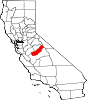
CDPs Ahwahnee | Bass Lake | Bonadelle Ranchos-Madera Ranchos | Coarsegold | Fairmead | La Vina | Madera Acres | Nipinnawasee | Oakhurst | Parksdale | Parkwood | Rolling Hills | Yosemite Lakes
Unincorporated
communitiesAhwahnee Estates | Bass Lake Annex | Berenda | Bonadelle Ranchos | Bonadelle Ranchos Five | Bonadelle Ranchos Nine | Bonita | Borden | Cascadel Woods | Central Camp | Dairyland | Daulton | Fine Gold | Fresno Crossing | Gregg | Hildreth | Indian Lakes Estates | Indian Springs | Irrigosa | Italian Swiss Colony | Kismet | Knowles | Knowles Junction | Lake Madera Country Estates | Madera Country Club Estates | Madera Highlands | Madera Ranchos | Minturn | North Fork | Notarb | Old Corral | O'Neals | Raymond | Ripperdan | River Road Estates | San Joaquin River Estates | Sharon | Sierra Vista | South Fork | Storey | Sugar Pine | Sumner Hill | The Pines | Trigo | Valley Lake Ranchos | Whisky Falls | Yosemite Forks | Yosemite Lakes Park
Indian
reservationsGhost towns Ash | Bailey Flats | Bethel | Birch | Buchanan | Califa | Cascadel | Femmon | Fort Miller | Gertrude | Gold | Grub Gulch | Herbert | Hillside | Jesbel | Lankershim | Lincoln | Magnet | Medano | Miami | Millerton | Minarets | Narbo | Oak | Ovejo | Plains | Rallsville | Starville | Talbot | Tharsa | Tillman | Tyler | Watt | Willow Glen | Wishon
Categories:- Populated places in Madera County, California
- Unincorporated communities in California
- Madera County, California geography stubs


Wikimedia Foundation. 2010.