- Yosemite Lakes, California
Infobox Settlement
official_name = Yosemite Lakes, California
settlement_type = CDP
imagesize =
image_caption =
image_
imagesize =
image_caption =
image_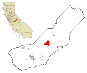
mapsize = 250x200px
map_caption = Location in Madera County and the state ofCalifornia
mapsize1 =
map_caption1 =
subdivision_type = Country
subdivision_type1 = State
subdivision_type2 = County
subdivision_name =United States
subdivision_name1 =California
subdivision_name2 = Madera
government_type =
leader_title =
leader_name =
established_date =
area_magnitude =
area_total_km2 = 54.4
area_total_sq_mi = 21
area_land_km2 = 54.2
area_land_sq_mi = 20.9
area_water_km2 = 0.2
area_water_sq_mi = 0.1
elevation_ft = 1263
elevation_m = 385
population_as_of = 2000
population_footnotes =
population_total = 4160
population_metro =
population_density_km2 = 76.5
population_density_sq_mi = 198.1
timezone = Pacific (PST)
utc_offset = -8
latd = 37 |latm = 10 |lats = 54 |latNS = N
longd = 119 |longm = 46 |longs = 17 |longEW = W
timezone_DST = PDT
utc_offset_DST = -7
postal_code_type =ZIP code
postal_code = 93614
area_code = 559
blank_name = FIPS code
blank_info = 06-86878
blank1_name = GNIS feature ID
blank1_info = 1867075
footnotes =
website =Yosemite Lakes is a
census-designated place (CDP) in Madera County,California ,United States . It is part of theMadera, California Metropolitan Statistical Area . The population was 4,160 at the 2000 census.Geography
Yosemite Lakes is located at coor dms|37|10|54|N|119|46|17|W|city (37.181600, -119.771484)GR|1.
According to the
United States Census Bureau , the CDP has a total area of 21.0square mile s (54.4km² ), of which, 20.9 square miles (54.2 km²) of it is land and 0.1 square miles (0.2 km²) of it (0.43%) is water.Demographics
As of the
census GR|2 of 2000, there were 4,160 people, 1,534 households, and 1,288 families residing in the CDP. Thepopulation density was 198.9 people per square mile (76.8/km²). There were 1,763 housing units at an average density of 84.3/sq mi (32.6/km²). The racial makeup of the CDP was 93.20% White, 0.36% African American, 0.99% Native American, 0.70% Asian, 0.41% Pacific Islander, 2.28% from other races, and 2.07% from two or more races. Hispanic or Latino of any race were 7.93% of the population.There were 1,534 households out of which 32.1% had children under the age of 18 living with them, 73.6% were married couples living together, 7.4% had a female householder with no husband present, and 16.0% were non-families. 12.6% of all households were made up of individuals and 4.7% had someone living alone who was 65 years of age or older. The average household size was 2.71 and the average family size was 2.95.
In the CDP the population was spread out with 25.1% under the age of 18, 4.8% from 18 to 24, 23.4% from 25 to 44, 29.4% from 45 to 64, and 17.2% who were 65 years of age or older. The median age was 43 years. For every 100 females there were 97.7 males. For every 100 females age 18 and over, there were 94.5 males.
The median income for a household in the CDP was $56,382, and the median income for a family was $58,341. Males had a median income of $44,792 versus $31,442 for females. The
per capita income for the CDP was $24,096. About 3.5% of families and 3.5% of the population were below thepoverty line , including 1.6% of those under age 18 and 4.2% of those age 65 or over.Politics
In the state legislature Yosemite Lakes is located in the 14th Senate District, represented by Republican
Dave Cogdill , and in the 25th Assembly District, represented by RepublicanTom Berryhill . Federally, Yosemite Lakes is located inCalifornia's 19th congressional district , which has a Cook PVI of R +10 [cite web | title = Will Gerrymandered Districts Stem the Wave of Voter Unrest? | publisher = Campaign Legal Center Blog | url=http://www.clcblog.org/blog_item-85.html | accessdate = 2007-10-20] and is represented by RepublicanGeorge Radanovich .References
External links
Wikimedia Foundation. 2010.