- Oakhurst, California
-
For the former town of this name in Fresno County, see Oakhurst, Fresno County, California.
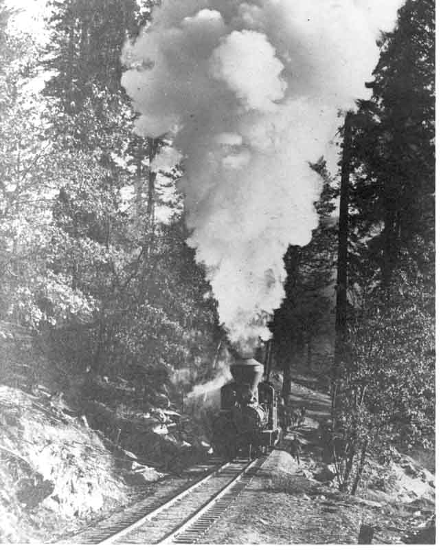
Oakhurst — census-designated place — Hauling logs at Sugar Pine (near Oakhurst) ca. 1915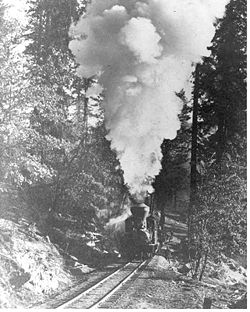 Location in Madera County and the state of California
Coordinates: 37°19′41″N 119°38′58″W / 37.32806°N 119.64944°WCoordinates: 37°19′41″N 119°38′58″W / 37.32806°N 119.64944°W Country  United States
State  California
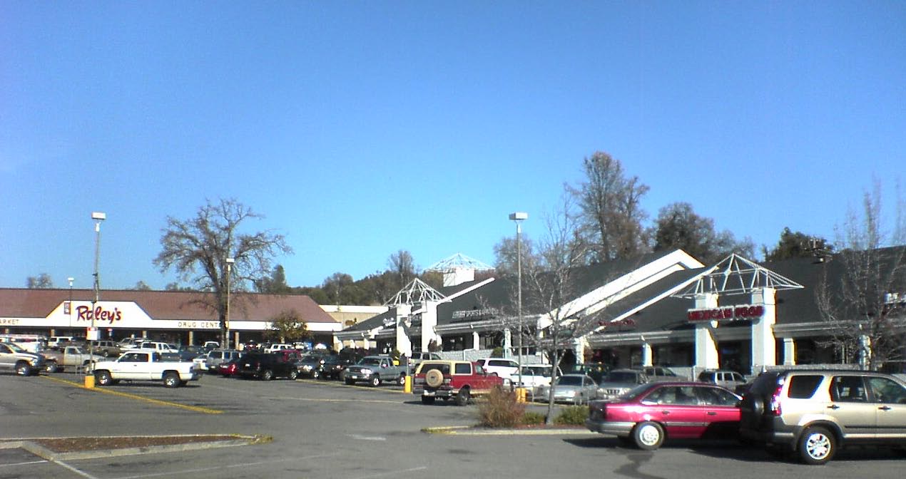
County Madera Area[1] – Total 6.006 sq mi (15.556 km2) – Land 5.999 sq mi (15.537 km2) – Water 0.007 sq mi (0.019 km2) 0.12% Elevation[2] 2,274 ft (693 m) Population (2010) – Total 2,829 – Density 471/sq mi (181.9/km2) Time zone Pacific (PST) (UTC-8) – Summer (DST) PDT (UTC-7) ZIP code 93644 Area code(s) 559 FIPS code 06-52764 GNIS feature ID 0277565  Shopping Center in Oakhurst
Oakhurst (formerly, Fresno Flats)[3] is a census-designated place (CDP) in Madera County, California, 14 miles (23 km) south of the entrance to Yosemite National Park, in the foothills of the Sierra Nevada mountain range. Oakhurst is located on the Fresno River 3 miles (4.8 km) south-southwest of Yosemite Forks,[3] at an elevation of 2274 feet (693 m).[2] It is part of the Madera–Chowchilla Metropolitan Statistical Area. At the 2010 census, the population was 2,829, down from 2,868 people at the 2000 census. (Read more below in Demographics.)
Contents
Geography
A small community located in central California near Yosemite National Park. Oakhurst is located at the junction of Highways 41 & 49, at the southern end of California's gold country.
Oakhurst is located at 37°19′41″N 119°38′58″W / 37.32806°N 119.64944°W.[2]
According to the United States Census Bureau, the CDP has a total area of 6.0 square miles (16 km2), of which, 6.0 square miles (16 km2) of it is land and 0.12% is water.
History
The Fresno Flats post office opened in 1873, moved and changed its name to Oakhurst in 1912.[3] MLB pitcher Ted Lilly attended high school at Yosemite High School, one of two of the towns high schools.
Demographics
2010
The 2010 United States Census[4] reported that Oakhurst had a population of 2,829. The population density was 471.0 people per square mile (181.9/km²). The racial makeup of Oakhurst was 2,532 (89.5%) White, 22 (0.8%) African American, 61 (2.2%) Native American, 44 (1.6%) Asian, 3 (0.1%) Pacific Islander, 66 (2.3%) from other races, and 101 (3.6%) from two or more races. Hispanic or Latino of any race were 473 persons (16.7%).
The Census reported that 2,772 people (98.0% of the population) lived in households, 0 (0%) lived in non-institutionalized group quarters, and 57 (2.0%) were institutionalized.
There were 1,226 households, out of which 301 (24.6%) had children under the age of 18 living in them, 515 (42.0%) were opposite-sex married couples living together, 153 (12.5%) had a female householder with no husband present, 76 (6.2%) had a male householder with no wife present. There were 61 (5.0%) unmarried opposite-sex partnerships, and 14 (1.1%) same-sex married couples or partnerships. 386 households (31.5%) were made up of individuals and 216 (17.6%) had someone living alone who was 65 years of age or older. The average household size was 2.26. There were 744 families (60.7% of all households); the average family size was 2.80.
The population was spread out with 526 people (18.6%) under the age of 18, 228 people (8.1%) aged 18 to 24, 567 people (20.0%) aged 25 to 44, 758 people (26.8%) aged 45 to 64, and 750 people (26.5%) who were 65 years of age or older. The median age was 48.4 years. For every 100 females there were 90.5 males. For every 100 females age 18 and over, there were 86.2 males.
There were 1,379 housing units at an average density of 229.6 per square mile (88.6/km²), of which 691 (56.4%) were owner-occupied, and 535 (43.6%) were occupied by renters. The homeowner vacancy rate was 3.5%; the rental vacancy rate was 5.5%. 1,485 people (52.5% of the population) lived in owner-occupied housing units and 1,287 people (45.5%) lived in rental housing units.
2000
As of the census[5] of 2000, there were 2868 people, 1,250 households, and 773 families residing in the CDP. The population density was 484.8 people per square mile (187.1/km²). There were 1,380 housing units at an average density of 233.3 per square mile (90.0/km²). The racial makeup of the CDP was 87.62% White, 0.45% African American, 2.93% Native American, 1.05% Asian, 0.10% Pacific Islander, 6.03% from other races, and 1.81% from two or more races. Hispanic or Latino of any race were 9.94% of the population.
There were 1,250 households out of which 23.7% had children under 18 living with them, 44.6% were married couples living together, 12.4% had a female householder with no husband present, and 38.1% were non-families. 31.3% of all households were made up of individuals and 19.7% had someone living alone who was 65 years of age or older. The average household size was 2.21 and the average family size was 2.72.
In the CDP the population was spread out with 19.7% under the age of 18, 7.9% from 18 to 24, 21.5% from 25 to 44, 24.2% from 45 to 64, and 26.7% who were 65 years of age or older. The median age was 46 years. For every 100 females there were 86.0 males. For every 100 females age 18 and over, there were 81.1 males.
The median income for a household in the CDP was $27,679, and the median income for a family was $35,495. Males had a median income of $36,979 versus $21,111 for females. The per capita income for the CDP was $16,851. About 12.8% of families and 17.3% of the population were below the poverty line, including 27.2% of those under age 18 and 10.9% of those age 65 or over. Tourism constitutes the major industry.
On February 5, 2008 residents voted on Measure C. The outcome decided that Oakhurst would not incorporate as a city. The residents voted to remain unincorporated.
Politics
In the state legislature Oakhurst is located in the 14th Senate District, represented by Republican Tom Berryhill, and in the 25th Assembly District, represented by Republican Kristin Olsen. Federally, Oakhurst is located in California's 19th congressional district, which has a Cook PVI of R +10[6] and is represented by Republican Jeff Denham.
In February 2008 Measure C, to incorporate Oakhurst as a city was defeated at the ballot box.
Economy
Industry
Oakhurst earned the nickname of "birthplace of computer gaming" being home to the pioneering computer game developer Sierra On-line from 1981 to 1999.
Many industry firsts were achieved in Oakhurst including the development of the first 3D adventure game (King's Quest, 1984) and one of the first online gaming networks (The Sierra Network, 1989).
Sierra Entertainment, headquartered in Los Angeles, CA continued to publish games for the personal computer and popular gaming consoles until 2008 when their parent company Vivendi Universal merged with games publisher Activision. The Sierra name was then closed down for possible future sale.
Public utilities
Cable television services for the town of Oakhurst are contracted to Northland Cable TV.[7]
Sierra Telephone Company, which serves northern Madera County and much of adjoining Mariposa County, is based in Oakhurst.
References
- ^ U.S. Census
- ^ a b c U.S. Geological Survey Geographic Names Information System: Oakhurst, California
- ^ a b c Durham, David L. (1998). California's Geographic Names: A Gazetteer of Historic and Modern Names of the State. Quill Driver Books. p. 810-811. ISBN 9781884995149.
- ^ All data are derived from the United States Census Bureau reports from the 2010 United States Census, and are accessible on-line here. The data on unmarried partnerships and same-sex married couples are from the Census report DEC_10_SF1_PCT15. All other housing and population data are from Census report DEC_10_DP_DPDP1. Both reports are viewable online or downloadable in a zip file containing a comma-delimited data file. The area data, from which densities are calculated, are available on-line here. Percentage totals may not add to 100% due to rounding. The Census Bureau defines families as a household containing one or more people related to the householder by birth, opposite-sex marriage, or adoption. People living in group quarters are tabulated by the Census Bureau as neither owners nor renters. For further details, see the text files accompanying the data files containing the Census reports mentioned above.
- ^ "American FactFinder". United States Census Bureau. http://factfinder.census.gov. Retrieved 2008-01-31.
- ^ "Will Gerrymandered Districts Stem the Wave of Voter Unrest?". Campaign Legal Center Blog. http://www.clcblog.org/blog_item-85.html. Retrieved 2007-10-20.
- ^ Northland Cable TV
External links
Municipalities and communities of Madera County, California Cities 
CDPs Ahwahnee | Bass Lake | Bonadelle Ranchos-Madera Ranchos | Coarsegold | Fairmead | La Vina | Madera Acres | Nipinnawasee | Oakhurst | Parksdale | Parkwood | Rolling Hills | Yosemite Lakes
Unincorporated
communitiesAhwahnee Estates | Bass Lake Annex | Berenda | Bonadelle Ranchos | Bonadelle Ranchos Five | Bonadelle Ranchos Nine | Bonita | Borden | Cascadel Woods | Central Camp | Dairyland | Daulton | Fine Gold | Fresno Crossing | Gregg | Hildreth | Indian Lakes Estates | Indian Springs | Irrigosa | Italian Swiss Colony | Kismet | Knowles | Knowles Junction | Lake Madera Country Estates | Madera Country Club Estates | Madera Highlands | Madera Ranchos | Minturn | North Fork | Notarb | Old Corral | O'Neals | Raymond | Ripperdan | River Road Estates | San Joaquin River Estates | Sharon | Sierra Vista | South Fork | Storey | Sugar Pine | Sumner Hill | The Pines | Trigo | Valley Lake Ranchos | Whisky Falls | Yosemite Forks | Yosemite Lakes Park
Indian
reservationsGhost towns Ash | Bailey Flats | Bethel | Birch | Buchanan | Califa | Cascadel | Femmon | Fort Miller | Gertrude | Gold | Grub Gulch | Herbert | Hillside | Jesbel | Lankershim | Lincoln | Magnet | Medano | Miami | Millerton | Minarets | Narbo | Oak | Ovejo | Plains | Rallsville | Starville | Talbot | Tharsa | Tillman | Tyler | Watt | Willow Glen | Wishon
Categories:- Census-designated places in Madera County, California
- Populated places established in 1873


Wikimedia Foundation. 2010.