- Nipinnawasee, California
-
Nipinnawasee — census-designated place — Location in California
 Nipinnawasee
Coordinates: 37°24′15″N 119°43′59″W / 37.40417°N 119.73306°WCoordinates: 37°24′15″N 119°43′59″W / 37.40417°N 119.73306°W Country  United States
State  California
County Madera County Area[1] – Total 3.062 sq mi (7.931 km2) – Land 3.062 sq mi (7.931 km2) – Water 0 sq mi (0 km2) 0% Elevation[2] 2,930 ft (893 m) Population (2010) – Total 475 – Density 155.1/sq mi (59.9/km2) Time zone Pacific (PST) (UTC-8) – Summer (DST) PDT (UTC-7) ZIP Code GNIS feature IDs 1656190; 2628765 U.S. Geological Survey Geographic Names Information System: Nipinnawasee, California; U.S. Geological Survey Geographic Names Information System: Nipinnawasee, California Nipinnawasee (formerly, Nipinnawassee, Nippinnawasee, and Nippinnawassee) is a census-designated place[3] in Madera County, California.[2] It is located 1 mile (1.6 km) southeast of Miami Mountain in the Sierra Nevada, 14 miles (22.5 km) from Mariposa, at an elevation of 2930 feet (893 m).[2] The population was 475 at the 2010 census.
Contents
History
The town was named about 1908 by Edgar B. Landon who brought the name from Michigan, where, according to the Native Americans of his native district, it means "plenty of deer".[2] The name was accepted by the Post Office in 1915.[2]
A post office operated at Nipinnawasee from 1912 to 1961.[4] Unfortunately, it was destroyed in 1961 when a fire consumed the entire town in just 15 minutes. Nipinnawasee proper was never rebuilt, although people continue to live in the area for the incredible views of the Sierras alone. Most residents “commute” into Oakhurst, just 15 minutes away.[5]
Geography
According to the United States Census Bureau, the CDP has a total area of 3.1 square miles (7.9 km²), all of it land.
Demographics
The 2010 United States Census[6] reported that Nipinnawasee had a population of 475. The population density was 155.1 people per square mile (59.9/km²). The racial makeup of Nipinnawasee was 422 (88.8%) White, 2 (0.4%) African American, 9 (1.9%) Native American, 0 (0.0%) Asian, 0 (0.0%) Pacific Islander, 3 (0.6%) from other races, and 39 (8.2%) from two or more races. Hispanic or Latino of any race were 50 persons (10.5%).
The Census reported that 475 people (100% of the population) lived in households, 0 (0%) lived in non-institutionalized group quarters, and 0 (0%) were institutionalized.
There were 192 households, out of which 47 (24.5%) had children under the age of 18 living in them, 126 (65.6%) were opposite-sex married couples living together, 15 (7.8%) had a female householder with no husband present, 9 (4.7%) had a male householder with no wife present. There were 9 (4.7%) unmarried opposite-sex partnerships, and 0 (0%) same-sex married couples or partnerships. 33 households (17.2%) were made up of individuals and 11 (5.7%) had someone living alone who was 65 years of age or older. The average household size was 2.47. There were 150 families (78.1% of all households); the average family size was 2.68.
The population was spread out with 90 people (18.9%) under the age of 18, 35 people (7.4%) aged 18 to 24, 74 people (15.6%) aged 25 to 44, 177 people (37.3%) aged 45 to 64, and 99 people (20.8%) who were 65 years of age or older. The median age was 49.5 years. For every 100 females there were 93.1 males. For every 100 females age 18 and over, there were 90.6 males.
There were 217 housing units at an average density of 70.9 per square mile (27.4/km²), of which 144 (75.0%) were owner-occupied, and 48 (25.0%) were occupied by renters. The homeowner vacancy rate was 1.4%; the rental vacancy rate was 11.1%. 337 people (70.9% of the population) lived in owner-occupied housing units and 138 people (29.1%) lived in rental housing units.
References
- ^ U.S. Census
- ^ a b c d e U.S. Geological Survey Geographic Names Information System: Nipinnawasee, California
- ^ U.S. Geological Survey Geographic Names Information System: Nipinnawasee, California
- ^ Durham, David L. (1998). California's Geographic Names: A Gazetteer of Historic and Modern Names of the State. Quill Driver Books. p. 809. ISBN 9781884995149.
- ^ Oakhurst Area Chamber of Commerce. Retrieved 1 June 2011.
- ^ All data are derived from the United States Census Bureau reports from the 2010 United States Census, and are accessible on-line here. The data on unmarried partnerships and same-sex married couples are from the Census report DEC_10_SF1_PCT15. All other housing and population data are from Census report DEC_10_DP_DPDP1. Both reports are viewable online or downloadable in a zip file containing a comma-delimited data file. The area data, from which densities are calculated, are available on-line here. Percentage totals may not add to 100% due to rounding. The Census Bureau defines families as a household containing one or more people related to the householder by birth, opposite-sex marriage, or adoption. People living in group quarters are tabulated by the Census Bureau as neither owners nor renters. For further details, see the text files accompanying the data files containing the Census reports mentioned above.
Municipalities and communities of Madera County, California Cities 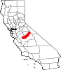
CDPs Ahwahnee | Bass Lake | Bonadelle Ranchos-Madera Ranchos | Coarsegold | Fairmead | La Vina | Madera Acres | Nipinnawasee | Oakhurst | Parksdale | Parkwood | Rolling Hills | Yosemite Lakes
Unincorporated
communitiesAhwahnee Estates | Bass Lake Annex | Berenda | Bonadelle Ranchos | Bonadelle Ranchos Five | Bonadelle Ranchos Nine | Bonita | Borden | Cascadel Woods | Central Camp | Dairyland | Daulton | Fine Gold | Fresno Crossing | Gregg | Hildreth | Indian Lakes Estates | Indian Springs | Irrigosa | Italian Swiss Colony | Kismet | Knowles | Knowles Junction | Lake Madera Country Estates | Madera Country Club Estates | Madera Highlands | Madera Ranchos | Minturn | North Fork | Notarb | Old Corral | O'Neals | Raymond | Ripperdan | River Road Estates | San Joaquin River Estates | Sharon | Sierra Vista | South Fork | Storey | Sugar Pine | Sumner Hill | The Pines | Trigo | Valley Lake Ranchos | Whisky Falls | Yosemite Forks | Yosemite Lakes Park
Indian
reservationsGhost towns Ash | Bailey Flats | Bethel | Birch | Buchanan | Califa | Cascadel | Femmon | Fort Miller | Gertrude | Gold | Grub Gulch | Herbert | Hillside | Jesbel | Lankershim | Lincoln | Magnet | Medano | Miami | Millerton | Minarets | Narbo | Oak | Ovejo | Plains | Rallsville | Starville | Talbot | Tharsa | Tillman | Tyler | Watt | Willow Glen | Wishon
Categories:- Census-designated places in Madera County, California
- Unincorporated communities in California


Wikimedia Foundation. 2010.