- Wheatland, California
Infobox Settlement
official_name = Wheatland, California
other_name =
native_name =
nickname =
settlement_type =City
motto =
imagesize =
image_caption =
flag_size =
image_
seal_size =
image_shield =
shield_size =
image_blank_emblem =
blank_emblem_type =
blank_emblem_size =
imagesize =
image_caption =
flag_size =
image_
seal_size =
image_shield =
shield_size =
image_blank_emblem =
blank_emblem_type =
blank_emblem_size =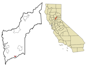
mapsize = 250x200px
map_caption = Location in Yuba County and the state ofCalifornia
mapsize1 =
map_caption1 =
image_dot_
dot_mapsize =
dot_map_caption =
dot_x =
dot_y =
pushpin_
pushpin_label_position =
pushpin_map_caption =
pushpin_mapsize =
subdivision_type = Country
subdivision_name =United States
subdivision_type1 = State
subdivision_name1 =California
subdivision_type2 = County
subdivision_name2 = Yuba
subdivision_type3 =
subdivision_name3 =
subdivision_type4 =
subdivision_name4 =
government_footnotes =
government_type =
leader_title =
leader_name =
leader_title1 =
leader_name1 =
leader_title2 =
leader_name2 =
leader_title3 =
leader_name3 =
leader_title4 =
leader_name4 =
established_title =
established_date =
established_title2 =
established_date2 =
established_title3 =
established_date3 =
area_magnitude =
unit_pref =
area_footnotes =
area_total_km2 = 2
area_land_km2 = 2
area_water_km2 = 0
area_total_sq_mi = 0.8
area_land_sq_mi = 0.8
area_water_sq_mi = 0
area_water_percent =
area_urban_km2 =
area_urban_sq_mi =
area_metro_km2 =
area_metro_sq_mi =
area_blank1_title =
area_blank1_km2 =
area_blank1_sq_mi =
population_as_of = 2000
population_footnotes =
population_note =
population_total = 2275
population_density_km2 = 1137.5
population_density_sq_mi = 2843.8
population_metro =
population_density_metro_km2 =
population_density_metro_sq_mi =
population_urban =
population_density_urban_km2 =
population_density_urban_sq_mi =
population_blank1_title =
population_blank1 =
population_density_blank1_km2 =
population_density_blank1_sq_mi =
timezone = Pacific (PST)
utc_offset = -8
timezone_DST = PDT
utc_offset_DST = -7
latd = 39 |latm = 0 |lats = 45 |latNS = N
longd = 121 |longm = 25 |longs = 31 |longEW = W
elevation_footnotes =
elevation_m = 28
elevation_ft = 92
postal_code_type =ZIP code
postal_code = 95692
area_code = 530
blank_name = FIPS code
blank_info = 06-85012
blank1_name = GNIS feature ID
blank1_info = 1652652
website =
footnotes =Wheatland is a city in Yuba County,
California ,United States . The population was 2,275 at the 2000 census.Geography
Wheatland is located at coor dms|39|0|45|N|121|25|31|W|city (39.012409, -121.425225)GR|1.
According to the
United States Census Bureau , the city has a total area of 0.8square mile s (2.0km² ), all of it land.History
Wheatland was the site of the bloody
Wheatland Hop Riot of 1913.In 1888, Edward P. Duplex was elected Mayor, the first black man to be elected mayor of a Western United States City. His original barbershop stands today on Main street.
Demographics
As of the
census GR|2 of 2000, there were 2,275 people, 785 households, and 584 families residing in the city. Thepopulation density was 3,007.5 people per square mile (1,155.8/km²). There were 816 housing units at an average density of 1,078.7/sq mi (414.6/km²). The racial makeup of the city was 74.64% White, 1.14% African American, 1.45% Native American, 5.19% Asian, 0.13% Pacific Islander, 11.08% from other races, and 6.37% from two or more races. Hispanic or Latino of any race were 21.23% of the population.There were 785 households out of which 40.0% had children under the age of 18 living with them, 52.4% were married couples living together, 16.8% had a female householder with no husband present, and 25.6% were non-families. 21.5% of all households were made up of individuals and 11.3% had someone living alone who was 65 years of age or older. The average household size was 2.90 and the average family size was 3.37.
In the city the population was spread out with 32.9% under the age of 18, 9.7% from 18 to 24, 26.2% from 25 to 44, 18.5% from 45 to 64, and 12.6% who were 65 years of age or older. The median age was 32 years. For every 100 females there were 93.8 males. For every 100 females age 18 and over, there were 87.2 males.
The median
income for a household in the city was $34,861, and the median income for a family was $39,375. Males had a median income of $32,656 versus $21,250 for females. Theper capita income for the city was $14,889. About 15.8% of families and 19.8% of the population were below thepoverty line , including 27.5% of those under age 18 and 6.6% of those age 65 or over.Politics
In the state legislature Wheatland is located in the 4th Senate District, represented by Republican
Sam Aanestad , and in the 3rd Assembly District, represented by RepublicanRick Keene . Federally, Wheatland is located inCalifornia's 2nd congressional district , which has a Cook PVI of R +13 [cite web | title = Will Gerrymandered Districts Stem the Wave of Voter Unrest? | publisher = Campaign Legal Center Blog | url=http://www.clcblog.org/blog_item-85.html | accessdate = 2008-02-10] and is represented by RepublicanWally Herger .External links
* [http://www.wheatland.ca.gov/ City of Wheatland Official Website]
* [http://pweb.jps.net/~wheatlandhistory/index.html Wheatland Historical Society]
* [http://home.comcast.net/~mccolley2220/index.html South Yuba County Live Weather and Scanner Feed]
* [http://www.thewheatlandcitizen.com The Wheatland Citizen News Paper]* [http://www.wheatlandhigh.org Wheatland Union High School District]
* [http://www.wheatland.k12.ca.us Wheatland School District]
Wikimedia Foundation. 2010.