- Yountville, California
Infobox Settlement
official_name = Yountville, California
settlement_type =Town
imagesize =
image_caption =
image_
imagesize =
image_caption =
image_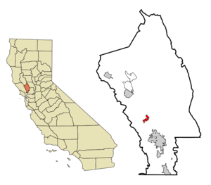
mapsize = 250x200px
map_caption = Location in Napa County and the state ofCalifornia
mapsize1 =
map_caption1 =
subdivision_type = Country
subdivision_type1 = State
subdivision_type2 = County
subdivision_name =United States
subdivision_name1 =California
subdivision_name2 = Napa
government_type =
leader_title =
leader_name =
established_date =
area_magnitude =
area_total_km2 = 4.2
area_total_sq_mi = 1.6
area_land_km2 = 4.2
area_land_sq_mi = 1.6
area_water_km2 = 0
area_water_sq_mi = 0
elevation_ft = 98
elevation_m = 30
population_as_of = 2000
population_footnotes =
population_total = 2916
population_metro =
population_density_km2 = 694.3
population_density_sq_mi = 1822.5
timezone = Pacific (PST)
utc_offset = -8
latd = 38 |latm = 24 |lats = 11 |latNS = N
longd = 122 |longm = 21 |longs = 44 |longEW = W
timezone_DST = PDT
utc_offset_DST = -7
postal_code_type =ZIP code
postal_code = 94599
area_code = 707
blank_name = FIPS code
blank_info = 06-86930
blank1_name = GNIS feature ID
blank1_info = 1652660
footnotes =
website =Yountville is an incorporated town in Napa County,
California ,United States . It is part of theNapa, California Metropolitan Statistical Area . Its area code 707. Its zipcode is 94599. It is in the Pacific time zone (GMT -8). The population was 2,916 at the 2000 census.The town's name is derived from the name of early pioneer George Calvert Yount. Yount was considered responsible for establishing the first vineyard in the Napa Valley.
Geography
Yountville is located at coor dms|38|24|11|N|122|21|44|W|city (38.403011, -122.362285)GR|1.
According to the
United States Census Bureau , the town has a total area of 1.6square mile s (4.2km² ), all of it land.Demographics
As of the
census GR|2 of 2000, there were 2,916 people, 1,048 households, and 553 families residing in the town. Thepopulation density was 1,790.8 people per square mile (690.7/km²). There were 1,133 housing units at an average density of 695.8/sq mi (268.4/km²). The racial makeup of the town was 92.15% White, 1.10% African American, 0.58% Native American, 1.37% Asian, 0.07% Pacific Islander, 2.81% from other races, and 1.92% from two or more races. Hispanic or Latino of any race were 9.64% of the population.There were 1,048 households out of which 17.8% had children under the age of 18 living with them, 42.0% were married couples living together, 7.4% had a female householder with no husband present, and 47.2% were non-families. 39.8% of all households were made up of individuals and 17.5% had someone living alone who was 65 years of age or older. The average household size was 1.95 and the average family size was 2.59.
In the town the population was spread out with 11.1% under the age of 18, 2.4% from 18 to 24, 17.5% from 25 to 44, 23.8% from 45 to 64, and 45.1% who were 65 years of age or older. The median age was 60 years. For every 100 females there were 126.2 males. For every 100 females age 18 and over, there were 128.1 males.
The median
income for a household in the town was $46,944, and the median income for a family was $56,250. Males had a median income of $46,853 versus $34,464 for females. Theper capita income for the town was $30,721. About 5.6% of families and 7.3% of the population were below thepoverty line , including 13.3% of those under age 18 and 6.9% of those age 65 or over.Politics
In the state legislature Yountville is located in the 2nd Senate District, represented by Democrat
Pat Wiggins , and in the 7th Assembly District, represented by DemocratNoreen Evans . Federally, Yountville is located inCalifornia's 1st congressional district .Attractions
* Home to the Lincoln Theatre
*TheYountville AVA is located here.
*Thomas Keller 'sFrench Laundry , widely considered one of the world's best restaurants, is in Yountville.
* The comfort food restaurant, Ad Hoc (also owned byThomas Keller ) is in Yountville.
* TheDomaine Chandon winery and its restaurant, étoile, are located in Yountville, on a hill overlooking the town.ee also
*
Veterans Home of California, Yountville (Yountville has the largest Vets Home in the United States)
*Napa City-County Library References
External links
* [http://www.yountville.com/index.php Yountville Chamber of Commerce website]
Wikimedia Foundation. 2010.