- Deer Park, California
-
- For the community with this name in El Dorado County, see Deer Park, El Dorado County, California; for the community formerly with this name in Fresno County, see Cedar Grove, Fresno County, California.
Deer Park — census-designated place — Location in Napa County and the state of California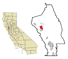
Coordinates: 38°32′14″N 122°28′21″W / 38.53722°N 122.4725°W Country  United States
State  California
County Napa Area[1] – Total 5.582 sq mi (14.458 km2) – Land 5.578 sq mi (14.448 km2) – Water 0.004 sq mi (0.009 km2) 0.07% Elevation 568 ft (173 m) Population (2010) – Total 1,267 – Density 227/sq mi (87.6/km2) Time zone Pacific (PST) (UTC-8) – Summer (DST) PDT (UTC-7) ZIP code 94576 Area code(s) 707 FIPS code 06-18324 GNIS feature IDs 1867011; 2408647 U.S. Geological Survey Geographic Names Information System: Deer Park, California; U.S. Geological Survey Geographic Names Information System: Deer Park, California Deer Park is a census-designated place (CDP)[2] in Napa County, California, United States. The population was 1,267 at the 2010 census. It is part of the Napa, California Metropolitan Statistical Area. Its area code is 707. Its zip code is 94576. It is in the Pacific time zone.
Contents
Geography
Deer Park is located at 38°32′14″N 122°28′21″W / 38.53722°N 122.4725°WCoordinates: 38°32′14″N 122°28′21″W / 38.53722°N 122.4725°W (38.537257, -122.472386)[3].
According to the United States Census Bureau, the CDP has a total area of 5.6 square miles (15 km2), 99.93% of it land and 0.07% of it water.
Demographics
2010
The 2010 United States Census[4] reported that Deer Park had a population of 1,267. The population density was 227.0 people per square mile (87.6/km²). The racial makeup of Deer Park was 1,108 (87.5%) White, 13 (1.0%) African American, 9 (0.7%) Native American, 51 (4.0%) Asian, 0 (0.0%) Pacific Islander, 61 (4.8%) from other races, and 25 (2.0%) from two or more races. Hispanic or Latino of any race were 147 persons (11.6%).
The Census reported that 1,245 people (98.3% of the population) lived in households, 5 (0.4%) lived in non-institutionalized group quarters, and 17 (1.3%) were institutionalized.
There were 564 households, out of which 114 (20.2%) had children under the age of 18 living in them, 281 (49.8%) were opposite-sex married couples living together, 44 (7.8%) had a female householder with no husband present, 15 (2.7%) had a male householder with no wife present. There were 31 (5.5%) unmarried opposite-sex partnerships, and 4 (0.7%) same-sex married couples or partnerships. 174 households (30.9%) were made up of individuals and 67 (11.9%) had someone living alone who was 65 years of age or older. The average household size was 2.21. There were 340 families (60.3% of all households); the average family size was 2.67.
The population was spread out with 191 people (15.1%) under the age of 18, 68 people (5.4%) aged 18 to 24, 245 people (19.3%) aged 25 to 44, 488 people (38.5%) aged 45 to 64, and 275 people (21.7%) who were 65 years of age or older. The median age was 51.9 years. For every 100 females there were 91.1 males. For every 100 females age 18 and over, there were 87.5 males.
There were 685 housing units at an average density of 122.7 per square mile (47.4/km²), of which 318 (56.4%) were owner-occupied, and 246 (43.6%) were occupied by renters. The homeowner vacancy rate was 2.2%; the rental vacancy rate was 6.0%. 764 people (60.3% of the population) lived in owner-occupied housing units and 481 people (38.0%) lived in rental housing units.
2000
As of the census[5] of 2000, there were 1,433 people, 575 households, and 395 families residing in the CDP. The population density was 250.5 people per square mile (96.7/km²). There were 653 housing units at an average density of 114.1 per square mile (44.1/km²). The racial makeup of the CDP in 2010 was 81.4% non-Hispanic White, 1.0% non-Hispanic Black or African American, 0.4% Native American, 4.0% Asian, 0.1% from other races, and 1.5% from two or more races. 11.6% of the population were Hispanic or Latino of any race.
Deer Park is home to a small but growing population of Argentine Americans already approaching 4 percent of the population of the small hamlet.
There were 575 households out of which 26.6% had children under the age of 18 living with them, 59.0% were married couples living together, 6.4% had a female householder with no husband present, and 31.3% were non-families. 24.7% of all households were made up of individuals and 6.4% had someone living alone who was 65 years of age or older. The average household size was 2.45 and the average family size was 2.88.
In the CDP the population was spread out with 19.7% under the age of 18, 6.9% from 18 to 24, 27.6% from 25 to 44, 30.9% from 45 to 64, and 14.8% who were 65 years of age or older. The median age was 43 years. For every 100 females there were 95.2 males. For every 100 females age 18 and over, there were 94.9 males.
The median income for a household in the CDP was $63,833, and the median income for a family was $69,741. Males had a median income of $45,197 versus $40,750 for females. The per capita income for the CDP was $34,665. About 3.1% of families and 4.3% of the population were below the poverty line, including 4.3% of those under age 18 and none of those age 65 or over.
Politics
In the state legislature, Deer Park is located in the 2nd Senate District, represented by Democrat Noreen Evans, and in the 7th Assembly District, represented by Democrat Michael Allen. Federally, Deer Park is located in California's 1st congressional district.
References
- ^ U.S. Census
- ^ U.S. Geological Survey Geographic Names Information System: Deer Park, California
- ^ "US Gazetteer files: 2010, 2000, and 1990". United States Census Bureau. 2011-02-12. http://www.census.gov/geo/www/gazetteer/gazette.html. Retrieved 2011-04-23.
- ^ All data are derived from the United States Census Bureau reports from the 2010 United States Census, and are accessible on-line here. The data on unmarried partnerships and same-sex married couples are from the Census report DEC_10_SF1_PCT15. All other housing and population data are from Census report DEC_10_DP_DPDP1. Both reports are viewable online or downloadable in a zip file containing a comma-delimited data file. The area data, from which densities are calculated, are available on-line here. Percentage totals may not add to 100% due to rounding. The Census Bureau defines families as a household containing one or more people related to the householder by birth, opposite-sex marriage, or adoption. People living in group quarters are tabulated by the Census Bureau as neither owners nor renters. For further details, see the text files accompanying the data files containing the Census reports mentioned above.
- ^ "American FactFinder". United States Census Bureau. http://factfinder.census.gov. Retrieved 2008-01-31.
Municipalities and communities of Napa County, California Cities and towns American Canyon | Calistoga | Napa | St. Helena | Yountville
CDPs Angwin | Deer Park | Moskowite Corner | Oakville | Rutherford | Silverado Resort
Unincorporated
communitiesAetna Springs | Atlas | Bale | Barro | Brazos | Buchli | Circle Oaks | Collins | Creston | Cuttings Wharf | Enchanted Hills | Howell Mountain | Imola | Knoxville | Krug | Larkmead | Lokoya | Lombard | Lowell | Merazo | Middleton | Napa Junction | Napa Soda Springs | Oak Knoll | Pope Valley | Ratto Landing | Rocktram | Salvador | Sanitarium | Spanish Flat | Spanish Flat Resort | Squab | Stanley | Steel Canyon Resort | Suscol | Thoman | Thompson | Union | Veteran Heights | Vichy Springs | Walter Springs | Woodleaf | Zinfandel
Ghost towns Carneros | Caymus | Guthrie | Kelly | Monticello | Napa Wye | Redbud Park | Shipyard Acres | Spruce Hill | Tuluka
Categories:- Census-designated places in Napa County, California


Wikimedia Foundation. 2010.