- Oakville, California
-
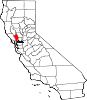
Oakville — Census-designated place — To-Kalon Vineyard, Robert Mondavi Winery, Oakville, California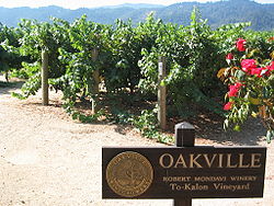 Location within the state of California
 Oakville
Coordinates: 38°26′13″N 122°24′4″W / 38.43694°N 122.40111°WCoordinates: 38°26′13″N 122°24′4″W / 38.43694°N 122.40111°W Country  United States
State  California
County Napa Area[1] – Total 1.360 sq mi (3.522 km2) – Land 1.360 sq mi (3.522 km2) – Water 0 sq mi (0 km2) 0% Elevation[2] 154 ft (47 m) Population (2010)[3] – Total 71 – Density 52.2/sq mi (20.2/km2) Time zone Pacific (PST) (UTC-8) – Summer (DST) PDT (UTC-7) ZIP codes 94562 Area code(s) 707 FIPS code GNIS feature IDs 229899[2]; 2583102 U.S. Geological Survey Geographic Names Information System: Oakville, California; U.S. Geological Survey Geographic Names Information System: Oakville, California Oakville is a census-designated place (CDP) in Napa County, California, United States.[4] Oakville started life in the 1860s as a water stop for the steam train owned by The Napa Valley Railroad Company. The railroad, founded by early California pioneer Samuel Brannan in 1864 shuttled tourists between ferry boats that docked in Vallejo to the resort town of Calistoga. The village gained its name from the dense groves of dark green valley oaks of the area. The population was 71 at the 2010 census.
Contents
History
H. W. Crabb turned Oakville from untamed country to wine country after his 1868 purchase of 240 acres (1.0 km2) close to the Napa River. Crabb established a vineyard and winery naming it To Kalon, which in Greek means "the beautiful." By 1877 Crabb had planted 130 acres (0.5 km2) and was producing 50,000 gallons of wine per year and by 1880, his vineyard had increased to 430 acres (1.7 km2).
In 1903 the U.S. Department of Agriculture established an experimental vineyard station in Oakville. This vineyard known as "Oakville Station" is operated by the University of California, Davis. Formally declared a Napa appellation in 1993 there are currently 24 wineries and over 5,000 acres (20 km2) of vineyard located within the boundary of the Oakville AVA. The Robert Mondavi Winery is located between Oakville and Rutherford, California (though its corporate headquarters are in nearby St. Helena). To Kalon was part of Mondavi's original inventory when it was established in 1965. Another Mondavi venture in Oakville is Opus One Winery. Heitz Wine Cellars' Martha's Vineyard is also located within the Oakville appellation.
Modern day tourists traveling on State Route 29 often include a stop at Oakville Grocery, one of the area's few non-winery business in order to purchase picnic supplies. The Napa Valley Wine Train runs through Oakville on the same route that the original steam train ran on over in the 19th century.
Oakville's zip code is 94562, and its area code 707.
Geography
According to the United States Census Bureau, the CDP covers an area of 1.4 square miles (3.5 km²), all of it land.
Demographics
The 2010 United States Census[5] reported that Oakville had a population of 71. The population density was 52.2 people per square mile (20.2/km²). The racial makeup of Oakville was 26 (36.6%) White, 0 (0.0%) African American, 1 (1.4%) Native American, 1 (1.4%) Asian, 1 (1.4%) Pacific Islander, 38 (53.5%) from other races, and 4 (5.6%) from two or more races. Hispanic or Latino of any race were 45 persons (63.4%).
The Census reported that 71 people (100% of the population) lived in households, 0 (0%) lived in non-institutionalized group quarters, and 0 (0%) were institutionalized.
There were 27 households, out of which 10 (37.0%) had children under the age of 18 living in them, 13 (48.1%) were opposite-sex married couples living together, 3 (11.1%) had a female householder with no husband present, 2 (7.4%) had a male householder with no wife present. There were 2 (7.4%) unmarried opposite-sex partnerships, and 0 (0%) same-sex married couples or partnerships. 7 households (25.9%) were made up of individuals and 3 (11.1%) had someone living alone who was 65 years of age or older. The average household size was 2.63. There were 18 families (66.7% of all households); the average family size was 3.28.
The population was spread out with 20 people (28.2%) under the age of 18, 9 people (12.7%) aged 18 to 24, 15 people (21.1%) aged 25 to 44, 18 people (25.4%) aged 45 to 64, and 9 people (12.7%) who were 65 years of age or older. The median age was 36.2 years. For every 100 females there were 97.2 males. For every 100 females age 18 and over, there were 104.0 males.
There were 44 housing units at an average density of 32.4 per square mile (12.5/km²), of which 9 (33.3%) were owner-occupied, and 18 (66.7%) were occupied by renters. The homeowner vacancy rate was 0%; the rental vacancy rate was 18.2%. 16 people (22.5% of the population) lived in owner-occupied housing units and 55 people (77.5%) lived in rental housing units.
Politics
In the state legislature Oakville is located in the 2nd Senate District, represented by Democrat Noreen Evans, and in the 7th Assembly District, represented by Democrat Michael Allen. Federally, Oakville is located in California's 1st congressional district.
See also
References
- ^ U.S. Census
- ^ a b U.S. Geological Survey Geographic Names Information System: Oakville, California
- ^ "Census 2010: Table 3A — Total Population by Race (Hispanic exclusive) and Hispanic or Latino: 2010" (Excel). California Department of Finance. http://www.dof.ca.gov/research/demographic/state_census_data_center/census_2010/documents/2010Census_Table3A_RedistrictingFile.xls. Retrieved March 22, 2010.
- ^ U.S. Geological Survey Geographic Names Information System: Oakville, California
- ^ All data are derived from the United States Census Bureau reports from the 2010 United States Census, and are accessible on-line here. The data on unmarried partnerships and same-sex married couples are from the Census report DEC_10_SF1_PCT15. All other housing and population data are from Census report DEC_10_DP_DPDP1. Both reports are viewable online or downloadable in a zip file containing a comma-delimited data file. The area data, from which densities are calculated, are available on-line here. Percentage totals may not add to 100% due to rounding. The Census Bureau defines families as a household containing one or more people related to the householder by birth, opposite-sex marriage, or adoption. People living in group quarters are tabulated by the Census Bureau as neither owners nor renters. For further details, see the text files accompanying the data files containing the Census reports mentioned above.
External links

Windsor Rutherford Winters Santa Rosa 
Vacaville  Oakville

Glen Ellen Yountville
NapaFairfield Municipalities and communities of Napa County, California Cities and towns American Canyon | Calistoga | Napa | St. Helena | Yountville
CDPs Angwin | Deer Park | Moskowite Corner | Oakville | Rutherford | Silverado Resort
Unincorporated
communitiesAetna Springs | Atlas | Bale | Barro | Brazos | Buchli | Circle Oaks | Collins | Creston | Cuttings Wharf | Enchanted Hills | Howell Mountain | Imola | Knoxville | Krug | Larkmead | Lokoya | Lombard | Lowell | Merazo | Middleton | Napa Junction | Napa Soda Springs | Oak Knoll | Pope Valley | Ratto Landing | Rocktram | Salvador | Sanitarium | Spanish Flat | Spanish Flat Resort | Squab | Stanley | Steel Canyon Resort | Suscol | Thoman | Thompson | Union | Veteran Heights | Vichy Springs | Walter Springs | Woodleaf | Zinfandel
Ghost towns Carneros | Caymus | Guthrie | Kelly | Monticello | Napa Wye | Redbud Park | Shipyard Acres | Spruce Hill | Tuluka
Categories:- California wine
- Census-designated places in Napa County, California
- Populated places in California with Hispanic majority populations


Wikimedia Foundation. 2010.