- Napa Soda Springs, California
-
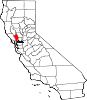
Napa Soda Springs — unincorporated community — Location in California
 Napa Soda Springs
Coordinates: 38°23′27″N 122°16′46″W / 38.39083°N 122.27944°WCoordinates: 38°23′27″N 122°16′46″W / 38.39083°N 122.27944°W Country  United States
State  California
County Napa County Elevation[1] 705 ft (215 m) Napa Soda Springs (formerly, Jacksons Napa Soda Springs)[2] is an unincorporated community in Napa County, California.[1] It lies at an elevation of 705 feet (215 m).[1] Napa Soda Springs is located 5 miles (8.0 km) east-southeast of Yountville.[2]
The Napa Soda Springs post office operated from 1882 to 1929.[2]
References
Municipalities and communities of Napa County, California Cities and towns American Canyon | Calistoga | Napa | St. Helena | Yountville
CDPs Angwin | Deer Park | Moskowite Corner | Oakville | Rutherford | Silverado Resort
Unincorporated
communitiesAetna Springs | Atlas | Bale | Barro | Brazos | Buchli | Circle Oaks | Collins | Creston | Cuttings Wharf | Enchanted Hills | Howell Mountain | Imola | Knoxville | Krug | Larkmead | Lokoya | Lombard | Lowell | Merazo | Middleton | Napa Junction | Napa Soda Springs | Oak Knoll | Pope Valley | Ratto Landing | Rocktram | Salvador | Sanitarium | Spanish Flat | Spanish Flat Resort | Squab | Stanley | Steel Canyon Resort | Suscol | Thoman | Thompson | Union | Veteran Heights | Vichy Springs | Walter Springs | Woodleaf | Zinfandel
Ghost towns Carneros | Caymus | Guthrie | Kelly | Monticello | Napa Wye | Redbud Park | Shipyard Acres | Spruce Hill | Tuluka
Categories:- Populated places in Napa County, California
- Unincorporated communities in California
- San Francisco Bay Area geography stubs


Wikimedia Foundation. 2010.