- Dos Palos Y, California
-
Dos Palos Y — census-designated place — Location in California
 Dos Palos Y
Coordinates: 37°02′56″N 120°38′08″W / 37.04889°N 120.63556°WCoordinates: 37°02′56″N 120°38′08″W / 37.04889°N 120.63556°W Country  United States
State  California
County Merced Area[1] – Total 1.572 sq mi (4.072 km2) – Land 1.572 sq mi (4.072 km2) – Water 0 sq mi (0 km2) 0% Elevation[2] 112 ft (34 m) Population (2010) – Total 323 – Density 205.4/sq mi (79.3/km2) Time zone Pacific (PST) (UTC-8) – Summer (DST) PDT (UTC-7) ZIP Code Area code(s) 209 GNIS feature IDs 1655978; 2582998 U.S. Geological Survey Geographic Names Information System: Dos Palos Y, California; U.S. Geological Survey Geographic Names Information System: Dos Palos Y, California Dos Palos Y is a census-designated place[3] in Merced County, California.[2] It is located 11.5 miles (19 km) east of Dos Palos,[4] at an elevation of 112 feet (34 m).[2] The population was 323 at the 2010 census.
Contents
Geography
According to the United States Census Bureau, the CDP covers an area of 1.6 square miles (4.1 km²), all of it land.
Demographics
The 2010 United States Census[5] reported that Dos Palos Y had a population of 323. The population density was 205.4 people per square mile (79.3/km²). The racial makeup of Dos Palos Y was 225 (69.7%) White, 1 (0.3%) African American, 8 (2.5%) Native American, 1 (0.3%) Asian, 0 (0.0%) Pacific Islander, 82 (25.4%) from other races, and 6 (1.9%) from two or more races. Hispanic or Latino of any race were 197 persons (61.0%).
The Census reported that 323 people (100% of the population) lived in households, 0 (0%) lived in non-institutionalized group quarters, and 0 (0%) were institutionalized.
There were 100 households, out of which 41 (41.0%) had children under the age of 18 living in them, 51 (51.0%) were opposite-sex married couples living together, 17 (17.0%) had a female householder with no husband present, 7 (7.0%) had a male householder with no wife present. There were 6 (6.0%) unmarried opposite-sex partnerships, and 2 (2.0%) same-sex married couples or partnerships. 22 households (22.0%) were made up of individuals and 9 (9.0%) had someone living alone who was 65 years of age or older. The average household size was 3.23. There were 75 families (75.0% of all households); the average family size was 3.77.
The population was spread out with 98 people (30.3%) under the age of 18, 35 people (10.8%) aged 18 to 24, 65 people (20.1%) aged 25 to 44, 76 people (23.5%) aged 45 to 64, and 49 people (15.2%) who were 65 years of age or older. The median age was 35.2 years. For every 100 females there were 107.1 males. For every 100 females age 18 and over, there were 108.3 males.
There were 123 housing units at an average density of 78.2 per square mile (30.2/km²), of which 49 (49.0%) were owner-occupied, and 51 (51.0%) were occupied by renters. The homeowner vacancy rate was 2.0%; the rental vacancy rate was 12.1%. 163 people (50.5% of the population) lived in owner-occupied housing units and 160 people (49.5%) lived in rental housing units.
References
- ^ U.S. Census
- ^ a b c U.S. Geological Survey Geographic Names Information System: Dos Palos Y, California
- ^ U.S. Geological Survey Geographic Names Information System: Dos Palos Y, California
- ^ Durham, David L. (1998). California's Geographic Names: A Gazetteer of Historic and Modern Names of the State. Quill Driver Books. p. 767. ISBN 9781884995149.
- ^ All data are derived from the United States Census Bureau reports from the 2010 United States Census, and are accessible on-line here. The data on unmarried partnerships and same-sex married couples are from the Census report DEC_10_SF1_PCT15. All other housing and population data are from Census report DEC_10_DP_DPDP1. Both reports are viewable online or downloadable in a zip file containing a comma-delimited data file. The area data, from which densities are calculated, are available on-line here. Percentage totals may not add to 100% due to rounding. The Census Bureau defines families as a household containing one or more people related to the householder by birth, opposite-sex marriage, or adoption. People living in group quarters are tabulated by the Census Bureau as neither owners nor renters. For further details, see the text files accompanying the data files containing the Census reports mentioned above.
External links
Municipalities and communities of Merced County, California Cities 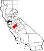
CDPs Ballico | Bear Creek | Cressey | Delhi | Dos Palos Y | El Nido | Franklin | Hilmar-Irwin | Le Grand | McSwain | Planada | Santa Nella | Snelling | South Dos Palos | Stevinson | Tuttle | University of California Merced | Volta | Winton
Unincorporated
communitiesAmsterdam | Arena | Athlone | Brito | Buhach | Calpack | Castle Gardens | Cortez | Fergus | Fluhr | Hamburg Farms | Hilmar | Hopeton | Ingomar | Irwin | Kadota | Lingard | Merced Falls | Plainsburg | Santa Rita Park | The Grove | Trent
Ghost towns Abbato | Agatha | Aladdin | Alcant | Alexandria | Arundel | Bellevue | Brickville | Burchell | Central Point | Charleston | Chester | Colony Center | Cuba | Dickenson | Edendale | Elgin | Ferrin | Gadwall | Gracey | Gwin | Hoff | La Branza | Linora | Marguerite | Nairn | Ortigalito | Plainsburg | Sturgeon | Tenger | Union | Yam
Categories:- Census-designated places in Merced County, California
- Unincorporated communities in California
- Populated places in California with Hispanic majority populations


Wikimedia Foundation. 2010.