- Eagle Field (airport)
-
Eagle Field 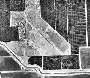
1998 USGS Photo IATA: none – ICAO: none Summary Airport type Private Owner Joseph L. Davis Location Fresno County, near Dos Palos, California Elevation AMSL 153 ft / 47 m Coordinates 36°53′56″N 120°40′18″W / 36.89889°N 120.67167°WCoordinates: 36°53′56″N 120°40′18″W / 36.89889°N 120.67167°W Website Runways Direction Length Surface ft m 12/30 2,300 701 Asphalt Eagle Field (FAA LID: CL01) is a private airport located approximately 7 miles (11 km) south-southwest of Dos Palos, California, officially in Firebaugh, California.
Contents
History
It was first activated on 24 June 1943 as United States Army Air Forces primary (level 1) pilot training airfield known as Dos Palos Airport. It was assigned to the USAAF West Coast Training Center (later Western Flying Training Command), operated under contract by Coast Aviation Corp. The airport had three turf runways, aligned 00/18 (1,900 feet); 09/27 (1,900 feet), and 13/31 (2,300 feet). It had four satellite airfields in the local area for emergency and overflow landings.
Flying training was performed with Ryan PT-22s as the primary trainer. Also had several PT-17 Stearmans and a few P-40 Warhawks assigned. It was inactivated on 28 December 1944 with the drawdown of AAFTC's pilot training program and was declared surplus and turned over to the Army Corps of Engineers.
The base was used as an aircraft storage depot for excess USAAF training aircraft, having UC-78s, PT-17s, Vultee BT-13/15, and AT-6 Texans. Eventually it was discharged to the War Assets Administration (WAA) and was used as a crop dusting airfield. After the war, the city of Dos Palos was to develop Eagle Field as a municipal airport but they failed in their effort. The property reverted to the federal government. In 1980 it was put up for auction.
Later on it became home of the Central California Historical Military Museum, which continues to operate at the field. The museum is also known as Eagle Field AAF - WWII Living History and Military Museum. Many wartime buildings remain at the airfield which is open to the public.
See also
References
 This article incorporates public domain material from websites or documents of the Air Force Historical Research Agency.
- Shaw, Frederick J. (2004), Locating Air Force Base Sites History’s Legacy, Air Force History and Museums Program, United States Air Force, Washington DC, 2004.
- Manning, Thomas A. (2005), History of Air Education and Training Command, 1942–2002. Office of History and Research, Headquarters, AETC, Randolph AFB, Texas ASIN: B000NYX3PC
External links
- Eagle Field - Central California Historical Military Museum
- Abandoned & Little-Known Airfields Eagle Field
- FAA Terminal Procedures for CL01, effective 20 October 2011
- Resources for this airport:
- AirNav airport information for CL01
- FlightAware airport information and live flight tracker
- SkyVector aeronautical chart for CL01
 Army Air Forces Training Command
Flying Training Flying Schools Eastern Flying Training Command · Central Flying Training Command · Western Flying Training CommandSpecialized Schools Bombardier · Contract Flying · Glider Training · Gunnery · Navigator
Technical Training Eastern Technical Training Command · Central Technical Training Command · Western Technical Training CommandCategories:- 1943 establishments
- USAAF Contract Flying School Airfields
- Airfields of the United States Army Air Forces in California
- Airports in Fresno County, California
- Museums in Fresno County, California
- Military and war museums in California
- Aerospace museums in California


Wikimedia Foundation. 2010.