- Los Banos, California
Infobox Settlement
official_name = Los Banos, California
settlement_type =City
imagesize =
image_caption =
image_
imagesize =
image_caption =
image_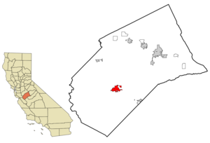
mapsize = 250x200px
map_caption = Location in Merced County and the state ofCalifornia
mapsize1 =
map_caption1 =
subdivision_type = Country
subdivision_type1 = State
subdivision_type2 = County
subdivision_name =United States
subdivision_name1 =California
subdivision_name2 = Merced
government_type =
leader_title =
leader_name =
established_date =
area_magnitude =
area_total_km2 = 21.1
area_total_sq_mi = 8.1
area_land_km2 = 20.8
area_land_sq_mi = 8
area_water_km2 = 0.3
area_water_sq_mi = 0.1
elevation_ft = 118
elevation_m = 36
population_as_of = 2007
population_footnotes =
population_total = 38,884
population_metro =
population_density_km2 = 1226
population_density_sq_mi = 3193.7
timezone = Pacific (PST)
utc_offset = -8
latd = 37 |latm = 3 |lats = 44 |latNS = N
longd = 120 |longm = 50 |longs = 39 |longEW = W
timezone_DST = PDT
utc_offset_DST = -7
postal_code_type =ZIP code
postal_code = 93635
area_code = 209
blank_name = FIPS code
blank_info = 06-44028
blank1_name = GNIS feature ID
blank1_info = 0277547
footnotes =
website =Los Banos is a city in Merced County,
California , near the junction of State Route 152 and Interstate 5. The population was 25,869 at the 2000 census. As of 2006 the World Gazetteer calculates the population as 35,054. The name "los banos" has its origins with Spanish and was named after a natural water spring that feeds natural wetlands in the western San Joaquín Valley. The original Spanish spelling was Los Baños, meaning "the baths," in reference to the adjacent water source. Its official spelling is without the eñe. However most official signs, even on Interstate 5, do insert the tilde above the n. It can be pronounced as if the eñe were present as in "los banyos," or as it is spelled - an anglicized "loss bannos". The city is served byLos Banos Municipal Airport for air transport access.Geography
Los Banos is located on the west side of the San Joaquin Valley in an area north of the
Westlands Water District at coor dms|37|3|44|N|120|50|39|W|city (37.062356, -120.844174)GR|1. To the west is theSan Luis reservoir and Interstate 5, which runs north-to-south between theBay Area andLos Angeles According to the
United States Census Bureau , the city has a total area of 8.2square mile s (21.1km² ), of which, 8.0 square miles (20.8 km²) of it is land and 0.1 square miles (0.3 km²) of it (1.47%) is water. It sits approximately fifty feet above sea level in elevation.Los Banos sits on the southwestern edge of extensive national and state game refuges; wetlands that support waterfowl and other wildlife habitat along a stretch of the San Joaquin river that still carries water and the
Grasslands Ecological Area , home to rareCalifornia Grasslands habitat. The Los Banos Complex includesSan Luis National Wildlife Refuge which includes the Kesterson Unit, East Bear Creek, West Bear Creek and the Blue Goose Unit. Nearby are theMerced National Wildlife Refuge and theSan Joaquin River National Wildlife Refuge . Fishers, hunters, birdwatchers and other recreational users flock to Los Banos year round.Demographics
As of the
census GR|2 of 2000, there were 25,869 people, 7,721 households, and 6,223 families residing in the city. Thepopulation density was 3,218.7 people per square mile (1,242.3/km²). There were 8,049 housing units at an average density of 1,001.5/sq mi (386.5/km²). The racial makeup of the city was 58.61% White, 4.25% African American, 1.35% Native American, 2.34% Asian, 0.33% Pacific Islander, 26.90% from other races, and 6.21% from two or more races. Hispanic or Latino of any race were 50.44% of the population.There were 7,721 households out of which 48.9% had children under the age of 18 living with them, 62.5% were married couples living together, 12.4% had a female householder with no husband present, and 19.4% were non-families. 15.8% of all households were made up of individuals and 7.0% had someone living alone who was 65 years of age or older. The average household size was 3.33 and the average family size was 3.69.
In the city the population was spread out with 35.1% under the age of 18, 8.9% from 18 to 24, 29.9% from 25 to 44, 16.8% from 45 to 64, and 9.3% who were 65 years of age or older. The median age was 30 years. For every 100 females there were 99.0 males. For every 100 females age 18 and over, there were 96.0 males.
The median income for a household in the city was $43,690, and the median income for a family was $45,304. Males had a median income of $38,294 versus $27,994 for females. The
per capita income for the city was $15,582. About 9.8% of families and 12.1% of the population were below thepoverty line , including 13.9% of those under age 18 and 9.8% of those age 65 or over.Since the 1980s, the city's population has changed with a continuing influx of people who work in the San Jose/
Silicon Valley area but seek more affordable housing, a pattern seen in many other small towns within commuting distance of Silicon Valley.Politics
In the state legislature Los Banos is located in the 12th Senate District, represented by Republican
Jeff Denham , and in the 17th Assembly District, represented by DemocratCathleen Galgiani . Federally, Los Banos is located inCalifornia's 18th congressional district , which has a Cook PVI of D +3 [cite web | title = Will Gerrymandered Districts Stem the Wave of Voter Unrest? | publisher = Campaign Legal Center Blog | url=http://www.clcblog.org/blog_item-85.html | accessdate = 2007-10-20] and is represented by DemocratDennis Cardoza . Tommy Jones is the mayor.History and culture
Los Banos area was initially settled, according to Mexican land grant records, back in the 1840s. The first American to settle in the area was Uriah Wood, who built his two room cabin in 1859. [Uriah Wood First White Settler in LB, Los Banos Enterprise, 7-16 1964 p D-4] The original site of Los Banos was located several miles from the current town center, about a mile and half west of the railroad near present day Volta. The town was essentially a trading post and received its name when the Post Office was established and the Post Office Department designated the office "Los Banos" after the nearby creek. When the railroad arrived, Los Banos relocated to its present day site. [Merced County CA Archives History - Books .....Early Days On The West Side (1925) Chapter XII]
Land and water rights were important to early Los Banos residents. But those rights were recongnized only when the land and deed were registered. Sometimes those rights depended on fleet footedness, as it did in the "race" between Los Banos residents Uriah Wood and Henry Miller. Wood, whose homestead resided off of Badger Flat Road, raced Miller to the land office in Stockton to insure his claim to the land would be recognized. After crossing the San Joaquin River, Wood paid the ferryman $5 to hold the boat on the east side of the river to insure he would gain sufficient distance from Miller to insure he would reach the land office first. Wood did and the seven sections that he registered cost him only .45¢ an acre. [Merced County CA Archives History - Books .....Early Days On The West Side (1925) Chapter XII]
. The 10-acre half-oval public plaza features a monumental scale bronze arrangement of Miller with cattle. At one time in the late nineteenth century, Miller was the largest land owner in the United States. His company, the Miller-Lux Corporation, was headquartered in Los Banos on a site currently housing the Mexican restaurant España's and the Canal Farm Inn.
Los Banos has a long history of Portuguese and Basque immigrants, as do many of the nearby towns on the west side of the San Joaquin Valley. This is reflected both in local restaurants and in several festivals and parades that take place during the year. Los Banos is locally known for its annual
May Day Fair during the first week of May.References
External links
* [http://www.losbanos.org/ Official City of Los Banos Web Site]
* [http://www.losbanosenterprise.com/ Local Online Newspaper]
* [http://www.ourlosbanos.com/ Local Forum And Los Banos Information Site] - OurLosBanos.com
* [http://www.fws.gov/sanluis/ San Luis National Wildlife Refuges]
Wikimedia Foundation. 2010.