- Crows Landing, California
-
Crows Landing — census-designated place — Position in California.
 Crows Landing
Coordinates: 37°23′41″N 121°05′04″W / 37.39472°N 121.08444°WCoordinates: 37°23′41″N 121°05′04″W / 37.39472°N 121.08444°W Country  United States
State  California
County Stanislaus Area[1] – Total 3.169 sq mi (8.208 km2) – Land 3.169 sq mi (8.208 km2) – Water 0 sq mi (0 km2) 0% Elevation[2] 128 ft (39 m) Population (2010) – Total 355 – Density 112/sq mi (43.3/km2) Time zone Pacific (PST) (UTC-8) – Summer (DST) PDT (UTC-7) ZIP Code GNIS feature ID 2582988 U.S. Geological Survey Geographic Names Information System: Crows Landing, California Crows Landing is a census-designated place (CDP) in Stanislaus County, California.[2] Crows Landing is about 6 miles (9.7 km) southeast of Patterson. It also gives its name to a brand of wine produced in the area. Crows Landing sits at an elevation of 128 feet (39 m).[2] The 2010 United States census reported Crows Landing's population was 355.
Contents
History
Crows Landing was relocated 4 miles (6.4 km) west to be established on the Southern Pacific Railroad tracks in 1887.
There's a small airport west of town that was used as an auxiliary landing site for training World War II pilots from Naval Air Station Alameda, and later for NASA's experimental aircraft from the Ames Research Center in Mountain View. It was transferred to Stanislaus County in 2000.[3]
In 2011, a report from KCRA-TV has is that NASA Crows Landing Airport, after closure, will be demolished into a film studio, thanks to Mare Island Studios.
Geography
According to the United States Census Bureau, the CDP covers an area of 3.2 square miles (8.2 km²), all of it land.
Demographics
The 2010 United States Census[4] reported that Crows Landing had a population of 355. The population density was 112.0 people per square mile (43.3/km²). The racial makeup of Crows Landing was 162 (45.6%) White, 5 (1.4%) African American, 1 (0.3%) Native American, 0 (0.0%) Asian, 0 (0.0%) Pacific Islander, 182 (51.3%) from other races, and 5 (1.4%) from two or more races. Hispanic or Latino of any race were 248 persons (69.9%).
The Census reported that 355 people (100% of the population) lived in households, 0 (0%) lived in non-institutionalized group quarters, and 0 (0%) were institutionalized.
There were 121 households, out of which 44 (36.4%) had children under the age of 18 living in them, 66 (54.5%) were opposite-sex married couples living together, 9 (7.4%) had a female householder with no husband present, 8 (6.6%) had a male householder with no wife present. There were 3 (2.5%) unmarried opposite-sex partnerships, and 0 (0%) same-sex married couples or partnerships. 36 households (29.8%) were made up of individuals and 19 (15.7%) had someone living alone who was 65 years of age or older. The average household size was 2.93. There were 83 families (68.6% of all households); the average family size was 3.73.
The population was spread out with 99 people (27.9%) under the age of 18, 34 people (9.6%) aged 18 to 24, 85 people (23.9%) aged 25 to 44, 81 people (22.8%) aged 45 to 64, and 56 people (15.8%) who were 65 years of age or older. The median age was 37.7 years. For every 100 females there were 107.6 males. For every 100 females age 18 and over, there were 106.5 males.
There were 143 housing units at an average density of 45.1 per square mile (17.4/km²), of which 77 (63.6%) were owner-occupied, and 44 (36.4%) were occupied by renters. The homeowner vacancy rate was 2.5%; the rental vacancy rate was 6.4%. 214 people (60.3% of the population) lived in owner-occupied housing units and 141 people (39.7%) lived in rental housing units.
References
- ^ U.S. Census
- ^ a b c U.S. Geological Survey Geographic Names Information System: Crows Landing, California
- ^ "Crows Landing Naval Auxiliary Landing Field (NRC)". Abandoned & Little-Known Airfields. http://members.tripod.com/airfields_freeman/CA/Airfields_CA_CValley.htm#crows. Retrieved 22 April 2010.
- ^ All data are derived from the United States Census Bureau reports from the 2010 United States Census, and are accessible on-line here. The data on unmarried partnerships and same-sex married couples are from the Census report DEC_10_SF1_PCT15. All other housing and population data are from Census report DEC_10_DP_DPDP1. Both reports are viewable online or downloadable in a zip file containing a comma-delimited data file. The area data, from which densities are calculated, are available on-line here. Percentage totals may not add to 100% due to rounding. The Census Bureau defines families as a household containing one or more people related to the householder by birth, opposite-sex marriage, or adoption. People living in group quarters are tabulated by the Census Bureau as neither owners nor renters. For further details, see the text files accompanying the data files containing the Census reports mentioned above.
Municipalities and communities of Stanislaus County, California Cities 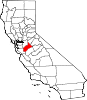
CDPs Airport | Bret Harte | Bystrom | Cowan | Crows Landing | Del Rio | Denair | Diablo Grande | East Oakdale | Empire | Grayson | Hickman | Keyes | Monterey Park Tract | Parklawn | Riverdale Park | Rouse | Salida | Shackelford | Valley Home | West Modesto | Westley
Unincorporated
communitiesAdela | Aurora | Claribel | Claus | Eugene | Hills Ferry | Knights Ferry | La Grange | Langworth | Las Palmas | McHenry | Montpelier | Mountain View | Roberts Ferry | Timba | Tuolumne | Twin Rivers
Ghost towns Tuolumne City
Categories:- Census-designated places in Stanislaus County, California
- Populated places in California with Hispanic majority populations
- Unincorporated communities in California


Wikimedia Foundation. 2010.