- Turlock, California
Infobox Settlement
official_name = Turlock, California
other_name =
native_name =
nickname = The city of God
settlement_type =City
motto =
imagesize =
image_caption =
flag_size =
image_
seal_size =
image_shield =
shield_size =
image_blank_emblem =
blank_emblem_type =
blank_emblem_size =
imagesize =
image_caption =
flag_size =
image_
seal_size =
image_shield =
shield_size =
image_blank_emblem =
blank_emblem_type =
blank_emblem_size =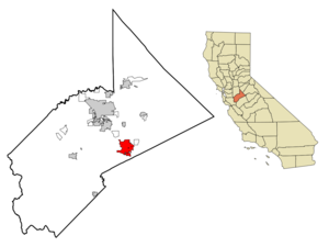
mapsize = 250x200px
map_caption = Location in Stanislaus County and the state ofCalifornia
mapsize1 =
map_caption1 =
image_dot_
dot_mapsize =
dot_map_caption =
dot_x =
dot_y =
pushpin_
pushpin_label_position =
pushpin_map_caption =
pushpin_mapsize =
subdivision_type = Country
subdivision_name =United States
subdivision_type1 = State
subdivision_name1 =California
subdivision_type2 = County
subdivision_name2 = Stanislaus
subdivision_type3 =
subdivision_name3 =
subdivision_type4 =
subdivision_name4 =
government_footnotes =
government_type =
leader_title =
leader_name =
leader_title1 =
leader_name1 =
leader_title2 =
leader_name2 =
leader_title3 =
leader_name3 =
leader_title4 =
leader_name4 =
established_title =
established_date =
established_title2 =
established_date2 =
established_title3 =
established_date3 =
area_magnitude =
unit_pref =
area_footnotes =
area_total_km2 = 34.5
area_land_km2 = 34.5
area_water_km2 = 0
area_total_sq_mi = 13.3
area_land_sq_mi = 13.3
area_water_sq_mi = 0
area_water_percent =
area_urban_km2 =
area_urban_sq_mi =
area_metro_km2 =
area_metro_sq_mi =
area_blank1_title =
area_blank1_km2 =
area_blank1_sq_mi =
population_as_of = 2007
population_footnotes =
population_note =
population_total = 69,321
population_density_km2 = 1617.7
population_density_sq_mi = 4196.2
population_metro =
population_density_metro_km2 =
population_density_metro_sq_mi =
population_urban =
population_density_urban_km2 =
population_density_urban_sq_mi =
population_blank1_title =
population_blank1 =
population_density_blank1_km2 =
population_density_blank1_sq_mi =
timezone = Pacific (PST)
utc_offset = -8
timezone_DST = PDT
utc_offset_DST = -7
latd = 37 |latm = 30 |lats = 21 |latNS = N
longd = 120 |longm = 50 |longs = 56 |longEW = W
elevation_footnotes =
elevation_m = 31
elevation_ft = 102
postal_code_type =ZIP code s
postal_code = 95380-95382
area_code = 209
blank_name = FIPS code
blank_info = 06-80812
blank1_name = GNIS feature ID
blank1_info = 0277622
website =
footnotes =Turlock is a city in Stanislaus County,
California ,United States . As of the 2000 Census, the city had a total population of 55,810, the second-largest city in Stanislaus County. The city's recent rapid growth is evident in its current official population of 69,321. [As reported by the [http://www.ci.turlock.ca.us/ city website] and official city signs.]Geography
Turlock is located at coor dms|37|30|21|N|120|50|56|W (37.505725, -120.849019)GR|1, between
Modesto, California andMerced, California , at the intersection of State Route 99 and State Route 165.Turlock lies in the
San Joaquin Valley , at an elevation of about 31 m (101ft) above MSL.According to the
United States Census Bureau , the city has a total area of 13.3 square miles (34.4 km²)GR|1, all land.History
Turlock was founded on December 22, 1871 by John W Mitchell, a prominent Cattle Rancher in the area. Construction of the
Central Pacific Railroad at that time had reached a station to be named after Mitchell, but he declined to have the station named after himself and suggested instead it be named after Turlough inCounty Mayo ,Ireland . Thus, the new railroad town was named Turlock.While it grew to be a relatively prosperous and busy hub of activity throughout the end of the 19th century, it was not incorporated as a city until February 15, 1908. [http://209.85.173.104/search?q=cache:Jr30tZhaeM0J:gifi.stat.ucla.edu/background/CodReg/LocGov/Cities_by_incorp_date.pdf+turlock+ca+incorporation+date+1908&hl=en&ct=clnk&cd=3&gl=us&client=firefox-a] By that time intensive agricultural development surrounded most of the city (agriculture remains a major economic force in the region in current times). Turlock became known as the "Heart of the Valley" because of its agricultural production. In the 1930s Turlock was cited by "Ripley's Believe It or Not" as having the most churches per capita in the
United States ; the number of churches had partly to do wide the variety of ethnic churches, which were established for the relatively small settler population. Various religious centers reflecting a diverse population such asSikh Gurdwaras, variousChristian Assyria n churches, and many mainlineProtestant ,Mormon andCatholic churches have been built.In 1960,California State University, Stanislaus , opened to students, helping to spur growth in the city as the university expanded in its early years. In the 1970s, State Route 99 (formerly U.S. Route 99) was completed through the area, largely bypassing the then-incorporated areas of Turlock in a route to the west of the city through mostly undeveloped land. Since that time, the city has grown westward considerably to meet the freeway's north-south path, although urban development west of the freeway has only recently begun to take hold. In an attempt to allow for orderly growth of the city, comprehensive growth master plans have established urban growth boundaries since the 1960s.Turlock experienced extensive growth of both residential and commercial areas in the 1980s, following a statewide boom in housing demand and construction. The housing boom of the 1980s diminished in the early 1990s but increased again in the second half of the 1990s, especially as a result of
San Francisco Bay Area growth, which placed a higher demand for more affordable housing in outlying areas. Following the Bay Area's "dot-com bust," housing demand has intensified, suggesting a strong local demand for housing. In recent years, Bay Area influence in housing demand has produced higher and higher house prices in an area formerly known for its affordable housing.A recent boom in the retail sector has produced a considerable amount of growth along the Highway 99 corridor.
The city's long-established northern
urban growth boundary limit, Taylor Road, has already been reached as a result of rapid residential development from the late 1990s to the present. Urban growth any further north than Taylor is restricted by the city's Master Plan.Demographics
As of the
United States 2000 Census GR|2, there are 55,810 people, 18,408 households, and 13,434 families residing in the city. Thepopulation density is 4,194.7 people per square mile (1,620.2/km²). There are 19,095 housing units at an average density of 1,435.2/sq mi (554.3/km²). The racial makeup of the city is 72.33% White, 1.43% African American, 0.94% Native American, 4.51% Asian, 0.27% Pacific Islander, 15.16% from other races, and 5.35% from two or more races. 29.42% of the population are Hispanic or Latino of any race.4.9% of Turlock's population reported ancestry in the category "Assyrian/Chaldean/Syriac". This was the fourth highest percentage in the United States for this category, the highest for a community outside of
Oakland County, Michigan and the only one of the top seven places in this category that was not one of Detroit's northern suburbs. [ [http://www.epodunk.com/ancestry/Assyrian-Chaldean-Syriac.html Assyrian-Chaldean-Syriac ancestry by city - ePodunk ] ]There are 18,408 households out of which 40.3% have children under the age of 18 living with them, 54.8% are married couples living together, 13.1% have a female householder with no husband present, and 27.0% are non-families. 21.2% of all households are made up of individuals and 9.1% have someone living alone who is 65 years of age or older. The average household size is 2.92 and the average family size is 3.42.
In the city the population is spread out with 29.8% under the age of 18, 11.4% from 18 to 24, 28.9% from 25 to 44, 18.1% from 45 to 64, and 11.8% who are 65 years of age or older. The median age is 31 years. For every 100 females there are 92.8 males. For every 100 females age 18 and over, there are 89.1 males.
The median
income for a household in the city is $39,050, and the median income for a family is $44,501. Males have a median income of $35,801 versus $27,181 for females. Theper capita income for the city is $16,844. 16.2% of the population and 12.4% of families are below thepoverty line . Out of the total population, 18.8% of those under the age of 18 and 9.8% of those 65 and older are living below the poverty line.Culturally, the area is home to large concentrations of Americans of
South Asian descent (particularlySikh s),Mexican-American s, and people of varied European descent. Swedes and Portuguese were early settlers to the area. Continued immigration from theAzores Islands (Portugal ) in recent decades has established a large Portuguese-speaking community within the city. Turlock is a major center for the Assyrian community in the United States, [ [http://www.nineveh.com/The%20Assyrians%20of%20the%20San%20Joaquin%20Valley,%20California.html The Assyrians of the San Joaquin Valley, California: From Early Settlements to the Present ] ] who began to arrive in the 1910s, with an increased influx into Turlock in the 1970s following political strife inIraq andIran .Politics
In the state legislature Turlock is located in the 12th Senate District, represented by Republican
Jeff Denham , and in the 26th Assembly District, represented by RepublicanGreg Aghazarian . Federally, Turlock is located inCalifornia's 19th congressional district , which has a Cook PVI of R +10 [cite web | title = Will Gerrymandered Districts Stem the Wave of Voter Unrest? | publisher = Campaign Legal Center Blog | url=http://www.clcblog.org/blog_item-85.html | accessdate = 2008-02-10] and is represented by RepublicanGeorge Radanovich .Education
Turlock is the home of
California State University, Stanislaus , aliberal arts university , and part of the 23-campusCalifornia State University system. As of March 2005, CSU Stanislaus reported a student population of 6,192 undergraduate students. The number rises to 7,858 when considering all students, including graduate students.Turlock is home to two public high schools:
Turlock High School and John H. Pitman High School. It also has two continuation schools: Roselawn High School and John B. Allard High School. [ [http://www.turlock.k12.ca.us/roselawn/ Roselawn High School ] ] [ [http://phs.turlock.k12.ca.us/ Pitman High School ] ] Turlock High School opened in 1907, and Pitman opened in a major growth zone of northern Turlock in 2002.Trivia
* The local newspaper is the
Turlock Journal
*MedicAlert was founded in Turlock byDr. Marion Collins
*Creature Tech --a graphic novel byDoug Tennapel --takes place in Turlock.
* In the short-lived cartoonEarth Worm Jim , Turlock was the setting.References
External links
* [http://www.ci.turlock.ca.us/ City of Turlock official website]
* [http://www.city-data.com/city/Turlock-California.html Factual Information from www.city-data.com]
Wikimedia Foundation. 2010.