- Denair, California
-
Denair — CDP — Motto: The Oasis of the San Joaquin Valley Location in Stanislaus County and the state of California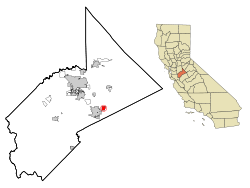
Coordinates: 37°31′39″N 120°47′59″W / 37.5275°N 120.79972°WCoordinates: 37°31′39″N 120°47′59″W / 37.5275°N 120.79972°W Country  United States
State  California
County Stanislaus Area[1] - Total 1.981 sq mi (5.131 km2) - Land 1.981 sq mi (5.131 km2) - Water 0 sq mi (0 km2) 0% Elevation 125 ft (38 m) Population (2010) - Total 4,404 - Density 2,223.1/sq mi (858.3/km2) Time zone Pacific (PST) (UTC-8) - Summer (DST) PDT (UTC-7) ZIP code 95316 Area code(s) 209 FIPS code 06-18856 GNIS feature ID 1655964 Denair is a census-designated place (CDP) in Stanislaus County, California, United States. The population was 4,404 at the 2010 census, up from 3,446 at the 2000 census. It is part of the Modesto Metropolitan Statistical Area.
Contents
History
Denair was established in 1904, along the Santa Fe Railroad tracks. The town was renamed from Elmwood Colony to Denair in honor of a local landowner, John Denair. One famous person known to have grown up in Denair is artist and musician Doug TenNapel. Waylon Jennings robbed a gas station in 1956.
Geography
Denair is located at 37°31′39″N 120°47′59″W / 37.5275°N 120.79972°W (37.527532, -120.799813)[2].
According to the United States Census Bureau, the CDP has a total area of 2.0 square miles (5.2 km2), all of it land.
Demographics
2010
The 2010 United States Census[3] reported that Denair had a population of 4,404. The population density was 2,222.9 people per square mile (858.2/km²). The racial makeup of Denair was 3,425 (77.8%) White, 25 (0.6%) African American, 55 (1.2%) Native American, 42 (1.0%) Asian, 4 (0.1%) Pacific Islander, 699 (15.9%) from other races, and 154 (3.5%) from two or more races. Hispanic or Latino of any race were 1,423 persons (32.3%).
The Census reported that 4,404 people (100% of the population) lived in households, 0 (0%) lived in non-institutionalized group quarters, and 0 (0%) were institutionalized.
There were 1,451 households, out of which 611 (42.1%) had children under the age of 18 living in them, 913 (62.9%) were opposite-sex married couples living together, 168 (11.6%) had a female householder with no husband present, 86 (5.9%) had a male householder with no wife present. There were 71 (4.9%) unmarried opposite-sex partnerships, and 10 (0.7%) same-sex married couples or partnerships. 221 households (15.2%) were made up of individuals and 113 (7.8%) had someone living alone who was 65 years of age or older. The average household size was 3.04. There were 1,167 families (80.4% of all households); the average family size was 3.38.
The population was spread out with 1,233 people (28.0%) under the age of 18, 407 people (9.2%) aged 18 to 24, 1,186 people (26.9%) aged 25 to 44, 1,098 people (24.9%) aged 45 to 64, and 480 people (10.9%) who were 65 years of age or older. The median age was 34.8 years. For every 100 females there were 96.8 males. For every 100 females age 18 and over, there were 94.3 males.
There were 1,523 housing units at an average density of 768.7 per square mile (296.8/km²), of which 1,128 (77.7%) were owner-occupied, and 323 (22.3%) were occupied by renters. The homeowner vacancy rate was 2.1%; the rental vacancy rate was 5.2%. 3,275 people (74.4% of the population) lived in owner-occupied housing units and 1,129 people (25.6%) lived in rental housing units.
2000
As of the census[4] of 2000, there are 3,446 people, 1,131 households, and 907 families residing in the CDP. The population density is 1,697.3 people per square mile (655.4/km²). There are 1,162 housing units at an average density of 572.3 per square mile (221.0/km²). The racial makeup of the CDP is 78.61% White, 0.26% African American, 1.45% Native American, 0.23% Asian, 0.03% Pacific Islander, 15.35% from other races, and 4.06% from two or more races. 26.55% of the population are Hispanic or Latino of any race.
There are 1,131 households out of which 42.2% have children under the age of 18 living with them, 63.4% are married couples living together, 11.9% have a female householder with no husband present, and 19.8% are non-families. 15.4% of all households are made up of individuals and 6.6% have someone living alone who is 65 years of age or older. The average household size is 3.05 and the average family size is 3.41.
In the CDP the population is spread out with 29.7% under the age of 18, 9.3% from 18 to 24, 27.2% from 25 to 44, 24.1% from 45 to 64, and 9.7% who are 65 years of age or older. The median age is 34 years. For every 100 females there are 97.0 males. For every 100 females age 18 and over, there are 97.0 males.
The median income for a household in the CDP is $41,399, and the median income for a family is $46,538. Males have a median income of $38,598 versus $28,929 for females. The per capita income for the CDP is $15,278. 16.1% of the population and 11.1% of families are below the poverty line. Out of the total population, 25.3% of those under the age of 18 and 3.0% of those 65 and older are living below the poverty line.
Controversy
On November 8, 2010 Denair Middle School asked a student to remove the American flag from the back of his bicycle citing mexicans and fears for the students safety. Four days later, Denair School Superintendent, Edward Parraz overturned the decision again allowing the student to display the flag adding that the racial concerns would be discussed with the students involved and their parents.[5][6][7][8][9][10][11]
Politics
In the state legislature Denair is located in the 14th Senate District, represented by Republican Tom Berryhill, and in the 26th Assembly District, represented by Republican Bill Berryhill. Federally, Denair is located in California's 19th congressional district, which has a Cook PVI of R +10[12] and is represented by Republican Jeff Denham.
References
- ^ U.S. Census
- ^ "US Gazetteer files: 2010, 2000, and 1990". United States Census Bureau. 2011-02-12. http://www.census.gov/geo/www/gazetteer/gazette.html. Retrieved 2011-04-23.
- ^ All data are derived from the United States Census Bureau reports from the 2010 United States Census, and are accessible on-line here. The data on unmarried partnerships and same-sex married couples are from the Census report DEC_10_SF1_PCT15. All other housing and population data are from Census report DEC_10_DP_DPDP1. Both reports are viewable online or downloadable in a zip file containing a comma-delimited data file. The area data, from which densities are calculated, are available on-line here. Percentage totals may not add to 100% due to rounding. The Census Bureau defines families as a household containing one or more people related to the householder by birth, opposite-sex marriage, or adoption. People living in group quarters are tabulated by the Census Bureau as neither owners nor renters. For further details, see the text files accompanying the data files containing the Census reports mentioned above.
- ^ "American FactFinder". United States Census Bureau. http://factfinder.census.gov. Retrieved 2008-01-31.
- ^ http://www.fox40.com/news/headlines/ktxl-americanflagbike11122010,0,3045879.htmlstory
- ^ "School Reverses Course After Ordering Student to Remove American Flag From Bike - American Flag - Fox Nation". Fox News. 12 November 2010. http://nation.foxnews.com/american-flag/2010/11/12/school-bans-student-flying-us-flag-racial-reasons.
- ^ http://www.fox40.com/news/headlines/ktxl-americanflagbike11122010,0,3045879.htmlstory
- ^ http://www.kcra.com/news/25754519/detail.html
- ^ http://www.fox40.com/videobeta/?watchId=74dc92b0-5969-4a9e-88ff-d708569bd6d5
- ^ "Flag Removed: Interview with school Superintendent". Fox40. 12 November 2010. http://www.fox40.com/videobeta/?watchId=74dc92b0-5969-4a9e-88ff-d708569bd6d5.
- ^ You Tube from KCRA: Bikers Escort Denair Boy to School
- ^ "Will Gerrymandered Districts Stem the Wave of Voter Unrest?". Campaign Legal Center Blog. http://www.clcblog.org/blog_item-85.html. Retrieved 2008-02-10.
Municipalities and communities of Stanislaus County, California County seat: Modesto Cities 
CDPs Airport | Bret Harte | Bystrom | Cowan | Crows Landing | Del Rio | Denair | Diablo Grande | East Oakdale | Empire | Grayson | Hickman | Keyes | Monterey Park Tract | Parklawn | Riverdale Park | Rouse | Salida | Shackelford | Valley Home | West Modesto | Westley
Unincorporated
communitiesAdela | Aurora | Claribel | Claus | Eugene | Hills Ferry | Knights Ferry | La Grange | Langworth | Las Palmas | McHenry | Montpelier | Mountain View | Roberts Ferry | Timba | Tuolumne | Twin Rivers
Ghost towns Tuolumne City
Categories:- Census-designated places in Stanislaus County, California


Wikimedia Foundation. 2010.