- Newman, California
-
City of Newman — City — "Main Street" in Newman Location in Stanislaus County and the state of California
Coordinates: 37°18′54″N 121°1′21″W / 37.315°N 121.0225°WCoordinates: 37°18′54″N 121°1′21″W / 37.315°N 121.0225°W Country  United States
State  California
County Stanislaus Area[1] – Total 2.102 sq mi (5.444 km2) – Land 2.102 sq mi (5.444 km2) – Water 0 sq mi (0 km2) 0% Elevation 89 ft (27 m) Population (2010) – Total 10,224 – Density 4,863.9/sq mi (1,878/km2) Time zone Pacific (PST) (UTC-8) – Summer (DST) PDT (UTC-7) ZIP code 95360 Area code(s) 209 FIPS code 06-51140 GNIS feature ID 0277563 Website www.cityofnewman.com Newman is a city in Stanislaus County, California, United States. The population was 10,224 at the 2010 census, up from 7,093 at the 2000 census. It is part of the Modesto Metropolitan Statistical Area. Founded by Simon Newman in 1888, the City of Newman is part of the West Side of California's central valley. Known for its annual Fall Festival and small town charm, the City of Newman retains its rural flavor while keeping up with larger more-urbanized communities.[2]
Contents
Geography
Newman is located at 37°18′54″N 121°1′21″W / 37.315°N 121.0225°W (37.315038, -121.022476)[3] According to the United States Census Bureau, the city has a total area of 2.1 square miles (5.4 km2), all of it land. Newman currently has over 10,000 people. Newman is located on California State Route 33 between the towns of Gustine and Crows Landing. Interstate 5 is located a few miles to the west of the city.
Demographics
2010
The 2010 United States Census[4] reported that Newman had a population of 10,224. The population density was 4,864.2 people per square mile (1,878.1/km²). The racial makeup of Newman was 6,812 (66.6%) White, 234 (2.3%) African American, 106 (1.0%) Native American, 191 (1.9%) Asian, 40 (0.4%) Pacific Islander, 2,287 (22.4%) from other races, and 554 (5.4%) from two or more races. Hispanic or Latino of any race were 6,299 persons (61.6%).
The Census reported that 10,158 people (99.4% of the population) lived in households, 0 (0%) lived in non-institutionalized group quarters, and 66 (0.6%) were institutionalized.
There were 3,006 households, out of which 1,581 (52.6%) had children under the age of 18 living in them, 1,818 (60.5%) were opposite-sex married couples living together, 400 (13.3%) had a female householder with no husband present, 214 (7.1%) had a male householder with no wife present. There were 232 (7.7%) unmarried opposite-sex partnerships, and 16 (0.5%) same-sex married couples or partnerships. 466 households (15.5%) were made up of individuals and 174 (5.8%) had someone living alone who was 65 years of age or older. The average household size was 3.38. There were 2,432 families (80.9% of all households); the average family size was 3.75.
The population was spread out with 3,317 people (32.4%) under the age of 18, 1,015 people (9.9%) aged 18 to 24, 2,773 people (27.1%) aged 25 to 44, 2,250 people (22.0%) aged 45 to 64, and 869 people (8.5%) who were 65 years of age or older. The median age was 30.7 years. For every 100 females there were 97.9 males. For every 100 females age 18 and over, there were 96.8 males.
There were 3,357 housing units at an average density of 1,597.2 per square mile (616.7/km²), of which 2,002 (66.6%) were owner-occupied, and 1,004 (33.4%) were occupied by renters. The homeowner vacancy rate was 5.9%; the rental vacancy rate was 6.9%. 6,685 people (65.4% of the population) lived in owner-occupied housing units and 3,473 people (34.0%) lived in rental housing units.
2000
As of the census[5] of 2000, there were 7,093 people, 2,079 households, and 1,700 families residing in the city. The population density was 5,173.4 people per square mile (1,999.0/km²). There were 2,176 housing units at an average density of 1,587.1 per square mile (613.3/km²). The racial makeup of the city was 60.76% White, 1.25% African American, 1.33% Native American, 1.85% Asian, 0.07% Pacific Islander, 28.92% from other races, and 5.82% from two or more races. Hispanic or Latino of any race were 51.43% of the population.
There were 2,079 households out of which 50.4% had children under the age of 18 living with them, 63.7% were married couples living together, 12.1% had a female householder with no husband present, and 18.2% were non-families. 14.6% of all households were made up of individuals and 7.3% had someone living alone who was 65 years of age or older. The average household size was 3.38 and the average family size was 3.74.
In the city the population was spread out with 35.3% under the age of 18, 9.5% from 18 to 24, 29.7% from 25 to 44, 16.7% from 45 to 64, and 8.8% who were 65 years of age or older. The median age was 29 years. For every 100 females there were 100.9 males. For every 100 females age 18 and over, there were 98.5 males.
The median income for a household in the city was $39,460, and the median income for a family was $42,523. Males had a median income of $36,352 versus $25,230 for females. The per capita income for the city was $14,781. About 10.0% of families and 13.1% of the population were below the poverty line, including 14.7% of those under age 18 and 10.9% of those age 65 or over.
Politics
In the state legislature Newman is located in the 12th Senate District, represented by Republican Anthony Cannella, and in the 17th Assembly District, represented by Democrat Cathleen Galgiani. Federally, Newman is located in California's 18th congressional district, which has a Cook PVI of D +3[6] and is represented by Democrat Dennis Cardoza.
References
- ^ U.S. Census
- ^ [1]
- ^ "US Gazetteer files: 2010, 2000, and 1990". United States Census Bureau. 2011-02-12. http://www.census.gov/geo/www/gazetteer/gazette.html. Retrieved 2011-04-23.
- ^ All data are derived from the United States Census Bureau reports from the 2010 United States Census, and are accessible on-line here. The data on unmarried partnerships and same-sex married couples are from the Census report DEC_10_SF1_PCT15. All other housing and population data are from Census report DEC_10_DP_DPDP1. Both reports are viewable online or downloadable in a zip file containing a comma-delimited data file. The area data, from which densities are calculated, are available on-line here. Percentage totals may not add to 100% due to rounding. The Census Bureau defines families as a household containing one or more people related to the householder by birth, opposite-sex marriage, or adoption. People living in group quarters are tabulated by the Census Bureau as neither owners nor renters. For further details, see the text files accompanying the data files containing the Census reports mentioned above.
- ^ "American FactFinder". United States Census Bureau. http://factfinder.census.gov. Retrieved 2008-01-31.
- ^ "Will Gerrymandered Districts Stem the Wave of Voter Unrest?". Campaign Legal Center Blog. http://www.clcblog.org/blog_item-85.html. Retrieved 2008-02-10.
External links
Municipalities and communities of Stanislaus County, California Cities 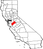
CDPs Airport | Bret Harte | Bystrom | Cowan | Crows Landing | Del Rio | Denair | Diablo Grande | East Oakdale | Empire | Grayson | Hickman | Keyes | Monterey Park Tract | Parklawn | Riverdale Park | Rouse | Salida | Shackelford | Valley Home | West Modesto | Westley
Unincorporated
communitiesAdela | Aurora | Claribel | Claus | Eugene | Hills Ferry | Knights Ferry | La Grange | Langworth | Las Palmas | McHenry | Montpelier | Mountain View | Roberts Ferry | Timba | Tuolumne | Twin Rivers
Ghost towns Tuolumne City
Categories:- Cities in Stanislaus County, California
- Incorporated cities and towns in California
- Populated places in California with Hispanic majority populations


Wikimedia Foundation. 2010.