- California State Route 132
Infobox road
state=CA
type=SR
route=132
section=432
maint=Caltrans 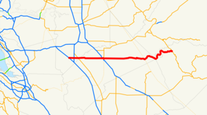
length_mi=76
length_round=0
length_ref= [http://www.dot.ca.gov/hq/structur/strmaint/brlog2.htm January 1, 2006 California Log of Bridges on State Highways] ]
direction_a=West
terminus_a=jct|state=CA|I|580 near Tracy
junction=jct|state=CA|SR|99 in Modesto
direction_b=East
terminus_b=jct|state=CA|SR|49 at Coulterville
previous_type=SR
previous_route=131
next_type=SR
next_route=133State Route 132 is a route in the Central Valley that leads to the Sierra Nevada foothills and the
California Gold Country . It also connects the city of Modesto with theSan Francisco Bay Area via I-580, although this route is discouraged due to it being a two-lane road between Modesto (Maze Boulevard in the city of Modesto) and Interstate 5 (Motorists are instead encouraged to take SR 120 in Manteca to I-5 and I-205 to I-580.) East of Modesto, the road climbs thefoothills and finally ends at SR 49. Portions between I-5 and I-580 is a four-lanefreeway , and there are plans to upgrade the portion between SR 99 and I-5 to anexpressway . Route 132 is a two lane road important to recreational travelers enroute toModesto Reservoir , Turlock Reservoir,Lake Don Pedro and the Sierra Nevada foothills. [Earth Metrics, "Environmental Assessment for Modesto California Paradise Postal Station",U.S. Postal Service , January, 1990]The city-built "Kansas-Needham Overhead", connecting Kansas Avenue and Needham Street over the
Union Pacific Railroad 'sFresno Subdivision in Modesto, is aligned for a future connection to a SR 132expressway west of Modesto. [Modesto, Budget 2001-2002, Forecasting and Capital Improvement Program: [http://www.ci.modesto.ca.us/fin/budget0102/vol_3/pdf/v3_traffic.pdf Traffic Circulation] , p. 1]This route is part of the
California Freeway and Expressway System [http://www.leginfo.ca.gov/cgi-bin/displaycode?section=shc&group=00001-01000&file=250-257 CA Codes (shc:250-257)] ] .Major intersections and exit list
:"Note: Except where prefixed with a letter,
postmile s were measured in 1964, based on the alignment as it existed at that time, and do not necessarily reflect current mileage. The numbers reset at some county lines; the start and end postmiles in each county are given in the county column."References
External links
* [http://www.westcoastroads.com/california/ca-132.html California @ WestCoastRoads.com - State Route 132]
* [http://www.dot.ca.gov/hq/roadinfo/sr132 Caltrans: Route 132 highway conditions]
* [http://www.cahighways.org/129-136.html#132 California Highways: SR 132]

Wikimedia Foundation. 2010.