- California State Route 108
Infobox road
state=CA
type=SR
route=108
section=408
maint=Caltrans 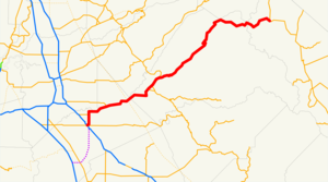
length_mi=120
length_round=0
length_ref= [ [http://www.dot.ca.gov/hq/structur/strmaint/brlog2.htm January 1, 2006 California Log of Bridges on State Highways] ]
direction_a=West
terminus_a=jct|state=CA|SR|99|SR|132 in Modesto
junction=jct|state=CA|SR|120 in Oakdale
jct|state=CA|SR|49 in Sonora
direction_b=East
terminus_b=jct|state=CA|US|395 near Bridgeport
previous_type=SR
previous_route=107
next_type=SR
next_route=109State Route 108, also known as Highway 108, is a numbered
state highway inCalifornia . SR 108 runs generally northeast across centralCalifornia from downtown Modesto near the SR 99/SR 132 interchange to U.S. Route 395 near theNevada state line. The route was once recommended to continue south of Modesto to Interstate 5, although today the route is a county road.This route is part of the
California Freeway and Expressway System [http://www.leginfo.ca.gov/cgi-bin/displaycode?section=shc&group=00001-01000&file=250-257 CA Codes (shc:250-257)] ] and is eligible for the State Scenic Highway System [http://www.leginfo.ca.gov/cgi-bin/displaycode?section=shc&group=00001-01000&file=260-284 CA Codes (shc:260-284)] ] .Route description
State Route 108 begins in downtown Modesto at the junction of SR 99 and SR 132, overlapping SR 132 for several blocks northeast on L Street to 9th Street. There it splits into a short
one-way pair , with eastbound SR 108 turning southeast with SR 132 on 9th Street to K Street and then northeast to Needham Street; the westbound direction remains on L Street to Needham Street. After several blocks eastward on Needham Street, SR 108 reaches McHenry Avenue, which it follows north out of the city.From Modesto, SR 108 runs north along McHenry Avenue for about convert|7|mi|km before turning eastward on Patterson Road to follow the
Stanislaus River east-northeast. In Riverbank, County Route J7 comes from the north and departs to the south after about a one mile (1.6 km) co-routing. After following the river about convert|10|mi|km, SR 108 passes straight through the heart of downtown Oakdale.At the main intersection in Oakdale, SR 120 joins SR 108 from the north and they are co-signed as they continue northeast, climbing into the foothills and passing just south of Knights Ferry. SR 120 brings with it the title Northern Yosemite Highway for this segment; with State Route 132 being the middle route from the west and State Route 140 being the southern route to Yosemite. Just past Knights Ferry, SR 108 crosses from
Stanislaus County intoTuolumne County , and the road changes from two lanes to four-lane separated highway for about convert|6|mi|km. This is advantageous as steep grade is located along this stretch of the road and the extra lanes are useful as passing lanes both ascending and descending the mountain range. About a mile after the end of the separated pavement, La Grange Road (County road J59) heads south, passing just west ofLake Don Pedro and meeting SR 132 near the town of La Grange. Another convert|3|mi|km eastward, at Yosemite Junction, SR 120 finally separates from SR 108 and heads southward toward to a co-routing with State Route 49 through Chinese Camp and across the upper end of Lake Don Pedro.Another convert|3|mi|km eastward, SR 49 joins from the south and is co-routed with SR 108 through Jamestown and into Sonora, where SR 49 departs to the north. SR 108 continues eastward and gains elevation as it passes through Twain Harte, Mi-Wuk Village, Long Barn, Cold Springs, and Strawberry. SR 108 crosses the summit of the Sierra Nevada mountains at
Sonora Pass , then descends, finally reaching the eastern terminus at Sonora Junction where it meets U.S. Route 395.Major intersections
:"Note: Except where prefixed with a letter,
postmile s were measured in 1964, based on the alignment as it existed at that time, and do not necessarily reflect current mileage. The numbers reset at county lines; the start and end postmiles in each county are given in the county column."External links
* [http://www.dot.ca.gov/hq/roadinfo/sr108 Caltrans: Route 108 Road Conditions]
* [http://www.cahighways.org/105-112.html#108 California Highways: Route 108]
* [http://www.westcoastroads.com/california/ca-108.html AARoads: State Route 108]References

Wikimedia Foundation. 2010.