- Manteca, California
-
This article is about the city in California. For The Canadian Jazz-Fusion Band, see Manteca (band). For song by Dizzy Gillespie and Chano Pozo, see Manteca (song).
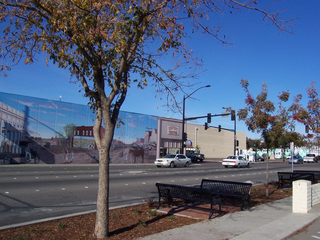
City of Manteca — City — From the corner of Yosemite and Main in Manteca
Nickname(s): The Family City Location in San Joaquin County and the state of California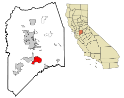
Coordinates: 37°48′10″N 121°13′15″W / 37.80278°N 121.22083°WCoordinates: 37°48′10″N 121°13′15″W / 37.80278°N 121.22083°W Country  United States
State  California
County San Joaquin Government - Mayor Willie Weatherford - Senate Lois Wolk (D) - Assembly Bill Berryhill (R) - U. S. Congress Jerry McNerney (D) Area[1] - Total 17.757 sq mi (45.991 km2) - Land 17.733 sq mi (45.929 km2) - Water 0.024 sq mi (0.062 km2) 0.13% Elevation 38 ft (11 m) Population (2010) - Total 67,096 - Density 3,778.6/sq mi (1,458.9/km2) Time zone Pacific Standard Time Zone (UTC-8) - Summer (DST) Pacific Daylight Time (UTC-7) ZIP codes 95336-95337 Area code(s) 209 FIPS code 06-45484 GNIS feature ID 1659046 Website http://www.ci.manteca.ca.us/ Manteca is a city in San Joaquin County, California, USA. As of the 2010 census, the city's population was 67,096.
Contents
History
Manteca is a city in the Central Valley of California, 76 miles east of San Francisco. It was founded in 1861 by Joshua Cowell. Cowell claimed around 1,000 acres (4.0 km2) and built houses on what is now the corner of Main and Yosemite where Bank of America now stands. In 1873, the Central Pacific Railroad laid track directly through the area. The residents wanted to refer to their new train station as "Cowell Station", but there was already a Cowell Station near Tracy. So, the residents agreed to change the name of the community, choosing "Monteca" as the new name. This was misprinted as "Manteca" (Spanish for lard) by the railroad, and the misspelled version was eventually accepted as the name of the town.[2] Hence in 1918, Manteca was incorporated as a city and Joshua Cowell became its first mayor.
Manteca fashions itself the "Family City", and it lies at a crossroads of major highways and railroads. As recently as the 1970s Manteca existed primarily on agriculture, and was still barely a stop between two freeways, Interstate 5 and State Route 99. The continuing rise in bay area housing prices caused Bay Area residents to look further eastward for cheaper places to live. Since the construction of the 120 bypass portion of State Route 120, Manteca has become a popular choice for these commuters. The 1990s saw an increase in the city's population, and the construction of its third high school, the first two being Manteca High School and East Union High School. The population of Manteca continues to increase, with some housing being constructed on what was once farmland to the north and southeast.
There is a school called East Union in Manteca. It was first used in 1857 for a school established in what is now Manteca. The school was named East Union in order to differentiate it from Union School, which is in an area now within Lathrop, California. A cemetery named East Union was established in 1872 and remains one of San Joaquin County's oldest landmarks. A road bordering the cemetery was named Union Road after the cemetery and is now one of the main streets through the city. In 1966, the city of Manteca started another high school to relieve overcrowding in Manteca High School. The new school was given the name East Union High School in tribute to an old farmhouse school.
Geography
According to the United States Census Bureau, the city has a total area of 17.8 square miles (46 km2), 99.87% of it land and 0.13% of it water.
Neighboring towns include Lathrop, Ripon, Escalon, and Tracy. Manteca is also in between the larger cities of Modesto and Stockton.
Demographics
2010
The 2010 United States Census[3] reported that Manteca had a population of 67,096. The population density was 3,778.5 people per square mile (1,458.9/km²). The racial makeup of Manteca was 49.6% White, 9.8% African American, 1.1% Native American, 12.1% Asian,0.6% Pacific Islander, 11.4% from other races, and 7.2% from two or more races. Hispanic or Latino of any race were 43.7%.
The Census reported that 66,601 people (99.3% of the population) lived in households, 150 (0.2%) lived in non-institutionalized group quarters, and 345 (0.5%) were institutionalized.
There were 21,618 households, out of which 9,681 (44.8%) had children under the age of 18 living in them, 11,973 (55.4%) were opposite-sex married couples living together, 3,009 (13.9%) had a female householder with no husband present, 1,590 (7.4%) had a male householder with no wife present. There were 1,629 (7.5%) unmarried opposite-sex partnerships, and 130 (0.6%) same-sex married couples or partnerships. 3,902 households (18.0%) were made up of individuals and 1,542 (7.1%) had someone living alone who was 65 years of age or older. The average household size was 3.08. There were 16,572 families (76.7% of all households); the average family size was 3.48.
The population was spread out with 19,432 people (29.0%) under the age of 18, 6,569 people (9.8%) aged 18 to 24, 18,075 people (26.9%) aged 25 to 44, 16,367 people (24.4%) aged 45 to 64, and 6,653 people (9.9%) who were 65 years of age or older. The median age was 33.6 years. For every 100 females there were 96.8 males. For every 100 females age 18 and over, there were 93.6 males.
There were 23,132 housing units at an average density of 1,302.7 per square mile (503.0/km²), of which 13,521 (62.5%) were owner-occupied, and 8,097 (37.5%) were occupied by renters. The homeowner vacancy rate was 2.7%; the rental vacancy rate was 6.5%. 41,225 people (61.4% of the population) lived in owner-occupied housing units and 25,376 people (37.8%) lived in rental housing units.
2000
As of the census[4] of 2000, there were 49,258 people, 16,368 households, and 12,488 families residing in the city. The population density was 1,195.4/km² (3,095.8/mi²). There were 16,937 housing units at an average density of 411.0/km² (1,064.5/mi²). The racial makeup of the city was 74.17% White, 2.85% African American, 1.31% Native American, 3.52% Asian, 0.36% Pacific Islander, 11.56% from other races, and 6.23% from two or more races. 25.10% of the population were Hispanic or Latino of any race.
There were 16,368 households out of which 43.3% had children under the age of 18 living with them, 57.2% were married couples living together, 13.0% had a female householder with no husband present, and 23.7% were non-families. 18.6% of all households were made up of individuals and 7.1% had someone living alone who was 65 years of age or older. The average household size was 2.98 and the average family size was 3.39.
In the city the population was spread out with 31.6% under the age of 18, 8.8% from 18 to 24, 30.5% from 25 to 44, 19.8% from 45 to 64, and 9.3% who were 65 years of age or older. The median age was 32 years. For every 100 females there were 96.3 males. For every 100 females age 18 and over, there were 92.9 males.
The median income for a household in the city was $46,677, and the median income for a family was $51,587. Males had a median income of $43,283 versus $27,772 for females. The per capita income for the city was $18,241. 9.7% of the population and 7.2% of families were below the poverty line. 10.7% of those under the age of 18 and 6.4% of those 65 and older were living below the poverty line.
Economy
Top employers
According to the City's 2009 Comprehensive Annual Financial Report,[5] the top employers in the city are:
# Employer # of Employees 1 Manteca Unified School District 2,100+ 2 Kaiser Permanente 600-650 3 Doctors Hospital of Manteca 400-450 4 City of Manteca 400-450 5 Bass Pro Shops 300-349 6 Wal-Mart 300-349 7 Eckert Cold Storage 200-249 8 APDS Logistics 200-249 9 Elegant Surfaces 200-249 10 Costco 150-200 Transit
Bus service in Manteca is provided by Manteca Transit.
A regional rail service for commuters to San Jose is provided by the Altamont Commuter Express, or ACE.
Schools
Public schools in Manteca are part of the Manteca Unified School District. There are no middle schools; elementary school continues through the 8th grade, with a mix of both year-round and traditional schools. Manteca Unified School District has 19 elementary schools, 5 high schools, and 2 continuation schools. Not all of the schools listed below are in Manteca itself.
High schools
- Calla High School
- East Union High School
- Lathrop High School
- Manteca High School
- Sierra High School
- Weston Ranch High School
- New Vision High School (continuation)
Elementary schools
- August Knodt
- Brock Elliott
- French Camp
- George Komure
- George McParland
- Golden West
- Great Valley
- Joseph Widmer Jr
- Joshua Cowell
- Lathrop
- Lincoln
- Neil Hafley
- New Haven
- Nile Garden
- Sequoia
- Shasta
- Stella Brockman
- Veritas
- Walter E. Woodward
- Manteca Christian (private)
- Alta Vista (private)
- St. Anthony's (private)
Adult schools
- Lindbergh Educational Center
Noted people from Manteca
- Marliece Andrada (b. 1972) - Actress and Playboy's Playmate of the Month in March 1998.
- Ernie Barber (b. 1914)- Former NFL player for the Washington Redskins
- April Bowlby (b. 1980) - Actress
- Scott Brooks (b. 1965) - Former NBA basketball player and current head coach for the Oklahoma City Thunder attended East Union High School.
- Milo Candini (b. 1917–d. 1998),[6] Major League Baseball player 1943-51
- Chris Carr, 1978 and 1984 American Motorcyclist Association champion[7][8]
- Joshua Cowell (b. 1842–d. 1925) - Original founder of Manteca, buried in East Union Cemetery[9]
- Ken Huckaby (b. 1971) - Major League Baseball player, attended Manteca High School.
- Athena Lundberg (b. 1986)- Playboy Playmate of the Month for January 2006, lived in Lathrop, California and attended Sierra High School for a short time.
- Justin Roiland (b. 1980) - Writer and voice actor, most notable for his role as "Oscar" on Disney's Fish Hooks
- John J. McFall (b. 1918–d. 2006) - Former member of the United States House of Representatives
- Patricia Miranda (b. 1979) - Bronze medal winner in wrestling at the 2004 Summer Olympics
- Scott Speed (b. 1983) - Stock car racing driver currently competing in NASCAR. Former Formula One driver.
- Dev Tailes (b. 1989) - Pop Artist attended Sierra High School. Featured in Billboard Hot 100 song Like a G6.
References
- ^ U.S. Census
- ^ Manteca, California Historical Society
- ^ All data are derived from the United States Census Bureau reports from the 2010 United States Census, and are accessible on-line here. The data on unmarried partnerships and same-sex married couples are from the Census report DEC_10_SF1_PCT15. All other housing and population data are from Census report DEC_10_DP_DPDP1. Both reports are viewable online or downloadable in a zip file containing a comma-delimited data file. The area data, from which densities are calculated, are available on-line here. Percentage totals may not add to 100% due to rounding. The Census Bureau defines families as a household containing one or more people related to the householder by birth, opposite-sex marriage, or adoption. People living in group quarters are tabulated by the Census Bureau as neither owners nor renters. For further details, see the text files accompanying the data files containing the Census reports mentioned above.
- ^ "American FactFinder". United States Census Bureau. http://factfinder.census.gov. Retrieved 2008-01-31.
- ^ City of Manteca CAFR
- ^ http://www.baseball-reference.com/c/candimi01.shtml
- ^ "Western Riders Dominate Scrambles". American Motorcyclist: 37. November 1978.
- ^ "Western Riders Dominate Scrambles". American Motorcyclist: 63. April 1984.
- ^ "Joshua Cowell". Find a Grave. http://www.findagrave.com/cgi-bin/fg.cgi?page=gr&GRid=22154955. Retrieved November 18, 2011.
External links
- Liberals Club Website
- Official website
- Manteca Convention and Visitors Bureau
- Manteca Chamber of Commerce
- The Manteca Bulletin, daily newspaper
- The Sun Post, weekly newspaper
- Manteca Unified School District
Municipalities and communities of San Joaquin County, California County seat: Stockton Cities 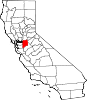
CDPs Acampo | August | Collierville | Country Club | Dogtown | Farmington | French Camp | Garden Acres | Kennedy | Lincoln Village | Linden | Lockeford | Morada | Mountain House | Peters | Taft Mosswood | Terminous | Thornton | Victor | Waterloo | Woodbridge
Unincorporated
communitiesAtlanta | Banta | Carbona | Clements | Gillis | Goodmans Corner | Holt | Mormon | New Jerusalem | North Woodbridge | South Woodbridge | Vernalis
Ghost towns Carnegie | Mokelumne City | San Joaquin City
Categories:- Incorporated cities and towns in California
- Cities in San Joaquin County, California


Wikimedia Foundation. 2010.