- Lathrop, California
Infobox Settlement
official_name = Lathrop, CA
other_name = LHP
native_name =
nickname =
settlement_type =City
motto =
imagesize =
image_caption =
flag_size =
image_
seal_size =
image_shield =
shield_size =
image_blank_emblem =
blank_emblem_type =
blank_emblem_size =
imagesize =
image_caption =
flag_size =
image_
seal_size =
image_shield =
shield_size =
image_blank_emblem =
blank_emblem_type =
blank_emblem_size =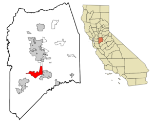
mapsize = 250x200px
map_caption = Location in San Joaquin County and the state ofCalifornia
mapsize1 =
map_caption1 =
image_dot_
dot_mapsize =
dot_map_caption =
dot_x =
dot_y =
pushpin_
pushpin_label_position =
pushpin_map_caption =
pushpin_mapsize =
subdivision_type = Country
subdivision_name =United States
subdivision_type1 = State
subdivision_name1 =California
subdivision_type2 = County
subdivision_name2 = San Joaquin
subdivision_type3 =
subdivision_name3 =
subdivision_type4 =
subdivision_name4 =
government_footnotes =
government_type =
leader_title =Mayor
leader_name =Kristy Sayles
leader_title1 =
leader_title1 = Senate
leader_name1 =Michael Machado (D)
leader_title2 = Assembly
leader_name2 =Cathleen Galgiani (D)
leader_title3 = U. S. Congress
leader_name3 =Dennis Cardoza (D)
leader_title4 =
leader_name4 =
established_title =
established_date =
established_title2 =
established_date2 =
established_title3 =
established_date3 =
area_magnitude =
unit_pref =
area_footnotes =
area_total_km2 = 43.3
area_land_km2 = 42.4
area_water_km2 = 2.03
area_total_sq_mi = 16.7
area_land_sq_mi = 16.4
area_water_sq_mi = 0.3
area_water_percent =
area_urban_km2 =
area_urban_sq_mi =
area_metro_km2 =
area_metro_sq_mi =
area_blank1_title =
area_blank1_km2 =
area_blank1_sq_mi =
population_as_of = 2006
population_footnotes =
population_note =
population_total = 14625
population_density_km2 = 246.2
population_density_sq_mi = 637.6
population_metro =
population_density_metro_km2 =
population_density_metro_sq_mi =
population_urban =
population_density_urban_km2 =
population_density_urban_sq_mi =
population_blank1_title =
population_blank1 =
population_density_blank1_km2 =
population_density_blank1_sq_mi =
timezone = PST
utc_offset = -8
timezone_DST = PDT
utc_offset_DST = -7
latd = 37 |latm = 49 |lats = 1 |latNS = N
longd = 121 |longm = 17 |longs = 19 |longEW = W
elevation_footnotes =
elevation_m = 7
elevation_ft = 20
postal_code_type =ZIP code
postal_code = 95330
area_code = 209
blank_name = FIPS code
blank_info = 06-40704
blank1_name = GNIS feature ID
blank1_info = 1658948
website =
footnotes =Lathrop is a city located in USCity|San Joaquin County|California. The population is currently 14,625. (2006)
Weather
Lathrop's average high temperature in January is 54 °F (12 °C) and the average low in January is 38 °F (3 °C). In July, the average high temperature is convert|94|°F|°C|abbr=on and the average low in July is convert|61|°F|°C|abbr=on.
Geography
Lathrop is located at coor dms|37|49|1|N|121|17|19|W|city (37.816904, -121.288633)GR|1. The San Joaquin River is in the east side of Lathrop where the Mossdale development is. Lathrop's elevation is about 20 feet (7 m)
According to the
United States Census Bureau , the city has a total area of 16.7 square miles (43.3 km²), of which, 16.4 square miles (42.4 km²) of it is land and 0.3 square miles (0.9 km²) of it (2.03%) is water.Demographics
As of the
census GR|2 of 2000, there were 10,445 people, 2,908 households, and 2,483 families residing in the city. Thepopulation density was 637.6 people per square mile (246.2/km²). There were 2,991 housing units at an average density of 182.6/sq mi (70.5/km²). The racial makeup of the city was 50.92% White, 4.49% African American, 1.21% Native American, 13.36% Asian (mostly Filipino), 0.54% Pacific Islander, 21.11% from other races, and 8.38% from two or more races. Hispanic or Latino of any race were 38.59% of the population.There were 2,908 households out of which 51.1% had children under the age of 18 living with them, 65.9% were married couples living together, 13.4% had a female householder with no husband present, and 14.6% were non-families. 10.4% of all households were made up of individuals and 2.9% had someone living alone who was 65 years of age or older. The average household size was 3.59 and the average family size was 3.82.
In the city the population was spread out with 34.8% under the age of 18, 9.0% from 18 to 24, 32.0% from 25 to 44, 18.1% from 45 to 64, and 6.0% who were 65 years of age or older. The median age was 30 years. For every 100 females there were 103.0 males. For every 100 females age 18 and over, there were 98.8 males.
The median income for a household in the city was $55,037, and the median income for a family was $57,319. Males had a median income of $40,406 versus $27,028 for females. The
per capita income for the city was $16,032. About 7.7% of families and 9.3% of the population were below thepoverty line , including 12.6% of those under age 18 and 5.8% of those age 65 or over.ister City
Lathrop participates in the Sister City program and is tied to
Baccara, Philippines .Economic Potential
Lathrop sits aside
Interstate 5 , one of the major freeways in California and the major north-south freeway along the entire West Coast. Lathrop is located in the metro triangle, which is bounded by theBay Area , Stockton and Sacramento. Lathrop is centrally located within a 30-minute commute of Tracy, Manteca, Stockton, Lodi, Modesto, Livermore and Pleasanton.The City of Lathrop has a seven mile (11 km) radius population of 105,893 with an average household income of $63,072.
Lathrop is strategically centered between the Stockton, Modesto and Tracy submarkets – all within a convert|20|mi|km|0 radius with a combined current population of nearly 750,000 and an expectation that this number will approach 1 million within ten years.
Over 40,000 vehicles per day commute over the Altamont Pass into the Bay Area for employment. There is a strong demand for housing from the Bay Area as residents are moving to affordability.
New developments in Lathrop
River Islands at LathropResidential construction to begin in 05/0611,000 residential unitsconvert|325|acre|km2|1|sing=on Employment Center50 acres of town center17,000 new jobs – 4 million square feet (370,000 m²) of non-residential development
Mossdale VillageResidential construction is currently underway2,500 units Master Planned CommunityFreeway Commercial – 27 acres at SWQ I-5/Louise--Grocery and big box opportunities for this siteNearly convert|1000000|sqft|m2|-3 of retail/office space
Central Lathrop Specific Planconvert|1540|acre|km2|0|sing=on site – west side of I-5, north of Louise Ave.Up to 6,800 dwelling units, including low density, medium density and high densitySite for power center and other retail uses along west side of I-5Nearly convert|4500000|sqft|m2 of office commercial in Lathrop’s I-5 regional commercial corridorEntitlement hearing scheduled for OctoberAnnexation being pursue
Elementary Schools
*Joseph Widmer Jr. Elementary School
*Lathrop Elementary School
*Mossdale Elementary School
*Lathrop Annex (K-2nd)High Schools
Lathrop High School, the first secondary school in the Manteca Unified School District located in Lathrop, opened in August 2008.
External links
Official city web site: [http://www.ci.lathrop.ca.us] .
Wikimedia Foundation. 2010.