- Lockeford, California
Infobox Settlement
official_name = Lockeford, California
other_name =
native_name =
nickname =
settlement_type = CDP
motto =
imagesize =
image_caption =
flag_size =
image_
seal_size =
image_shield =
shield_size =
image_blank_emblem =
blank_emblem_type =
blank_emblem_size =
imagesize =
image_caption =
flag_size =
image_
seal_size =
image_shield =
shield_size =
image_blank_emblem =
blank_emblem_type =
blank_emblem_size =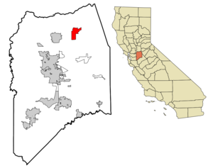
mapsize = 250x200px
map_caption = Location in San Joaquin County and the state ofCalifornia
mapsize1 =
map_caption1 =
image_dot_
dot_mapsize =
dot_map_caption =
dot_x =
dot_y =
pushpin_
pushpin_label_position =
pushpin_map_caption =
pushpin_mapsize =
subdivision_type = Country
subdivision_name =United States
subdivision_type1 = State
subdivision_name1 =California
subdivision_type2 = County
subdivision_name2 = San Joaquin
subdivision_type3 =
subdivision_name3 =
subdivision_type4 =
subdivision_name4 =
government_footnotes =
government_type =
leader_title = N/A
leader_name =
leader_title1 =
leader_title1 = Senate
leader_name1 =Dave Cogdill (R)
leader_title2 = Assembly
leader_name2 =Greg Aghazarian (R)
leader_title3 = U. S. Congress
leader_name3 =Jerry McNerney (D)
leader_title4 =
leader_name4 =
established_title =
established_date =
established_title2 =
established_date2 =
established_title3 =
established_date3 =
area_magnitude =
unit_pref =
area_footnotes =
area_total_km2 = 21.7
area_land_km2 = 21.7
area_water_km2 = 0
area_total_sq_mi = 8.4
area_land_sq_mi = 8.4
area_water_sq_mi = 0
area_water_percent =
area_urban_km2 =
area_urban_sq_mi =
area_metro_km2 =
area_metro_sq_mi =
area_blank1_title =
area_blank1_km2 =
area_blank1_sq_mi =
population_as_of = 2000
population_footnotes =
population_note =
population_total = 3179
population_density_km2 = 146.5
population_density_sq_mi = 378.5
population_metro =
population_density_metro_km2 =
population_density_metro_sq_mi =
population_urban =
population_density_urban_km2 =
population_density_urban_sq_mi =
population_blank1_title =
population_blank1 =
population_density_blank1_km2 =
population_density_blank1_sq_mi =
timezone = PST
utc_offset = -8
timezone_DST = PDT
utc_offset_DST = -7
latd = 38 |latm = 9 |lats = 27 |latNS = N
longd = 121 |longm = 9 |longs = 5 |longEW = W
elevation_footnotes =
elevation_m = 31
elevation_ft = 102
postal_code_type =ZIP code
postal_code = 95237
area_code = 209
blank_name = FIPS code
blank_info = 06-42104
blank1_name = GNIS feature ID
blank1_info = 0277543
website =
footnotes =Lockeford is a
census-designated place (CDP) in San Joaquin County,California ,United States . The population was 3,179 at the 2000 census.Geography
Lockeford is located at coor dms|38|9|27|N|121|9|5|W|city (38.157565, -121.151455)GR|1.
According to the
United States Census Bureau , the CDP has a total area of 8.4square mile s (21.7km² ), all of it land.Demographics
As of the
census GR|2 of 2000, there were 3,179 people, 1,099 households, and 856 families residing in the CDP. Thepopulation density was 379.7 people per square mile (146.6/km²). There were 1,136 housing units at an average density of 135.7/sq mi (52.4/km²). The racial makeup of the CDP was 77.41% White, 0.25% African American, 1.04% Native American, 1.42% Asian, 0.38% Pacific Islander, 16.07% from other races, and 3.43% from two or more races. Hispanic or Latino of any race were 24.66% of the population.There were 1,099 households out of which 36.1% had children under the age of 18 living with them, 62.4% were married couples living together, 9.1% had a female householder with no husband present, and 22.1% were non-families. 18.2% of all households were made up of individuals and 9.6% had someone living alone who was 65 years of age or older. The average household size was 2.89 and the average family size was 3.26.
In the CDP the population was spread out with 27.8% under the age of 18, 8.6% from 18 to 24, 26.9% from 25 to 44, 23.0% from 45 to 64, and 13.7% who were 65 years of age or older. The median age was 37 years. For every 100 females there were 105.1 males. For every 100 females age 18 and over, there were 102.4 males.
The median income for a household in the CDP was $43,750, and the median income for a family was $55,750. Males had a median income of $37,759 versus $24,353 for females. The
per capita income for the CDP was $19,533. About 10.5% of families and 12.5% of the population were below thepoverty line , including 18.5% of those under age 18 and 3.6% of those age 65 or over.External links
* [http://www.vinopiazza.com/ Vino Piazza, the Winery Plaza]
*Diaries of Delia Locke, wife of Lockeford founder Dean Jewett Locke, from 1855-1879 are available online at the [http://library.pacific.edu/ha/digital/index.asp University of the Pacific Library Digital Collections.]
Wikimedia Foundation. 2010.