- Morada, California
-
Morada — census-designated place — Location in San Joaquin County and the state of California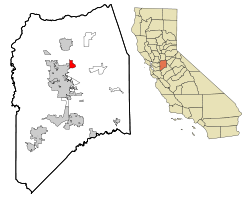
Coordinates: 38°2′24″N 121°14′58″W / 38.04°N 121.24944°WCoordinates: 38°2′24″N 121°14′58″W / 38.04°N 121.24944°W Country  United States
State  California
County San Joaquin Government – N/A – Senate Tom Berryhill (R) – Assembly Greg Aghazarian (R) – U. S. Congress Jerry McNerney (D) Area[1] – Total 2.988 sq mi (7.740 km2) – Land 2.981 sq mi (7.721 km2) – Water 0.007 sq mi (0.019 km2) 0.24% Elevation 43 ft (13 m) Population (2010) – Total 3,828 – Density 1,281.1/sq mi (494.6/km2) Time zone PST (UTC-8) – Summer (DST) PDT (UTC-7) ZIP code 95212 Area code(s) 209 FIPS code 06-49180 GNIS feature ID 1867042 Morada is a census-designated place (CDP) in San Joaquin County, California, United States. The population was 3,828 at the 2010 census, up from 3,726 at the 2000 census.
Contents
Geography
Morada is located at 38°2′24″N 121°14′58″W / 38.04°N 121.24944°W (38.039971, -121.249389)[2].
According to the United States Census Bureau, the CDP has a total area of 3.0 square miles (7.8 km2), 99.76% of it land and 0.24% of it water.
Demographics
2010
The 2010 United States Census[3] reported that Morada had a population of 3,828. The population density was 1,281.0 people per square mile (494.6/km²). The racial makeup of Morada was 2,848 (74.4%) White, 47 (1.2%) African American, 28 (0.7%) Native American, 412 (10.8%) Asian, 30 (0.8%) Pacific Islander, 263 (6.9%) from other races, and 200 (5.2%) from two or more races. Hispanic or Latino of any race were 676 persons (17.7%).
The Census reported that 3,810 people (99.5% of the population) lived in households, 0 (0%) lived in non-institutionalized group quarters, and 18 (0.5%) were institutionalized.
There were 1,425 households, out of which 410 (28.8%) had children under the age of 18 living in them, 934 (65.5%) were opposite-sex married couples living together, 120 (8.4%) had a female householder with no husband present, 61 (4.3%) had a male householder with no wife present. There were 53 (3.7%) unmarried opposite-sex partnerships, and 8 (0.6%) same-sex married couples or partnerships. 265 households (18.6%) were made up of individuals and 166 (11.6%) had someone living alone who was 65 years of age or older. The average household size was 2.67. There were 1,115 families (78.2% of all households); the average family size was 3.03.
The population was spread out with 809 people (21.1%) under the age of 18, 259 people (6.8%) aged 18 to 24, 644 people (16.8%) aged 25 to 44, 1,315 people (34.4%) aged 45 to 64, and 801 people (20.9%) who were 65 years of age or older. The median age was 48.4 years. For every 100 females there were 101.4 males. For every 100 females age 18 and over, there were 99.1 males.
There were 1,503 housing units at an average density of 502.9 per square mile (194.2/km²), of which 1,270 (89.1%) were owner-occupied, and 155 (10.9%) were occupied by renters. The homeowner vacancy rate was 2.3%; the rental vacancy rate was 8.2%. 3,390 people (88.6% of the population) lived in owner-occupied housing units and 420 people (11.0%) lived in rental housing units.
2000
As of the census[4] of 2000, there were 3,726 people, 1,356 households, and 1,084 families residing in the CDP. The population density was 1,237.3 people per square mile (477.9/km²). There were 1,395 housing units at an average density of 463.2 per square mile (178.9/km²). The racial makeup of the CDP was 81.86% White, 6.52% Asian, 0.70% African American, 0.67% Native American, 0.46% Pacific Islander, 6.17% from other races, and 3.62% from two or more races. Hispanic or Latino of any race were 13.12% of the population.
There were 1,356 households out of which 29.6% had children under the age of 18 living with them, 69.9% were married couples living together, 7.2% had a female householder with no husband present, and 20.0% were non-families. 17.3% of all households were made up of individuals and 9.4% had someone living alone who was 65 years of age or older. The average household size was 2.70 and the average family size was 3.04.
In the CDP the population was spread out with 23.9% under the age of 18, 6.3% from 18 to 24, 20.7% from 25 to 44, 31.2% from 45 to 64, and 17.9% who were 65 years of age or older. The median age was 44 years. For every 100 females there were 102.0 males. For every 100 females age 18 and over, there were 97.4 males.
The median income for a household in the CDP was $72,241, and the median income for a family was $86,240. Males had a median income of $63,750 versus $34,861 for females. The per capita income for the CDP was $34,939. About 5.5% of families and 7.7% of the population were below the poverty line, including 8.6% of those under age 18 and 4.0% of those age 65 or over.
References
- ^ U.S. Census
- ^ "US Gazetteer files: 2010, 2000, and 1990". United States Census Bureau. 2011-02-12. http://www.census.gov/geo/www/gazetteer/gazette.html. Retrieved 2011-04-23.
- ^ All data are derived from the United States Census Bureau reports from the 2010 United States Census, and are accessible on-line here. The data on unmarried partnerships and same-sex married couples are from the Census report DEC_10_SF1_PCT15. All other housing and population data are from Census report DEC_10_DP_DPDP1. Both reports are viewable online or downloadable in a zip file containing a comma-delimited data file. The area data, from which densities are calculated, are available on-line here. Percentage totals may not add to 100% due to rounding. The Census Bureau defines families as a household containing one or more people related to the householder by birth, opposite-sex marriage, or adoption. People living in group quarters are tabulated by the Census Bureau as neither owners nor renters. For further details, see the text files accompanying the data files containing the Census reports mentioned above.
- ^ "American FactFinder". United States Census Bureau. http://factfinder.census.gov. Retrieved 2008-01-31.
Municipalities and communities of San Joaquin County, California Cities 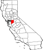
CDPs Acampo | August | Collierville | Country Club | Dogtown | Farmington | French Camp | Garden Acres | Kennedy | Lincoln Village | Linden | Lockeford | Morada | Mountain House | Peters | Taft Mosswood | Terminous | Thornton | Victor | Waterloo | Woodbridge
Unincorporated
communitiesAtlanta | Banta | Carbona | Clements | Gillis | Goodmans Corner | Holt | Mormon | New Jerusalem | North Woodbridge | South Woodbridge | Vernalis
Ghost towns Carnegie | Mokelumne City | San Joaquin City
Categories:- Census-designated places in San Joaquin County, California


Wikimedia Foundation. 2010.