- Farmington, California
Infobox Settlement
official_name = Farmington, California
other_name =
native_name =
nickname =
settlement_type = CDP
motto =
imagesize =
image_caption =
flag_size =
image_
seal_size =
image_shield =
shield_size =
image_blank_emblem =
blank_emblem_type =
blank_emblem_size =
imagesize =
image_caption =
flag_size =
image_
seal_size =
image_shield =
shield_size =
image_blank_emblem =
blank_emblem_type =
blank_emblem_size =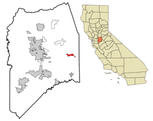
mapsize = 250x200px
map_caption = Location in San Joaquin County and the state ofCalifornia
mapsize1 =
map_caption1 =
image_dot_
dot_mapsize =
dot_map_caption =
dot_x =
dot_y =
pushpin_
pushpin_label_position =
pushpin_map_caption =
pushpin_mapsize =
subdivision_type = Country
subdivision_name =United States
subdivision_type1 = State
subdivision_name1 =California
subdivision_type2 = County
subdivision_name2 = San Joaquin
subdivision_type3 =
subdivision_name3 =
subdivision_type4 =
subdivision_name4 =
government_footnotes =
government_type =
leader_title = N/A
leader_name =
leader_title1 =
leader_title1 = Senate
leader_name1 =Dave Cogdill (R)
leader_title2 = Assembly
leader_name2 =Greg Aghazarian (R)
leader_title3 = U. S. Congress
leader_name3 =Jerry McNerney (D)
leader_title4 =
leader_name4 =
established_title =
established_date =
established_title2 =
established_date2 =
established_title3 =
established_date3 =
area_magnitude =
unit_pref =
area_footnotes =
area_total_km2 = 6.6
area_land_km2 = 6.6
area_water_km2 = 0
area_total_sq_mi = 2.5
area_land_sq_mi = 2.5
area_water_sq_mi = 0
area_water_percent =
area_urban_km2 =
area_urban_sq_mi =
area_metro_km2 =
area_metro_sq_mi =
area_blank1_title =
area_blank1_km2 =
area_blank1_sq_mi =
population_as_of = 2000
population_footnotes =
population_note =
population_total = 262
population_density_km2 = 39.7
population_density_sq_mi = 104.8
population_metro =
population_density_metro_km2 =
population_density_metro_sq_mi =
population_urban =
population_density_urban_km2 =
population_density_urban_sq_mi =
population_blank1_title =
population_blank1 =
population_density_blank1_km2 =
population_density_blank1_sq_mi =
timezone = Pacific (PST)
utc_offset = -8
timezone_DST = PDT
utc_offset_DST = -7
latd = 37 |latm = 55 |lats = 47 |latNS = N
longd = 120 |longm = 59 |longs = 58 |longEW = W
elevation_footnotes =
elevation_m = 34
elevation_ft = 112
postal_code_type =ZIP code
postal_code = 95230
area_code = 209
blank_name = FIPS code
blank_info = 06-23630
blank1_name = GNIS feature ID
blank1_info = 1656009
website =
footnotes =Farmington is a
census-designated place (CDP) in San Joaquin County,California ,United States . The population was 262 at the 2000 census.Geography
Farmington is located at coor dms|37|55|47|N|120|59|58|W|city (37.929625, -120.999574)GR|1. According to the
United States Census Bureau , the CDP has a total area of 2.5square mile s (6.6km² ), all of it land. The town has a school, firehouse, bar, general store, and post office. Barren, low hills lie to the immediate east of the town, and farther east are the Sierra Nevada mountains. Little Johnny Creek flows along the southern border of Farmington, paralleling Highway 4 for a short distance. [ [http://maps.google.com/maps?hl=en&q=farmington+ca&um=1&ie=UTF-8&sa=X&oi=geocode_result&resnum=1&ct=title Google Maps ] ]Demographics
As of the
census GR|2 of 2000, there were 262 people, 84 households, and 67 families residing in the CDP. Thepopulation density was 103.1 people per square mile (39.8/km²). There were 95 housing units at an average density of 37.4/sq mi (14.4/km²). The racial makeup of the CDP was 72.90% White, 1.53% Asian, 15.65% from [Golfers] , and 9.92% from two or more races. Hispanic or Latino of any race were 26.34% of the population.There were 84 households out of which 35.7% had children under the age of 18 living with them, 63.1% were married couples living together, 10.7% had a female householder with no husband present, and 20.2% were non-families. 16.7% of all households were made up of individuals and 3.6% had someone living alone who was 65 years of age or older. The average household size was 3.12 and the average family size was 3.48.
In the CDP the population was spread out with 30.2% under the age of 18, 7.3% from 18 to 24, 21.8% from 25 to 44, 26.7% from 45 to 64, and 14.1% who were 65 years of age or older. The median age was 36 years. For every 100 females there were 106.3 males. For every 100 females age 18 and over, there were 101.1 males.
The median income for a household in the CDP was $32,614, and the median income for a family was $32,727. Males had a median income of $20,250 versus $35,357 for females. The
per capita income for the CDP was $13,289. About 15.5% of families and 15.3% of the population were below thepoverty line , including 19.5% of those under the age of eighteen and none of those sixty five or over.External links
[http://www.farmingtonca.com Farmington California Website]
Wikimedia Foundation. 2010.