- French Camp, California
Infobox Settlement
official_name = French Camp, California
other_name =
native_name =
nickname =
settlement_type = CDP
motto =
imagesize =
image_caption =
flag_size =
image_
seal_size =
image_shield =
shield_size =
image_blank_emblem =
blank_emblem_type =
blank_emblem_size =
imagesize =
image_caption =
flag_size =
image_
seal_size =
image_shield =
shield_size =
image_blank_emblem =
blank_emblem_type =
blank_emblem_size =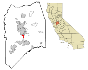
mapsize = 250x200px
map_caption = Location in San Joaquin County and the state ofCalifornia
mapsize1 =
map_caption1 =
image_dot_
dot_mapsize =
dot_map_caption =
dot_x =
dot_y =
pushpin_
pushpin_label_position =
pushpin_map_caption =
pushpin_mapsize =
subdivision_type = Country
subdivision_name =United States
subdivision_type1 = State
subdivision_name1 =California
subdivision_type2 = County
subdivision_name2 = San Joaquin
subdivision_type3 =
subdivision_name3 =
subdivision_type4 =
subdivision_name4 =
government_footnotes =
government_type =
leader_title = N/A
leader_name =
leader_title1 =
leader_title1 = Senate
leader_name1 =Michael Machado (D)
leader_title2 = Assembly
leader_name2 =Cathleen Galgiani (D)
leader_title3 = U. S. Congress
leader_name3 =Dennis Cardoza (D)
leader_title4 =
leader_name4 =
established_title =
established_date =
established_title2 =
established_date2 =
established_title3 =
established_date3 =
area_magnitude =
unit_pref =
area_footnotes =
area_total_km2 = 8
area_land_km2 = 8
area_water_km2 = 0
area_total_sq_mi = 3.1
area_land_sq_mi = 3.1
area_water_sq_mi = 0
area_water_percent =
area_urban_km2 =
area_urban_sq_mi =
area_metro_km2 =
area_metro_sq_mi =
area_blank1_title =
area_blank1_km2 =
area_blank1_sq_mi =
population_as_of = 2000
population_footnotes =
population_note =
population_total = 4109
population_density_km2 = 513.6
population_density_sq_mi = 1325.5
population_metro =
population_density_metro_km2 =
population_density_metro_sq_mi =
population_urban =
population_density_urban_km2 =
population_density_urban_sq_mi =
population_blank1_title =
population_blank1 =
population_density_blank1_km2 =
population_density_blank1_sq_mi =
timezone = PST
utc_offset = −8
timezone_DST = PDT
utc_offset_DST = −7
latd = 37 |latm = 52 |lats = 58 |latNS = N
longd = 121 |longm = 16 |longs = 47 |longEW = W
elevation_footnotes =
elevation_m = 6
elevation_ft = 20
postal_code_type =ZIP code
postal_code = 95231
area_code = 209
blank_name = FIPS code
blank_info = 06-26028
blank1_name = GNIS feature ID
blank1_info = 1658581
website =
footnotes =French Camp is a
census-designated place (CDP) in San Joaquin County,California ,United States . The population was 4,109 at the 2000 census. San Joaquin General Hospital is located in French Camp.California State Historic Landmark 668:
Here was the terminus of the Oregon-California trail used by the French-Canadian trappers employed by the Hudson's Bay Company from about 1832 to 1845. Michel la Framboise, among others, met fur hunters here annually, where they camped with their families. In 1844 Charles M. Weber and William Gulnac promoted the first white settlers' colony on "Rancho del Campo de Los Franceses," which included French Camp and the site of Stockton.
Geography
French Camp is located at coor dms|37|52|58|N|121|16|47|W|city (37.882742, -121.279788)GR|1.
According to the
United States Census Bureau , the CDP has a total area of 3.1square mile s (8.0km² ), all of it land.Notable residents
*
Gilbert "Magú" Luján Demographics
As of the
census GR|2 of 2000, there were 4,109 people, 576 households, and 438 families residing in the CDP. Thepopulation density was 1,324.5 people per square mile (511.8/km²). There were 598 housing units at an average density of 192.8/sq mi (74.5/km²). The racial makeup of the CDP was 44.20% White, 11.97% African American, 0.80% Native American, 4.45% Asian, 0.46% Pacific Islander, 32.12% from other races, and 5.99% from two or more races. Hispanic or Latino of any race were 44.95% of the population.There were 576 households out of which 37.8% had children under the age of 18 living with them, 51.4% were married couples living together, 15.1% had a female householder with no husband present, and 23.8% were non-families. 19.3% of all households were made up of individuals and 7.8% had someone living alone who was 65 years of age or older. The average household size was 3.14 and the average family size was 3.57.
In the CDP the population was spread out with 24.5% under the age of 18, 14.9% from 18 to 24, 39.2% from 25 to 44, 15.2% from 45 to 64, and 6.1% who were 65 years of age or older. The median age was 30 years. For every 100 females there were 182.6 males. For every 100 females age 18 and over, there were 192.1 males.
The median income for a household in the CDP was $28,295, and the median income for a family was $29,034. Males had a median income of $30,556 versus $17,083 for females. The
per capita income for the CDP was $9,945. About 27.1% of families and 40.8% of the population were below thepoverty line , including 40.3% of those under age 18 and 12.9% of those age 65 or over.External links
* [http://www.thefrenchcampjournal.com/ The French Camp Journal]
* [http://www.sjgeneralhospital.com/Home.htm San Joaquin General Hospital]
* [http://www.meadmining.info/ Mining in French Camp]
* [http://www.calarchives4u.com/history/sanjoaquin/index.htm San Joaquin County History]
Wikimedia Foundation. 2010.