- Val Verde, California
Infobox Settlement
official_name = Val Verde, California
settlement_type = CDP
nickname =
motto =
imagesize =
image_caption =
image_
imagesize =
image_caption =
image_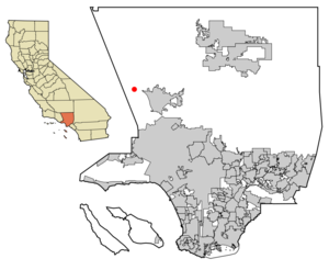
mapsize = 250x200px
map_caption = Location of Val Verde in Los Angeles County,California .
mapsize1 =
map_caption1 =subdivision_type = Country
subdivision_name =United States
subdivision_type1 = State
subdivision_name1 =California
subdivision_type2 = County
subdivision_name2 = Los Angeles
government_footnotes =
government_type =
leader_title =
leader_name =
leader_title1 =
leader_name1 =
established_title =
established_date =area_footnotes =
area_magnitude =
area_total_km2 = 0.9
area_land_km2 = 0.9
area_water_km2 = 0.0
area_total_sq_mi = 0.3
area_land_sq_mi = 0.3
area_water_sq_mi = 0.0population_as_of = 2000
population_footnotes =
population_total = 1472
population_density_km2 = 1710.0
population_density_sq_mi = 4428.8timezone = PST
utc_offset = -8
timezone_DST = PDT
utc_offset_DST = -7
elevation_footnotes =
elevation_m = 362
elevation_ft = 1188
latd = 34 |latm = 26 |lats = 43 |latNS = N
longd = 118 |longm = 39 |longs = 26 |longEW = Wpostal_code_type =
ZIP code
postal_code = 91384
area_code = 661
blank_name = FIPS code
blank_info = 06-81967
blank1_name = GNIS feature ID
blank1_info = 1661607
website =
footnotes =Val Verde is a
census-designated place (CDP) in Los Angeles County,California ,United States . The population was 1,472 at the 2000 census. The predominant feature is the small rural valley in which this town sits, north of the San Fernando valley, isolated from development and unlikely to be visited by anyone who does not already know of it. There is a park in the town with the typical rolling hills of California which is especially pleasant in the springtime, when the grass is green and not golden, as it is in the rest of the year. Thus it is possible to watch birds fly "from above" them, while sitting on the hills.History
Originally the settlement of Val Verde was a short-lived boom town built by Spanish settlers near a gold strike in the 1800s. Later, the modern settlement was founded in the mid-1920s as the name Eureka. That later incarnation was designed as a resort community for
African Americans as in that period African Americans were frequently barred from public beaches and swimming pools. The town became known as the "Black Palm Springs." Later the name was reverted to the original name of Val Verde.With the advent of civil rights reforms in the 1960s, many African Americans moved out of the area for larger areas they were previously segregated from. The town now boasts a large percentage of Latinos and Whites.cite news |title= Renaissance for 'Black Palm Springs' |url= http://www.scvhistory.com/scvhistory/signal/worden/lw072496.htm |publisher=
Santa Clarita Valley Historical Society |first= Leon |last= Worden |date= 1996-07-24]Geography
Val Verde is located at coor dms|34|26|43|N|118|39|26|W|city (34.445211, -118.657240)GR|1.
According to the
United States Census Bureau , the CDP has a total area of 0.9km² (0.3 mi²), all land.Demographics
As of the
census GR|2 of 2000, there were 1,472 people, 424 households, and 318 families residing in the CDP. Thepopulation density was 1,722.2/km² (4,428.8/mi²). There were 444 housing units at an average density of 519.5/km² (1,335.9/mi²). The racial makeup of the CDP was 55.98% White, 4.28% African American, 0.68% Native American, 1.63% Asian, 0.20% Pacific Islander, 33.22% from other races, and 4.01% from two or more races. Hispanic or Latino of any race were 51.63% of the population.There were 424 households out of which 50.2% had children under the age of 18 living with them, 58.3% were married couples living together, 9.7% had a female householder with no husband present, and 25.0% were non-families. 16.0% of all households were made up of individuals and 2.1% had someone living alone who was 65 years of age or older. The average household size was 3.47 and the average family size was 3.89.
In the CDP the population was spread out with 33.4% under the age of 18, 12.4% from 18 to 24, 36.0% from 25 to 44, 15.0% from 45 to 64, and 3.2% who were 65 years of age or older. The median age was 27 years. For every 100 females there were 105.3 males. For every 100 females age 18 and over, there were 107.2 males.
The median income for a household in the CDP was $52,593, and the median income for a family was $53,843. Males had a median income of $30,583 versus $24,861 for females. The
per capita income for the CDP was $15,626. About 3.6% of families and 6.4% of the population were below thepoverty line , including none of those under age 18 and 37.1% of those age 65 or over.Politics
In the state legislature Val Verde is located in the 17th Senate District, represented by Republican
George Runner , and in the 37th Assembly District, represented by RepublicanAudra Strickland . Federally, Val Verde is located inCalifornia's 25th congressional district , which has a Cook PVI of R +7 [cite web | title = Will Gerrymandered Districts Stem the Wave of Voter Unrest? | publisher = Campaign Legal Center Blog | url=http://www.clcblog.org/blog_item-85.html | accessdate = 2008-02-10] and is represented by Republican Buck McKeon.References
External links
Wikimedia Foundation. 2010.