- Commerce, California
-
City of Commerce — City — Images, from top, left to right: Citadel Outlets, Rosewood Park & Aquatorium, Commerce Casino, Civic Center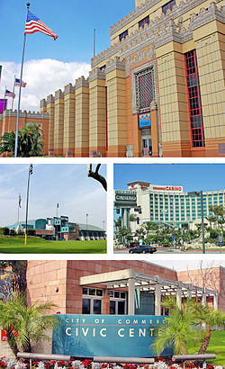 Location of Commerce in Los Angeles County, California
Coordinates: 34°0′2″N 118°9′17″W / 34.00056°N 118.15472°WCoordinates: 34°0′2″N 118°9′17″W / 34.00056°N 118.15472°W Country  United States
State  California
County Los Angeles Incorporated (city) 1960-01-28[1] Government – Mayor Joe Aguilar[2] Area[3] – Total 6.538 sq mi (16.933 km2) – Land 6.537 sq mi (16.930 km2) – Water 0.001 sq mi (0.003 km2) 0.02% Elevation 141 ft (43 m) Population (2010) – Total 12,823 – Density 1,961.3/sq mi (757.3/km2) Time zone PST (UTC-8) – Summer (DST) PDT (UTC-7) ZIP Code 90022, 90023, 90040, 90091[4] Area code(s) 323 FIPS code 06-14974 GNIS feature ID 1660503 Website http://www.ci.commerce.ca.us/ Commerce is a city located in southeast Los Angeles County, California, United States. The population was 12,823 at the 2010 census, up from 12,568 at the 2000 census. It is bordered by Vernon on the west, Los Angeles on the northwest, East Los Angeles on the north, Montebello on the east, Downey and Bell Gardens on the south, and Maywood on the southwest. The Los Angeles River forms part of its southwestern boundary, and the Rio Hondo separates it from Downey. Commerce is served by the Long Beach and Santa Ana freeways, as well as the Metrolink commuter rail service. It is usually referred to as the "City of Commerce" to distinguish it from the common noun.
Contents
Geography
Commerce is located at 34°0′2″N 118°9′17″W / 34.00056°N 118.15472°W (34.000613, -118.154781).[5]
According to the United States Census Bureau, the city has a total area of 6.5 square miles (17 km2), over 99% of it land.
History and development
In the 19th century, the area was part of Antonio Maria Lugo's Rancho San Antonio. Its conversion to an industrial area began in 1887, when the Atchison, Topeka & Santa Fe Railway built its main line through the area. The ranch remained intact until Arcadia Bandini de Stearns Baker, reputedly once the wealthiest woman in Los Angeles, sold some of it around the turn of the 20th century. By the 1920s, factories had arrived. In the late 1940s, industrial leaders banded together with residents in the communities of Bandini and Rosewood and part of Bell Gardens to encourage commerce. They changed the name to match that goal.
The city was incorporated in 1960 to prevent neighboring cities such as Vernon and Los Angeles from annexing industrial land for tax revenue. In the 1970s and 1980s, Commerce successfully negotiated the turbulent period of deindustrialization that hammered nearby cities such as South Gate and Norwalk, maintaining much of its manufacturing and goods-distribution base and successfully converting former industrial land to lucrative commercial uses. The most notable example of this phenomenon is the Citadel outlet mall, which occupies the site of a former tire factory. With a major rail yard within its borders, Commerce has also benefited greatly from the huge expansion in international trade traffic through the ports of Los Angeles and Long Beach, albeit at the expense of severe air pollution caused by truck congestion on the Long Beach Freeway.
Chrysler had an assembly plant in Commerce from 1930 through July 1971 located at 5800 S. Eastern and Slauson. It was closed at the end of the 1971 model year, as Chrysler decided to triple-stack its transport trains for the 1972 model year; its Los Angeles facility couldn't accommodate this change.
The City celebrated its 50th anniversary on January 28, 2010.
Demographics
Historical populations Census Pop. %± 1960 9,555 — 1970 10,635 11.3% 1980 10,509 −1.2% 1990 12,135 15.5% 2000 12,568 3.6% 2010 12,823 2.0% source:[6] 2010
The 2010 United States Census[7] reported that Commerce had a population of 12,823. The population density was 1,961.4 people per square mile (757.3/km²). The racial makeup of Commerce was 6,930 (54.0%) White, 96 (0.7%) African American, 161 (1.3%) Native American, 140 (1.1%) Asian, 9 (0.1%) Pacific Islander, 4,886 (38.1%) from other races, and 601 (4.7%) from two or more races. Hispanic or Latino of any race were 12,114 persons (94.5%).
The Census reported that 12,753 people (99.5% of the population) lived in households, 2 (0%) lived in non-institutionalized group quarters, and 68 (0.5%) were institutionalized.
There were 3,382 households, out of which 1,751 (51.8%) had children under the age of 18 living in them, 1,693 (50.1%) were opposite-sex married couples living together, 708 (20.9%) had a female householder with no husband present, 308 (9.1%) had a male householder with no wife present. There were 248 (7.3%) unmarried opposite-sex partnerships, and 23 (0.7%) same-sex married couples or partnerships. 559 households (16.5%) were made up of individuals and 326 (9.6%) had someone living alone who was 65 years of age or older. The average household size was 3.77. There were 2,709 families (80.1% of all households); the average family size was 4.17.
The population was spread out with 3,824 people (29.8%) under the age of 18, 1,458 people (11.4%) aged 18 to 24, 3,581 people (27.9%) aged 25 to 44, 2,590 people (20.2%) aged 45 to 64, and 1,370 people (10.7%) who were 65 years of age or older. The median age was 31.2 years. For every 100 females there were 96.4 males. For every 100 females age 18 and over, there were 92.7 males.
There were 3,470 housing units at an average density of 530.8 per square mile (204.9/km²), of which 1,619 (47.9%) were owner-occupied, and 1,763 (52.1%) were occupied by renters. The homeowner vacancy rate was 1.0%; the rental vacancy rate was 1.8%. 6,631 people (51.7% of the population) lived in owner-occupied housing units and 6,122 people (47.7%) lived in rental housing units.
2000
As of the census[8] of 2000, there were 12,568 people, 3,284 households, and 2,686 families residing in the city. The population density was 1,913.6 inhabitants per square mile (738.6/km²). There were 3,377 housing units at an average density of 514.2 per square mile (198.5/km²). The racial makeup of the city was 44.76% White, 0.78% Black or African American, 1.58% Native American, 1.08% Asian, 0.08% Pacific Islander, 46.94% from other races, and 4.77% from two or more races. 93.61% of the population were Hispanic or Latino of any race.
There were 3,284 households out of which 47.3% had children under the age of 18 living with them, 54.3% were married couples living together, 19.9% had a female householder with no husband present, and 18.2% were non-families. 15.5% of all households were made up of individuals and 9.2% had someone living alone who was 65 years of age or older. The average household size was 3.80 and the average family size was 4.17.
In the city the population was spread out with 33.8% under the age of 18, 11.1% from 18 to 24, 28.8% from 25 to 44, 16.1% from 45 to 64, and 10.2% who were 65 years of age or older. The median age was 28 years. For every 100 females there were 96.5 males. For every 100 females age 18 and over, there were 93.3 males.
The median income for a household in the city was $34,040, and the median income for a family was $36,572. Males had a median income of $27,738 versus $22,857 for females. The per capita income for the city was $11,117. About 15.4% of families and 17.9% of the population were below the poverty line, including 21.8% of those under age 18 and 9.9% of those age 65 or over.
Government and infrastructure
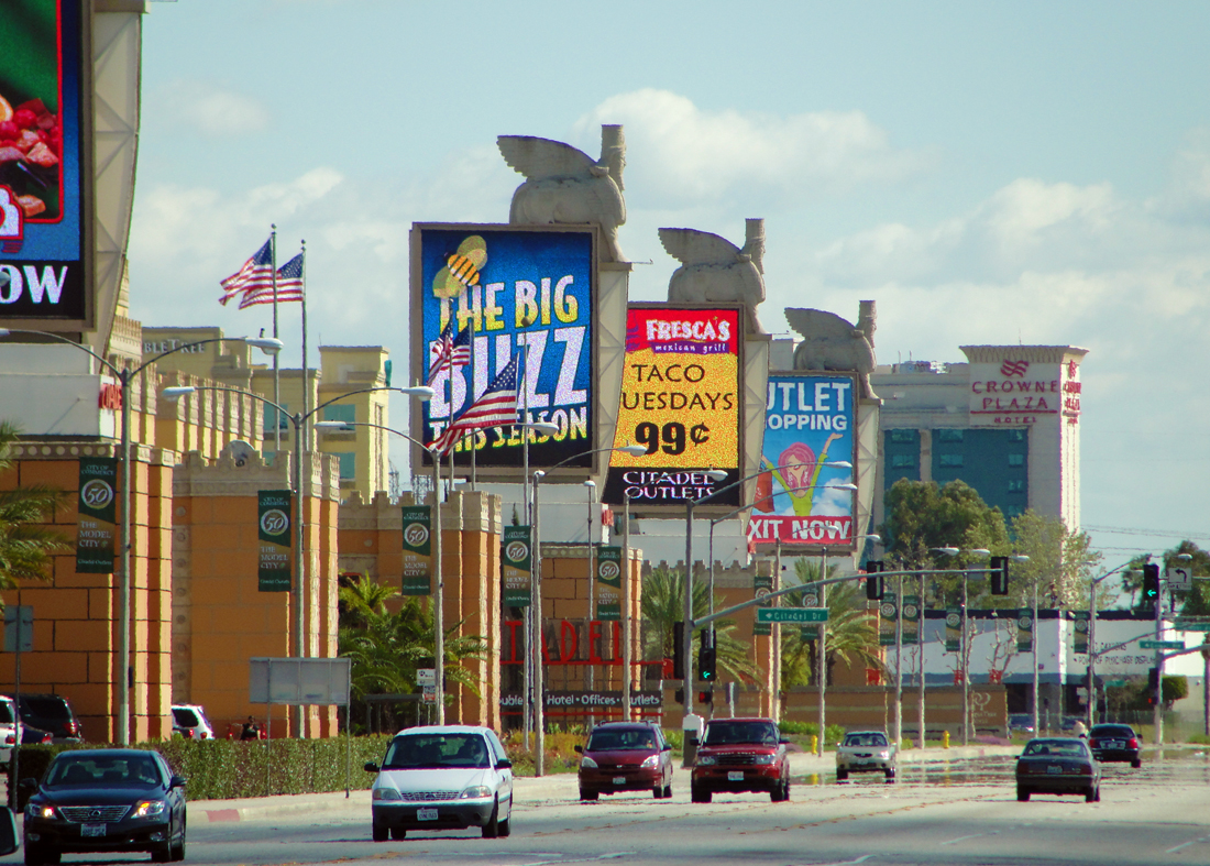
 Citadel Outlets & Commerce Casino as seen from the I-5 FWY
In the state legislature Commerce is located in the 30th Senate District, represented by Democrat Ronald S. Calderon, and in the 50th Assembly District, represented by Democrat Ricardo Lara. Federally, Commerce is located in California's 34th congressional district, which has a Cook PVI of D +23[9] and is represented by Democrat Lucille Roybal-Allard.
Commerce residents have many civic services funded from taxes on the local card club, the Commerce Casino, which accounts for 46% ($19.5 Million for budget year 2005/06) of Commerce's tax revenues, and the Citadel. This includes four libraries, a senior center, a teen center, an aquatics center, city-owned camp located in the San Bernardino National Forest An indoor 20 lane 50-foot marksmanship range is also available for firearms training and Contract use. Commerce is also one of the few cities in California that provides its residents with zero-fare bus service.[citation needed]
The Los Angeles County Department of Health Services operates the Whittier Health Center in Whittier, serving Commerce.[10]
The United States Postal Service Commerce Post Office is located at 5670 East Washington Boulevard.[11]
Emergency services
Fire services
Fire protection in Commerce is provided by the Los Angeles County Fire Department, which has its headquarters in Commerce.[12] The LACFD operates Station #22 at 928 South Gerhart Avenue, Station #27, the battalion headquarters, at 6031 Rickenbacker Road, and Station #50 at 2327 South Saybrook Avenue, all in Commerce, as a part of Battalion 3.[13][14] Ambulance transport is provided by Care Ambulance Service.
Police services
The Los Angeles County Sheriff's Department (LASD) operates the East Los Angeles Station in East Los Angeles, serving Commerce.[15]
Economy
Principal Employers
According to the City's 2009 Comprehensive Annual Financial Report,[16] the top employers in the city are:
# Employer # of Employees 1 Commerce Casino 2,191 2 County of Los Angeles 910 3 Parsec 890 4 Smart & Final 769 5 Unified Grocers 748 6 American International Industries 592 7 Mission Foods 590 7 99 Cents Only Stores 549 9 Megatoys 480 10 Wine Warehouse 376 11 Valassis Direct Mail 350 12 Gibson Overseas 346 13 City of Commerce 315 14 AT&T 302 Education
Most of Commerce is served by Montebello Unified School District, while small portions are served by the Los Angeles Unified School District.
Montebello Unified School District
Elementary schools that serve Commerce include:
- Bandini Elementary School (Commerce)[17]
- Rosewood Park Elementary School (Commerce)[18]
- Suva Elementary School (Bell Gardens)[19]
Intermediate schools that serve Commerce include:
- Bell Gardens Intermediate School (Bell Gardens)[20]
- Suva Intermediate School (Bell Gardens)[21]
- La Merced Intermediate School (Montebello)[22]
K-8 schools:
- Laguna Nueva School (Commerce)[23]
High schools that serve Commerce include:
- Bell Gardens High School (Bell Gardens)
- Montebello High School (Montebello)
- Schurr High School (Montebello)
Los Angeles Unified School District
- Ford Boulevard Elementary School (Unincorporated Los Angeles County)[24]
- Griffith Middle School (Unincorporated Los Angeles County)
- Garfield High School (Unincorporated Los Angeles County)
See also
- List of California public officials charged with crimes, Commerce
References
- ^ "Incorporation Dates of California Cities". http://www.cacities.org/resource_files/20457.IncorpDateLO.doc. Retrieved 2007-01-18.
- ^ "City Council - City of Commerce". http://www.ci.commerce.ca.us/citycouncil.htm. Retrieved 2007-01-18.
- ^ U.S. Census
- ^ "USPS - ZIP Code Lookup - Find a ZIP+ 4 Code By City Results". http://zip4.usps.com/zip4/zcl_1_results.jsp?visited=1&pagenumber=0&state=ca&city=Commerce. Retrieved 2007-01-18.
- ^ "US Gazetteer files: 2010, 2000, and 1990". United States Census Bureau. 2011-02-12. http://www.census.gov/geo/www/gazetteer/gazette.html. Retrieved 2011-04-23.
- ^ "CENSUS OF POPULATION AND HOUSING (1790-2000)". U.S. Census Bureau. http://www.census.gov/prod/www/abs/decennial/index.html. Retrieved 2010-07-30.
- ^ All data are derived from the United States Census Bureau reports from the 2010 United States Census, and are accessible on-line here. The data on unmarried partnerships and same-sex married couples are from the Census report DEC_10_SF1_PCT15. All other housing and population data are from Census report DEC_10_DP_DPDP1. Both reports are viewable online or downloadable in a zip file containing a comma-delimited data file. The area data, from which densities are calculated, are available on-line here. Percentage totals may not add to 100% due to rounding. The Census Bureau defines families as a household containing one or more people related to the householder by birth, opposite-sex marriage, or adoption. People living in group quarters are tabulated by the Census Bureau as neither owners nor renters. For further details, see the text files accompanying the data files containing the Census reports mentioned above.
- ^ "American FactFinder". United States Census Bureau. http://factfinder.census.gov. Retrieved 2008-01-31.
- ^ "Will Gerrymandered Districts Stem the Wave of Voter Unrest?". Campaign Legal Center Blog. http://www.clcblog.org/blog_item-85.html. Retrieved 2008-02-10.
- ^ "Whittier Health Center." Los Angeles County Department of Health Services. Retrieved on March 18, 2010.
- ^ "Post Office Location - COMMERCE." United States Postal Service. Retrieved on December 6, 2008.
- ^ "Fire Reports." Los Angeles County Fire Department. Retrieved on March 12, 2010.
- ^ "Hometown Fire Stations." Los Angeles County Fire Department. Retrieved on December 6, 2008.
- ^ "Planning Areas." City of Commerce. Retrieved on December 6, 2008.
- ^ "East Los Angeles Station." Los Angeles County Sheriff's Department. Retrieved on January 21, 2010.
- ^ City of Commerce, California Comprehensive Annual Financial Report, for the Year ended June 30, 2010 Retrieved 2010-09-24
- ^ http://www.bae.montebello.k12.ca.us/
- ^ http://www.rpe.montebello.k12.ca.us/
- ^ http://www.sue.montebello.k12.ca.us/
- ^ http://www.bgi.montebello.k12.ca.us/
- ^ http://www.sui.montebello.k12.ca.us/
- ^ http://www.lmi.montebello.k12.ca.us/
- ^ http://www.lne.montebello.k12.ca.us/
- ^ http://www.lausd.k12.ca.us/Ford_EL
External links
- City of Commerce official website
- LA County Disaster Communications Service (DCS) East LA Station
- Commerce Aquatics website
Greater Los Angeles Area Central city Counties Satellite cities Cities
>200kCities and towns
100k–200kBurbank • Compton • Corona • Costa Mesa • Downey • East Los Angeles • El Monte • Fontana • Fullerton • Garden Grove • Inglewood • Lancaster • Mission Viejo • Moreno Valley • Murrieta • Norwalk • Ontario • Orange • Palmdale • Pasadena • Pomona • Rancho Cucamonga • Santa Clarita • Simi Valley • South Gate • Temecula • Thousand Oaks • Torrance • Ventura • Victorville • West CovinaArea regions Antelope Valley • Conejo Valley • Downtown Los Angeles • East Los Angeles • Gateway Cities • Greater Hollywood • Harbor Area • Inland Empire • Palos Verdes Hills • Pomona Valley • San Bernardino Valley • San Fernando Valley • San Gabriel Valley • Santa Ana Valley • Santa Clarita Valley • South Bay • South Los Angeles • Westside Los AngelesLandforms Los Angeles Basin • Baldwin Hills (range) • Calico Mountains • Catalina Island • Channel Islands • Coachella Valley • High Desert—Mojave Desert • Low Desert—Colorado Desert • San Fernando Valley • San Bernardino Mountains • San Gabriel Mountains • Santa Ana Mountains • Santa Monica Mountains • Santa Susana Mountains • Verdugo MountainsBodies of water Los Angeles River • Aliso Creek • Arroyo Seco • Ballona Creek • Bell Creek • Big Bear Lake • Coyote Creek • Lake Arrowhead • Lake Perris • Lake Piru • Malibu Creek • Pacific Ocean • Pyramid Lake • Rio Hondo • San Gabriel River • San Juan Creek • San Pedro Bay • Santa Ana River • Santa Clara River • Santa Margarita River • Santa Monica BayCategories:- Cities in Los Angeles County, California
- Populated places in California with Hispanic majority populations
- Incorporated cities and towns in California
- Populated places established in 1960


Wikimedia Foundation. 2010.