- South San Jose Hills, California
Infobox Settlement
official_name = South San Jose Hills, California
settlement_type = CDP
nickname =
motto =
imagesize =
image_caption =
image_
imagesize =
image_caption =
image_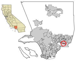
mapsize = 250x200px
map_caption = Location of South San Jose Hills in Los Angeles County,California .
mapsize1 =
map_caption1 =subdivision_type = Country
subdivision_name =United States
subdivision_type1 = State
subdivision_name1 =California
subdivision_type2 = County
subdivision_name2 = Los Angeles
government_footnotes =
government_type =
leader_title =
leader_name =
leader_title1 =
leader_name1 =
established_title =
established_date =area_footnotes =
area_magnitude =
area_total_km2 = 3.8
area_land_km2 = 3.8
area_water_km2 = 0.0
area_total_sq_mi = 1.5
area_land_sq_mi = 1.5
area_water_sq_mi = 0.0population_as_of = 2000
population_footnotes =
population_total = 20218
population_density_km2 = 5357.7
population_density_sq_mi = 13876.4timezone = PST
utc_offset = -8
timezone_DST = PDT
utc_offset_DST = -7
elevation_footnotes =
elevation_m = 127
elevation_ft = 417
latd = 34 |latm = 0 |lats = 41 |latNS = N
longd = 117 |longm = 54 |longs = 17 |longEW = Wpostal_code_type =
ZIP code
postal_code = 91744
area_code = 626
blank_name = FIPS code
blank_info = 06-73290
blank1_name = GNIS feature ID
blank1_info = 1867058
website =
footnotes =South San Jose Hills is a
unincorporated community andcensus-designated place in Los Angeles County,California ,United States . The population was 20,218 at the 2000 census.Description
South San Jose Hills is an unincorporated, mainly residential community located on the southern end of the
San Jose Hills , which forms a part ofSan Gabriel Valley .South San Jose Hills is bounded by City of Industry to the south, Valinda to the west, West Covina to the north, and Walnut to the east. The community is easily accessible via the Pomona Freeway (State Route 60), which runs just south of the community. The
ZIP code serving the community is 91744. Most addresses do not use South San Jose Hills as the city but rather La Puente, West Covina, or Valinda, depending on the location of the residence or business. Parts of the area are nicknamed "Happy Homes", based on the former name of the development and on thestreet gang that later took that name.Demographics
As of the
census GR|2 of 2000, there were 20,218 people, 3,984 households, and 3,605 families residing in the CDP. Thepopulation density was 5,346.7/km² (13,876.4/mi²). There were 4,059 housing units at an average density of 1,073.4/km² (2,785.8/mi²). The racial makeup of the CDP was 38.76% White, 1.86% African American, 1.54% Native American, 6.54% Asian, 0.35% Pacific Islander, 46.35% from other races, and 4.59% from two or more races. Hispanic or Latino of any race were 83.43% of the population.There were 3,984 households out of which 53.2% had children under the age of 18 living with them, 67.4% were married couples living together, 14.4% had a female householder with no husband present, and 9.5% were non-families. 6.7% of all households were made up of individuals and 3.0% had someone living alone who was 65 years of age or older. The average household size was 5.07 and the average family size was 4.95.
In the CDP the population was spread out with 34.6% under the age of 18, 12.0% from 18 to 24, 30.8% from 25 to 44, 16.7% from 45 to 64, and 5.9% who were 65 years of age or older. The median age was 27 years. For every 100 females there were 100.2 males. For every 100 females age 18 and over, there were 99.0 males.
The median income for a household in the CDP was $48,655, and the median income for a family was $46,702. Males had a median income of $26,477 versus $22,113 for females. The
per capita income for the CDP was $11,324. About 13.4% of families and 18.5% of the population were below thepoverty line , including 23.7% of those under age 18 and 9.7% of those age 65 or over.Politics
In the state legislature South San Jose Hills is located in the 24th Senate District, represented by Democrat
Gloria Romero , and in the 58th Assembly District, represented by DemocratCharles M. Calderon . Federally, South San Jose Hills is located inCalifornia's 38th congressional district , which has a Cook PVI of D +20 [cite web | title = Will Gerrymandered Districts Stem the Wave of Voter Unrest? | publisher = Campaign Legal Center Blog | url=http://www.clcblog.org/blog_item-85.html | accessdate = 2008-02-10] and is represented by DemocratGrace Napolitano .External links
* [http://www.city-data.com/city/South-San-Jose-Hills-California.html South San Jose Hills community profile]
*Mapit-US-cityscale|34.011261|-117.904846
Wikimedia Foundation. 2010.