- Milligan District, California
-
Coordinates: 38°20′53″N 120°42′03″W / 38.34806°N 120.70083°W
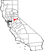
Milligan District — Former settlement — Location in California
 Milligan District
Coordinates: 38°20′53″N 120°42′03″W / 38.34806°N 120.70083°W Country United States State California County Amador County Elevation[1] 1,601 ft (488 m) Milligan District (also, Slabtown[2] and Hoodsville[3]) is a former settlement in Amador County, California. It lay at an elevation of 1601 feet (488 m).
References
- ^ U.S. Geological Survey Geographic Names Information System: Milligan District, California
- ^ U.S. Geological Survey Geographic Names Information System: Milligan District, California
- ^ Durham, David L. (1998). California's Geographic Names: A Gazetteer of Historic and Modern Names of the State. Quill Driver Books. p. 504. ISBN 9781884995149.
Municipalities and communities of Amador County, California Cities Amador City | Ione | Jackson | Plymouth | Sutter Creek
CDPs Buckhorn | Buena Vista | Camanche North Shore | Camanche Village | Drytown | Fiddletown | Kirkwood‡ | Martell | Pine Grove | Pioneer | Red Corral | River Pines | Volcano
Unincorporated
communitiesAllen | Barton | Bonnefoy | Bunker Hill | Carbondale | Clarsona | Clinton | Dagon | Edwin | Electra | Enterprise | Firebrick | Kit Carson | New Chicago | Pine Acres | Plasse | Ranch House Estates | Scottsville | Sunnybrook | Sutter Hill
Ghost towns Amador Crossing | Arkansas Ferry | Armstrong's Mill | Camp O'pera | Camp Union | Cape Cod Bar | Chaparral Hill | China City | Chinatown | Copper Hill | Defender | Dew Drop | Figtree | Forest Home | Fort Ann | Fort John | French Camp | Hardenburg | Irishtown | Lancha Plana | Lignite | Lower Rancheria | Mahala Flat | May | Milligan District | Old Rancheria | Pokerville | Pomegranate | Ranlett | Ritchey | Secreta | Snake Flat | Tragedy Spring | Union Flat | Watkins Bar | Wieland | Yeomet | Yusumne
Footnotes ‡This CDP also has portions in an adjacent county or counties
Categories:- Former settlements in Amador County, California
- Former populated places in California
- Amador County, California geography stubs


Wikimedia Foundation. 2010.