- Mountain States
-
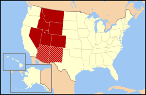
The Mountain States (also known as the Mountain West and the Interior West) form one of the nine geographic divisions of the United States that are officially recognized by the United States Census Bureau. It is a subregion of the Western United States. The Mountain States are usually split up into two other regions known as the Northwest and Southwest. Idaho, Montana, and Wyoming are considered part of the northwest, while Arizona, New Mexico, Colorado, Nevada, and Utah are considered part of the southwest.
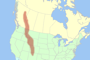
The division consists of eight states: Arizona, Colorado, Idaho, Montana, Nevada, New Mexico, Utah, and Wyoming. These eight states have the highest mean elevations of all 50 U.S. states. Together with the Pacific States of Alaska, California, Hawaii, Oregon and Washington, the Mountain States constitute the broader region of the West, one of the four regions the United States Census Bureau formally recognizes (the Northeast, South and Midwest being the other three). The word "Mountain" refers to the Rocky Mountains, which run north-south throughout Montana, Idaho, Wyoming, parts of Utah, Colorado, and New Mexico. Arizona and Nevada, as well as most other parts of Utah and New Mexico have other mountain ranges and scattered mountains located in them as well.
Mountain Time is observed in nearly the entire division, except Nevada (all but the stateline city of West Wendover) and the Idaho panhandle. Daylight saving time is not observed in Arizona, except for lands within the Navajo Nation (Northeast corner of the state) which observe daylight saving time due to the Nation traversing state lines. For this reason, most of Arizona is one hour behind the rest of the Mountain Time Zone from the second Sunday in March until the first Sunday in November.[1]
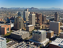
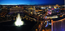
Phoenix is the largest city and metropolitan area of the Mountain States, followed by Denver and Las Vegas.
Contents
Regional Geography
The Mountain West is one of the largest and most diverse regions in the United States. Most regional boundaries of the Mountain West are often looked at as the area from the High Plains to the Sierra Nevada Mountains and Cascade Mountains. Although, the southern and northern portions of the Mountain West are often split into two separate regions. The Southern portion (Arizona, New Mexico, Utah, Colorado, and Nevada) are often called the greater Southwest region. Meanwhile, the northern portion (Wyoming, Idaho, and Montana) are often either called Northwest states or the Northern Mountain West region.[2]
Terrain
The terrain of the Mountain West is more diverse than any other region in the United States. Its physical geography range from the highest mountain peaks in the United States, to large desert lands, and flat rolling plains in the eastern portion of the region. The mountain west states contain all of the major deserts found in North America. The Great Basin Desert is located in most all of the Nevada, Western Utah, Southern Idaho, and Southern Oregon. Wyoming also has a vast amount of desert land in the southwestern portion of their state, which is known as the Red Desert. The Mojave Desert is mainly located in California, but over half of the desert is located in southern Nevada, in the mountain west. Meanwhile, the Sonoran Desert is located in most all of Arizona and the Chihuahuan Desert is also located in most of Southwestern and Southern New Mexico.
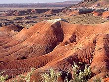
Colorado, New Mexico, Utah, and Arizona also have other smaller desert lands, which are part of the Colorado Plateau desert lands. The Painted Desert is located in Northern and Northeastern Arizona, and the San Rafael Desert is also located all over Eastern Utah. New Mexico also has other desert lands located in Northern and Northwestern New Mexico. Also, Colorado has large desert lands on the Colorado plateau in Northwester, Western, and Southwestern Colorado. Colorado also has scattered desert lands in Southern Colorado, off the Colorado plateau. These desert lands in Colorado are located in and around areas such as, the Royal Gorge, Great Sand Dunes, Pueblo, San Luis Valley, Cortez, Dove Creek, Delta, Canyon of the Ancients National Monument, Roan Plateau, Dinosaur National Monument, Colorado National Monument, and the Grand Mesa. [3] The San Luis Valley is well known as the largest high valley desert in the world.
In the far eastern portions of the Mountain West, there are the High Plains area of the Great Plains. These plains mainly consist of flat rolling land, with some Butte's and scattered forests located in these areas. Even though these plains areas are part of the Great Plains, they are not part of the same region. Reasons for this is that the High Plains receive very little rainfall and sit at high elevations usually about 3,000 feet. Many people view the High Plains as the point where you begin to enter the greater Mountain West region.[4]
The Mountain West also has some of the highest mountain peaks in America. Some of the more famous mountains in the Mountain West are Mount Elbert, Pikes Peak, Mount Evans, Longs Peak, Kings Peak, Wind River Peak, Cloud Peak, Wheeler Peak, Truchas Peak, Granite Peak, Borah Peak, and Humphreys Peak.[5]
Climate
The climate of the Mountain West is also one of the more diverse climates in the United States. The entire region generally features a semi-arid to arid climate, with some alpine climates in the mountains of each state. Some parts of the tall mountains can receive very large amounts of snow and rain, while other parts of the region receive very little rain and virtually no snow at all. The High Plains in the eastern portion of the region receive moderate snow falls, but virtually very little rain at all.
The states of Nevada and Arizona are generally filled with desert lands and scattered mountain ranges. Much of Nevada receives little to no snow in the southern portion of the state, while Northern Nevada can receive large amounts of snow in and around the mountains, and even in the desert lands in Nevada. Arizona generally receives little rain or snow, but high elevations in and near mountains receive extremely large amounts of rain and snow. Northern and Northeastern Arizona display characteristics of a "High Desert", where the summers are very hot and dry, while the winters can become very cold and it can snow as well.
Utah is also generally large desert lands with mountains as well. However, the desert lands in Utah receive significant snow falls in the desert lands, and also large snow falls in and around the mountains. Colorado and New Mexico have very similar climates. Both states can receive significant snow falls off the mountains, while the mountains in both states receive extremely large amounts of snow. However, southern and southwestern New Mexico generally does not receive much snow at all, similar to southern Nevada and southern Arizona. The desert lands found in northeastern Arizona, eastern Utah, northern New Mexico, western and southern Colorado are also generally referred to as the "High Desert" lands.
The Northern portion of the Mountain West tends to be a bit cooler than the southwestern areas. Wyoming, Idaho, and Montana all receive significant snow falls off the mountains and very large snow falls in the mountains as well. The High Desert also exists in the northern mountain west. Southeastern Oregon, southern Idaho, and southwestern Wyoming have the Great Basin Desert lands located in them, which is part of the high desert.[6]
States
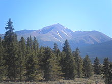
Mount Elbert in the Sawatch Range of Colorado is the highest peak of the Rocky Mountains and the Mountain States.
The Mountain States by Population[7]
Rank State 2010 pop 2000 pop Change Capital Most populous city 1 Arizona 6,392,017 5,130,632 +24.59% Phoenix Phoenix 2 Colorado 5,029,196 4,301,261 +16.92% Denver Denver 3 Utah 2,763,885 2,233,169 +23.77% Salt Lake City Salt Lake City 4 Nevada 2,700,551 1,998,257 +35.15% Carson City Las Vegas 5 New Mexico 2,059,179 1,819,046 +13.20% Santa Fe Albuquerque 6 Idaho 1,567,582 1,293,953 +21.15% Boise City Boise City 7 Montana 989,415 902,195 +9.67% Helena Billings 8 Wyoming 563,626 493,782 +14.14% Cheyenne Cheyenne Mountain States 22,065,451 18,172,295 +21.42% Phoenix The Mountain States by Mean Elevation[8]
Rank State Highest point Highest elevation Lowest point Lowest elevation Mean elevation Elevation span 1 Colorado Mount Elbert[9] 14,440 ft
4401 mArikaree River at Kansas border 3,317 ft
1011 m6,800 ft
2073 m11,123 ft
3390 m2 Wyoming Gannett Peak[10] 13,809 ft
4209 mBelle Fourche River at South Dakota border 3,099 ft
945 m6,700 ft
2042 m10,710 ft
3265 m3 Utah Kings Peak[11] 13,518 ft
4120 mBeaver Dam Wash at Arizona border 2,180 ft
664 m6,100 ft
1859 m11,338 ft
3456 m4 New Mexico Wheeler Peak[12] 13,167 ft
4013 mRed Bluff Reservoir on Texas border 2,842 ft
866 m5,700 ft
1737 m10,325 ft
3147 m5 Nevada Boundary Peak[13] 13,147 ft
4007 mColorado River at California border 479 ft
146 m5,500 ft
1676 m12,668 ft
3861 m6 Idaho Borah Peak[14] 12,668 ft
3861 mSnake River at Washington border 710 ft
216 m5,000 ft
1524 m11,958 ft
3645 m7 Arizona Humphreys Peak[15] 12,637 ft
3852 mColorado River at Sonora border 70 ft
21 m4,100 ft
1250 m12,567 ft
3830 m8 Montana Granite Peak[16] 12,807 ft
3904 mKootenai River at Idaho border 1,800 ft
549 m3,400 ft
1036 m11,007 ft
3355 mMountain States Mount Elbert[9] 14,440 ft
4401 mColorado River at Sonora border 70 ft
21 m5,400 ft
1646 m14,370 ft
4380 mCities
The 30 Most Populous Municipalities of the Mountain States[7]
Rank Municipality State 2010 pop 2000 pop Change 1 Phoenix Arizona 1,445,632 1,321,045 +9.43% 2 Denver Colorado 600,158 554,636 +8.21% 3 Las Vegas Nevada 583,756 478,434 +22.01% 4 Albuquerque New Mexico 545,852 448,607 +21.68% 5 Tucson Arizona 520,116 486,699 +6.87% 6 Mesa Arizona 439,041 396,375 +10.76% 7 Colorado Springs Colorado 416,427 360,890 +15.39% 8 Aurora Colorado 325,078 276,393 +17.61% 9 Henderson Nevada 257,729 175,381 +46.95% 10 Chandler Arizona 236,123 176,581 +33.72% 11 Glendale Arizona 226,721 218,812 +3.61% 12 Reno Nevada 225,221 180,480 +24.79% 13 Scottsdale Arizona 217,385 202,705 +7.24% 14 North Las Vegas Nevada 216,961 115,488 +87.86% 15 Gilbert Arizona 208,453 109,697 +90.03% 16 Boise City Idaho 205,671 185,787 +10.70% 17 Salt Lake City Utah 186,440 181,743 +2.58% 18 Tempe Arizona 161,719 158,625 +1.95% 19 Peoria Arizona 154,065 108,364 +42.17% 20 Fort Collins Colorado 143,986 118,652 +21.35% 21 Lakewood Colorado 142,980 144,126 −0.80% 22 West Valley City Utah 129,480 108,896 +18.90% 23 Thornton Colorado 118,772 82,384 +44.17% 24 Surprise Arizona 117,517 NA NA 25 Provo Utah 112,488 105,166 +6.96% 26 Pueblo Colorado 106,595 102,121 +4.38% 27 Arvada Colorado 106,433 102,153 +4.19% 28 Westminster Colorado 106,114 100,940 +5.13% 29 West Jordan Utah 103,712 68,336 +51.77% 30 Centennial Colorado 100,377 NA NA Urban Areas
The 31 Most Populous Core Based Statistical Areas of the Mountain States[17][7]
Rank CBSA 2010 pop 2000 pop Change 1 Phoenix-Mesa-Glendale, AZ MSA 4,192,887 3,251,876 +28.94% 2 Denver-Aurora-Broomfield, CO MSA 2,543,482 2,179,240 +16.71% 3 Las Vegas-Paradise, NV MSA 1,951,269 1,375,765 +41.83% 4 Salt Lake City, UT MSA 1,124,197 968,858 +16.03% 5 Tucson, AZ MSA 980,263 843,746 +16.18% 6 Albuquerque, NM MSA 887,077 729,649 +21.58% 7 Colorado Springs, CO MSA 645,613 537,484 +20.12% 8 Boise City-Nampa, ID MSA 616,561 464,840 +32.64% 9 Ogden-Clearfield, UT MSA 547,184 442,656 +23.61% 10 Provo-Orem, UT MSA 526,810 376,774 +39.82% 11 Reno-Sparks, NV MSA 425,417 342,885 +24.07% 12 Fort Collins-Loveland, CO MSA 299,630 251,494 +19.14% 13 Boulder, CO MSA 294,567 269,814 +9.17% 14 Greeley, CO MSA 252,825 180,926 +39.74% 15 Prescott, AZ MSA 211,033 167,517 +25.98% 16 Las Cruces, NM MSA 209,233 174,682 +19.78% 17 Lake Havasu City-Kingman, AZ MSA 200,186 155,032 +29.13% 18 Yuma, AZ MSA 195,751 160,026 +22.32% 19 Pueblo, CO MSA 159,063 141,472 +12.43% 20 Billings, MT MSA 158,050 138,904 +13.78% 21 Grand Junction, CO MSA 146,723 116,255 +26.21% 22 Santa Fe, NM MSA 144,170 129,292 +11.51% 23 Coeur d'Alene, ID MSA 138,494 108,685 +27.43% 24 Saint George, UT MSA 138,115 90,354 +52.86% 25 Flagstaff, AZ MSA 134,421 116,320 +15.56% 26 Sierra Vista-Douglas, AZ μSA 131,346 117,755 +11.54% 27 Idaho Falls, ID MSA 130,374 101,677 +28.22% 28 Farmington, NM MSA 130,044 113,801 +14.27% 29 Logan, UT-ID MSA 125,442 102,720 +22.12% 30 Missoula, MT MSA 109,299 95,802 +14.09% 31 Show Low, AZ μSA 107,449 97,470 +10.24% The Six Combined Statistical Areas of the Mountain States[17][7][18]
CSA 2010 pop 2000 pop Change Component CBSAs Denver-Aurora-Boulder, CO CSA 3,090,874 2,629,980 +17.52% Denver-Aurora-Broomfield, CO MSA
Boulder, CO MSA
Greeley, CO MSALas Vegas-Paradise-Pahrump, NV CSA 1,995,215 1,408,250 +41.68% Las Vegas-Paradise, NV MSA
Pahrump, NV µSASalt Lake City-Ogden-Clearfield, UT CSA 1,744,886 1,469,474 +18.74% Salt Lake City, UT MSA
Ogden-Clearfield, UT MSA
Brigham City, UT µSA
Heber, UT µSAReno-Sparks-Fernley, NV CSA 477,397 377,386 +26.50% Reno-Sparks, NV MSA
Fernley, NV µSASanta Fe-Espanola, NM CSA 184,416 170,482 +8.17% Santa Fe, NM MSA
Espanola, NM µSAClovis-Portales, NM CSA 68,222 63,062 +8.18% Clovis, NM µSA
Portales, NM µSAGallery
-
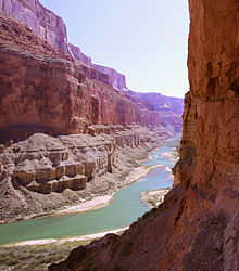
The Grand Canyon of the Colorado River in Arizona.
-
Sunset in Saguaro National Park in Arizona.
-
Bell Rock near Sedona, Arizona.
-
The resort town of Aspen, Colorado.
-
The Cliff Palace in Mesa Verde National Park in Colorado.
-
Mutton busting at the National Western Stock Show in Denver, Colorado.
-
The Diamond on Longs Peak in Rocky Mountain National Park in Colorado.
-
Borah Peak is the highest point in the State of Idaho.
-
Hells Canyon of the Snake River between Idaho and Oregon.
-
Redfish Lake in Idaho.
-
Shoshone Falls on the Snake River in Idaho, 1898.
-
The Absaroka Range of Montana.
-
Autumn comes to Chief Mountain in Glacier National Park in Montana.
-
Feral horses in the Pryor Mountain Wild Horse Range in Montana.
-
Saint Mary Lake in Glacier National Park in Montana.
-
The Burning Man Festival in the Black Rock Desert of Nevada.
-
Stella Lake in Great Basin National Park in Nevada.
-
The Nevada shore of Lake Tahoe.
-
Downtown Reno, Nevada.
-
The Taos Pueblo of New Mexico.
-
The Very Large Array near Socorro, New Mexico.
-
Sunset at Delicate Arch in Arches National Park in Utah.
-
The Bonneville Salt Flats in Utah.
-
Mesa Arch in Canyonlands National Park in Utah.
-
Devils Tower in Wyoming near the Black Hills.
-
Two Grizzly Bears in Yellowstone National Park in Wyoming.
-
Old Faithful geyser erupts in Yellowstone National Park in Wyoming.
-
The Teton Range from Jackson Hole, Wyoming.
See also
- Mountain Time Zone
- Rocky Mountains
- United States
References
- ^ http://www.infoplease.com/spot/daylight1.html Infoplease: Daylight Saving Time, A trip around the world reveals that time isn't a synchronized science
- ^ http://www.geog.nau.edu/courses/alew/ggr346/text/chapters/ch9.html
- ^ http://research.allacademic.com/meta/p_mla_apa_research_citation/2/6/6/3/3/p266339_index.html
- ^ http://www.hprcc.unl.edu/
- ^ http://www.infoplease.com/ipa/A0001798.html
- ^ http://www.desertusa.com/glossary.html
- ^ a b c d "The American FactFinder". 2010 United States Census. United States Census Bureau, Population Division. http://factfinder2.census.gov/. Retrieved October 17, 2011.
- ^ See the List of U.S. states by elevation.
- ^ a b "Mount Elbert". NGS data sheet. U.S. National Geodetic Survey. http://www.ngs.noaa.gov/cgi-bin/ds_mark.prl?PidBox=KL0637. Retrieved October 20, 2011.
- ^ "Gannett Peak Cairn". NGS data sheet. U.S. National Geodetic Survey. http://www.ngs.noaa.gov/cgi-bin/ds_mark.prl?PidBox=OW0356. Retrieved October 20, 2011.
- ^ "Kings Peak Target". NGS data sheet. U.S. National Geodetic Survey. http://www.ngs.noaa.gov/cgi-bin/ds_mark.prl?PidBox=LO1058. Retrieved October 20, 2011.
- ^ "Wheeler". NGS data sheet. U.S. National Geodetic Survey. http://www.ngs.noaa.gov/cgi-bin/ds_mark.prl?PidBox=GM0779. Retrieved October 20, 2011.
- ^ "Boundary". NGS data sheet. U.S. National Geodetic Survey. http://www.ngs.noaa.gov/cgi-bin/ds_mark.prl?PidBox=HR2576. Retrieved October 20, 2011.
- ^ "Beauty Reset". NGS data sheet. U.S. National Geodetic Survey. http://www.ngs.noaa.gov/cgi-bin/ds_mark.prl?PidBox=PZ0770. Retrieved October 20, 2011.
- ^ "Frisco". NGS data sheet. U.S. National Geodetic Survey. http://www.ngs.noaa.gov/cgi-bin/ds_mark.prl?PidBox=FQ0624. Retrieved October 20, 2011.
- ^ "Granite Peak". NGS data sheet. U.S. National Geodetic Survey. http://www.ngs.noaa.gov/cgi-bin/ds_mark.prl?PidBox=QW0616. Retrieved October 20, 2011.
- ^ a b "OMB Bulletin No. 10-02: Update of Statistical Area Definitions and Guidance on Their Uses". United States Office of Management and Budget. December 1, 2009. http://www.whitehouse.gov/omb/assets/bulletins/b10-02.pdf. Retrieved October 18, 2011.
- ^ The Sacramento—Arden-Arcade—Yuba City, CA-NV Combined Statistical Area includes the Gardnerville Ranchos, NV Micropolitan Statistical Area, but is located primarily in the State of California.
External links
United States (Outline) History Pre-Columbian era · Colonial era (Thirteen Colonies · Colonial American military history) · American Revolution (War) · Federalist Era · War of 1812 · Territorial acquisitions · Territorial evolution · Mexican–American War · Civil War · Reconstruction era · Indian Wars · Gilded Age · African-American Civil Rights Movement (1896–1954) · Spanish–American War · Imperialism · World War I · Roaring Twenties · Great Depression · World War II (Home front) · Cold War · Korean War · Space Race · African-American Civil Rights Movement (1955–1968) · Feminist Movement · Vietnam War · Post-Cold War (1991–present) · War on Terror (War in Afghanistan · Iraq War) · Timeline of modern American conservatismTopicsDemographic · Discoveries · Economic (Debt Ceiling) · Inventions (before 1890 · 1890–1945 · 1946–1991 · after 1991) · Military · Postal · Technological and industrialFederal
governmentLegislature - Congress
Senate
· Vice President
· President pro tem
House of Representatives
· Speaker
Judiciary - Supreme Court
Federal courts
Courts of appeal
District courtsExecutive - President
Executive Office
Cabinet / Executive departments
Civil service
Independent agencies
Law enforcement
Public policy
Intelligence
Central Intelligence Agency
Defense Intelligence Agency
National Security Agency
Federal Bureau of InvestigationPolitics Divisions · Elections (Electoral College) · Foreign policy · Foreign relations · Ideologies · Local governments · Parties (Democratic Party · Republican Party · Third parties) · Political status of Puerto Rico · Red states and blue states · Scandals · State governments · Uncle SamGeography Cities, towns, and villages · Counties · Extreme points · Islands · Mountains (Peaks · Appalachian · Rocky) · National Park System · Regions (Great Plains · Mid-Atlantic · Midwestern · New England · Northwestern · Southern · Southwestern · Pacific · Western) · Rivers (Colorado · Columbia · Mississippi · Missouri · Ohio · Rio Grande) · States · Territory · Water supply and sanitationEconomy Agriculture · Banking · Communications · Companies · Dollar · Energy · Federal Budget · Federal Reserve System · Financial position · Insurance · Mining · Public debt · Taxation · Tourism · Trade · Transportation · Wall StreetSociety TopicsCrime · Demographics · Education · Family structure · Health care · Health insurance · Incarceration · Languages (American English · Spanish · French) · Media · People · Public holidays · Religion · SportsArchitecture · Art · Cinema · Cuisine · Dance · Fashion · Flag · Folklore · Literature · Music · Philosophy · Radio · Television · TheaterIssuesCategories:- Census regions of the United States
- Regions of the Western United States
-
Wikimedia Foundation. 2010.

