- Northeastern United States (U.S. Census Bureau)
-
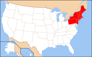 A map of the Northeastern United States as defined by the United States Census Bureau, though other entities define the region in varying ways.
The Northeastern United States is a region of the United States as defined by the United States Census Bureau.[1]
Composition
The region comprises nine states: the New England states of Connecticut, Maine, Massachusetts, New Hampshire, Rhode Island and Vermont; and the Mid-Atlantic states of New Jersey, New York and Pennsylvania.[2] The Census Bureau regions are "widely used...for data collection and analysis."[3][4][5] Not all definitions of the Northeastern United States, however, are the same as the Census Bureau's.[6][7]
Demography
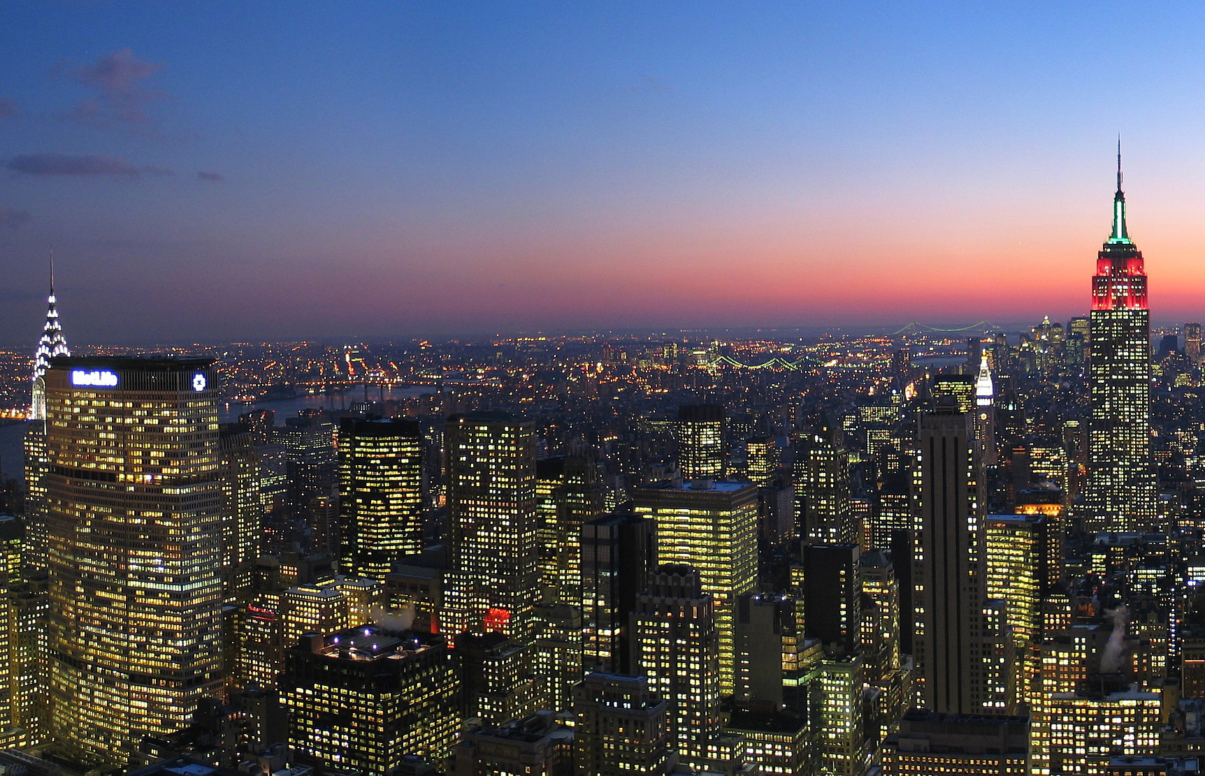
 New York, the most populated city of the United States
 Philadelphia, the second most populated city in the Northeast and the fifth most populated city in the United States
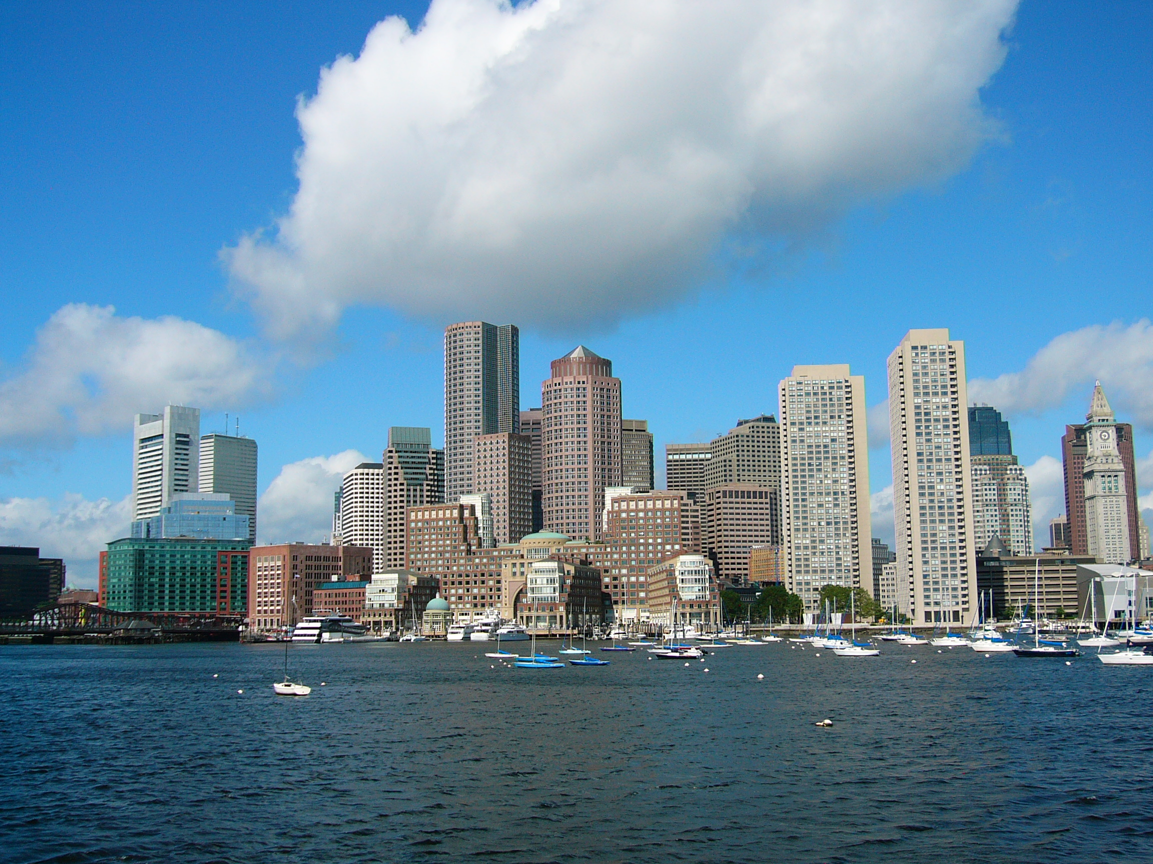
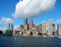 Boston, the most populated city in New England and the third most populated in the Northeast
The region accounts for approximately 25% of U.S. gross domestic product as of 2007.[8] As of the 2010 Census, the population of the region totaled 55,317,240. [9]
Rank Metropolitan Area State(s) and/or Territory 2010 Census Population 1 New York CT, NJ, NY 18,897,109 2 Philadelphia DE, NJ, PA 5,965,343 3 Boston MA, NH 4,552,402 4 Pittsburgh PA 2,356,285 5 Providence MA, RI 1,600,852 6 Hartford CT 1,212,381 7 Buffalo NY 1,135,509 8 Rochester NY 1,054,323 Rank City State(s) and/or Territory 2010 Census Population 1 New York City NY 8,175,133 2 Philadelphia PA 1,526,006 3 Boston MA 617,594 4 Pittsburgh PA 305,704 5 Newark NJ 277,140 6 Buffalo NY 261,310 7 Jersey City NJ 247,597 8 Rochester NY 210,565 9 Yonkers NY 195,976 References
- ^ "Census Regions and Divisions of the United States". US Census Bureau. http://www.census.gov/geo/www/us_regdiv.pdf.
- ^ US Regional Divisions, accessed 16 Apr 2008
- ^ U.S. Energy Information Administration, "The National Energy Modeling System: An Overview 2003", Report #:DOE/EIA-0581(2009) (October 2009).
- ^ "The most widely used regional definitions follow those of the U.S. Bureau of the Census." Seymour Sudman & Norman M. Bradburn, Asking Questions: A Practical Guide to Questionnaire Design, Jossey-Bass (1982): p. 205.
- ^ "Perhaps the most widely used regional classification system is one developed by the U.S. Census Bureau." Dale M. Lewison, Retailing, Prentice Hall (1997): p. 384. ISBN 9780134614274
- ^ "Northeast", MSN Encarta dictionary.
- ^ American Heritage Dictionary on dictionary.com, http://dictionary.reference.com/browse/northeast
- ^ Gross Domestic Product (GDP) by State[dead link]
- ^ http://www.census.gov/prod/cen2010/briefs/c2010br-01.pdf
- ^ "Population and Housing Occupancy Status: 2010 - United States -- Metropolitan Statistical Area; and for Puerto Rico more information 2010 Census National Summary File of Redistricting Data". 2010 United States Census. United States Census Bureau, Population Division. April 14, 2011. http://factfinder2.census.gov/faces/tableservices/jsf/pages/productview.xhtml?pid=DEC_10_NSRD_GCTPL2.US24PR&prodType=table. Retrieved July 25, 2011.
- ^ "American FactFinder". U.S. Census Bureau. http://factfinder2.census.gov. Retrieved July 25, 2011.
United States (Outline) History Pre-Columbian era · Colonial era (Thirteen Colonies · Colonial American military history) · American Revolution (War) · Federalist Era · War of 1812 · Territorial acquisitions · Territorial evolution · Mexican–American War · Civil War · Reconstruction era · Indian Wars · Gilded Age · African-American Civil Rights Movement (1896–1954) · Spanish–American War · Imperialism · World War I · Roaring Twenties · Great Depression · World War II (Home front) · Cold War · Korean War · Space Race · African-American Civil Rights Movement (1955–1968) · Feminist Movement · Vietnam War · Post-Cold War (1991–present) · War on Terror (War in Afghanistan · Iraq War) · Timeline of modern American conservatismTopicsDemographic · Discoveries · Economic (Debt Ceiling) · Inventions (before 1890 · 1890–1945 · 1946–1991 · after 1991) · Military · Postal · Technological and industrialFederal
governmentLegislature - Congress
Senate
· Vice President
· President pro tem
House of Representatives
· Speaker
Judiciary - Supreme Court
Federal courts
Courts of appeal
District courtsExecutive - President
Executive Office
Cabinet / Executive departments
Civil service
Independent agencies
Law enforcement
Public policy
Intelligence
Central Intelligence Agency
Defense Intelligence Agency
National Security Agency
Federal Bureau of InvestigationPolitics Divisions · Elections (Electoral College) · Foreign policy · Foreign relations · Ideologies · Local governments · Parties (Democratic Party · Republican Party · Third parties) · Political status of Puerto Rico · Red states and blue states · Scandals · State governments · Uncle SamGeography Cities, towns, and villages · Counties · Extreme points · Islands · Mountains (Peaks · Appalachian · Rocky) · National Park System · Regions (Great Plains · Mid-Atlantic · Midwestern · New England · Northwestern · Southern · Southwestern · Pacific · Western) · Rivers (Colorado · Columbia · Mississippi · Missouri · Ohio · Rio Grande) · States · Territory · Water supply and sanitationEconomy Agriculture · Banking · Communications · Companies · Dollar · Energy · Federal Budget · Federal Reserve System · Financial position · Insurance · Mining · Public debt · Taxation · Tourism · Trade · Transportation · Wall StreetSociety TopicsCrime · Demographics · Education · Family structure · Health care · Health insurance · Incarceration · Languages (American English · Spanish · French) · Media · People · Public holidays · Religion · SportsArchitecture · Art · Cinema · Cuisine · Dance · Fashion · Flag · Folklore · Literature · Music · Philosophy · Radio · Television · TheaterIssuesCategories:- Northeastern United States
- Demographic history of the United States
- Census regions of the United States


Wikimedia Foundation. 2010.