Absaroka Range

Absaroka Range

Geobox|Range
name=Absaroka Range
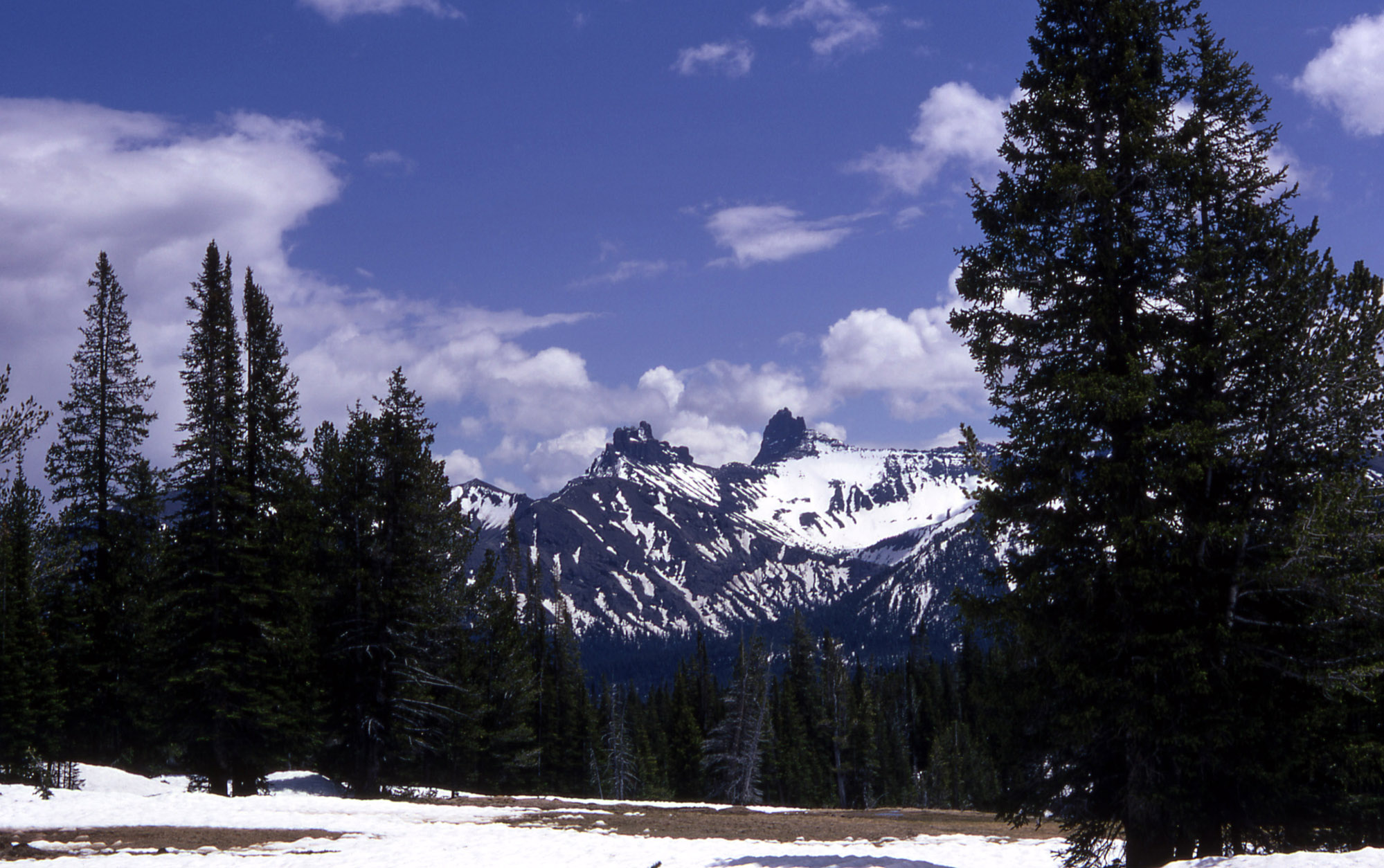


image_caption=Pilot and Index peaks in the Absaroka Mountains
country=United States
state=Montana | state1=Wyoming
parent=Rocky Mountains| border=Beartooth Mountains
length_imperial=| length_orientation=
width_imperial= | width_orientation=
highest=Francs Peak
highest_elevation_imperial=13153
highest_lat_d=43|highest_lat_m=57|highest_lat_s=|highest_lat_NS=N
highest_long_d=109|highest_long_m=20|highest_long_s=40|highest_long_EW=W
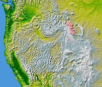

map_caption=Absaroka Range is shown highlighted in pink on a map of the western United States
The Absaroka Range is a mountain range, which is a sub-range on the eastern side of the Rocky Mountains stretching for about 150 mi (240 km) across the Montana-Wyoming border, and forming the eastern boundary of Yellowstone National Park.

The highest peak in the range is Francs Peak at 13,153 ft (4,009 m). There are forty-six other peaks over 12,000 ft (3,658 m).

The range is drained by the Yellowstone River and various tributaries, including the Bighorn River.

Much of the Absarokas are protected, not only by Yellowstone Park, but also by the Absaroka-Beartooth Wilderness, North Absaroka Wilderness, Teton Wilderness, and Washakie Wilderness, all located in Bridger-Teton National Forest, Custer National Forest and Shoshone National Forests.

U.S. Highway 212 from Billings, Montana to Yellowstone climbs over Beartooth Pass (10,796 ft, 3,290 m) in the neighboring Beartooth Mountains before winding through the Absarokas at the NE gate to Yellowstone National Park. It is only open during the summer.

USS "Absaroka" was named after this mountain range.

It is named for the Absaroka Indians. [cite book|title=The Origin of Certain Place Names in the United States|year=1905|pages=22|author=Gannett, Henry|url=http://books.google.com/books/pdf/The_Origin_of_Certain_Place_Names_in_the.pdf?id=BqwPAAAAIAAJ&output=pdf&sig=3IVIg6u-evPGlrv4j1uDL7rQ09c]

References


Wikimedia Foundation. 2010.

Игры ⚽ Нужно сделать НИР?

Look at other dictionaries:

  • Absaroka Range — Géographie Altitude 4 009 m, Francs Peak …   Wikipédia en Français

  • Absaroka Range —   [æbsə rəʊkə reɪndʒ, benannt nach den Absaroka, Eigenbezeichnung der Crow], Teil der Rocky Mountains, in Südmontana und Nordwestwyoming, USA, bis 4 008 m über dem Meeresspiegel (Francs Peak). Ein Teil gehört zum Yellowstone National Park …   Universal-Lexikon

  • Absaroka Range — p1 Absaroka Range Blick auf Pilot und Index Peak der Absaroka Range Höchster Gipfel Francs Peak (4.008  …   Deutsch Wikipedia

  • Absaroka Range — Sp Absãrokos kalnãgūbris Ap Absaroka Range L Uolinių kk. dalis, JAV (Montana ir Vajomingas) …   Pasaulio vietovardžiai. Internetinė duomenų bazė

  • Absaroka Range — /ab sahr euh keuh/ a range in S Montana and NW Wyoming: part of the Rocky Mountains. Highest peak, 13,140 ft. (4005 m). * * * Range of the Rocky Mountains in the U.S. It extends from southern Montana across Yellowstone National Park into… …   Universalium

  • Absaroka Range — Ab•sa′ro•ka Range′ [[t]æbˈsɑr ə kə[/t]] n. geg a mountain range in S Montana and NW Wyoming. Highest peak, 13,140 ft. (4005 m) …   From formal English to slang

  • Absaroka Range — geographical name mountain range S Montana & NW Wyoming E of Yellowstone National Park see Franks Peak …   New Collegiate Dictionary

  • Absaroka Range — /ab sahr euh keuh/ a range in S Montana and NW Wyoming: part of the Rocky Mountains. Highest peak, 13,140 ft. (4005 m) …   Useful english dictionary

  • Absaroka Range —  , Rocky Mountains …   Bryson’s dictionary for writers and editors

  • Absaroka (disambiguation) — Absaroka may refer to:People: * The Crow Nation, also known as the Absaroka, a Native American peoplePlaces: * Absaroka, region in the United States that considered secession from state governments * Absaroka Range, mountain range in Montana and… …   Wikipedia

Share the article and excerpts

Direct link
Do a right-click on the link above
and select “Copy Link”