- Borah Peak
-
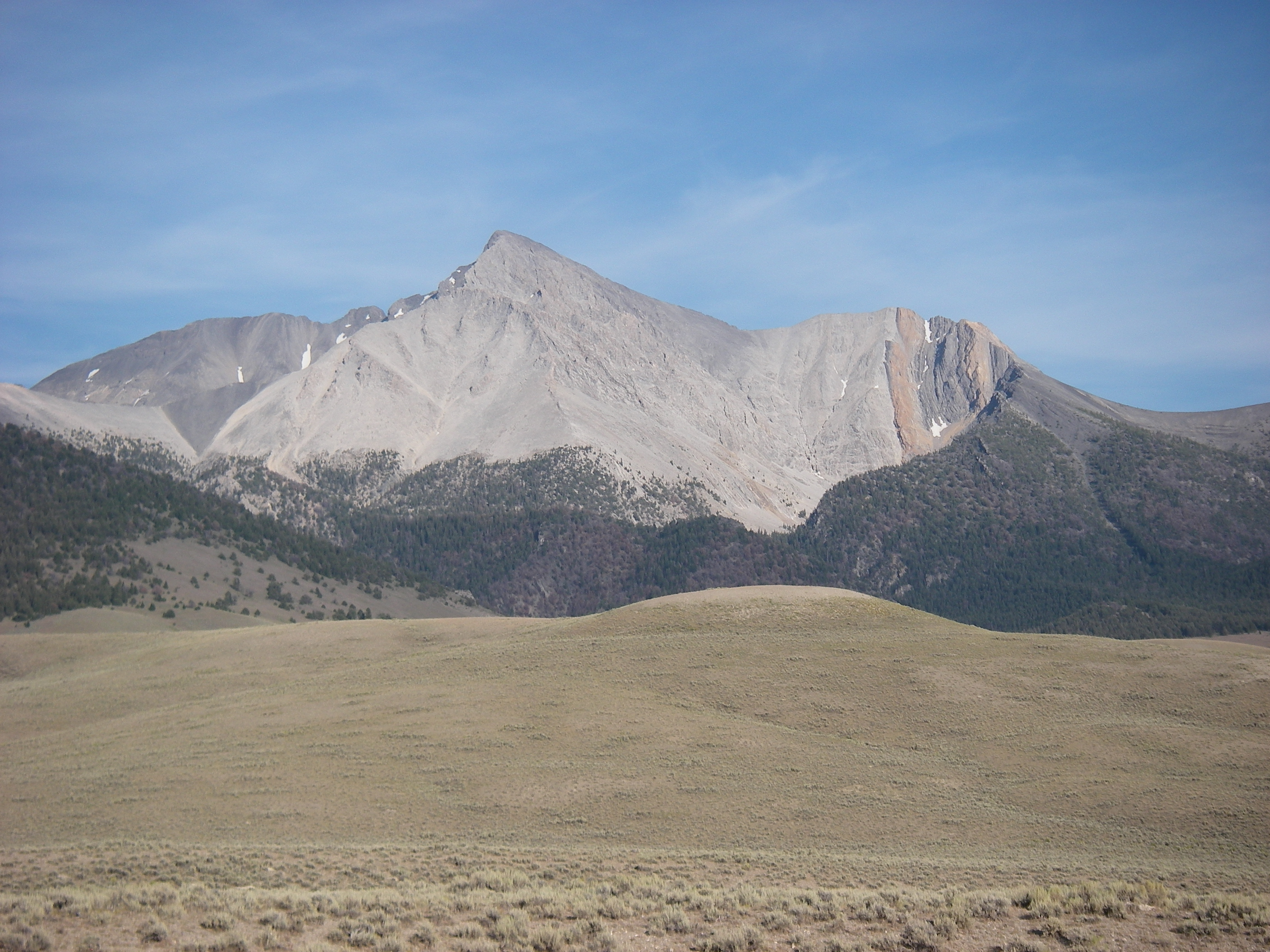
Borah Peak 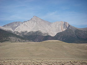
August 2009Elevation 12,668 ft (3,861 m) NAVD 88[1] Prominence 5,982 ft (1,823 m) [2] Parent peak Gannett Peak [3] Listing Ultra
U.S. state high pointLocation Custer County, Idaho,
 Borah Peak
 USA
USARange Lost River Range Coordinates 44°08′15″N 113°46′52″W / 44.1373891°N 113.78110123°WCoordinates: 44°08′15″N 113°46′52″W / 44.1373891°N 113.78110123°W[1] Topo map USGS Borah Peak Climbing First ascent 1912 by T.M. Bannon [4] Easiest route Scramble Borah Peak (also known as Mount Borah or Beauty Peak) is the highest mountain in the U.S. state of Idaho.[5] It is located in the central section of the Lost River Range, within the Challis National Forest in eastern Custer County. The peak is named for William Borah (1865–1940), a prominent U.S. Senator from Idaho (1907–40).
Contents
1983 earthquake
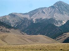 Borah Peak with fault scarp
On Friday, October 28, 1983, a magnitude 7.3 earthquake struck the Borah Peak area at 8:06 am MDT.[6][7]
The earthquake lifted Borah Peak over 7 feet (2.13 m). The peak was scarred on the western side and, as of July 2010, the mark is still visible. Two children in Challis were the only fatalities of the quake, struck by falling masonry while walking to elementary school.
Climbing
The normal route involves ascending 5,262 vertical feet (1604 m) from the trailhead to the summit in just over 3.5 miles (5.6 km). This route on the southwest ridge, the most popular route, is a strenuous hike for the most part until one reaches a Class 4 arête just before the main summit crest. This point is known as Chickenout Ridge as many people will abort the attempt once they see the hazards up close. In the cooler seasons this dangerous crossing involves a traverse over snow, with steeply slanting slopes on either side. An ice axe is strongly recommended for this section. Parties should turn back if there is any doubt about being able to make the crossing.
Borah Peak's north face is one of Idaho's only year-round snow climbs and provides a much greater challenge than the normal route. The face features a number of grade II class 5 routes on mixed terrain.
Three climbers have died on Borah Peak. Two climbers ascending the northwest ridge in 1977 were killed in an avalanche. Another climber in 1987 lost his life on a glissade during descent.[4]
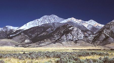 Borah Peak, looking east
See also
- List of U.S. states by elevation
- Mountain peaks of North America
- Mountain peaks of the Rocky Mountains
- Mountain peaks of the United States
- 1983 Borah Peak earthquake
References
- ^ a b "Beauty Reset". NGS data sheet. U.S. National Geodetic Survey. http://www.ngs.noaa.gov/cgi-bin/ds_mark.prl?PidBox=PZ0770. Retrieved 2008-04-08.
- ^ "Borah Peak, Idaho". Peakbagger.com. http://www.peakbagger.com/peak.aspx?pid=5142. Retrieved 2008-04-08.
- ^ "America's 57 - The Ultras". Peaklist.org. http://www.PeakList.org/USlists/USP5000.html. Retrieved 2008-09-28.
- ^ a b "Borah Peak". IdahoSummits.com. http://idahosummits.com/borah_feature/borah.htm. Retrieved 2008-12-27.
- ^ "Elevations and Distances in the United States". United States Geological Survey. April 29, 2005. http://erg.usgs.gov/isb/pubs/booklets/elvadist/elvadist.html. Retrieved 2009-03-28.
- ^ "Summary of 1983 Borah Peak Earthquake". University of Utah Seismograph Stations. http://www.seis.utah.edu/lqthreat/nehrp_htm/1983bora/1983bo1.shtml. Retrieved 2006-09-14.
- ^ eartquake.usgs.gov Borah Peak earthquake accessed on 2009-04-28
External links
- Mount Borah Climbing Guide - photos of the normal route
- Borah Peak Trip Report
U.S. State Highest Natural Points Alabama • Alaska • Arizona • Arkansas • California • Colorado • Connecticut • Delaware • Florida • Georgia • Hawaii • Idaho • Illinois • Indiana • Iowa • Kansas • Kentucky • Louisiana • Maine • Maryland • Massachusetts • Michigan • Minnesota • Mississippi • Missouri • Montana • Nebraska • Nevada • New Hampshire • New Jersey • New Mexico • New York • North Carolina • North Dakota • Ohio • Oklahoma • Oregon • Pennsylvania • Rhode Island • South Carolina • South Dakota • Tennessee • Texas • Utah • Vermont • Virginia • Washington • West Virginia • Wisconsin • Wyoming
Categories:- Mountains of Idaho
- Landforms of Custer County, Idaho
- Highest points of U.S. states


Wikimedia Foundation. 2010.