- Challis, Idaho
-
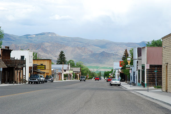
Challis, Idaho — City — The Main Street of Challis, May 2007 Location in Custer County and the state of Idaho
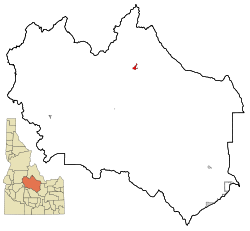
Coordinates: 44°30′15″N 114°13′42″W / 44.50417°N 114.22833°WCoordinates: 44°30′15″N 114°13′42″W / 44.50417°N 114.22833°W Country  United States
State Idaho County Custer Area – Total 1.8 sq mi (4.7 km2) – Land 1.8 sq mi (4.6 km2) – Water 0.0 sq mi (0.1 km2) Elevation 5,253 ft (1,601 m) Population (2000) – Total 909 – Density 510.8/sq mi (197.2/km2) Time zone Mountain (MST) (UTC-7) – Summer (DST) MDT (UTC-6) ZIP code 83226 Area code(s) 208 FIPS code 16-13780 GNIS feature ID 0397543 Challis is a city in Custer County, Idaho, United States. The population was 909 at the 2000 census. The city is the county seat of Custer County.[1]
Contents
History
Challis was founded in 1878 and named for A.P. Challis, who was a surveyor when the townsite was laid out.[2] Challis post office was established in 1878.[3]
1983 Earthquake
On Friday, October 28, 1983, the Borah Peak earthquake occurred at 8:06 am MDT, measured at 6.9 on the Richter Scale. The Challis-Mackay region experienced rather thorough damage, with 11 commercial buildings and 39 homes with major damage; while another 200 houses were damaged, minor to moderately. Mackay in particular, about 50 miles (80 km) southeast of Challis, experienced the most severe damage. Most of the city's large buildings on its Main Street were damaged, to some extent; eight of these buildings were deemed condemned and closed down. Most of these buildings were built from materials such as brick, concrete block, and stone, each varying.[4]
Geography and climate
Challis is located at 44°30′15″N 114°13′42″W / 44.50417°N 114.22833°W (44.504260, -114.228279).[5]
According to the United States Census Bureau, the city has a total area of 1.8 square miles (4.7 km2), of which, 1.8 square miles (4.7 km2) of it is land and 0.04 square miles (0.10 km2) of it (1.11%) is water.
Challis experiences a semi-arid climate (Köppen climate classification BSk) with cold winters, hot summers, and low precipitation throughout the year.
Climate data for Challis (1971-2000) Month Jan Feb Mar Apr May Jun Jul Aug Sep Oct Nov Dec Year Average high °F (°C) 31.4
(−0.3)38.8
(3.8)49.0
(9.4)58.7
(14.8)67.4
(19.7)76.8
(24.9)85.3
(29.6)84.0
(28.9)74.3
(23.5)61.2
(16.2)42.7
(5.9)31.6
(−0.2)58.43
(14.69)Daily mean °F (°C) 21.9
(−5.6)28.2
(−2.1)37.4
(3.0)45.4
(7.4)53.4
(11.9)61.5
(16.4)68.6
(20.3)67.1
(19.5)57.9
(14.4)47.0
(8.3)32.8
(0.4)22.2
(−5.4)45.28
(7.38)Average low °F (°C) 12.4
(−10.9)17.6
(−8.0)25.8
(−3.4)32.0
(0.0)39.4
(4.1)46.2
(7.9)51.8
(11.0)50.1
(10.1)41.4
(5.2)32.7
(0.4)22.9
(−5.1)12.7
(−10.7)32.08
(0.05)Precipitation inches (mm) 0.51
(13)0.35
(8.9)0.58
(14.7)0.58
(14.7)1.12
(28.4)0.99
(25.1)0.78
(19.8)0.65
(16.5)0.64
(16.3)0.43
(10.9)0.56
(14.2)0.53
(13.5)7.72
(196.1)Source: NOAA (normals, 1971-2000) [6] Demographics
As of the census[7] of 2000, there were 909 people, 410 households, and 248 families residing in the city. The population density was 510.8 people per square mile (197.2/km²). There were 525 housing units at an average density of 295.0 per square mile (113.9/km²). The racial makeup of the city was 97.14% White, 0.88% Native American, 1.21% from other races, and 0.77% from two or more races. Hispanic or Latino of any race were 3.85% of the population.
There were 410 households out of which 29.0% had children under the age of 18 living with them, 52.4% were married couples living together, 5.1% had a female householder with no husband present, and 39.3% were non-families. 35.6% of all households were made up of individuals and 17.6% had someone living alone who was 65 years of age or older. The average household size was 2.21 and the average family size was 2.90.
Historical populations Census Pop. %± 1880 614 — 1890 356 −42.0% 1900 387 8.7% 1910 338 −12.7% 1920 484 43.2% 1930 418 −13.6% 1940 620 48.3% 1950 728 17.4% 1960 732 0.5% 1970 784 7.1% 1980 758 −3.3% 1990 1,073 41.6% 2000 909 −15.3% Est. 2007 873 −4.0% source:[8][9] In the city the population was spread out with 25.0% under the age of 18, 4.7% from 18 to 24, 26.0% from 25 to 44, 24.9% from 45 to 64, and 19.5% who were 65 years of age or older. The median age was 42 years. For every 100 females there were 98.0 males. For every 100 females age 18 and over, there were 94.3 males.
The median income for a household in the city was $29,904, and the median income for a family was $39,444. Males had a median income of $38,250 versus $21,964 for females. The per capita income for the city was $15,803. About 8.5% of families and 12.7% of the population were below the poverty line, including 8.2% of those under age 18 and 18.5% of those age 65 or over.
References
- ^ "Find a County". National Association of Counties. http://www.naco.org/Counties/Pages/FindACounty.aspx. Retrieved 2011-06-07.
- ^ Boone, Lalia (1988) Idaho Place Names, p. 73. Moscow, ID: University of Idaho Press. ISBN 0-89301-119-3 (Sources vary as to the spelling of his first name: Alvah/Alvan/Alvin).
- ^ Helbock, Richard W. (1998) United States Post Offices, Volume I - The West, p. 56. Lake Oswego, OR: La Posta Publications
- ^ "Historic Earthquakes: Borah Peak, Idaho". USGS. 2008-07-16. http://earthquake.usgs.gov/regional/states/events/1983_10_28.php. Retrieved 2010-03-30.
- ^ "US Gazetteer files: 2010, 2000, and 1990". United States Census Bureau. 2011-02-12. http://www.census.gov/geo/www/gazetteer/gazette.html. Retrieved 2011-04-23.
- ^ "Climatography of the United States NO.81". National Oceanic and Atmospheric Administration. http://cdo.ncdc.noaa.gov/climatenormals/clim81/IDnorm.pdf. Retrieved January 13, 2011.
- ^ "American FactFinder". United States Census Bureau. http://factfinder.census.gov. Retrieved 2008-01-31.
- ^ Moffatt, Riley. Population History of Western U.S. Cities & Towns, 1850-1990. Lanham: Scarecrow, 1996, 91.
- ^ "Subcounty population estimates: Idaho 2000-2007" (CSV). United States Census Bureau, Population Division. 2009-03-18. http://www.census.gov/popest/cities/files/SUB-EST2007-16.csv. Retrieved 2009-04-27.
Municipalities and communities of Custer County, Idaho Cities Challis | Clayton | Lost River | Mackay | Stanley

Unincorporated
communityEllis
Ghost towns Categories:- Cities in Idaho
- Populated places in Custer County, Idaho
- County seats in Idaho
- Populated places established in 1878

Wikimedia Foundation. 2010.