- Taum Sauk Mountain
-
"Taum Sauk" redirects here. For pumped storage power plant, see Taum Sauk Hydroelectric Power Station.
Taum Sauk Mountain 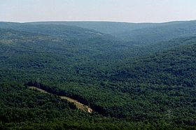
Taum Sauk Mountain is part of a large parks-and-wilderness area.Elevation 1,772 ft (540 m) Listing U.S. state high point Location Iron County, Missouri, USA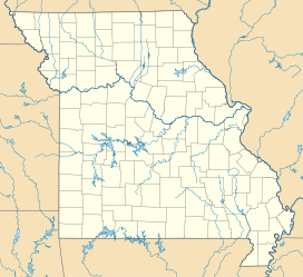
 Taum Sauk Mountain
Range Saint Francois Mountains Coordinates 37°34′13″N 90°43′40″W / 37.57028°N 90.72778°WCoordinates: 37°34′13″N 90°43′40″W / 37.57028°N 90.72778°W Topo map USGS Ironton Climbing Easiest route Hike  Taum Sauk is located in a large parks and wilderness area.
Taum Sauk Mountain (pronounced /ˈtɔːm ˈsɔːk/[citation needed]) in the Saint Francois Mountains is the highest natural point in the U.S. state of Missouri, 1,772 feet (540 m) above mean sea level.[1] The topography of Taum Sauk is that of a somewhat flat ridge rather than a peak.
While not as impressive at 1,772 feet (540 m) as other peaks, Taum Sauk and the St. Francois range are true mountains, being the result of a volcanic orogeny. Whereas vertical relief in the rest of the Ozarks region is the result of erosion of sedimentary strata, the St. Francois are an ancient Precambrian igneous uplift several times older than the Appalachians. Geologists believe that Taum Sauk and its neighbors may be among the few areas in the US never to have been submerged in ancient seas.[citation needed] The peaks of the St. Francois range existed as islands in the shallow seaway throughout most of the Paleozoic Era as the sandstones, limestones, and shales typical of the Ozarks were deposited. Weathering and erosion of these ancient peaks provided the clastic sediments of the surrounding rock layers.
Taum Sauk is said to be named for a Piankeshaw chief named Sauk-Ton-Qua.[2]
-
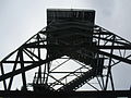
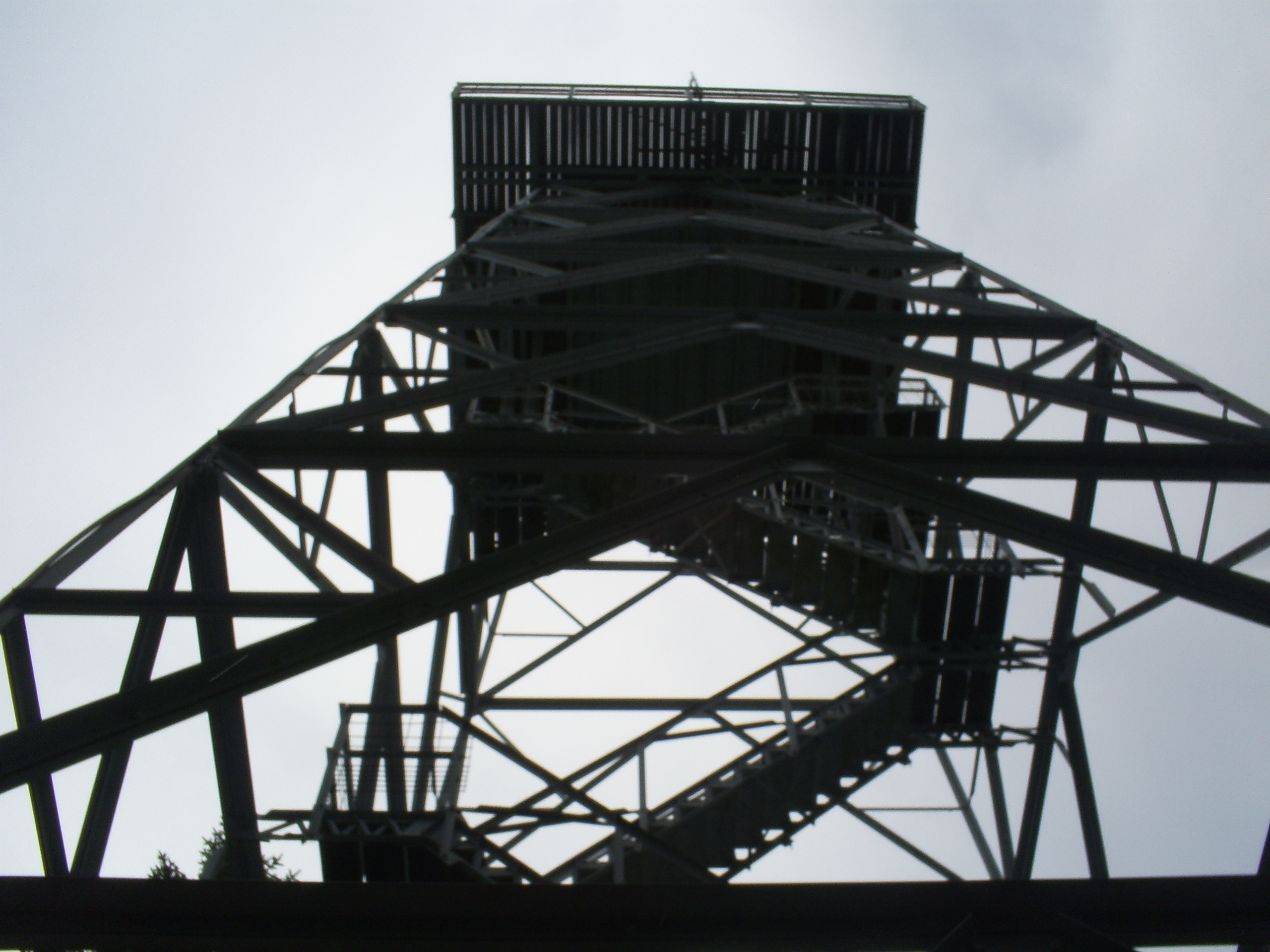
Taum Sauk lookout tower. -

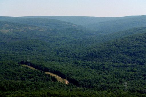
View from lookout tower.
Although Taum Sauk Mountain is the highest mountain in Missouri at 1,772 feet above sea level, Taum Sauk is not the tallest Mountain from base to summit. Taum Sauk rises from an an already elevated plain. The tallest mountain in Missouri is Black Mountain. Although Black Mountain is only the 42nd highest mountain in terms of elevation above sea level, it rises from the St. Francis River running at its base, at approximately 540 feet above sea level, to a summit of 1,506 feet. Black Mountain rises just under 1,000 feet, while Taum Sauk rises approximately 700 feet.
Taum Sauk is the highest mountain in Missouri. Black Mountain is the tallest mountain in Missouri.
State park
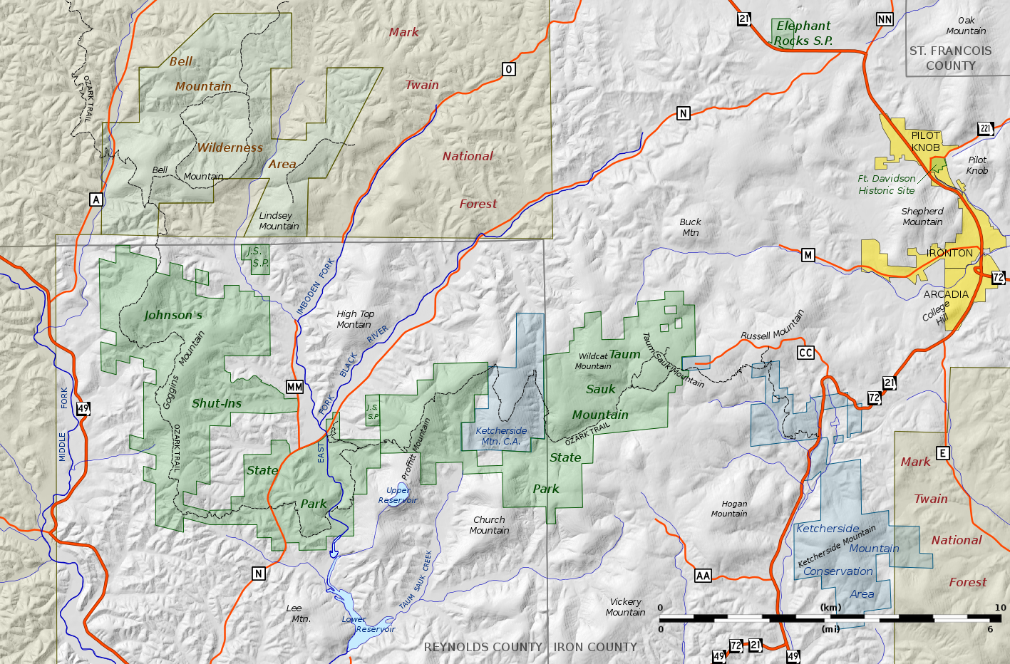
In 1991 Missouri created Taum Sauk Mountain State Park, a 7,448-acre (30.14 km2) state park on the mountain: it has a rustic campground, a paved trail to the highpoint marked by a polished granite plaque, and a lookout tower from which a good view can be had; the dense forest on the mountain obscures the view from most other vantage points. Taum Sauk State Park is in a common jurisdiction with nearby Johnson's Shut-ins State Park, and together they comprise the second largest state park in Missouri with a total area of 15,961.5 acres (64.594 km2). These parks and the adjacent Bell Mountain Wilderness Area make up part of a large wilderness area that is very popular with hikers and backpackers. The 33-mile (53 km) Taum Sauk section of the Ozark Trail is considered by the Ozark Trail Association to be one of the finest trails in Missouri.[3]
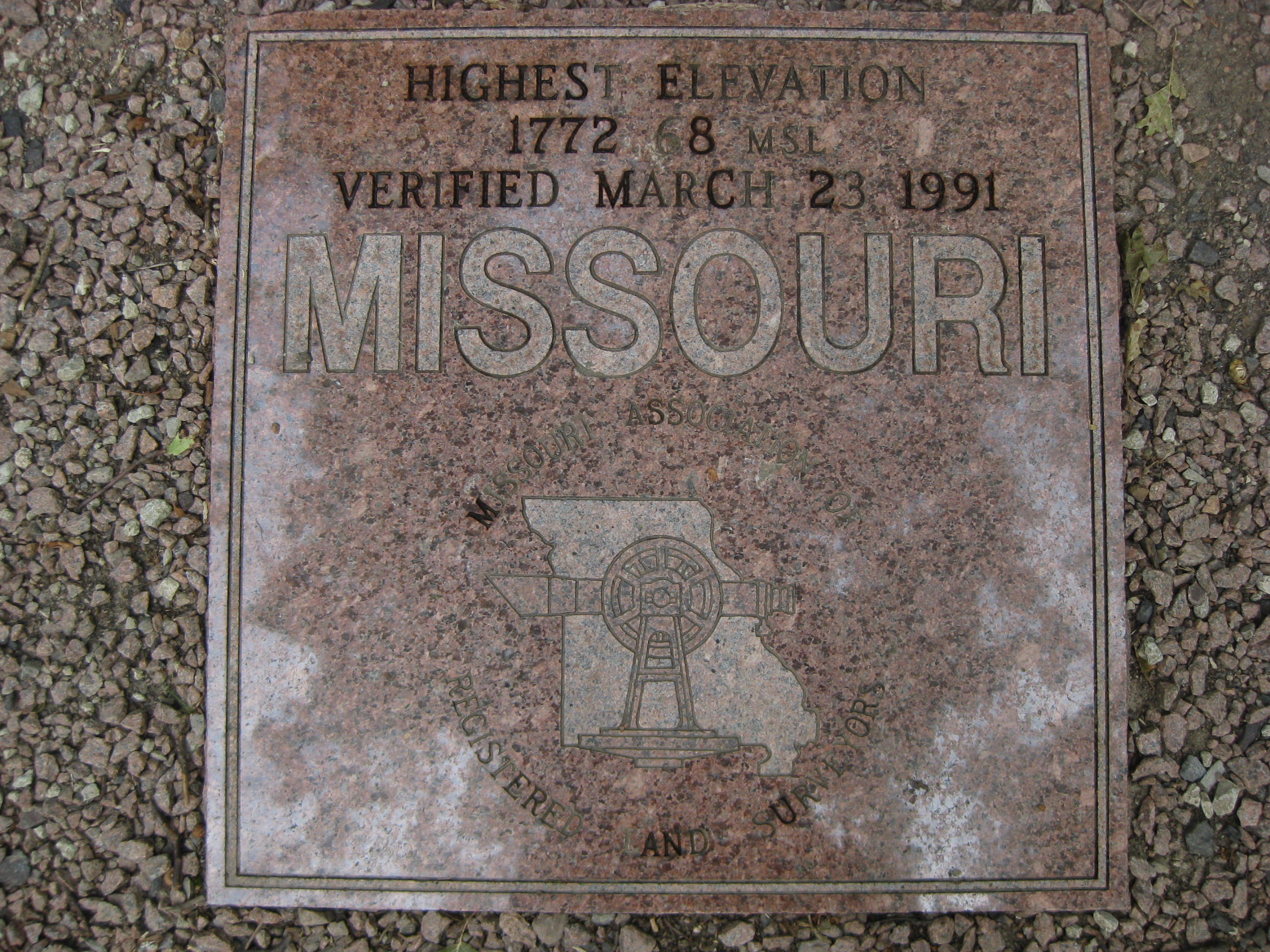
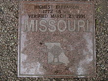 Polished granite plaque at Missouri high point Taum Sauk reading "HIGHEST ELEVATION 1772.68 MSL VERIFIED MARCH 23, 1991 MISSOURI: MISSOURI ASSOCIATION OF REGISTERED LAND SURVEYORS"
Mina Sauk Falls, the highest waterfall in Missouri, is on Taum Sauk and can be visited by hiking a rugged trail that makes a 3-mile (4.8 km) loop from the highpoint parking area. These falls normally have water cascading over them only during times of wet weather. At other times they are reduced to a trickle or less.
The Taum Sauk pumped storage plant, which failed on December 14, 2005 sending a flash flood 20 feet (6 m) deep down the Black River, is not actually on Taum Sauk Mountain. It is on Proffit Mountain, about five miles (8 km) southwest.
References
Specific references:
- ^ "Elevations and Distances in the United States (online edition)". United States Geological Survey. 2001. http://erg.usgs.gov/isb/pubs/booklets/elvadist/elvadist.html#Highest. Retrieved 2008-01-24.
- ^ Mary Eakins (November 2007). "The Legend of Taum Sauk Mountain". Missouri Vacation!. River Valley Region Association. http://missouri-vacations.com/taum-sauk-mountain-state-park/. Retrieved 2010-09-19.
- ^ "Taum Sauk Section". The Ozark Trail. The Ozark Trail Association. http://www.ozarktrail.com/taumsauk.php?PHPSESSID=944497deb720cfc9bbba530b90439841. Retrieved 2008-12-15.
General references:
- Unklesbay, A.G; & Vineyard, Jerry D. (1992). Missouri Geology — Three Billion Years of Volcanoes, Seas, Sediments, and Erosion. University of Missouri Press. ISBN 0-8262-0836-3.
U.S. State Highest Natural Points Alabama • Alaska • Arizona • Arkansas • California • Colorado • Connecticut • Delaware • Florida • Georgia • Hawaii • Idaho • Illinois • Indiana • Iowa • Kansas • Kentucky • Louisiana • Maine • Maryland • Massachusetts • Michigan • Minnesota • Mississippi • Missouri • Montana • Nebraska • Nevada • New Hampshire • New Jersey • New Mexico • New York • North Carolina • North Dakota • Ohio • Oklahoma • Oregon • Pennsylvania • Rhode Island • South Carolina • South Dakota • Tennessee • Texas • Utah • Vermont • Virginia • Washington • West Virginia • Wisconsin • Wyoming
Categories:- Geography of Iron County, Missouri
- Mountains of Missouri
- St. Francois Mountains
- Highest points of U.S. states
-


Wikimedia Foundation. 2010.