- List of Missouri state parks
-
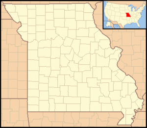
Map of Missouri State Parks (red) and
State Historic Sites (blue)
(Note: Katy Trail State Park is not included on this map because of its linear nature.)This is a list of state parks and state historic sites in Missouri. In the state of Missouri both state parks and state historic sites are administered by the Division of State Parks of the Missouri Department of Natural Resources. The division manages 83 parks and historic sites plus the Roger Pryor Pioneer Backcountry, which together total more than 200,000 acres (809 km2). According to the state its parks system includes approximately 3,700 campsites, 194 cabins, and 840 miles (1,350 km) of trails, including the longest developed rails-to-trails project in the nation.[1]
Name Size Established Arrow Rock State Historic Site 167.39 acres 0.6774 km2 1923 Babler State Park 2,441 acres 9.88 km2 1937 Sam A. Baker State Park 5,323.62 acres 21.5439 km2 1926 Battle of Athens State Historic Site 408.50 acres 1.6531 km2 1975 Battle of Carthage State Historic Site 7.4 acres 0.030 km2 1990 Battle of Lexington State Historic Site 92.25 acres 0.3733 km2 1958 Bennett Spring State Park 3,216.74 acres 13.0177 km2 1923 Thomas Hart Benton Home and Studio State Historic Site 0.32 acres 1,300 m2 1977 Big Lake State Park 407.41 acres 1.6487 km2 1932 Big Oak Tree State Park 1,028.68 acres 4.1629 km2 1937 Big Sugar Creek State Park 2,082.54 acres 8.4277 km2 1992 Bollinger Mill State Historic Site 43 acres 0.17 km2 1967 Nathan Boone Homestead State Historic Site 400.20 acres 1.6196 km2 1991 Boone's Lick State Historic Site 51.17 acres 0.2071 km2 1960 Bothwell Lodge State Historic Site 246.91 acres 0.9992 km2 1974 Castlewood State Park 1,818.3 acres 7.358 km2 1974 Clark's Hill/Norton State Historic Site 13.4 acres 0.054 km2 2002 Confederate Memorial State Historic Site 135.22 acres 0.5472 km2 1952 Crowder State Park 1,912.10 acres 7.7380 km2 1938 Cuivre River State Park 6,393.94 acres 25.8754 km2 1946 Current River State Park 780 acres 3.2 km2 2008 Deutschheim State Historic Site 0.69 acres 2,800 m2 1978 Dillard Mill State Historic Site 131.77 acres 0.5333 km2 1977 Gov. Daniel Dunklin's Grave State Historic Site 1.37 acres 5,500 m2 1965 Elephant Rocks State Park 131.74 acres 0.5331 km2 1967 Felix Vallé House State Historic Site 10.13 acres 0.0410 km2 1970 Finger Lakes State Park 1,128.69 acres 4.5676 km2 1973 First Missouri State Capitol State Historic Site 0.66 acres 2,700 m2 1960 Fort Davidson State Historic Site 77.19 acres 0.3124 km2 1968 Gen. John J. Pershing Boyhood Home State Historic Site 2.69 acres 10,900 m2 1952 Graham Cave State Park 369.51 acres 1.4954 km2 1964 Grand Gulf State Park 321.96 acres 1.3029 km2 1984 Ha Ha Tonka State Park 3,709.74 acres 15.0128 km2 1978 Harry S Truman Birthplace State Historic Site 2.51 acres 10,200 m2 1957 Harry S Truman State Park 1,440 acres 5.8 km2 1976 Hawn State Park 4,953.66 acres 20.0468 km2 1955 Hunter-Dawson State Historic Site 19.80 acres 0.0801 km2 1967 Iliniwek Village State Historic Site 127.49 acres 0.5159 km2 1992 Jefferson Landing State Historic Site 1.27 acres 5,100 m2 1976 Jewell Cemetery State Historic Site 0.45 acres 1,800 m2 1970 Johnson's Shut-Ins State Park 8,549.51 acres 34.5986 km2 1955 Jones-Confluence Point State Park 1,121.43 acres 4.5383 km2 2001 Katy Trail State Park 225.1 mi 362.3 km Knob Noster State Park 3,934.38 acres 15.9219 km2 1946 Lake of the Ozarks State Park 17,626.55 acres 71.3321 km2 1946 Lake Wappapello State Park 1,854.23 acres 7.5038 km2 1956 Lewis and Clark State Park 189.13 acres 0.7654 km2 1934 Locust Creek Covered Bridge State Historic Site 32.22 acres 0.1304 km2 1968 Long Branch State Park 1,828.47 acres 7.3996 km2 1983 Mark Twain Birthplace State Historic Site 13 acres 0.053 km2 1924 Mark Twain State Park 2,775.14 acres 11.2306 km2 1924 Mastodon State Historic Site 425 acres 1.72 km2 1976 Meramec State Park 6,896.33 acres 27.9085 km2 1927 Missouri Mines State Historic Site 25 acres 0.10 km2 1976 Missouri State Capitol 3 acres 12,000 m2 1826 Missouri State Museum 1978 Montauk State Park 1,396.12 acres 5.6499 km2 1926 Morris State Park 161.22 acres 0.6524 km2 2000 Onondaga Cave State Park 1,317.70 acres 5.3325 km2 1982 Osage Village State Historic Site 100 acres 0.40 km2 1984 Pershing State Park 3,565.66 acres 14.4297 km2 1937 Pomme de Terre State Park 734.44 acres 2.9722 km2 1960 Prairie State Park 3,942 acres 15.95 km2 1980 Roaring River State Park 4,093.38 acres 16.5653 km2 1928 Robertsville State Park 1,224.65 acres 4.9560 km2 1979 Rock Bridge Memorial State Park 2,272.83 acres 9.1978 km2 1967 Route 66 State Park 418.61 acres 1.6941 km2 1997 St. Francois State Park 2,734.97 acres 11.0680 km2 1964 St. Joe State Park 8,242.98 acres 33.3582 km2 1976 Sandy Creek Covered Bridge State Historic Site 205.78 acres 0.8328 km2 1968 Sappington Cemetery State Historic Site 2 acres 8,100 m2 1970 Scott Joplin House State Historic Site 3.86 acres 15,600 m2 1983 Stockton State Park 2,175.90 acres 8.8056 km2 1969 Table Rock State Park 356.03 acres 1.4408 km2 1959 Taum Sauk Mountain State Park 7,501.09 acres 30.3558 km2 1991 Thousand Hills State Park 3,079.70 acres 12.4631 km2 1952 Towosahgy State Historic Site 64 acres 0.26 km2 1967 Trail of Tears State Park 3,415.39 acres 13.8216 km2 1957 Union Covered Bridge State Historic Site 1.24 acres 0.0050 km2 1967 Van Meter State Park 1,104.63 acres 4.4703 km2 1932 Wakonda State Park 1,053.87 acres 4.2649 km2 1960 Wallace State Park 501.61 acres 2.0299 km2 1932 Washington State Park 2,147.57 acres 8.6909 km2 1932 Watkins Woolen Mill State Park 1,500.22 acres 6.0712 km2 1964 Watkins Woolen Mill State Historic Site 1,500.22 acres 6.0712 km2 1964 Weston Bend State Park 1,133.08 acres 4.5854 km2 1980 See also
External links
References
- ^ "About the Missouri State Park System". Missouri State Parks and Historic Sites. Missouri Department of Natural Resources. 2008-09-19. http://www.mostateparks.com/aboutus.htm. Retrieved 2009-01-01.
 State of Missouri
Topics - Government
- Delegations
- Geography
- Transportation
- History
- People
- Visitor Attractions
Society Regions - Bootheel
- Crowley's Ridge
- Dissected Till Plains
- Four State Area
- Henry Shaw Ozark Corridor
- Honey Lands
- Lead Belt
- Lincoln Hills
- Little Dixie
- Loess Hills
- Mid-Missouri
- Mississippi Embayment
- Missouri Rhineland
- Northern Plains
- Osage Plains
- Ozark Plateau
- Platte Purchase
- Pony Express
- St. Francois Mountains
- Westplex
Metro areas Largest cities Counties and
independent cities- Adair
- Andrew
- Atchison
- Audrain
- Barry
- Barton
- Bates
- Benton
- Bollinger
- Boone
- Buchanan
- Butler
- Caldwell
- Callaway
- Camden
- Cape Girardeau
- Carroll
- Carter
- Cass
- Cedar
- Chariton
- Christian
- Clark
- Clay
- Clinton
- Cole
- Cooper
- Crawford
- Dade
- Dallas
- Daviess
- DeKalb
- Dent
- Douglas
- Dunklin
- Franklin
- Gasconade
- Gentry
- Greene
- Grundy
- Harrison
- Henry
- Hickory
- Holt
- Howard
- Howell
- Iron
- Jackson
- Jasper
- Jefferson
- Johnson
- Knox
- Laclede
- Lafayette
- Lawrence
- Lewis
- Lincoln
- Linn
- Livingston
- Macon
- Madison
- Maries
- Marion
- McDonald
- Mercer
- Miller
- Mississippi
- Moniteau
- Monroe
- Montgomery
- Morgan
- New Madrid
- Newton
- Nodaway
- Oregon
- Osage
- Ozark
- Pemiscot
- Perry
- Pettis
- Phelps
- Pike
- Platte
- Polk
- Pulaski
- Putnam
- Ralls
- Randolph
- Ray
- Reynolds
- Ripley
- St. Charles
- St. Clair
- St. Francois
- St. Louis (City)
- St. Louis (County)
- Ste. Genevieve
- Saline
- Schuyler
- Scotland
- Scott
- Shannon
- Shelby
- Stoddard
- Stone
- Sullivan
- Taney
- Texas
- Vernon
- Warren
- Washington
- Wayne
- Webster
- Worth
- Wright
Categories:- Missouri state parks
- Lists of parks by U.S. state

Wikimedia Foundation. 2010.