- Mastodon State Historic Site
-
Kimmswick Bone Bed
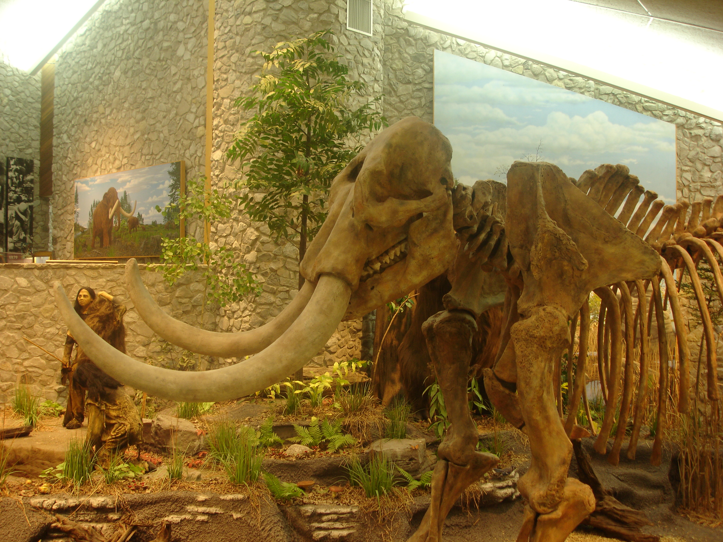
 Museum display at Mastodon SHS
Location: Jefferson County, Missouri, USA Nearest city: Imperial, Missouri Coordinates: 38°22′45″N 90°23′41″W / 38.37917°N 90.39472°WCoordinates: 38°22′45″N 90°23′41″W / 38.37917°N 90.39472°W Governing body: Missouri Division of State Parks NRHP Reference#: 80002371 Added to NRHP: November 5, 1980 Mastodon State Historic Site is an archaeological and paleontological site in Imperial, Missouri, containing the Kimmswick Bone Bed. Bones of mastodons and other now-extinct animals were first found here in the early 19th century. The area gained fame as one of the most extensive Pleistocene ice age deposits in the country and attracted scientific interest worldwide.

Archaeological history was made at the site in 1979 when scientists excavated a stone spear point made by hunters of the Clovis culture (14,000 - 10,000 years ago) in direct association with mastodon bones. This was the first solid evidence of the coexistence of people and these giant prehistoric beasts.
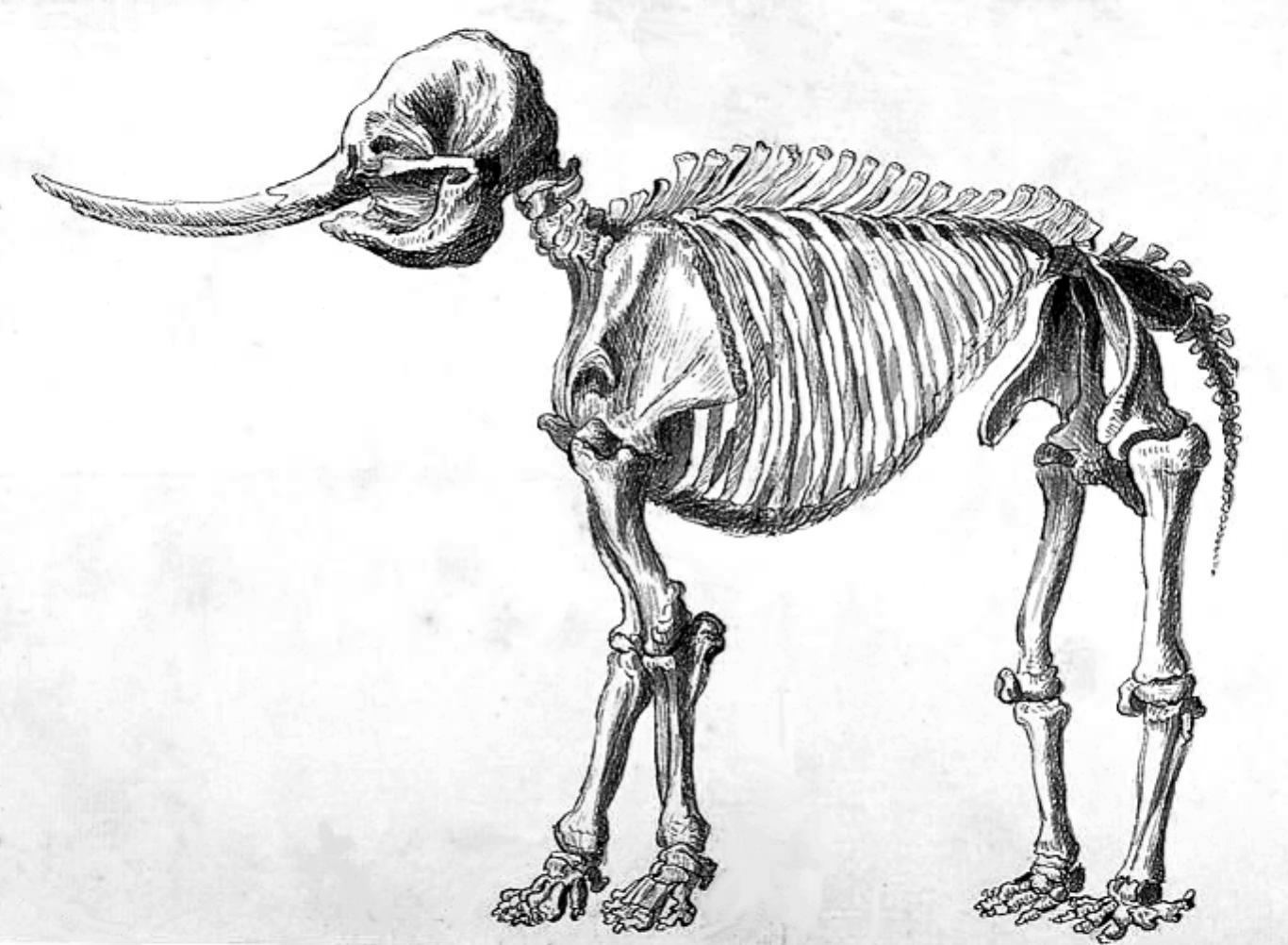
Today, the 425-acre (1.7 km2) property preserves this National Register of Historic Places site and provides recreational opportunities. A museum tells the natural and cultural story of the oldest American Indian site one can visit in the state's park system. A full-size replica of a mastodon skeleton highlights the exhibits. A picnic area, several trails and a special-use campground offer chances to explore the land where the lives of Native Americans and mastodons once intertwined.
External links
38°22′45″N 90°23′41″W / 38.379167°N 90.394722°W
U.S. National Register of Historic Places Topics Lists by states Alabama • Alaska • Arizona • Arkansas • California • Colorado • Connecticut • Delaware • Florida • Georgia • Hawaii • Idaho • Illinois • Indiana • Iowa • Kansas • Kentucky • Louisiana • Maine • Maryland • Massachusetts • Michigan • Minnesota • Mississippi • Missouri • Montana • Nebraska • Nevada • New Hampshire • New Jersey • New Mexico • New York • North Carolina • North Dakota • Ohio • Oklahoma • Oregon • Pennsylvania • Rhode Island • South Carolina • South Dakota • Tennessee • Texas • Utah • Vermont • Virginia • Washington • West Virginia • Wisconsin • WyomingLists by territories Lists by associated states Other  Category:National Register of Historic Places •
  Portal:National Register of Historic Places
Protected Areas of Missouri Federal National Wildlife Refuges:Big Muddy • Clarence Cannon • Great River • Middle Mississippi River • Mingo • Ozark Cavefish • Pilot Knob • Squaw Creek • Swan Lake • Two RiversNational Forests:State Babler • Sam A. Baker • Bennett Spring • Big Lake • Big Oak Tree • Big Sugar Creek • Castlewood • Crowder • Cuivre River • Current River • Elephant Rocks • Finger Lakes • Graham Cave • Grand Gulf • Ha Ha Tonka • Harry S Truman • Hawn • Johnson's Shut-Ins • Jones-Confluence Point • Katy Trail • Knob Noster • Lake of the Ozarks • Lake Wappapello • Lewis and Clark • Long Branch • Mark Twain • Meramec • Montauk • Morris • Onondaga Cave • Pershing • Pomme de Terre • Prairie • Roaring River • Robertville • Rock Bridge Memorial • Route 66 • St. Francois • St. Joe • Stockton • Table Rock • Taum Sauk Mountain • Thousand Hills • Trail of Tears • Van Meter • Wakonda • Wallace • Washington • Watkins Woolen Mill • Weston BendArrow Rock • Battle of Athens • Battle of Carthage • Battle of Lexington • Thomas Hart Benton Home and Studio • Bollinger Mill • Nathan Boone Homestead • Boone's Lick • Bothwell Lodge • Clark's Hill/Norton • Confederate Memorial • Deutschheim • Dillard Mill • Gov. Daniel Dunklin's Grave • Felix Vallé House • First Missouri State Capitol • Fort Davidson • Gen. John J. Pershing Boyhood Home • Harry S Truman Birthplace • Hunter-Dawson • Iliniwek Village • Jefferson Landing • Jewell Cemetery • Locust Creek Covered Bridge • Mark Twain Birthplace • Mastodon • Missouri Mines • Missouri State Capitol • Missouri State Museum • Osage Village • Sandy Creek Covered Bridge • Sappington Cemetery • Scott Joplin House • Towosahgy • Union Covered Bridge • Watkins Woolen MillConservation areas:List of Missouri conservation areasMissouri Department of Natural Resources Categories:- Pleistocene
- Clovis sites
- Paleontological sites of North America
- Archaeological sites in Missouri
- Pre-Columbian archaeological sites
- Native American archeology
- National Register of Historic Places in Missouri
- Missouri state parks
- Natural history museums in Missouri
- Museums in Jefferson County, Missouri
- Protected areas established in 1980

Wikimedia Foundation. 2010.