- Confederate Memorial State Historic Site
-
Confederate Memorial State Historic Site Missouri State Historic Site Country United States State Missouri County Lafayette County Coordinates 39°5′54″N 93°43′45″W / 39.09833°N 93.72917°W Area 0.21 sq mi (1 km2) Founded 1952 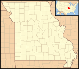

Website: http://mostateparks.com/confedmem.htm The Confederate Memorial State Historic Site is located in Missouri, United States north of Higginsville. The 135-acre (0.55 km2) park was established in 1952 on the site of the Confederate Soldiers Home of Missouri from 1891 to 1950.[1]
See also
External links
References
- ^ Western Historical Manuscript Collection-Columbia, "Missouri. Confederate Home, Higginsville, Records, 1897-1944" at http://whmc.umsystem.edu/invent/0066.html (accessed 4 December 2009) lists correspondence, contracts, financial records, minutes, photographs, reports, cash books, farm accounts, journals, ledgers, and voucher registers are available in the Western Historical Manuscript Collection at the University of Missouri, Columbia.
Protected Areas of Missouri Federal National Wildlife Refuges:Big Muddy • Clarence Cannon • Great River • Middle Mississippi River • Mingo • Ozark Cavefish • Pilot Knob • Squaw Creek • Swan Lake • Two RiversNational Forests:State Babler • Sam A. Baker • Bennett Spring • Big Lake • Big Oak Tree • Big Sugar Creek • Castlewood • Crowder • Cuivre River • Current River • Elephant Rocks • Finger Lakes • Graham Cave • Grand Gulf • Ha Ha Tonka • Harry S Truman • Hawn • Johnson's Shut-Ins • Jones-Confluence Point • Katy Trail • Knob Noster • Lake of the Ozarks • Lake Wappapello • Lewis and Clark • Long Branch • Mark Twain • Meramec • Montauk • Morris • Onondaga Cave • Pershing • Pomme de Terre • Prairie • Roaring River • Robertville • Rock Bridge Memorial • Route 66 • St. Francois • St. Joe • Stockton • Table Rock • Taum Sauk Mountain • Thousand Hills • Trail of Tears • Van Meter • Wakonda • Wallace • Washington • Watkins Woolen Mill • Weston BendArrow Rock • Battle of Athens • Battle of Carthage • Battle of Lexington • Thomas Hart Benton Home and Studio • Bollinger Mill • Nathan Boone Homestead • Boone's Lick • Bothwell Lodge • Clark's Hill/Norton • Confederate Memorial • Deutschheim • Dillard Mill • Gov. Daniel Dunklin's Grave • Felix Vallé House • First Missouri State Capitol • Fort Davidson • Gen. John J. Pershing Boyhood Home • Harry S Truman Birthplace • Hunter-Dawson • Iliniwek Village • Jefferson Landing • Jewell Cemetery • Locust Creek Covered Bridge • Mark Twain Birthplace • Mastodon • Missouri Mines • Missouri State Capitol • Missouri State Museum • Osage Village • Sandy Creek Covered Bridge • Sappington Cemetery • Scott Joplin House • Towosahgy • Union Covered Bridge • Watkins Woolen MillConservation areas:List of Missouri conservation areasMissouri Department of Natural Resources Categories:- Geography of Lafayette County, Missouri
- Missouri state parks
- Protected areas established in 1952
- Old soldiers' homes in the United States
- Missouri geography stubs

Wikimedia Foundation. 2010.