- List of Ultras of the United States
-
Main article: Mountain peaks of the United StatesSee also: Ultra-prominent summit, Table of the highest major summits of the United States, Table of the most prominent summits of the United States, and Table of the most isolated major summits of the United States
Contents
The following sortable table lists the 129 ultra-prominent mountain peaks of the United States.
Topographic elevation is the vertical distance above the reference geoid, a precise mathematical model of the Earth's sea level as an equipotential gravitational surface. Topographic prominence is the elevation difference between the summit and the highest or key col to a higher summit. Topographic isolation is the minimum great circle distance to a point of higher elevation.
This article defines a significant summit as a summit with at least 100 meters (328.1 feet) of topographic prominence, and a major summit as a summit with at least 500 meters (1640.4 feet) of topographic prominence. An ultra-prominent summit is a summit with at least 1500 meters (4921.3 feet) of topographic prominence.
All elevations in the 48 states of the contiguous United States include an elevation adjustment from the National Geodetic Vertical Datum of 1929 (NGVD 29) to the North American Vertical Datum of 1988 (NAVD 88). For further information, please see this United States National Geodetic Survey note.
Of these 129 ultra prominent peaks, 66 are located in Alaska, 9 in California, 8 in Nevada, 8 in Utah, 7 in Washington, 6 in Hawaiʻi, 5 in Arizona, 4 in Oregon, 4 in Montana, 3 in Colorado, 3 in Wyoming, 3 in Idaho, and one each in New Hampshire, North Carolina, and New Mexico.
In the United States, only Mount McKinley exceeds 5000 meters (16,404.2 feet) of topographic prominence. Three major summits exceed 4000 meters (13,123.4 feet), ten exceed 3000 meters (9842.5 feet), 45 exceed 2000 meters (6561.7 feet), and the following 129 summits exceed 1500 meters (4,921.3 feet) of topographic prominence.
Table
Gallery
-
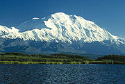
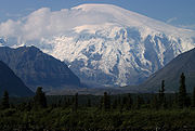
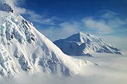
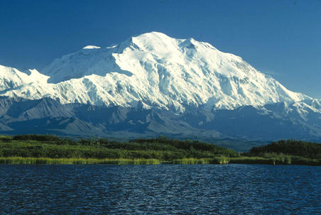
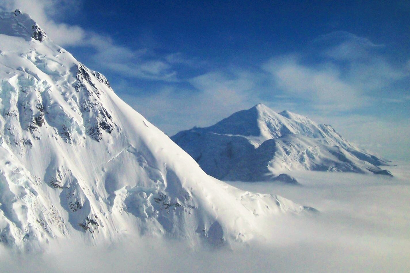
1. Mount McKinley, or Denali, in Alaska is the highest mountain peak of the United States and North America.
-

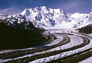
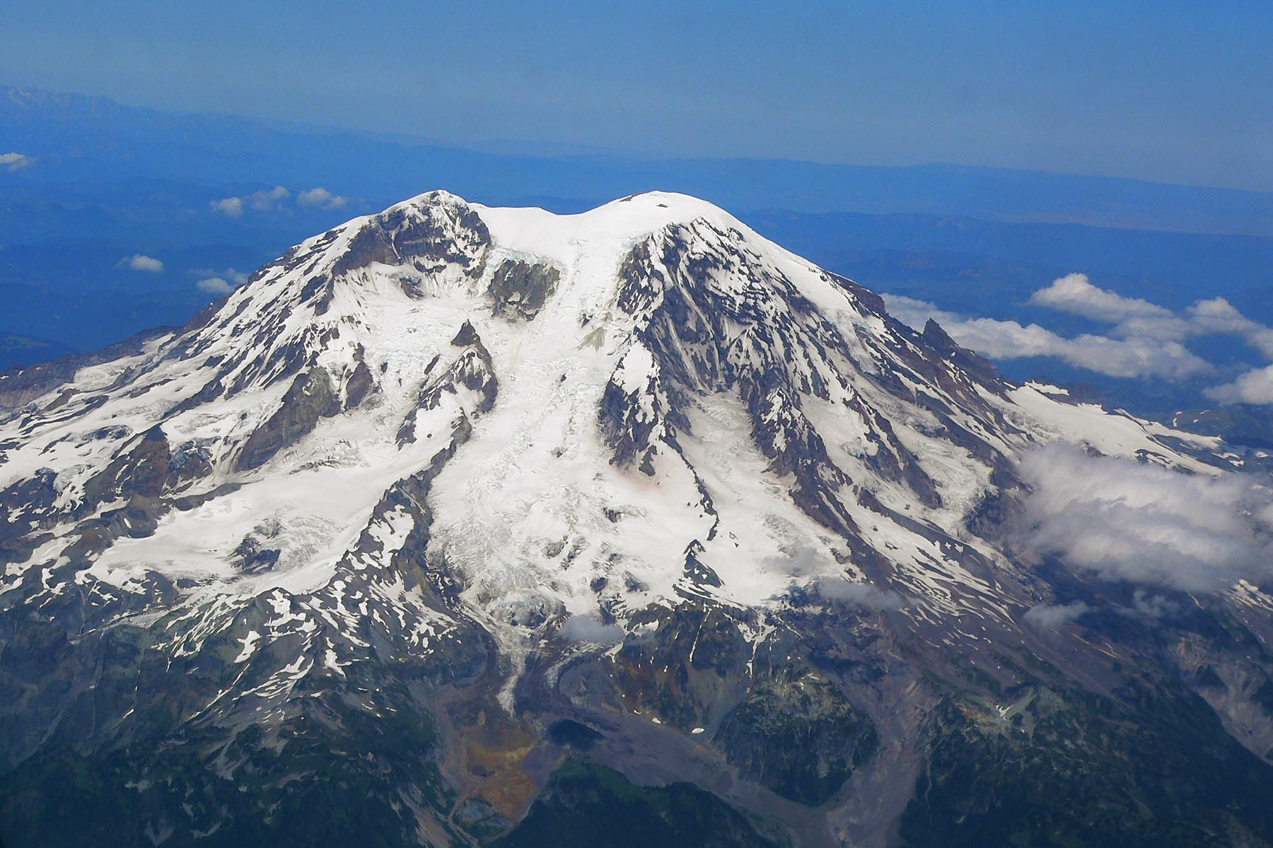
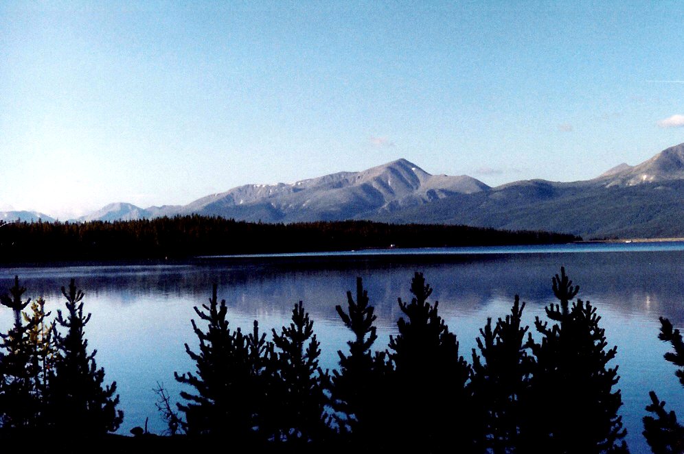
3. Mount Rainier in Washington is the third most topographically prominent mountain peak of the U.S.
-

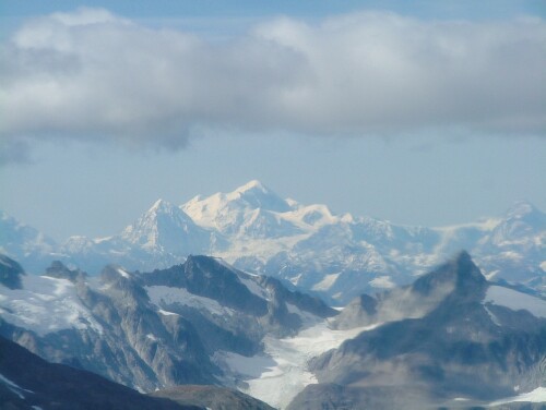
4. Mount Fairweather on the border of Alaska and British Columbia is the fourth most topographically prominent mountain peak of the U.S.
-
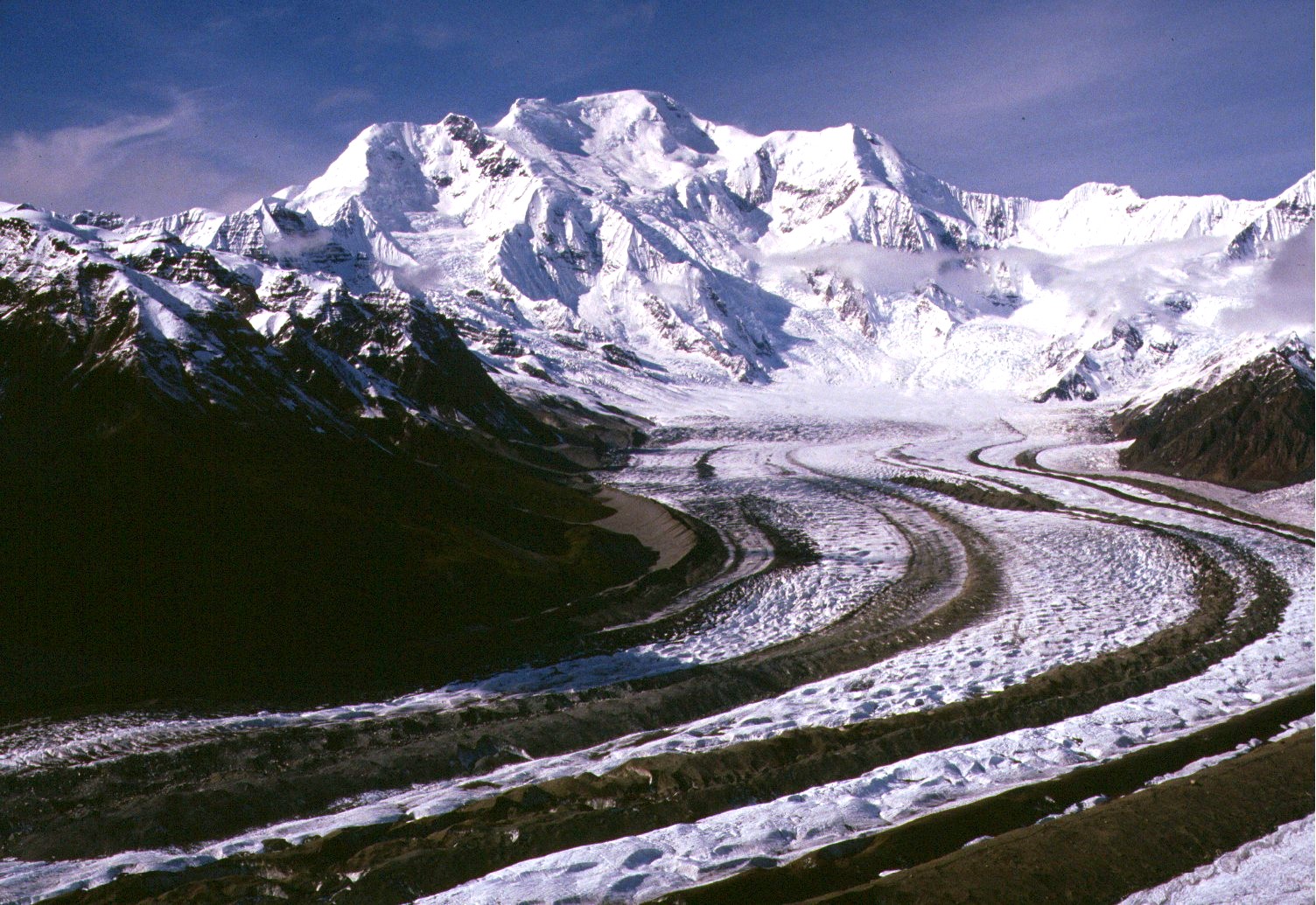
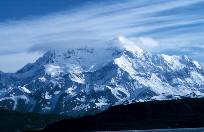
5. Mount Blackburn in Alaska is the highest peak of the Wrangell Mountains.
-

7. Mount Saint Elias on the border of Alaska and the Yukon is the second highest mountain peak of both the United States and Canada.
-
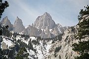
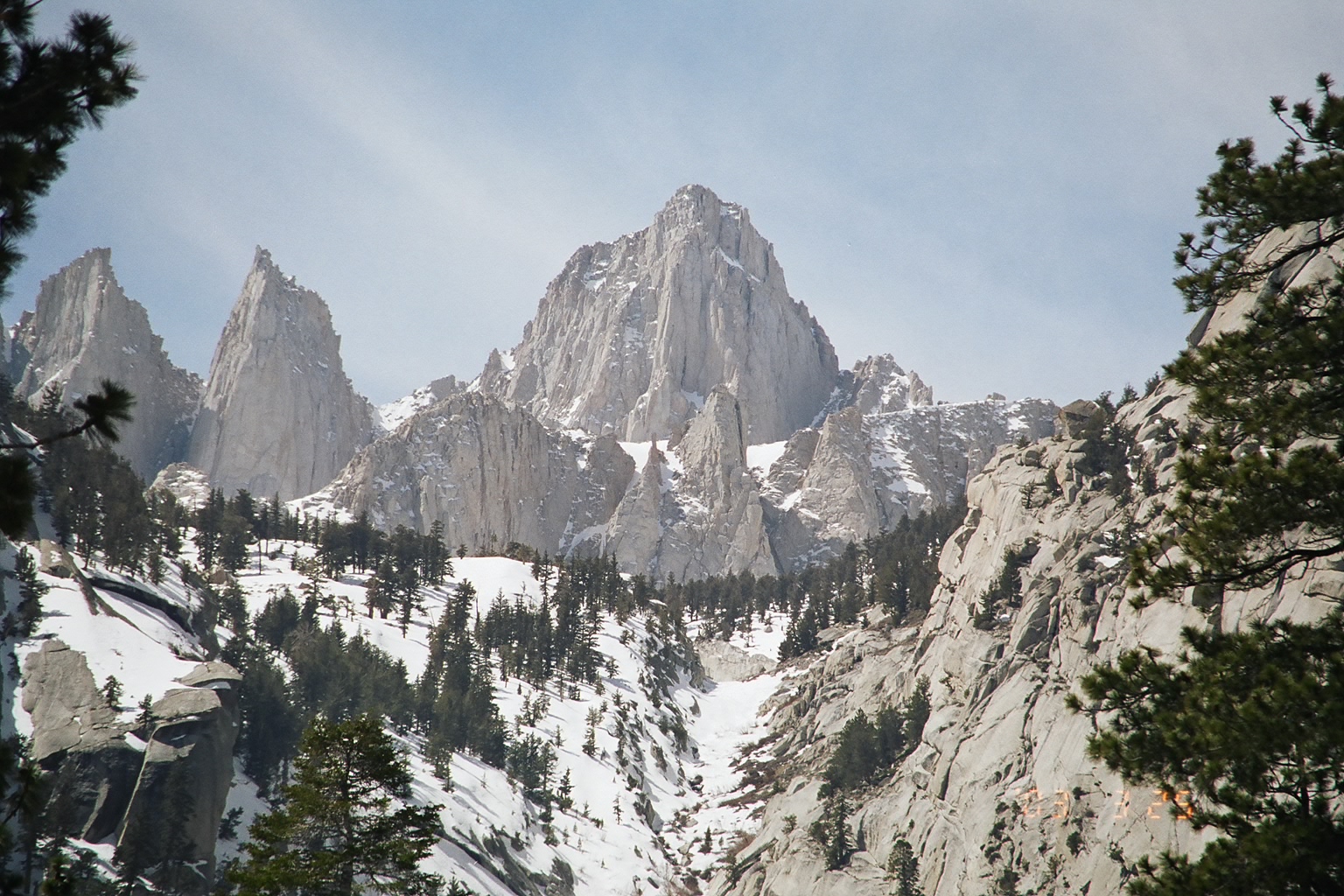
9. Mount Whitney in California is the highest mountain peak of the contiguous United States.
-

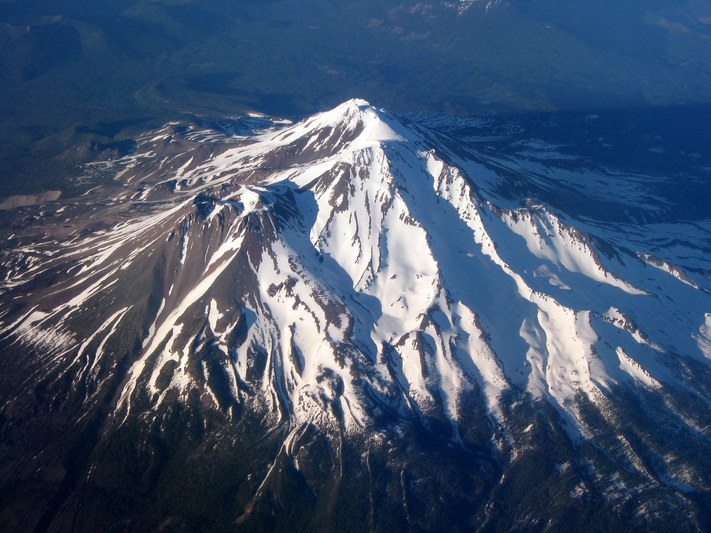
11. Mount Shasta in California is the second highest summit of the Cascade Range.
-
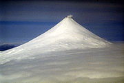
12. Mount Shishaldin on Unimak Island in Alaska is the highest point in the Aleutian Islands.
-

14. Mount Elbert in Colorado is the highest peak of the Rocky Mountains.
-
29. Mount Sanford in Alaska is the second highest peak of the Wrangell Mountains.
-
35. Mount Foraker is the second highest mountain peak of the Alaska Range.
-
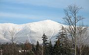
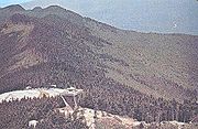
59. Mount Washington is the highest mountain peak in the Northeastern United States.
-
62. Mount Mitchell in North Carolina is the highest mountain peak of the Eastern United States.
See also
- Outline of the United States
- Index of United States-related articles
- United States of America
- Geography of the United States
- Category:Mountains of the United States
- Geography of the United States
- Physical geography
- Topography
- Topographic elevation
- Topographic isolation
- Topographic prominence
- Topographic summit
- Topography
- Lists of mountains
- Mountain peaks of greater North America
- The 356 Ultra-prominent mountain peaks of greater North America
- The 39 Ultra-prominent mountain peaks of Greenland
- The 142 Ultra-prominent mountain peaks of Canada
- The 129 Ultra-prominent mountain peaks of the United States
- The 65 Ultra-prominent mountain peaks of Alaska
- The 9 Ultra-prominent mountain peaks of California
- The 3 Ultra-prominent mountain peaks of Colorado
- The 28 Ultra-prominent mountain peaks of México
- The 23 Ultra-prominent mountain peaks of Central America
- The 7 Ultra-prominent mountain peaks of the Caribbean
- The 356 Ultra-prominent mountain peaks of greater North America
- Mountain peaks of Greenland
- Mountain peaks of Canada
- Mountain peaks of the Rocky Mountains
- Mountain peaks of the United States
- The 129 Ultra-prominent mountain peaks of the United States
- Mountain peaks of Alaska
- Mountain peaks of California
- Mountain peaks of Colorado
- Mountain peaks of México
- Mountain peaks of Central America
- Mountain peaks of the Caribbean
- Mountain peaks of greater North America
References
- ^ The summit of Mount McKinley (Denali) is the highest point of the Alaska Range, the State of Alaska, the United States of America, and all of North America.
- ^ "Mount McKinley". Summits of the World. peakbagger.com. http://www.peakbagger.com/peak.aspx?pid=271. Retrieved January 27, 2010.
- ^ The summit of Mauna Kea is the highest point of the Island of Hawaiʻi, the State of Hawaiʻi, and the entire North Pacific Ocean. Mauna Kea is also the tallest mountain on Earth as measured from base to summit. The shield volcano sits on the ocean floor at a depth of 5,998 meters (19,678 ft) for a total height of 10,205.3 meters (33,482 ft).
- ^ "Mauna Kea". NGS Station Datasheet. United States National Geodetic Survey. http://www.ngs.noaa.gov/cgi-bin/ds_mark.prl?PidBox=TU2314. Retrieved January 2, 2010.
- ^ "Mauna Kea". Summits of the World. peakbagger.com. http://www.peakbagger.com/peak.aspx?pid=11909. Retrieved January 2, 2010.
- ^ The summit of Mount Rainier is the highest point of the Cascade Range and the State of Washington.
- ^ "Mount Rainier". NGS Station Datasheet. United States National Geodetic Survey. http://www.ngs.noaa.gov/cgi-bin/ds_mark.prl?PidBox=SB1041. Retrieved January 27, 2010.
- ^ "Mount Rainier". Summits of the World. peakbagger.com. http://www.peakbagger.com/peak.aspx?pid=2296. Retrieved January 27, 2010.
- ^ The summit elevation of Mount Rainier includes a vertical adjustment of +1.935 m (+6.3 ft).
- ^ The summit of Mount Fairweather (Fairweather Mountain) on the border of Alaska is the highest point of the Province of British Columbia.
- ^ "Mount Fairweather". Summits of the World. peakbagger.com. http://www.peakbagger.com/peak.aspx?pid=566. Retrieved January 11, 2010.
- ^ "Mount Blackburn". NGS Station Datasheet. United States National Geodetic Survey. http://www.ngs.noaa.gov/cgi-bin/ds_mark.prl?PidBox=UV4136. Retrieved January 11, 2010.
- ^ "Mount Blackburn". Summits of the World. peakbagger.com. http://www.peakbagger.com/peak.aspx?pid=437. Retrieved January 11, 2010.
- ^ The summit of Mount Hayes is the northernmost 4000 m (13,123-foot) summit of North America.
- ^ "Mount Hayes". NGS Station Datasheet. United States National Geodetic Survey. http://www.ngs.noaa.gov/cgi-bin/ds_mark.prl?PidBox=TT6365. Retrieved January 27, 2010.
- ^ "Mount Hayes". Summits of the World. peakbagger.com. http://www.peakbagger.com/peak.aspx?pid=305. Retrieved January 27, 2010.
- ^ The summit of Mount Saint Elias on the international border between Alaska and the Yukon is the second highest mountain peak of both Canada and the United States.
- ^ "Mount Saint Elias". Summits of the World. peakbagger.com. http://www.peakbagger.com/peak.aspx?pid=552. Retrieved January 11, 2010.
- ^ "Mount Marcus Baker". Summits of the World. peakbagger.com. http://www.peakbagger.com/peak.aspx?pid=443. Retrieved January 27, 2010.
- ^ The summit of Mount Whitney is the highest point of the Sierra Nevada, the State of California, and the contiguous United States.
- ^ "Mount Whitney". NGS Station Datasheet. United States National Geodetic Survey. http://www.ngs.noaa.gov/cgi-bin/ds_mark.prl?PidBox=GT1812. Retrieved January 17, 2010.
- ^ "Mount Whitney". Summits of the World. peakbagger.com. http://www.peakbagger.com/peak.aspx?pid=2829. Retrieved January 17, 2010.
- ^ The summit elevation of Mount Whitney includes a vertical adjustment of +1.869 m (+6.1 ft).
- ^ The summit of Haleakalā is the highest point of the Island of Maui.
- ^ "Haleakalā". Summits of the World. peakbagger.com. http://www.peakbagger.com/peak.aspx?pid=11905. Retrieved January 2, 2010.
- ^ "Mount Shasta". NGS Station Datasheet. United States National Geodetic Survey. http://www.ngs.noaa.gov/cgi-bin/ds_mark.prl?PidBox=MX1016. Retrieved January 17, 2010.
- ^ "Mount Shasta". Summits of the World. peakbagger.com. http://www.peakbagger.com/peak.aspx?pid=2477. Retrieved January 17, 2010.
- ^ The summit elevation of Mount Shasta includes a vertical adjustment of +1.791 m (+5.9 ft).
- ^ The summit of Shishaldin Volcano is the highest point of Unimak Island and all the Aleutian Islands.
- ^ "Shishaldin Volcano". Summits of the World. peakbagger.com. http://www.peakbagger.com/peak.aspx?pid=359. Retrieved January 4, 2010.
- ^ "Redoubt Volcano". NGS Station Datasheet. United States National Geodetic Survey. http://www.ngs.noaa.gov/cgi-bin/ds_mark.prl?PidBox=UW6080. Retrieved January 2, 2010.
- ^ "Redoubt Volcano". Summits of the World. peakbagger.com. http://www.peakbagger.com/peak.aspx?pid=411. Retrieved January 2, 2010.
- ^ The summit of Mount Elbert is the highest point of the Rocky Mountains and the State of Colorado.
- ^ "Mount Elbert". NGS Station Datasheet. United States National Geodetic Survey. http://www.ngs.noaa.gov/cgi-bin/ds_mark.prl?PidBox=KL0637. Retrieved January 17, 2010.
- ^ "Mount Elbert". Summits of the World. peakbagger.com. http://www.peakbagger.com/peak.aspx?pid=5736. Retrieved January 17, 2010.
- ^ The summit elevation of Mount Elbert includes a vertical adjustment of +1.995 m (+6.5 ft).
- ^ "Mount Baker". Summits of the World. peakbagger.com. http://www.peakbagger.com/peak.aspx?pid=1633. Retrieved January 27, 2010.
- ^ The summit elevation of Mount Baker includes a vertical adjustment of +1.43 m (+4.7 ft).
- ^ "Mount Torbert". Summits of the World. peakbagger.com. http://www.peakbagger.com/peak.aspx?pid=221. Retrieved January 27, 2010.
- ^ "San Jacinto Peak". NGS Station Datasheet. United States National Geodetic Survey. http://www.ngs.noaa.gov/cgi-bin/ds_mark.prl?PidBox=DX5119. Retrieved January 17, 2010.
- ^ "San Jacinto Peak". Summits of the World. peakbagger.com. http://www.peakbagger.com/peak.aspx?pid=1480. Retrieved January 17, 2010.
- ^ The summit elevation of San Jacinto Peak includes a vertical adjustment of +1.107 m (+3.6 ft).
- ^ "San Gorgonio Mountain". Summits of the World. peakbagger.com. http://www.peakbagger.com/peak.aspx?pid=1417. Retrieved January 28, 2010.
- ^ The summit elevation of San Gorgonio Mountain includes a vertical adjustment of +1.303 m (+4.3 ft).
- ^ "Charleston Peak". NGS Station Datasheet. United States National Geodetic Survey. http://www.ngs.noaa.gov/cgi-bin/ds_mark.prl?PidBox=GR1965. Retrieved January 2, 2010.
- ^ "Charleston Peak". Summits of the World. peakbagger.com. http://www.peakbagger.com/peak.aspx?pid=3748. Retrieved January 2, 2010.
- ^ The summit elevation of Charleston Peak includes a vertical adjustment of +1.25 m (+4.1 ft).
- ^ "Pavlof Volcano". NGS Station Datasheet. United States National Geodetic Survey. http://www.ngs.noaa.gov/cgi-bin/ds_mark.prl?PidBox=UW1057. Retrieved January 2, 2010.
- ^ "Pavlof Volcano". Summits of the World. peakbagger.com. http://www.peakbagger.com/peak.aspx?pid=403. Retrieved January 2, 2010.
- ^ "Mount Veniaminof". NGS Station Datasheet. United States National Geodetic Survey. http://www.ngs.noaa.gov/cgi-bin/ds_mark.prl?PidBox=UW1462. Retrieved January 27, 2010.
- ^ "Mount Veniaminof". Summits of the World. peakbagger.com. http://www.peakbagger.com/peak.aspx?pid=400. Retrieved January 27, 2010.
- ^ "Mount Adams". NGS Station Datasheet. United States National Geodetic Survey. http://www.ngs.noaa.gov/cgi-bin/ds_mark.prl?PidBox=SB1004. Retrieved January 17, 2010.
- ^ "Mount Adams". Summits of the World. peakbagger.com. http://www.peakbagger.com/peak.aspx?pid=2365. Retrieved January 17, 2010.
- ^ The summit elevation of Mount Adams includes a vertical adjustment of +1.655 m (+5.4 ft).
- ^ "Mount Hubbard". Summits of the World. peakbagger.com. http://www.peakbagger.com/peak.aspx?pid=548. Retrieved January 25, 2010.
- ^ "Mount Chamberlin". NGS Station Datasheet. United States National Geodetic Survey. http://www.ngs.noaa.gov/cgi-bin/ds_mark.prl?PidBox=TT7804. Retrieved January 2, 2010.
- ^ "Mount Chamberlin". Summits of the World. peakbagger.com. http://www.peakbagger.com/peak.aspx?pid=117. Retrieved January 2, 2010.
- ^ "Iliamna Volcano". Summits of the World. peakbagger.com. http://www.peakbagger.com/peak.aspx?pid=412. Retrieved January 2, 2010.
- ^ "Mount Olympus". NGS Station Datasheet. United States National Geodetic Survey. http://www.ngs.noaa.gov/cgi-bin/ds_mark.prl?PidBox=SY1857. Retrieved January 17, 2010.
- ^ "Mount Olympus". Summits of the World. peakbagger.com. http://www.peakbagger.com/peak.aspx?pid=950. Retrieved January 17, 2010.
- ^ The summit elevation of Mount Olympus includes a vertical adjustment of +1.338 m (+4.4 ft).
- ^ "Mount Cook". Summits of the World. peakbagger.com. http://www.peakbagger.com/peak.aspx?pid=554. Retrieved January 26, 2010.
- ^ The summit of Mount Hood is the highest point of the State of Oregon.
- ^ "Mount Hood". NGS Station Datasheet. United States National Geodetic Survey. http://www.ngs.noaa.gov/cgi-bin/ds_mark.prl?PidBox=RC2244. Retrieved January 17, 2010.
- ^ "Mount Hood". Summits of the World. peakbagger.com. http://www.peakbagger.com/peak.aspx?pid=2382. Retrieved January 17, 2010.
- ^ The summit elevation of Mount Hood includes a vertical adjustment of +1.341 m (+4.4 ft).
- ^ "Mount Sanford". Summits of the World. peakbagger.com. http://www.peakbagger.com/peak.aspx?pid=428. Retrieved January 27, 2010.
- ^ "Mount Tom White". NGS Station Datasheet. United States National Geodetic Survey. http://www.ngs.noaa.gov/cgi-bin/ds_mark.prl?PidBox=UV3135. Retrieved January 27, 2010.
- ^ "Mount Tom White". Summits of the World. peakbagger.com. http://www.peakbagger.com/peak.aspx?pid=456. Retrieved January 27, 2010.
- ^ "Wheeler Peak". NGS Station Datasheet. United States National Geodetic Survey. http://www.ngs.noaa.gov/cgi-bin/ds_mark.prl?PidBox=JP0339. Retrieved January 17, 2010.
- ^ "Wheeler Peak". Summits of the World. peakbagger.com. http://www.peakbagger.com/peak.aspx?pid=3572. Retrieved January 17, 2010.
- ^ The summit elevation of Wheeler Peak includes a vertical adjustment of +1.649 m (+5.4 ft).
- ^ "Glacier Peak". NGS Station Datasheet. United States National Geodetic Survey. http://www.ngs.noaa.gov/cgi-bin/ds_mark.prl?PidBox=TQ0506. Retrieved January 17, 2010.
- ^ "Glacier Peak". Summits of the World. peakbagger.com. http://www.peakbagger.com/peak.aspx?pid=1972. Retrieved January 17, 2010.
- ^ The summit elevation of Glacier Peak includes a vertical adjustment of +1.492 m (+4.9 ft).
- ^ "Mount Kimball". Summits of the World. peakbagger.com. http://www.peakbagger.com/peak.aspx?pid=16711. Retrieved January 27, 2010.
- ^ "Mount Griggs". Summits of the World. peakbagger.com. http://www.peakbagger.com/peak.aspx?pid=387. Retrieved January 27, 2010.
- ^ The summit of Mount Foraker is the westernmost 5000 m (16,404-foot) summit of North America.
- ^ "Mount Foraker". NGS Station Datasheet. United States National Geodetic Survey. http://www.ngs.noaa.gov/cgi-bin/ds_mark.prl?PidBox=UW6284. Retrieved January 27, 2010.
- ^ "Mount Foraker". Summits of the World. peakbagger.com. http://www.peakbagger.com/peak.aspx?pid=284. Retrieved January 27, 2010.
- ^ "White Mountain Peak". NGS Station Datasheet. United States National Geodetic Survey. http://www.ngs.noaa.gov/cgi-bin/ds_mark.prl?PidBox=HR2559. Retrieved January 17, 2010.
- ^ "White Mountain Peak". Summits of the World. peakbagger.com. http://www.peakbagger.com/peak.aspx?pid=3628. Retrieved January 17, 2010.
- ^ The summit elevation of White Mountain Peak includes a vertical adjustment of +1.91 m (+6.3 ft).
- ^ "Mount Crillon". NGS Station Datasheet. United States National Geodetic Survey. http://www.ngs.noaa.gov/cgi-bin/ds_mark.prl?PidBox=UV2202. Retrieved January 27, 2010.
- ^ "Mount Crillon". Summits of the World. peakbagger.com. http://www.peakbagger.com/peak.aspx?pid=584. Retrieved January 27, 2010.
- ^ "Mauna Loa". NGS Station Datasheet. United States National Geodetic Survey. http://www.ngs.noaa.gov/cgi-bin/ds_mark.prl?PidBox=TU0145. Retrieved January 2, 2010.
- ^ "Mauna Loa". Summits of the World. peakbagger.com. http://www.peakbagger.com/peak.aspx?pid=11915. Retrieved January 2, 2010.
- ^ The shield volcano Mauna Loa is the most voluminous mountain on Earth with an estimated volume of 74,000 km³ (17,800 cubic miles), or enough material to fill the Grand Canyon more than 18 times.
- ^ "Cloud Peak". NGS Station Datasheet. United States National Geodetic Survey. http://www.ngs.noaa.gov/cgi-bin/ds_mark.prl?PidBox=PW0524. Retrieved January 17, 2010.
- ^ "Cloud Peak". Summits of the World. peakbagger.com. http://www.peakbagger.com/peak.aspx?pid=5323. Retrieved January 17, 2010.
- ^ The summit elevation of Cloud Peak includes a vertical adjustment of +1.293 m (+4.2 ft).
- ^ The summit of Gannett Peak is the highest point of the Central Rocky Mountains and the State of Wyoming.
- ^ "Gannett Peak". NGS Station Datasheet. United States National Geodetic Survey. http://www.ngs.noaa.gov/cgi-bin/ds_mark.prl?PidBox=OW0356. Retrieved January 17, 2010.
- ^ "Gannett Peak". Summits of the World. peakbagger.com. http://www.peakbagger.com/peak.aspx?pid=5352. Retrieved January 17, 2010.
- ^ The summit elevation of Gannett Peak includes a vertical adjustment of +1.737 m (+5.7 ft).
- ^ The summit of Mount Vsevidof is the highest point of Umnak Island.
- ^ "Mount Vsevidof". NGS Station Datasheet. United States National Geodetic Survey. http://www.ngs.noaa.gov/cgi-bin/ds_mark.prl?PidBox=UV9745. Retrieved January 27, 2010.
- ^ "Mount Vsevidof". Summits of the World. peakbagger.com. http://www.peakbagger.com/peak.aspx?pid=352. Retrieved January 27, 2010.
- ^ "Mount Hesperus". Summits of the World. peakbagger.com. http://www.peakbagger.com/peak.aspx?pid=210. Retrieved January 2, 2010.
- ^ "Mount Bona". NGS Station Datasheet. United States National Geodetic Survey. http://www.ngs.noaa.gov/cgi-bin/ds_mark.prl?PidBox=UV4083. Retrieved January 27, 2010.
- ^ "Mount Bona". Summits of the World. peakbagger.com. http://www.peakbagger.com/peak.aspx?pid=496. Retrieved January 27, 2010.
- ^ "Mount Drum". Summits of the World. peakbagger.com. http://www.peakbagger.com/peak.aspx?pid=430. Retrieved January 27, 2010.
- ^ "Mount Chiginagak". Summits of the World. peakbagger.com. http://www.peakbagger.com/peak.aspx?pid=16712. Retrieved January 27, 2010.
- ^ "Grand Teton". NGS Station Datasheet. United States National Geodetic Survey. http://www.ngs.noaa.gov/cgi-bin/ds_mark.prl?PidBox=OX0838. Retrieved January 17, 2010.
- ^ "Grand Teton". Summits of the World. peakbagger.com. http://www.peakbagger.com/peak.aspx?pid=5218. Retrieved January 17, 2010.
- ^ The summit elevation of Grand Teton includes a vertical adjustment of +1.571 m (+5.2 ft).
- ^ "Sacajawea Peak". Summits of the World. peakbagger.com. http://www.peakbagger.com/peak.aspx?pid=3158. Retrieved January 28, 2010.
- ^ The summit elevation of Sacajawea Peak includes a vertical adjustment of +1.56 m (+5.1 ft).
- ^ "Mount Neacola". Summits of the World. peakbagger.com. http://www.peakbagger.com/peak.aspx?pid=16714. Retrieved January 2, 2010.
- ^ The summit of Kings Peak is the highest point of the Western Rocky Mountains and the State of Utah.
- ^ "Kings Peak". NGS Station Datasheet. United States National Geodetic Survey. http://www.ngs.noaa.gov/cgi-bin/ds_mark.prl?PidBox=LO1058. Retrieved January 3, 2010.
- ^ "Kings Peak". Summits of the World. peakbagger.com. http://www.peakbagger.com/peak.aspx?pid=5507. Retrieved January 3, 2010.
- ^ The summit elevation of Kings Peak includes a vertical adjustment of +1.794 m (+5.9 ft).
- ^ "Mount Graham". NGS Station Datasheet. United States National Geodetic Survey. http://www.ngs.noaa.gov/cgi-bin/ds_mark.prl?PidBox=CY1235. Retrieved January 17, 2010.
- ^ "Mount Graham". Summits of the World. peakbagger.com. http://www.peakbagger.com/peak.aspx?pid=4211. Retrieved January 17, 2010.
- ^ The summit elevation of Mount Graham includes a vertical adjustment of +1.036 m (+3.4 ft).
- ^ "Mount Douglas". Summits of the World. peakbagger.com. http://www.peakbagger.com/peak.aspx?pid=373. Retrieved January 27, 2010.
- ^ "Mount San Antonio". NGS Station Datasheet. United States National Geodetic Survey. http://www.ngs.noaa.gov/cgi-bin/ds_mark.prl?PidBox=EV3735. Retrieved January 28, 2010.
- ^ "Mount San Antonio". Summits of the World. peakbagger.com. http://www.peakbagger.com/peak.aspx?pid=1338. Retrieved January 28, 2010.
- ^ The summit elevation of Mount San Antonio includes a vertical adjustment of +1.214 m (+4.0 ft).
- ^ "Kichatna Spire". Summits of the World. peakbagger.com. http://www.peakbagger.com/peak.aspx?pid=16713. Retrieved January 27, 2010.
- ^ "De Long Peak". Summits of the World. peakbagger.com. http://www.peakbagger.com/peak.aspx?pid=16715. Retrieved January 27, 2010.
- ^ "De Long Peak". Canadian Mountain Encyclopedia. bivouac.com. http://www.bivouac.com/MtnPg.asp?MtnId=7783. Retrieved January 27, 2010.
- ^ "Telescope Peak". NGS Station Datasheet. United States National Geodetic Survey. http://www.ngs.noaa.gov/cgi-bin/ds_mark.prl?PidBox=GS0799. Retrieved January 17, 2010.
- ^ "Telescope Peak". Summits of the World. peakbagger.com. http://www.peakbagger.com/peak.aspx?pid=3662. Retrieved January 17, 2010.
- ^ The summit elevation of Telescope Peak includes a vertical adjustment of +1.169 m (+3.8 ft).
- ^ "Mount Peale". NGS Station Datasheet. United States National Geodetic Survey. http://www.ngs.noaa.gov/cgi-bin/ds_mark.prl?PidBox=JM0496. Retrieved January 3, 2010.
- ^ "Mount Peale". Summits of the World. peakbagger.com. http://www.peakbagger.com/peak.aspx?pid=3879. Retrieved January 3, 2010.
- ^ The summit elevation of Mount Peale includes a vertical adjustment of +1.509 m (+5.0 ft).
- ^ The summit of Pogromni Volcano is the westernmost ultra-prominent summit of continental North America.
- ^ "Pogromni Volcano". NGS Station Datasheet. United States National Geodetic Survey. http://www.ngs.noaa.gov/cgi-bin/ds_mark.prl?PidBox=UV9965. Retrieved January 2, 2010.
- ^ "Pogromni Volcano". Summits of the World. peakbagger.com. http://www.peakbagger.com/peak.aspx?pid=366. Retrieved January 2, 2010.
- ^ "Dewey Peak". Summits of the World. peakbagger.com. http://www.peakbagger.com/peak.aspx?pid=16716. Retrieved January 27, 2010.
- ^ "Dewey Peak". Canadian Mountain Encyclopedia. bivouac.com. http://www.bivouac.com/MtnPg.asp?MtnId=7784. Retrieved January 27, 2010.
- ^ The summit of Mount Washington is the highest point of the Northern Appalachian Mountains, the State of New Hampshire, and all of northeastern North America. Mount Washington is the easternmost ultra-prominent summit of continental North America.
- ^ "Mount Washington". NGS Station Datasheet. United States National Geodetic Survey. http://www.ngs.noaa.gov/cgi-bin/ds_mark.prl?PidBox=PF0951. Retrieved January 17, 2010.
- ^ "Mount Washington". Summits of the World. peakbagger.com. http://www.peakbagger.com/peak.aspx?pid=6960. Retrieved January 17, 2010.
- ^ The summit elevation of Mount Washington includes a vertical adjustment of +0.02 m (+0.1 ft).
- ^ "Mount Igikpak". Summits of the World. peakbagger.com. http://www.peakbagger.com/peak.aspx?pid=73. Retrieved January 27, 2010.
- ^ "Snow Tower". Summits of the World. peakbagger.com. http://www.peakbagger.com/peak.aspx?pid=16717. Retrieved January 2, 2010.
- ^ The summit of Mount Mitchell is the highest point of the Appalachian Mountains, the State of North Carolina, and all of eastern North America.
- ^ "Mount Mitchell". Summits of the World. peakbagger.com. http://www.peakbagger.com/peak.aspx?pid=7822. Retrieved January 28, 2010.
- ^ The summit elevation of Mount Mitchell includes a vertical adjustment of +0.025 m (+0.1 ft).
- ^ "Truuli Peak". Summits of the World. peakbagger.com. http://www.peakbagger.com/peak.aspx?pid=477. Retrieved January 27, 2010.
- ^ The summit of Humphreys Peak is the highest point of the State of Arizona.
- ^ "Humphreys Peak". NGS Station Datasheet. United States National Geodetic Survey. http://www.ngs.noaa.gov/cgi-bin/ds_mark.prl?PidBox=FQ0624. Retrieved January 28, 2010.
- ^ "Humphreys Peak". Summits of the World. peakbagger.com. http://www.peakbagger.com/peak.aspx?pid=3938. Retrieved January 28, 2010.
- ^ The summit elevation of Humphreys Peak includes a vertical adjustment of +1.345 m (+4.4 ft).
- ^ The summit of Borah Peak is the highest point of the State of Idaho.
- ^ "Borah Peak". NGS Station Datasheet. United States National Geodetic Survey. http://www.ngs.noaa.gov/cgi-bin/ds_mark.prl?PidBox=PZ0770. Retrieved January 28, 2010.
- ^ "Borah Peak". Summits of the World. peakbagger.com. http://www.peakbagger.com/peak.aspx?pid=5142. Retrieved January 28, 2010.
- ^ The summit elevation of Borah Peak includes a vertical adjustment of +1.682 m (+5.5 ft).
- ^ "Mount Natazhat". Summits of the World. peakbagger.com. http://www.peakbagger.com/peak.aspx?pid=494. Retrieved January 27, 2010.
- ^ "Hanagita Peak". NGS Station Datasheet. United States National Geodetic Survey. http://www.ngs.noaa.gov/cgi-bin/ds_mark.prl?PidBox=UV3837. Retrieved January 2, 2010.
- ^ "Hanagita Peak". Summits of the World. peakbagger.com. http://www.peakbagger.com/peak.aspx?pid=453. Retrieved January 2, 2010.
- ^ The summit of Tanaga Volcano is the highest point of Tanaga Island.
- ^ "Tanaga Volcano". Summits of the World. peakbagger.com. http://www.peakbagger.com/peak.aspx?pid=328. Retrieved January 2, 2010.
- ^ The summit of Makushin Volcano is the highest point of Unalaska Island.
- ^ "Makushin Volcano". Summits of the World. peakbagger.com. http://www.peakbagger.com/peak.aspx?pid=343. Retrieved January 27, 2010.
- ^ "Sovereign Mountain". Summits of the World. peakbagger.com. http://www.peakbagger.com/peak.aspx?pid=418. Retrieved January 27, 2010.
- ^ "Mount Jefferson". NGS Station Datasheet. United States National Geodetic Survey. http://www.ngs.noaa.gov/cgi-bin/ds_mark.prl?PidBox=JQ0584. Retrieved January 17, 2010.
- ^ "Mount Jefferson". Summits of the World. peakbagger.com. http://www.peakbagger.com/peak.aspx?pid=3501. Retrieved January 17, 2010.
- ^ The summit elevation of Mount Jefferson includes a vertical adjustment of +1.666 m (+5.5 ft).
- ^ "Mount Ellen (Utah)". Summits of the World. peakbagger.com. http://www.peakbagger.com/peak.aspx?pid=3883. Retrieved January 28, 2010.
- ^ The summit elevation of Mount Ellen (Utah) includes a vertical adjustment of +1.486 m (+4.9 ft).
- ^ "Isanotski Peaks". NGS Station Datasheet. United States National Geodetic Survey. http://www.ngs.noaa.gov/cgi-bin/ds_mark.prl?PidBox=UV9857. Retrieved January 27, 2010.
- ^ "Isanotski Peaks". Summits of the World. peakbagger.com. http://www.peakbagger.com/peak.aspx?pid=357. Retrieved January 27, 2010.
- ^ "Deseret Peak". NGS Station Datasheet. United States National Geodetic Survey. http://www.ngs.noaa.gov/cgi-bin/ds_mark.prl?PidBox=LP0457. Retrieved January 17, 2010.
- ^ "Deseret Peak". Summits of the World. peakbagger.com. http://www.peakbagger.com/peak.aspx?pid=3586. Retrieved January 17, 2010.
- ^ The summit elevation of Deseret Peak includes a vertical adjustment of +1.366 m (+4.5 ft).
- ^ "Mount Jefferson". NGS Station Datasheet. United States National Geodetic Survey. http://www.ngs.noaa.gov/cgi-bin/ds_mark.prl?PidBox=QD1739. Retrieved January 17, 2010.
- ^ "Mount Jefferson". Summits of the World. peakbagger.com. http://www.peakbagger.com/peak.aspx?pid=2401. Retrieved January 17, 2010.
- ^ The summit elevation of Mount Jefferson includes a vertical adjustment of +1.388 m (+4.6 ft).
- ^ "Isthmus Peak". NGS Station Datasheet. United States National Geodetic Survey. http://www.ngs.noaa.gov/cgi-bin/ds_mark.prl?PidBox=UW7466. Retrieved January 27, 2010.
- ^ "Isthmus Peak". Summits of the World. peakbagger.com. http://www.peakbagger.com/peak.aspx?pid=16718. Retrieved January 27, 2010.
- ^ "Frosty Peak". NGS Station Datasheet. United States National Geodetic Survey. http://www.ngs.noaa.gov/cgi-bin/ds_mark.prl?PidBox=UW1192. Retrieved January 27, 2010.
- ^ "Frosty Peak". Summits of the World. peakbagger.com. http://www.peakbagger.com/peak.aspx?pid=16719. Retrieved January 27, 2010.
- ^ "Pilot Peak". NGS Station Datasheet. United States National Geodetic Survey. http://www.ngs.noaa.gov/cgi-bin/ds_mark.prl?PidBox=MT0738. Retrieved January 3, 2010.
- ^ "Pilot Peak". Summits of the World. peakbagger.com. http://www.peakbagger.com/peak.aspx?pid=3441. Retrieved January 3, 2010.
- ^ The summit elevation of Pilot Peak includes a vertical adjustment of +1.178 m (+3.9 ft).
- ^ "Crazy Peak". NGS Station Datasheet. United States National Geodetic Survey. http://www.ngs.noaa.gov/cgi-bin/ds_mark.prl?PidBox=RV0503. Retrieved January 28, 2010.
- ^ "Crazy Peak". Summits of the World. peakbagger.com. http://www.peakbagger.com/peak.aspx?pid=4905. Retrieved January 28, 2010.
- ^ The summit elevation of Crazy Peak includes a vertical adjustment of +1.422 m (+4.7 ft).
- ^ "Great Sitkin Volcano". Summits of the World. peakbagger.com. http://www.peakbagger.com/peak.aspx?pid=322. Retrieved January 27, 2010.
- ^ "Puʻu Kukui". Summits of the World. peakbagger.com. http://www.peakbagger.com/peak.aspx?pid=11885. Retrieved January 2, 2010.
- ^ The summit of Mount Cleveland is the highest point of Chuginadak Island.
- ^ "Mount Cleveland". NGS Station Datasheet. United States National Geodetic Survey. http://www.ngs.noaa.gov/cgi-bin/ds_mark.prl?PidBox=UV9122. Retrieved January 2, 2010.
- ^ "Mount Cleveland". Summits of the World. peakbagger.com. http://www.peakbagger.com/peak.aspx?pid=334. Retrieved January 2, 2010.
- ^ "McDonald Peak". Summits of the World. peakbagger.com. http://www.peakbagger.com/peak.aspx?pid=4705. Retrieved January 27, 2010.
- ^ The summit elevation of McDonald Peak includes a vertical adjustment of +1.318 m (+4.3 ft).
- ^ "Devils Paw". Summits of the World. peakbagger.com. http://www.peakbagger.com/peak.aspx?pid=782. Retrieved January 25, 2010.
- ^ "Mount Wrangell". Summits of the World. peakbagger.com. http://www.peakbagger.com/peak.aspx?pid=434. Retrieved January 27, 2010.
- ^ "South Sister". NGS Station Datasheet. United States National Geodetic Survey. http://www.ngs.noaa.gov/cgi-bin/ds_mark.prl?PidBox=QD1872. Retrieved January 17, 2010.
- ^ "South Sister". Summits of the World. peakbagger.com. http://www.peakbagger.com/peak.aspx?pid=2416. Retrieved January 17, 2010.
- ^ The summit elevation of South Sister includes a vertical adjustment of +1.41 m (+4.6 ft).
- ^ "Mount Seattle". NGS Station Datasheet. United States National Geodetic Survey. http://www.ngs.noaa.gov/cgi-bin/ds_mark.prl?PidBox=UV3034. Retrieved January 27, 2010.
- ^ "Mount Seattle". Summits of the World. peakbagger.com. http://www.peakbagger.com/peak.aspx?pid=555. Retrieved January 27, 2010.
- ^ "Sierra Blanca Peak". NGS Station Datasheet. United States National Geodetic Survey. http://www.ngs.noaa.gov/cgi-bin/ds_mark.prl?PidBox=DR1010. Retrieved January 2, 2010.
- ^ "Sierra Blanca Peak". Summits of the World. peakbagger.com. http://www.peakbagger.com/peak.aspx?pid=4277. Retrieved January 2, 2010.
- ^ The summit elevation of Sierra Blanca Peak includes a vertical adjustment of +1.098 m (+3.6 ft).
- ^ "Pikes Peak". NGS Station Datasheet. United States National Geodetic Survey. http://www.ngs.noaa.gov/cgi-bin/ds_mark.prl?PidBox=JK1242. Retrieved January 17, 2010.
- ^ "Pikes Peak". Summits of the World. peakbagger.com. http://www.peakbagger.com/peak.aspx?pid=5689. Retrieved January 17, 2010.
- ^ The summit elevation of Pikes Peak includes a vertical adjustment of +1.678 m (+5.5 ft).
- ^ "Mount Russell". NGS Station Datasheet. United States National Geodetic Survey. http://www.ngs.noaa.gov/cgi-bin/ds_mark.prl?PidBox=UW6293. Retrieved January 27, 2010.
- ^ "Mount Russell". Summits of the World. peakbagger.com. http://www.peakbagger.com/peak.aspx?pid=297. Retrieved January 27, 2010.
- ^ "Mount Nebo". Summits of the World. peakbagger.com. http://www.peakbagger.com/peak.aspx?pid=5475. Retrieved January 28, 2010.
- ^ The summit elevation of Mount Nebo includes a vertical adjustment of +1.395 m (+4.6 ft).
- ^ "Snowshoe Peak". Summits of the World. peakbagger.com. http://www.peakbagger.com/peak.aspx?pid=4694. Retrieved January 27, 2010.
- ^ The summit elevation of Snowshoe Peak includes a vertical adjustment of +1.367 m (+4.5 ft).
- ^ "North Schell Peak". NGS Station Datasheet. United States National Geodetic Survey. http://www.ngs.noaa.gov/cgi-bin/ds_mark.prl?PidBox=KP0332. Retrieved January 17, 2010.
- ^ "North Schell Peak". Summits of the World. peakbagger.com. http://www.peakbagger.com/peak.aspx?pid=3563. Retrieved January 17, 2010.
- ^ The summit elevation of North Schell Peak includes a vertical adjustment of +1.617 m (+5.3 ft).
- ^ "Hayford Peak". NGS Station Datasheet. United States National Geodetic Survey. http://www.ngs.noaa.gov/cgi-bin/ds_mark.prl?PidBox=GR1917. Retrieved January 17, 2010.
- ^ "Hayford Peak". Summits of the World. peakbagger.com. http://www.peakbagger.com/peak.aspx?pid=3717. Retrieved January 17, 2010.
- ^ The summit elevation of Hayford Peak includes a vertical adjustment of +1.211 m (+4.0 ft).
- ^ "Mount Foresta". Summits of the World. peakbagger.com. http://www.peakbagger.com/peak.aspx?pid=16720. Retrieved January 27, 2010.
- ^ "Star Peak". NGS Station Datasheet. United States National Geodetic Survey. http://www.ngs.noaa.gov/cgi-bin/ds_mark.prl?PidBox=LS0554. Retrieved January 17, 2010.
- ^ "Star Peak". Summits of the World. peakbagger.com. http://www.peakbagger.com/peak.aspx?pid=3442. Retrieved January 17, 2010.
- ^ The summit elevation of Star Peak includes a vertical adjustment of +1.167 m (+3.8 ft).
- ^ "Baranof Island High Point". Summits of the World. peakbagger.com. http://www.peakbagger.com/peak.aspx?pid=737. Retrieved January 27, 2010.
- ^ "Diamond Peak". NGS Station Datasheet. United States National Geodetic Survey. http://www.ngs.noaa.gov/cgi-bin/ds_mark.prl?PidBox=PZ0750. Retrieved January 17, 2010.
- ^ "Diamond Peak". Summits of the World. peakbagger.com. http://www.peakbagger.com/peak.aspx?pid=5164. Retrieved January 17, 2010.
- ^ The summit elevation of Diamond Peak includes a vertical adjustment of +1.572 m (+5.2 ft).
- ^ "Flat Top Mountain". Summits of the World. peakbagger.com. http://www.peakbagger.com/peak.aspx?pid=16380. Retrieved January 28, 2010.
- ^ The summit elevation of Flat Top Mountain includes a vertical adjustment of +1.329 m (+4.4 ft).
- ^ "Bearhole Peak". Summits of the World. peakbagger.com. http://www.peakbagger.com/peak.aspx?pid=16721. Retrieved January 27, 2010.
- ^ "Bearhole Peak". Canadian Mountain Encyclopedia. bivouac.com. http://www.bivouac.com/MtnPg.asp?MtnId=7788. Retrieved January 27, 2010.
- ^ "Mount Steller". NGS Station Datasheet. United States National Geodetic Survey. http://www.ngs.noaa.gov/cgi-bin/ds_mark.prl?PidBox=UW3131. Retrieved January 2, 2010.
- ^ "Mount Steller". Summits of the World. peakbagger.com. http://www.peakbagger.com/peak.aspx?pid=459. Retrieved January 2, 2010.
- ^ "Mount Stuart". NGS Station Datasheet. United States National Geodetic Survey. http://www.ngs.noaa.gov/cgi-bin/ds_mark.prl?PidBox=SX1189. Retrieved January 17, 2010.
- ^ "Mount Stuart". Summits of the World. peakbagger.com. http://www.peakbagger.com/peak.aspx?pid=2182. Retrieved January 17, 2010.
- ^ The summit elevation of Mount Stuart includes a vertical adjustment of +1.388 m (+4.6 ft).
- ^ "Blanca Peak". NGS Station Datasheet. United States National Geodetic Survey. http://www.ngs.noaa.gov/cgi-bin/ds_mark.prl?PidBox=HK0514. Retrieved January 2, 2010.
- ^ "Blanca Peak". Summits of the World. peakbagger.com. http://www.peakbagger.com/peak.aspx?pid=5921. Retrieved January 2, 2010.
- ^ The summit elevation of Blanca Peak includes a vertical adjustment of +1.755 m (+5.8 ft).
- ^ "Mount Miller". Summits of the World. peakbagger.com. http://www.peakbagger.com/peak.aspx?pid=460. Retrieved January 3, 2010.
- ^ "Carlisle Volcano". NGS Station Datasheet. United States National Geodetic Survey. http://www.ngs.noaa.gov/cgi-bin/ds_mark.prl?PidBox=TT5510. Retrieved January 10, 2010.
- ^ "Carlisle Volcano". Summits of the World. peakbagger.com. http://www.peakbagger.com/peak.aspx?pid=16726. Retrieved January 10, 2010.
- ^ "Mount Timpanogos". NGS Station Datasheet. United States National Geodetic Survey. http://www.ngs.noaa.gov/cgi-bin/ds_mark.prl?PidBox=LO0769. Retrieved January 17, 2010.
- ^ "Mount Timpanogos". Summits of the World. peakbagger.com. http://www.peakbagger.com/peak.aspx?pid=5474. Retrieved January 17, 2010.
- ^ The summit elevation of Mount Timpanogos includes a vertical adjustment of +1.352 m (+4.4 ft).
- ^ "Bashful Peak". Summits of the World. peakbagger.com. http://www.peakbagger.com/peak.aspx?pid=448. Retrieved January 27, 2010.
- ^ "Ibapah Peak". NGS Station Datasheet. United States National Geodetic Survey. http://www.ngs.noaa.gov/cgi-bin/ds_mark.prl?PidBox=KO0484. Retrieved January 3, 2010.
- ^ "Ibapah Peak". Summits of the World. peakbagger.com. http://www.peakbagger.com/peak.aspx?pid=3543. Retrieved January 3, 2010.
- ^ The summit elevation of Ibapah Peak includes a vertical adjustment of +1.517 m (+5.0 ft).
- ^ "Mount Cleveland". NGS Station Datasheet. United States National Geodetic Survey. http://www.ngs.noaa.gov/cgi-bin/ds_mark.prl?PidBox=TM1009. Retrieved January 17, 2010.
- ^ "Mount Cleveland". Summits of the World. peakbagger.com. http://www.peakbagger.com/peak.aspx?pid=4756. Retrieved January 17, 2010.
- ^ The summit elevation of Mount Cleveland includes a vertical adjustment of +1.432 m (+4.7 ft).
- ^ The summit of Kawaikini is the highest point of the Island of Kaua‘i.
- ^ "Kawaikini". Summits of the World. peakbagger.com. http://www.peakbagger.com/peak.aspx?pid=11862. Retrieved January 28, 2010.
- ^ "He Devil". NGS Station Datasheet. United States National Geodetic Survey. http://www.ngs.noaa.gov/cgi-bin/ds_mark.prl?PidBox=RA1331. Retrieved January 3, 2010.
- ^ "He Devil". Summits of the World. peakbagger.com. http://www.peakbagger.com/peak.aspx?pid=3198. Retrieved January 3, 2010.
- ^ The summit elevation of He Devil includes a vertical adjustment of +1.381 m (+4.5 ft).
- ^ "Tetlin Peak". Summits of the World. peakbagger.com. http://www.peakbagger.com/peak.aspx?pid=16722. Retrieved January 2, 2010.
- ^ "Arc Dome". NGS Station Datasheet. United States National Geodetic Survey. http://www.ngs.noaa.gov/cgi-bin/ds_mark.prl?PidBox=JQ0514. Retrieved January 28, 2010.
- ^ "Arc Dome". Summits of the World. peakbagger.com. http://www.peakbagger.com/peak.aspx?pid=3492. Retrieved January 28, 2010.
- ^ The summit elevation of Arc Dome includes a vertical adjustment of +1.665 m (+5.5 ft).
- ^ "Lassen Peak". NGS Station Datasheet. United States National Geodetic Survey. http://www.ngs.noaa.gov/cgi-bin/ds_mark.prl?PidBox=LT0688. Retrieved January 17, 2010.
- ^ "Lassen Peak". Summits of the World. peakbagger.com. http://www.peakbagger.com/peak.aspx?pid=2513. Retrieved January 17, 2010.
- ^ The summit elevation of Lassen Peak includes a vertical adjustment of +1.332 m (+4.4 ft).
- ^ "Mount Deborah". NGS Station Datasheet. United States National Geodetic Survey. http://www.ngs.noaa.gov/cgi-bin/ds_mark.prl?PidBox=TT6368. Retrieved January 27, 2010.
- ^ "Mount Deborah". Summits of the World. peakbagger.com. http://www.peakbagger.com/peak.aspx?pid=304. Retrieved January 27, 2010.
- ^ "Necous Peak". Summits of the World. peakbagger.com. http://www.peakbagger.com/peak.aspx?pid=16723. Retrieved January 27, 2010.
- ^ "Necous Peak". Canadian Mountain Encyclopedia. bivouac.com. http://www.bivouac.com/MtnPg.asp?MtnId=7791. Retrieved January 27, 2010.
- ^ "Abercrombie Mountain". NGS Station Datasheet. United States National Geodetic Survey. http://www.ngs.noaa.gov/cgi-bin/ds_mark.prl?PidBox=TO1131. Retrieved January 27, 2010.
- ^ "Abercrombie Mountain". Summits of the World. peakbagger.com. http://www.peakbagger.com/peak.aspx?pid=3042. Retrieved January 27, 2010.
- ^ The summit elevation of Abercrombie Mountain includes a vertical adjustment of +1.345 m (+4.4 ft).
- ^ "Mount Lemmon". NGS Station Datasheet. United States National Geodetic Survey. http://www.ngs.noaa.gov/cgi-bin/ds_mark.prl?PidBox=AI1947. Retrieved January 28, 2010.
- ^ "Mount Lemmon". Summits of the World. peakbagger.com. http://www.peakbagger.com/peak.aspx?pid=4191. Retrieved January 28, 2010.
- ^ The summit elevation of Mount Lemmon includes a vertical adjustment of +1.003 m (+3.3 ft).
- ^ The summit of Mount Gareloi is the westernmost ultra-prominent summit of greater North America.
- ^ "Mount Gareloi". NGS Station Datasheet. United States National Geodetic Survey. http://www.ngs.noaa.gov/cgi-bin/ds_mark.prl?PidBox=TT5136. Retrieved January 3, 2010.
- ^ "Mount Gareloi". Summits of the World. peakbagger.com. http://www.peakbagger.com/peak.aspx?pid=330. Retrieved January 3, 2010.
- ^ "Mount Eddy". NGS Station Datasheet. United States National Geodetic Survey. http://www.ngs.noaa.gov/cgi-bin/ds_mark.prl?PidBox=MX1043. Retrieved January 17, 2010.
- ^ "Mount Eddy". Summits of the World. peakbagger.com. http://www.peakbagger.com/peak.aspx?pid=1139. Retrieved January 17, 2010.
- ^ The summit elevation of Mount Eddy includes a vertical adjustment of +1.228 m (+4.0 ft).
- ^ "Chiricahua Peak". Summits of the World. peakbagger.com. http://www.peakbagger.com/peak.aspx?pid=4223. Retrieved January 28, 2010.
- ^ The summit elevation of Chiricahua Peak includes a vertical adjustment of +1.173 m (+3.8 ft).
- ^ "Stony Peak". Summits of the World. peakbagger.com. http://www.peakbagger.com/peak.aspx?pid=16724. Retrieved January 27, 2010.
- ^ "Stony Peak". Canadian Mountain Encyclopedia. bivouac.com. http://www.bivouac.com/MtnPg.asp?MtnId=7792. Retrieved January 27, 2010.
- ^ "Mount Augusta". Summits of the World. peakbagger.com. http://www.peakbagger.com/peak.aspx?pid=551. Retrieved January 26, 2010.
- ^ "Copper Peak". Summits of the World. peakbagger.com. http://www.peakbagger.com/peak.aspx?pid=16725. Retrieved January 3, 2010.
- ^ "Copper Peak". Canadian Mountain Encyclopedia. bivouac.com. http://www.bivouac.com/MtnPg.asp?MtnId=7793. Retrieved January 3, 2010.
- ^ "Mount Bear". Summits of the World. peakbagger.com. http://www.peakbagger.com/peak.aspx?pid=501. Retrieved January 27, 2010.
- ^ "Korovin Volcano". Summits of the World. peakbagger.com. http://www.peakbagger.com/peak.aspx?pid=319. Retrieved January 27, 2010.
- ^ "Vulgarian Spire". Summits of the World. peakbagger.com. http://www.peakbagger.com/peak.aspx?pid=18958. Retrieved January 27, 2010.
- ^ "Vulgarian Spire". Canadian Mountain Encyclopedia. bivouac.com. http://www.bivouac.com/MtnPg.asp?MtnId=7687. Retrieved January 27, 2010.
- ^ "Miller Peak". Summits of the World. peakbagger.com. http://www.peakbagger.com/peak.aspx?pid=4202. Retrieved January 28, 2010.
- ^ The summit elevation of Miller Peak includes a vertical adjustment of +1.067 m (+3.5 ft).
- ^ The summit of Kamakou is the highest point of the Island of Molokaʻi.
- ^ "Kamakou". Summits of the World. peakbagger.com. http://www.peakbagger.com/peak.aspx?pid=11881. Retrieved January 2, 2010.
External links
- National Geodetic Survey (NGS)
- United States Geological Survey (USGS)
- North America @ peakbagger.com
- peaklist.org
- summitpost.org
- World Mountain Encyclopedia @ peakware.com
Asia: West Asia • Central Asia • W Himalayas • E Himalayas • East Asia • Northeast Asia • Japan • Southeast Asia • Philippines • IndonesiaMountain peaks of North America Sovereign states - Antigua and Barbuda
- Bahamas
- Barbados
- Belize
- Canada
- Costa Rica
- Cuba
- Dominica
- Dominican Republic
- El Salvador
- Grenada
- Guatemala
- Haiti
- Honduras
- Jamaica
- Mexico
- Nicaragua
- Panama
- Saint Kitts and Nevis
- Saint Lucia
- Saint Vincent and the Grenadines
- Trinidad and Tobago
- United States
Dependencies and
other territories- Anguilla
- Aruba
- Bermuda
- Bonaire
- British Virgin Islands
- Cayman Islands
- Curaçao
- Greenland
- Guadeloupe
- Martinique
- Montserrat
- Puerto Rico
- Saint Barthélemy
- Saint Martin
- Saint Pierre and Miquelon
- Saba
- Sint Eustatius
- Sint Maarten
- Turks and Caicos Islands
- United States Virgin Islands
Categories:- Geography of the United States
- Lists of mountains by country
- Lists of mountains of the United States
- Mountains of the United States
-


Wikimedia Foundation. 2010.