- Mount Shasta
-
This article is about the volcano in California. For the town, see Mount Shasta, California. For other peaks named Shasta, see List of peaks named Shasta.
Mount Shasta 
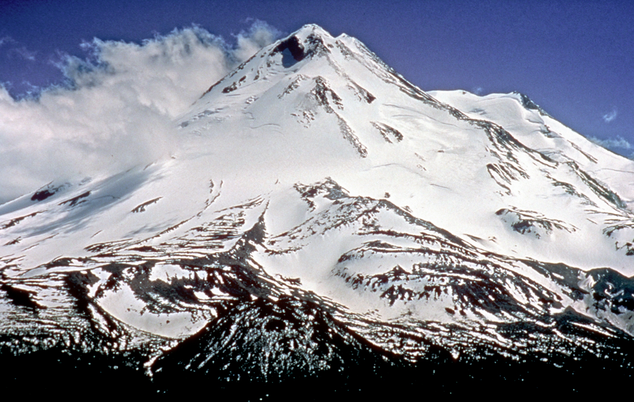
Mount Shasta from the south, taken near Dunsmuir, CaliforniaElevation 14,179 ft (4,322 m) NAVD 88[1] Prominence 9,822 ft (2,994 m) Ranked 96th Parent peak Mount Whitney [2] Listing Ultra Location Location Siskiyou County, California, USA Range Cascade Range Coordinates 41°24′33.11″N 122°11′41.60″W / 41.4091972°N 122.194889°WCoordinates: 41°24′33.11″N 122°11′41.60″W / 41.4091972°N 122.194889°W[1] Topo map USGS Mount Shasta Geology Type Stratovolcano Age of rock About 593,000 years Volcanic arc/belt Cascade Volcanic Arc Last eruption 1786 [3] Climbing First ascent 1854 by E. D. Pearce and party [4] Easiest route Avalanche Gulch ("John Muir") route: talus/snow climb [4] Mount Shasta (Úytaahkoo in Karuk or "White Mountain": the origin of the name "Shasta" is vague, perhaps from Russian (Tchastal, "white, clean, pure") from the early Russian settlers in California) is located at the southern end of the Cascade Range in Siskiyou County, California and at 14,179 feet (4,322 m)[1] is the second highest peak in the Cascades and the fifth highest in California. Mount Shasta has an estimated volume of 85 cubic miles (350 km3) which makes it the most voluminous stratovolcano in the Cascade Volcanic Arc.[5][6]
The mountain and its surrounding area are managed by the U.S. Forest Service, Shasta-Trinity National Forest.
Contents
Descriptions
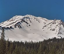
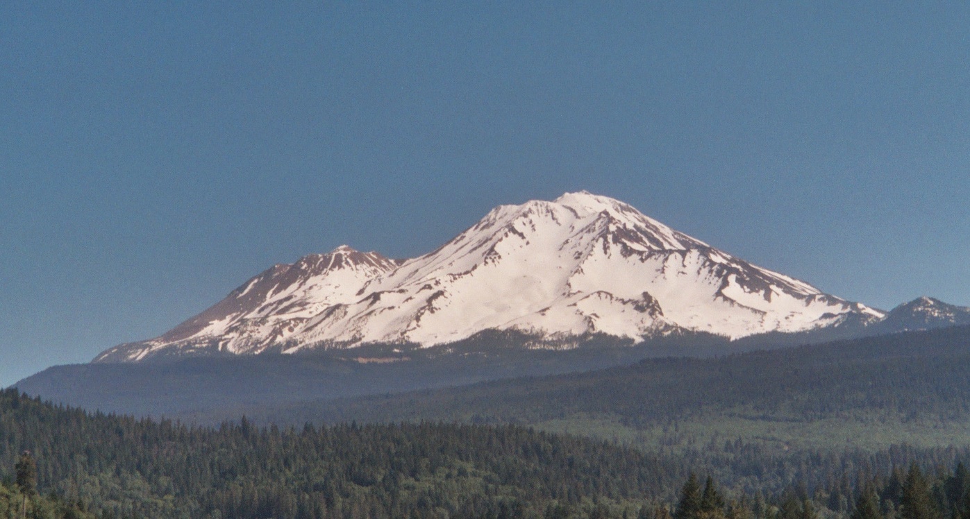
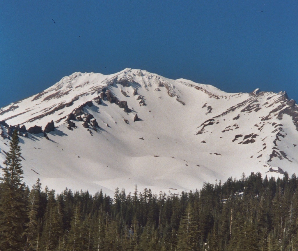
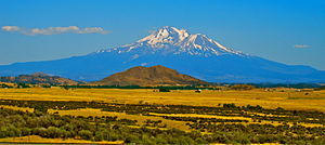 Due to its relative isolation, Mount Shasta has a high degree of vertical relief and is the second-most prominent peak in California. Here it is seen from Interstate 5 near Yreka.
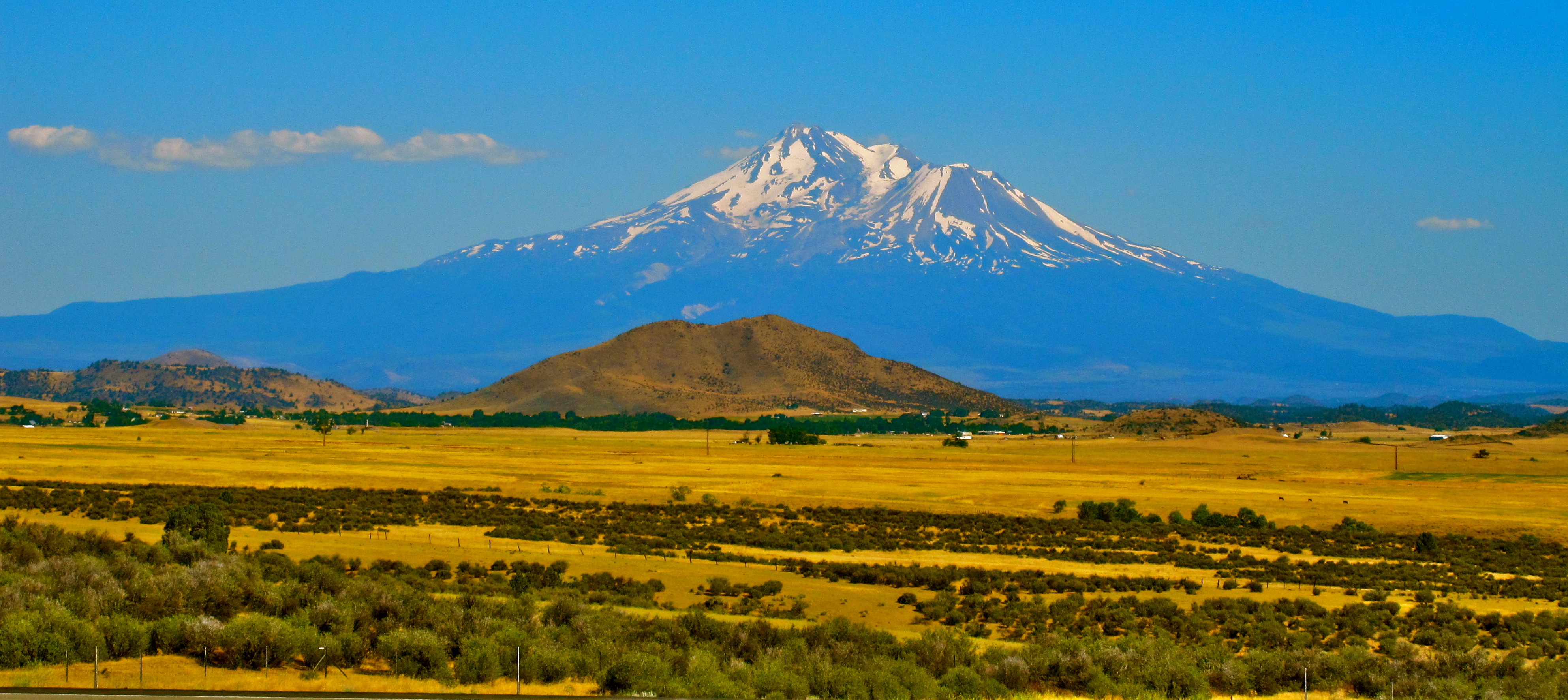
Mount Shasta is not connected to any nearby mountain and dominates the northern California landscape. It rises abruptly and stands nearly 10,000 feet (3,000 m) above the surrounding terrain. On a clear day, Mount Shasta can be seen from 150 miles away. The mountain has attracted the attention of poets, authors, and presidents. Mount Shasta was described by the poet Joaquin Miller:
- "Lonely as God, and white as a winter moon, Mount Shasta starts up sudden and solitary from the heart of the great black forests of Northern California."[7]
Naturalist and author John Muir said of Mount Shasta:
- "When I first caught sight of it over the braided folds of the Sacramento Valley, I was fifty miles away and afoot, alone and weary. Yet all my blood turned to wine, and I have not been weary since."[8]
Theodore Roosevelt said:
- "I consider the evening twilight on Mt. Shasta one of the grandest sights I have ever witnessed."[9]
Geology and climate
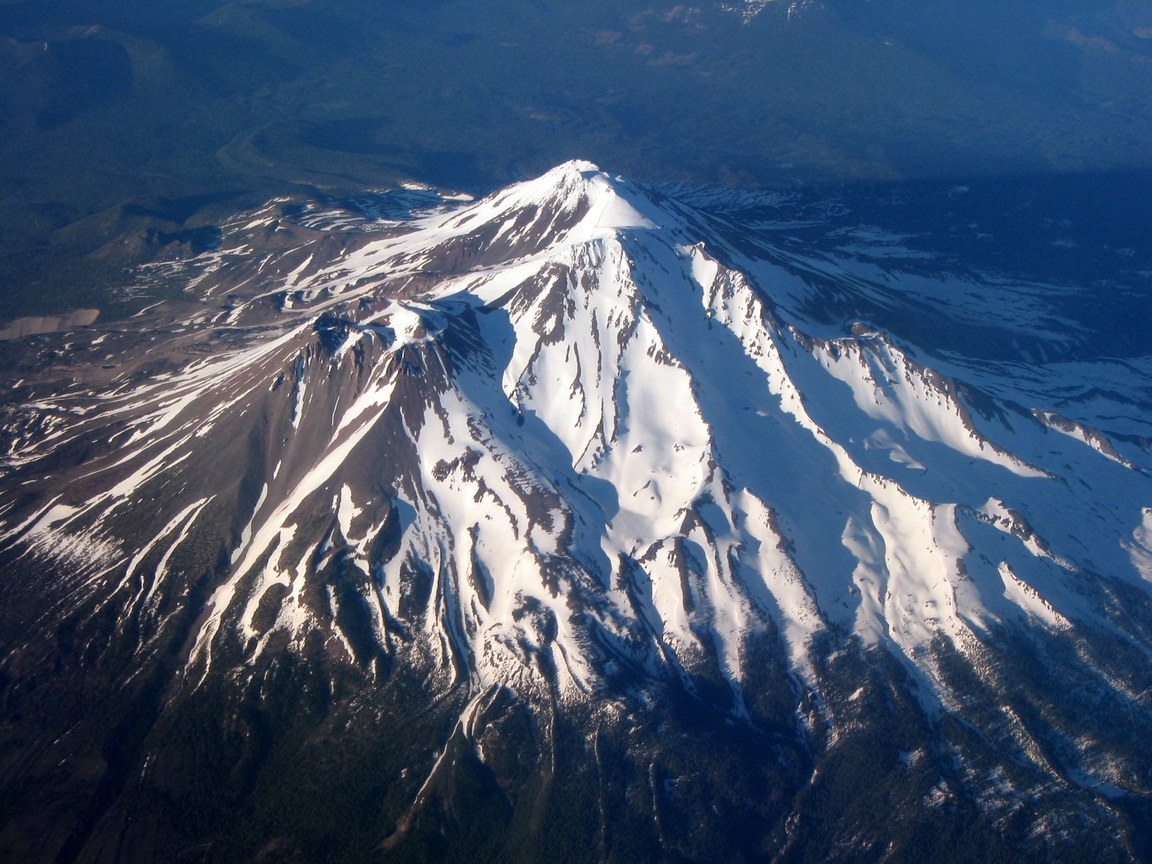
 Aerial view of Mount Shasta from the west.
The mountain consists of four overlapping volcanic cones which have built a complex shape, including the main summit and the prominent satellite cone of 12,330-foot (3,760 m) Shastina, which has a visibly conical form. If Shastina were a separate mountain, it would rank as the fourth-highest peak of the Cascade Range (after Mt. Rainier, Rainier's Liberty Cap, and Mt. Shasta itself).
Mount Shasta's surface is relatively free of deep glacial erosion except, paradoxically, for its south side where Sargents Ridge[10] runs parallel to the U-shaped Avalanche Gulch. This is the largest glacial valley on the volcano, although it does not presently have a glacier in it.
There are seven named glaciers on Mount Shasta, with the four largest (Whitney, Bolam, Hotlum, and Wintun) radiating down from high on the main summit cone to below 10,000 feet (3,000 m) primarily on the north and east sides.[4] The Whitney Glacier is the longest and the Hotlum is the most voluminous glacier in the state of California. Three of the smaller named glaciers occupy cirques near and above 11,000 feet (3,400 m) on the south and southeast sides, including the Watkins, Konwakiton, and Mud Creek Glaciers.
There are many buried glacial scars on the mountain which were originally created in recent glacial periods ("ice ages") of the present Wisconsinian glaciation. Most have since been filled in with andesite lava, pyroclastic flows, and talus from lava domes. Shastina, by comparison, has a fully intact summit crater indicating that Shastina developed after the last ice age.
 Northern side of Mount Shasta
About 593,000 years ago, andesitic lavas erupted in what is now Mount Shasta's western flank near McBride Spring. Over time, an ancestral Mount Shasta stratovolcano was built to a large but unknown height; sometime between 300,000 and 360,000 years ago the entire north side of the volcano collapsed, creating an enormous landslide or debris avalanche, 6.5 cubic miles (27 km3)[11] in volume. The slide flowed northwestward into Shasta Valley, where the Shasta River now cuts through the 28-mile-long (45 km) flow.
What remains of the oldest of Mount Shasta's four cones is exposed at Sargents Ridge on the south side of the mountain. Lavas from the Sargents Ridge vent cover the Everitt Hill shield at Mount Shasta's southern foot. The last lavas to erupt from the vent were hornblende-pyroxene andesites with a hornblende dacite dome at its summit. Glacial erosion has since modified its shape.
The next cone to form is exposed south of Mount Shasta's current summit and is called Misery Hill. It was formed 15,000 to 20,000 years ago from pyroxene andesite flows and has since been intruded by a hornblende dacite dome.
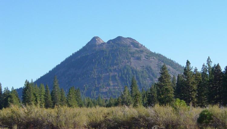
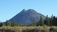 Nearby Black Butte from Weed, California
Since then the Shastina cone has been built by mostly pyroxene andesite lava flows. Some 9,500 years ago, these flows reached about 6.8 miles (10.9 km) south and 3 miles (4.8 km) north of the area now occupied by nearby Black Butte. The last eruptions formed Shastina's present summit about a hundred years later. But before that, Shastina, along with the then forming Black Butte dacite plug dome complex to the west, created numerous pyroclastic flows that covered 43 square miles (110 km2), including large parts of what is now Mount Shasta, California and Weed, California. Diller Canyon (400 feet (120 m) deep and 0.25 miles (400 m) wide) is an avalanche chute that was probably carved into Shastina's western face by these flows.
The last to form, and the highest cone, the Hotlum Cone, formed about 8,000 years ago. It is named after the Hotlum glacier on its northern face; its longest lava flow, the 500-foot-thick (150 m) Military Pass flow, extends 5.5 miles (8.9 km) down its northwest face. Since the creation of the Hotlum Cone, a dacite dome intruded the cone and now forms the summit. The rock at the 600-foot-wide (180 m) summit crater has been extensively hydrothermally altered by sulfurous hot springs and fumaroles there (only a few examples still remain).
In the last 8,000 years, the Hotlum Cone has erupted at least eight or nine times. About 200 years ago the last significant Mount Shasta eruption came from this cone and created a pyroclastic flow, a hot lahar (mudflow), and three cold lahars, which streamed 7.5 miles (12.1 km) down Mount Shasta's east flank via Ash Creek. A separate hot lahar went 12 miles (19 km) down Mud Creek. This eruption was observed by the explorer La Pérouse, from his ship off the California coast, in 1786.[3]
Climbing and recreation
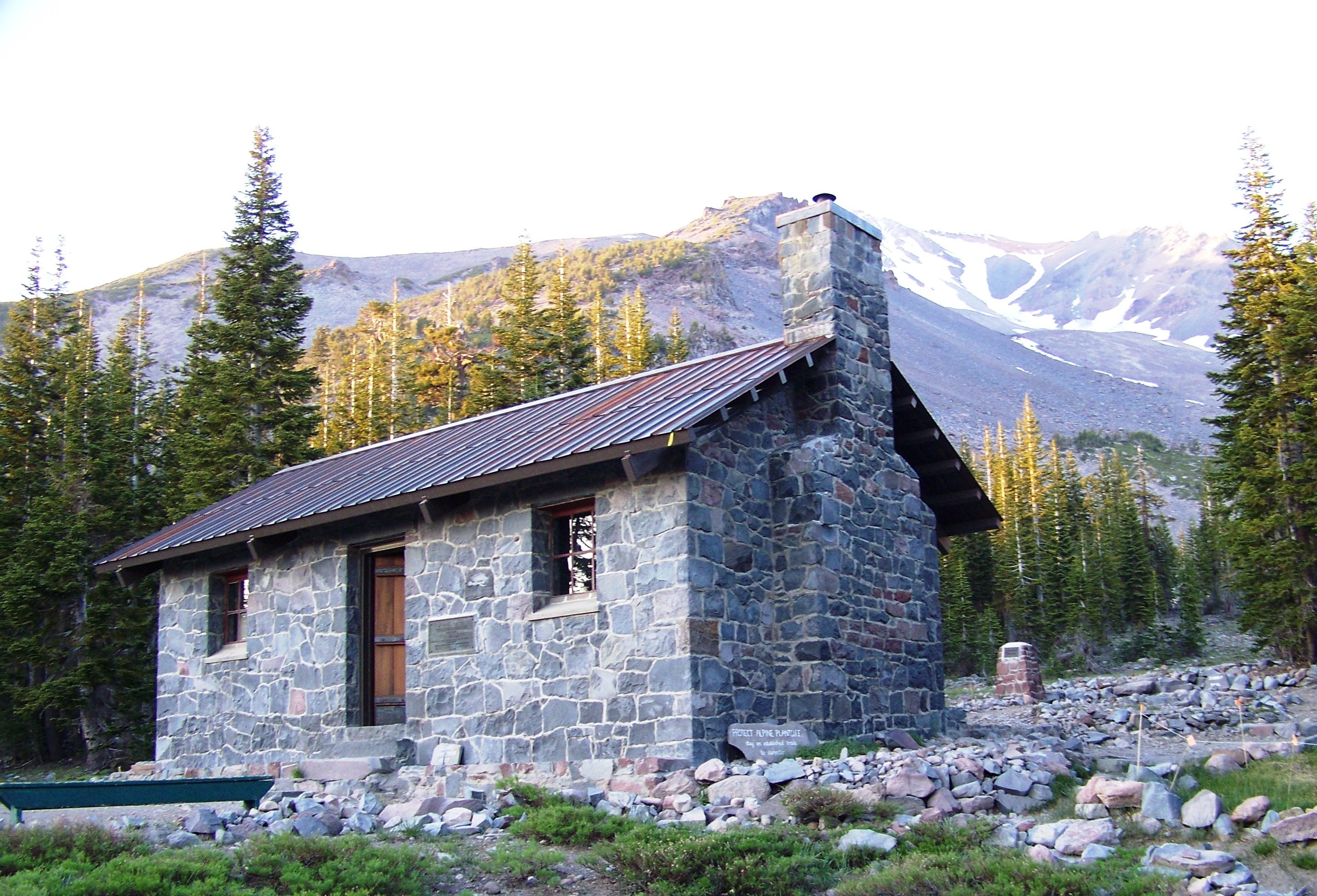
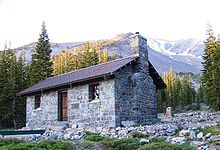 Mount Shasta Alpine Lodge at Horse Camp on Mount Shasta. Avalanche Gulch is to the right of the chimney.
 Mount Shasta's west face. June 2009
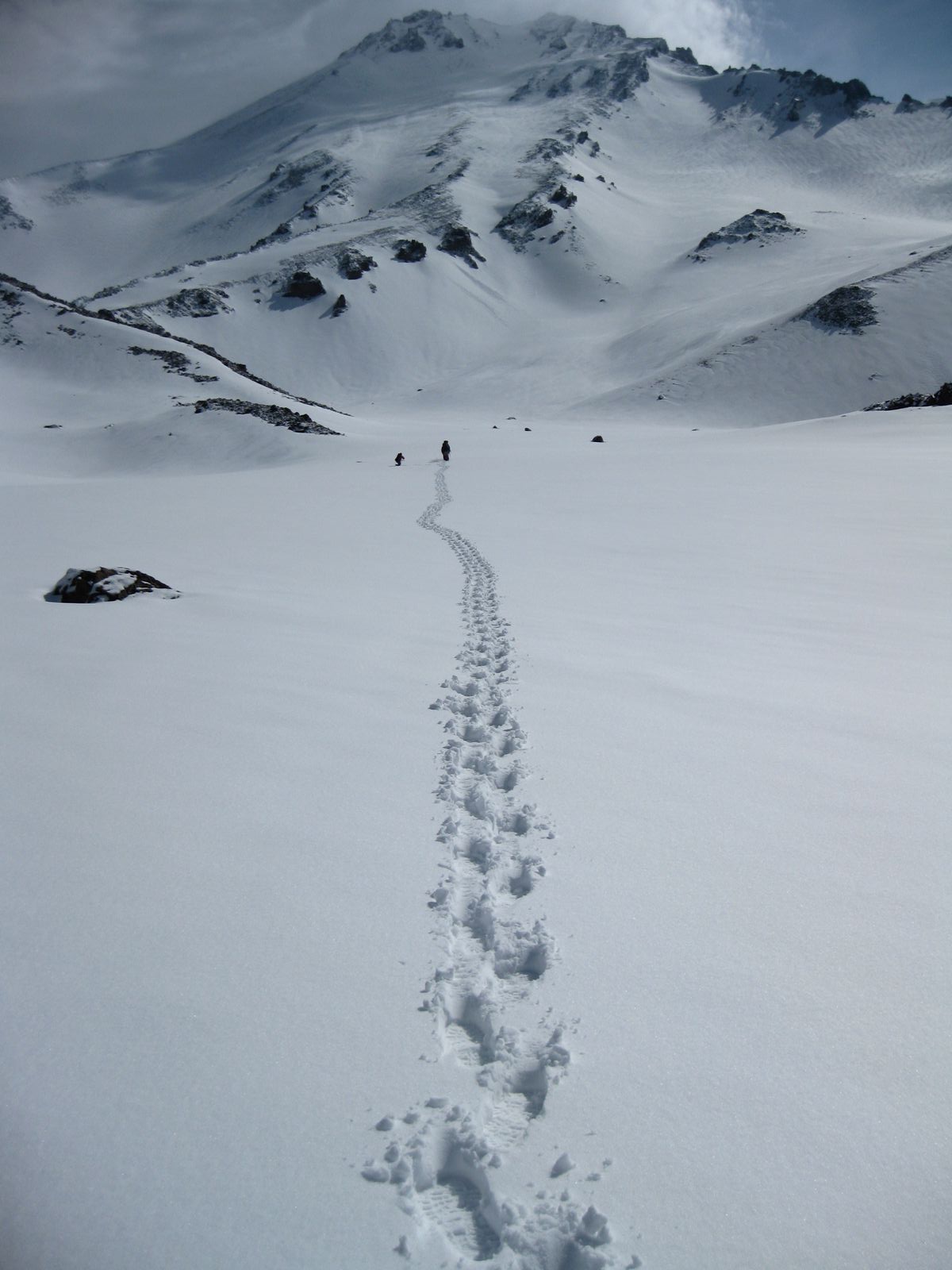
Many climbers attempt the summit of Mount Shasta. The summer climbing season runs from late April until October, although many attempts are made in the winter. The most popular route is Avalanche Gulch, also known as the John Muir Route. It begins at a Sierra Club Foundation hut known as the Mount Shasta Alpine Lodge at Horse Camp, at elevation 7,900 feet (2,400 m) on the southwest side of the mountain, near the tree line. It involves 6,300 feet (1,900 m) of vertical gain over moraines and snowfields, with some danger from rockfall and a bergschrund.[4] Hiking trails also exist in areas around the base of the mountain.[4]
 Avalanche Gulch on Mount Shasta. Sargents Ridge is at center right. Casaval Ridge is at center left, and the west face is on the far left.
In winter, Sargents Ridge and Casaval Ridge, to the east and west of Avalanche Gulch[12] respectively, become the most traveled routes, to avoid avalanche danger. Mount Shasta is also a popular destination for backcountry skiing. Many of the climbing routes can be descended by experienced skiers, and there are numerous lower-angled areas around the base of the mountain.[4]
Volcanic hazards
 Diller Canyon on Shastina from Weed, California; pyroclastic flows and other volcanic deposits are under the towns of Weed and nearby Mount Shasta.
During the last 10,000 years Mount Shasta has erupted an average of every 800 years but in the past 4,500 years the volcano has erupted an average of every 600 years. The last significant eruption on Mount Shasta may have occurred 200 years ago.
Mount Shasta can release volcanic ash, pyroclastic flows or dacite and andesite lava. Its deposits can be detected under nearby small towns totaling 20,000 in population. Mount Shasta has an explosive, eruptive history. There are fumaroles on the mountain, which show that Mount Shasta is still alive.
The worst case scenario for an eruption is a large pyroclastic flow, such as what occurred in the 1980 eruption of Mount St. Helens. Since there is ice, such as Whitney Glacier and Mud Creek Glacier, lahars would also result. Ash would probably blow inland, perhaps as far as eastern Nevada. There is a small chance that an eruption could also be bigger resulting in a collapse of the mountain, as happened when Mount Mazama in Oregon collapsed to form what is now called Crater Lake, but this is of much lower probability.
The United States Geological Survey considers Mount Shasta a dormant volcano, which will erupt again. It is impossible to pinpoint the date of next eruption, but it likely will occur within the next several hundred years.
History
The oldest known human habitation in the area dates to about 7,000 years ago, and by about 5,000 years ago, there was substantial human habitation in the surrounding area.
At the time of Euro-American contact in the 1820s, the Native American tribes who lived within view of Mount Shasta included the Shasta, Okwanuchu, Modoc, Achomawi, Atsugewi, Karuk, Klamath, Wintu, and Yana tribes.
The historic eruption of Mount Shasta in 1786 may have been observed by Lapérouse, but this is disputed. Although perhaps first seen by Spanish explorers, the first reliably-reported land sighting of Mount Shasta by a European or American was by Peter Skene Ogden (a leader of a Hudson's Bay Company trapping brigade) in 1826. In 1827, the name "Sasty" or "Sastise" was given to nearby Mount McLoughlin by Ogden.[13] The name was transferred to present-day Mount Shasta in 1841, partly as a result of work by the United States Exploring Expedition.
Beginning in the 1820s, Mount Shasta was a prominent landmark along what became known as the Siskiyou Trail, which runs at Mount Shasta's base. The Siskiyou Trail was located on the track of an ancient trade and travel route of Native American footpaths between California's Central Valley and the Pacific Northwest.
The California Gold Rush brought the first Euro-American settlements into the area in the early 1850s, including at Yreka, California and Upper Soda Springs. The first recorded ascent of Mount Shasta occurred in 1854 (by Elias Pearce), after several earlier failed attempts. In 1856, the first women (Harriette Eddy, Mary Campbell McCloud, and their party) reached the summit.
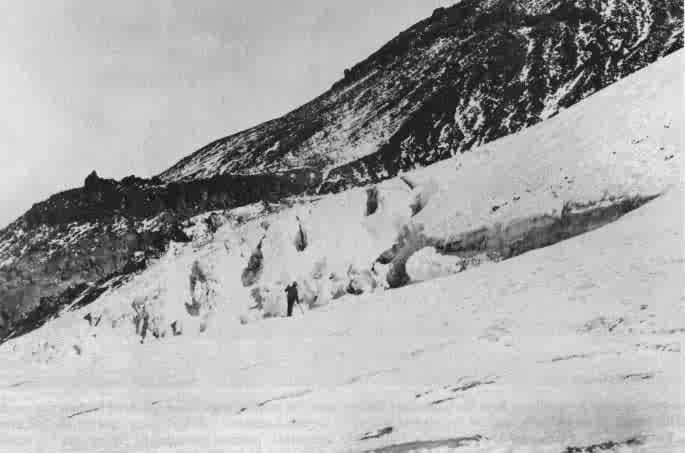
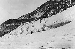 Clarence King exploring the Whitney Glacier in 1870. This was the first glacier in the continental United States discovered and named. It was named for Josiah Whitney, head of the California Geological Survey.
By the 1860s and 1870s, Mount Shasta was the subject of scientific and literary interest. A magazine by California pioneer and entrepreneur James Hutchings, titled Hutchings' California Magazine, contained an account of an early summit trip in 1855 in its May 1857 issue.[14] The summit was achieved (or nearly achieved) by John Muir, Josiah Whitney, Clarence King, and John Wesley Powell. In 1877, Muir wrote a dramatic popular article about an experience in which he survived an overnight blizzard on Mount Shasta by lying in the hot sulfur springs found near the summit.[15]
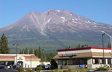
The 1887 completion of the Central Pacific Railroad, built along the line of the Siskiyou Trail between California and Oregon, brought a substantial increase in tourism, lumbering, and population into the area around Mount Shasta. Early resorts and hotels, such as Shasta Springs, grew up along the Siskiyou Trail around Mount Shasta, catering to these early adventuresome tourists and mountaineers.
In the early Twentieth century, the Pacific Highway followed the track of the Siskiyou Trail to the base of Mount Shasta, leading to still more access to the mountain. Today's version of the Siskiyou Trail, Interstate 5, brings thousands of people a year to Mount Shasta.
February 13–19, 1959 the Mount Shasta Ski Bowl obtained the record of 15.75 feet (480 cm) for the most snowfall during one storm in the U.S.[16]
It was declared a National Natural Landmark in December 1976.[17]
Religious and spiritual activities
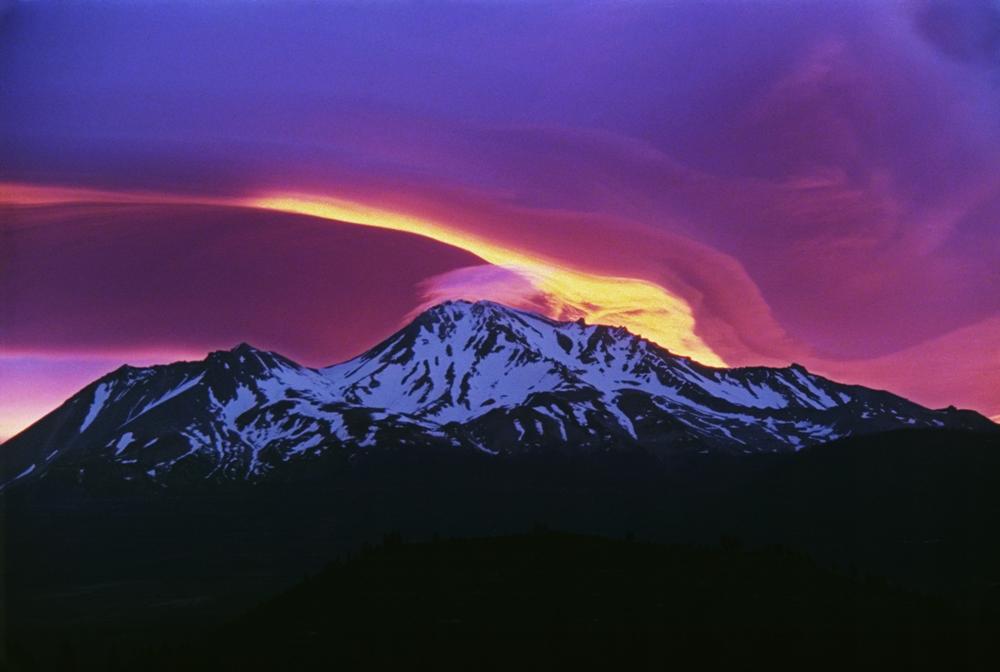
 Sunrise on Mount Shasta
The lore of some of the Native Americans in the area held that Mount Shasta is inhabited by the spirit chief Skell who descended from heaven to the mountain's summit.
Among the many settlers in the area, Italian settlers arrived in the early 1900s to work in the mills and as stonemasons, establishing a strong Catholic presence in the area. Many other faiths have been attracted to Mount Shasta over the years—more than any other Cascade volcano. Mount Shasta City and Dunsmuir, California, small towns near Shasta's western base, are focal points for many of these, which range from a Buddhist monastery (Shasta Abbey, founded by Houn Jiyu-Kennett in 1971) to modern-day Native American rituals. A group of Native Americans from the McCloud River area practice rituals on the mountain.[18]
Mount Shasta has been a focus for non-native American legends, centered around a hidden city of advanced beings from the lost continent of Lemuria.[19] The legend grew from an offhand mention of Lemuria in the 1880s, to a description of a hidden Lemurian village in 1925. In 1931, Wisar Spenle Cerve wrote a book, published by the Rosicrucians, about the hidden Lemurians of Mount Shasta that cemented the legend in many readers' minds.[19]
Guy Ballard's "I AM" Activity (started in the 1930s) and Elizabeth Clare Prophet's Church Universal and Triumphant (started in the 1950s) are probably the best-known among numerous groups to participate in Mount Shasta's spiritual heritage.
In August 1987, believers in the spiritual significance of the Harmonic Convergence described Mount Shasta as one of a small number of global "power centers".[20] Mount Shasta remains a focus of "New Age" attention.[21]
Cultural references
- Joaquin Miller sets his historical novel, Life Amongst the Modocs,[7] at the base of Mount Shasta. The poet had spent a number of years as a young man living with and near the Native Americans around Mount Shasta, and based this work on that time.
- Frederick Spencer Oliver's 1894 novel, A Dweller on Two Planets, is about the Lemurian race. In the novel, Lemurians who traveled to Mount Shasta when their continent sank beneath the Pacific Ocean, are now said to live inside the mountain in a series of tunnels. Several other authors have since expanded on these ideas.[22][23]
- Vienna Teng has a song on her album Warm Strangers entitled Shasta (Carrie's Song), in which a young woman travels past the mountain on her way to obtaining an abortion.
See also
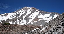 Mount Shasta's west face, as seen from Hidden Valley high on the mountain. The west face gulley is an alternate climbing route to the summit.
- California 4000 meter peaks
- Cascade Range
- Geology of the Pacific Northwest
- Lemuria
- Legends of Mount Shasta
- List of California fourteeners
- List of highest points in California by county
- Mountain peaks of California
- Mountain peaks of North America
- Mountain peaks of the United States
- Volcanic Legacy Scenic Byway
Notes
- ^ a b c "Mount Shasta". NGS data sheet. U.S. National Geodetic Survey. http://www.ngs.noaa.gov/cgi-bin/ds_mark.prl?PidBox=MX1016. Retrieved 2009-08-14.
- ^ "America's 57 - The Ultras". Peaklist.org. http://www.PeakList.org/USlists/USP5000.html. Retrieved 2008-09-28.
- ^ a b "Mount Shasta". Global Volcanism Program, Smithsonian Institution. http://www.volcano.si.edu/world/volcano.cfm?vnum=1203-01-. Retrieved 2008-12-18.
- ^ a b c d e f Selters, Andy; Michael Zanger (2006). The Mt. Shasta Book (3rd ed.). Wilderness Press. ISBN 0-89997-404-X.
- ^ Orr, Elizabeth L.; William N. Orr (1996). Geology of the Pacific Northwest. New York: The McGraw-Hill Companies. p. 115. ISBN 0-07-048018-4.
- ^ "Mount Shasta and Vicinity, California". USGS. http://vulcan.wr.usgs.gov/Volcanoes/Shasta/description_shasta.html. Retrieved 2009-10-22.
- ^ a b Miller, Joaquin; Malcolm Margolin; Alan Rosenus (January 1996) [1873]. Life amongst the Modocs: unwritten history. Berkeley: Urion Press (distributed by Heyday Books). ISBN 0-930588-79-7.
- ^ Muir, John 1838-1914. Letters, 1874-1888, of a personal nature, about Mount Shasta. In: Bade, William Frederic. The Life and Letters of John Muir. New York: Houghton Mifflin Co., 1923. Vol. II, pp. 29-41, 49-50, 82-85, 219. Two Volumes. Cited at Mt. Shasta Collection MS176 (spelling corrected to modern spelling). Retrieved 2008-04-08.
- ^ Roosevelt, Theodore 1858-1919. Letter to Harrie Cassie Best, dated Nov. 12, 1908, White House. In: James, George Wharton 1858-1923. Harry Cassie Best: Painter of the Yosemite Valley, California Oaks, and California Mountains. 1930? p. 18. Cited at Mt. Shasta Collection MS1032. Retrieved 2008-04-08.
- ^ "Sargents Ridge". Geographic Names Information System. United States Geological Survey. http://geonames.usgs.gov/pls/gnispublic/f?p=gnispq:3:::NO::P3_FID:265849. Retrieved 2008-04-19.
- ^ Sigurdsson, Haraldur (2001). Encyclopedia of Volcanoes. Academic Press. ISBN 0-12-643140-X.
- ^ "Avalanche Gulch". Geographic Names Information System. United States Geological Survey. http://geonames.usgs.gov/pls/gnispublic/f?p=gnispq:3:::NO::P3_FID:256378. Retrieved 2008-04-19.
- ^ "History". College of the Siskiyous. 1989. http://www.siskiyous.edu/shasta/his/index.htm. Retrieved 2010-03-31.
- ^ Scenes of Wonder and Curiosity in California, (1862) by James M. Hutchings
- ^ Snow-Storm on Mount Shasta
- ^ "Sierra Snowfall". Welcome to the Storm King. Mic Mac Publishing. 28 Jan 2011. http://www.thestormking.com/Weather/Sierra_Snowfall/sierra_snowfall.html.
- ^ "Mount Shasta". NPS: Nature & Science » National Natural Landmarks. National Park Service. http://www.nature.nps.gov/nnl/Registry/USA_Map/States/California/NNL/MS/index.cfm. Retrieved 2008-04-07.
- ^ "In The Light of Reverence". POV. Public Broadcasting Service. http://www.pbs.org/pov/inthelightofreverence/.
- ^ a b "The Origin of the Lemurian Legend". Folklore of Mount Shasta. College of the Siskiyous. http://www.siskiyous.edu/shasta/fol/lem/index.htm.
- ^ "Harmonic Convergence". College of the Siskiyous. 1989. http://www.siskiyous.edu/shasta/fol/har/index.htm. Retrieved 2010-03-31.
- ^ "Legends: Ascended Masters". College of the Siskiyous. 1989. http://www.siskiyous.edu/shasta/bib/B17.htm. Retrieved 2010-03-31.
- ^ L. Sprague De Camp (1970). Lost Continents, Courier Dover Publications, pp 71-72. ISBN 0486226689.
- ^ Robert A. Heinlein (1941). Lost Legacy, Fictioneers, Inc.
References
- Crandell, D. R.; C. D. Miller, H. X. Glicken, R. L. Christiansen and C. G. Newhall (March 1984). "Catastrophic debris avalanche from ancestral Mount Shasta volcano, California". Geology 12 (3): 143–146. doi:10.1130/0091-7613(1984)12<143:CDAFAM>2.0.CO;2.
- Harris, Stephen L. (2005). Fire Mountains of the West: The Cascade and Mono Lake Volcanoes (3rd ed.). Mountain Press Publishing Company. ISBN 0-87842-511-X.
- Mount Shasta Collection at College of the Siskiyous
- Miesse, William C. (June 17, 2005). "Mount Shasta Fact Sheet". College of the Siskiyous Library. http://www.siskiyous.edu/library/shasta/factsheet/. Retrieved 2006-02-11.
- Miesse, William C. "The Name 'Shasta'". Mt. Shasta Annotated Bibliography. College of the Siskiyous Library. http://www.siskiyous.edu/shasta/bib/B14.htm. Retrieved 2006-02-11.
- Mount Shasta Collection: First women to summit
- Peninsula Geological Society and Stanford GES-052Q combined field trip, Mount Shasta-Klamath Northern Coast Range area, NW California, 05/17-05/20/2001 accessed 2008-01-25.
- Wood, Charles A.; Jürgen Kienle, eds. (1990). Volcanoes of North America. Cambridge University Press. ISBN 0-521-43811-X.
- Zanger, Michael (1992). Mt. Shasta: History, Legend, Lore. Celestial Arts. ISBN 0-89087-674-6.
- Crandell, D.R. and D.R. Nichols. (1987). Volcanic hazards at Mount Shasta, California. Reston, VA: U.S. Department of the Interior, U.S. Geological Survey.
- Miesse, William C. (2008). Sudden and solitary: Mount Shasta and its artistic legacy, 1841-2008. Berkeley, CA: Heyday Books.
External links
- "Mount Shasta Webcam". http://www.shastacam.com/. Retrieved 2011-05-08.
- "Live webcam". SnowCrest Inc.. http://www.snowcrest.net/camera/. Retrieved 2011-05-08.
- "Sisson Museum". http://www.mountshastasissonmuseum.org/index.htm. Retrieved 2011-05-08.
- "Museum of the Siskiyou Trail". http://museumsiskiyoutrail.org. Retrieved 2011-05-08.
- "Mount Shasta on Summitpost.org". SummitPost.org. http://www.summitpost.org/page/150188. Retrieved 2011-05-07.
- "Mount Shasta". Peakbagger.com. http://www.peakbagger.com/peak.aspx?pid=2477. Retrieved 2011-05-07.
- "Mount Shasta". Bivouac.com. http://www.bivouac.com/MtnPg.asp?MtnId=9144. Retrieved 2011-05-07.
- "Geology of Mount Shasta". College of the Siskiyous. http://www.siskiyous.edu/shasta/geo/. Retrieved 2011-05-08.
- "Mt. Shasta Climber's Guide". ClimbingMtShasta.org. http://www.climbingmtshasta.org/. Retrieved 2011-05-08.
- "Summiting the Volcano". Vimeo.com. http://vimeo.com/12878599. Retrieved 2011-05-08.
- "Land of the Giants". Vimeo.com. http://vimeo.com/8138267. Retrieved 2011-05-08.
- "Mount Shasta Climbing Above Red Banks". Timberline Trails. http://www.timberlinetrails.net/ShastaAboveRedBanks.html. Retrieved 2011-05-08.
Glaciers of Mount Shasta Cascade Volcanoes British Columbia 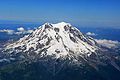
Washington Oregon California Categories:- Mount Shasta
- Fourteeners of California
- Native American mythology of California
- Religious places of the indigenous peoples of North America
- Volcanoes of Siskiyou County, California
- Landforms of Siskiyou County, California
- Stratovolcanoes
- Mountains of Siskiyou County, California
- National Natural Landmarks in California
- Sacred mountains
- Hot springs of California
- Subduction volcanoes
- Cascade Volcanoes
- UFO-related locations
- Visitor attractions in Siskiyou County, California


Wikimedia Foundation. 2010.