- Dunsmuir, California
-
City of Dunsmuir — City — Location in Siskiyou County and the state of California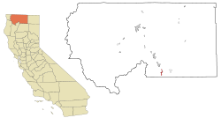
Coordinates: 41°13′18″N 122°16′23″W / 41.22167°N 122.27306°WCoordinates: 41°13′18″N 122°16′23″W / 41.22167°N 122.27306°W Country  United States
State  California
County Siskiyou Area[1] – Total 1.735 sq mi (4.494 km2) – Land 1.698 sq mi (4.398 km2) – Water 0.037 sq mi (0.096 km2) 2.14% Elevation 2,280 ft (695 m) Population (2010) – Total 1,650 – Density 951/sq mi (367.2/km2) Time zone Pacific (PST) (UTC-8) – Summer (DST) PDT (UTC-7) ZIP code 96025 Area code(s) 530 FIPS code 06-20242 GNIS feature ID 277501 Website http://ci.dunsmuir.ca.us/n/cod/ Dunsmuir is a city in Siskiyou County, California, United States. The population was 1,650 at the 2010 census, down from 1,923 at the 2000 census. It is currently a hub of tourism in Northern California as visitors enjoy fishing, skiing, climbing, or sight-seeing. During steam engine days, it was notable for being the site of an important Central Pacific (and later Southern Pacific) railroad yard, where extra steam locomotives were added to assist trains on the grade to the north.[2]
Contents
Commerce and tourism
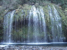
Located in the Shasta Cascade area of Northern California, Dunsmuir is a popular destination for tourists. Visitors come to trout fish in the Sacramento and McCloud Rivers, or to see and climb Mount Shasta, Castle Crags or the Trinity Alps. Visitors ski (both alpine and cross-country) and bicycle, or can hike to the waterfalls, streams and lakes in the area, including nearby Mossbrae Falls, Lake Siskiyou, Castle Lake and Shasta Lake.
The town is also a destination for historical and cultural tourists, as the town has preserved an authentic 1920s and 1930s look and feel. Dunsmuir's long connection with the railroad draws railfans to enjoy the sights and sounds of the railroad in the steep Sacramento River canyon. Fly fishing is allowed all year round in town (catch and release in Winter) and skiing is close by at Mount Shasta Ski Park.
Dunsmuir has frequent events that draw people from far and wide. In 2010 local concerts featured Charlie Musselwhite, the Palo Alto Chamber Orchestra and Janis Joplin's original band, Big Brother & The Holding company, the later held in the City Ball Park where Babe Ruth and some of the Yankee's played with the local boys. Regular musical entertainment is regularly featured at the new Dunsmuir Brewery Works & Pub and several other local venues, and at local weekend festivals including a celebration of the City's official tree, Dogwood Daze as well as Railroad Days and the Tribute to the Trees concert held al fresco along the river in the City's pristine park, The Dunsmuir Botanical Gardens.
History
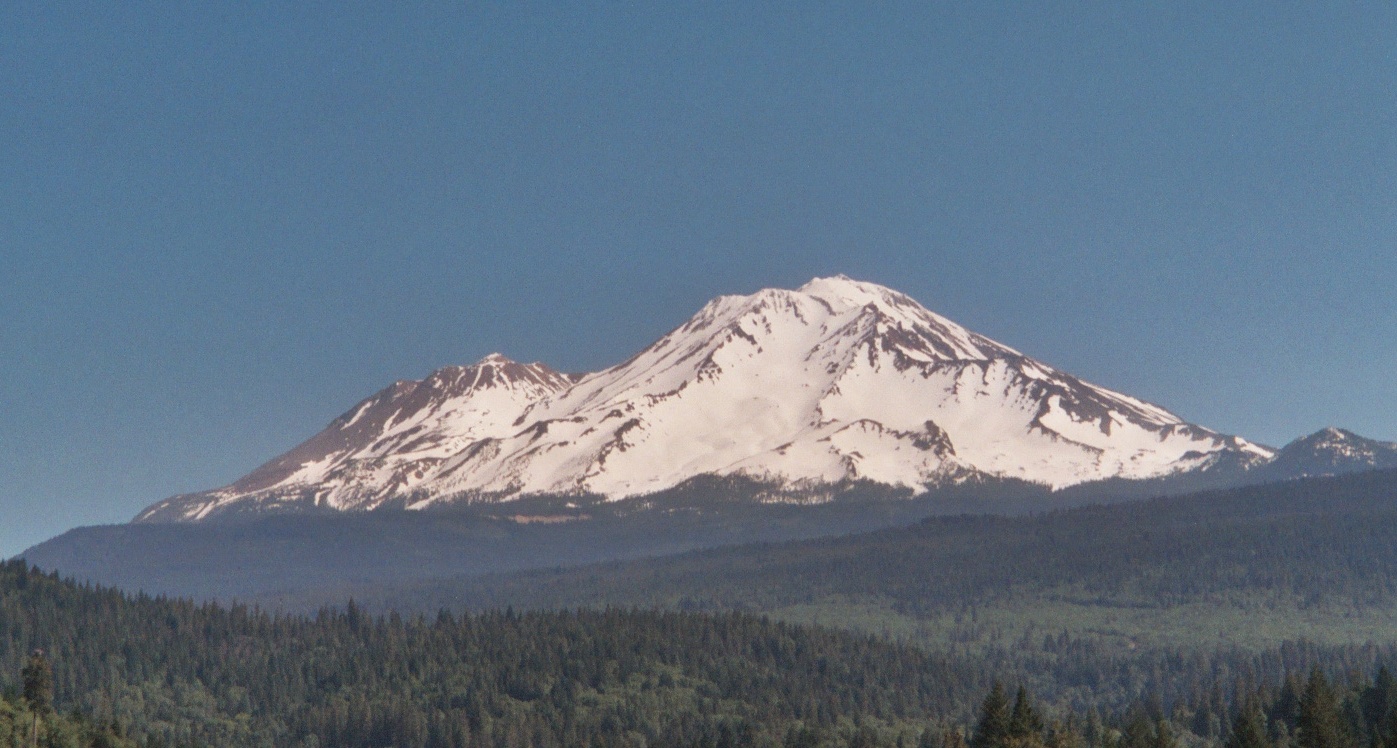
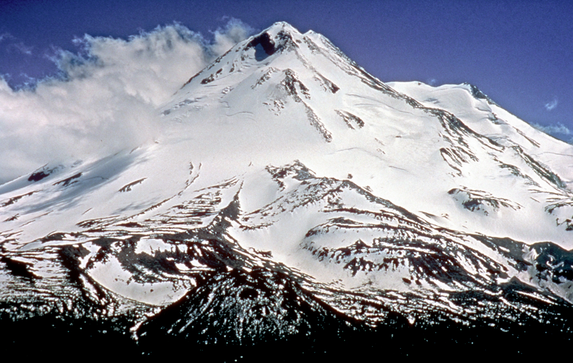
 Mount Shasta as viewed from Dunsmuir.
Sites in and near Dunsmuir have been inhabited for over 5000 years. At least three waves of early peoples swept through area, establishing residence. At the time of the first European-American contact in the 1820s, the site of Dunsmuir was within the range of the Okwanuchu tribe of Native Americans.
During the 1820s, early European-American hunters and trappers passed through Dunsmuir's site, following the Siskiyou Trail. In the mid-1830s, pioneer horse and cattle drives came up the Sacramento Canyon, delivering livestock from Mexican California to the new settlements in the Oregon Country to the north. In 1841, an overland party of the famous United States Exploring Expedition passed through the area.
The California Gold Rush led to increased traffic along the Siskiyou Trail through Dunsmuir's site, leading to the first non-Native American settlers at Upper Soda Springs in north Dunsmuir in the early 1850s. The discovery of gold at Yreka, California dramatically increased movement through the site of Dunsmuir, and a toll bridge and stagecoach hotel were built at Upper Soda Springs.
In 1887, the completion of the Central Pacific Railroad along the line of the Siskiyou Trail led to the creation of the modern town of Dunsmuir. The railroad developed a division point on the flats south of Upper Soda Springs, where railroad steam engines would be serviced, and added to trains to push them up the steep grades north of town. A roundhouse and turntable were built. All this activity required the creation of a town, initially known as 'Poverty Flats' or 'Pusher'. South of the present downtown and north of Castella is an area known as Nutglade, which was previously known as Dunsmuir and before that, Cedar Flat. So the name moved north from the South rail yard to the main rail yard. During the railroad heyday, Dunsmuir was the largest town in this County which is the size of Delaware and Rhode Island combined.
In 1888, British Columbian coal baron Alexander Dunsmuir was passing through the little development, and according to contemporary accounts, was so taken with the beauty of the area that he offered to donate a fountain to the new town, if they would name the town in his honor. The offer was accepted, and Dunsmuir's fountain remains operational near the City Park.
By the early 1900s, Dunsmuir was the largest town in Siskiyou County, and for a long time had been the largest California city north of Sacramento. The construction of the Pacific Highway along the Siskiyou Trail in the mid-1910s brought more tourists. By the mid-1950s, the railroad transitioned from steam to diesel locomotives, and the substantial workforce in Dunsmuir was not needed, resulting in the town's contraction.
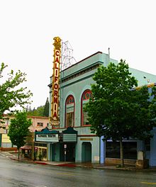 California Theater
As a result, Dunsmuir retains today much of the charm and scale of the 1920s and 1930s, and has been designated on the National Register of Historic Places. The downtown area is now a designated historic district. The painted signage is remarkable.
In July 1935, two fugitives were passing through town. Police Chief F.R. "Jack" Daw, and California Highway Patrol Officer C. "Doc" Malone went to catch them. The criminals ambushed the officers wounding Officer Malone and killing Chief Daw. One of the criminals, Clyde Johnson, was caught and put in jail in Yreka to await trial. A group of vigilantes from Dunsmuir went to Yreka, broke Johnson out of jail and lynched him. To this day the identity of those vigilantes has never been formally acknowledged. It is said to have been the last public lynching in California.[3]
On the night of July 14, 1991, a derailment on a horseshoe curve known as the "Cantara Loop" on the railroad north of Dunsmuir (then owned by the Southern Pacific Railroad) resulted in the release of approximately 19,000 gallons of metam sodium spilled into the Sacramento River.[4][5][6] The biocide killed every living thing in the river for a distance of some 38 miles (61 km), devastating a popular fly fishing area—one of the most severe toxic spills in U.S. history.
The Upper Sacramento River is now largely recovered from the spill though some species (crayfish and frogs) have not yet come back. The watershed is carefully stewarded by The Upper Sacramento River Exchange. The once-popular fishery is again healthy. Recent changes to angling regulations have opened the Upper Sacramento River to catch-and-release fishing all year round. Five pound trout have often been caught right in the City.
Weather
Dunsmuir has cold rainy and snowy winters and hot dry summers. Its climate is similar to nearby cities, Yreka and Medford (about ninety miles north in the state of Oregon). There are an average of 54.3 days with highs of 90 °F (32 °C) or higher and an average of 99.7 days with lows of 32 °F (0 °C) or lower. The record high was 109 °F (43 °C) on August 8, 1981, and the record low was 4 °F (−16 °C) on December 21, 1990.
The average annual precipitation is 63.31 inches (160.8 cm). There are an average of 98 days with measurable precipitation. The wettest year was 1983 with 117.47 inches (298.4 cm) and the dryest year was 1976 with 23.72 inches (60.2 cm). The most rainfall in one month was 39.20 inches (99.6 cm) in January 1995. The most rainfall in 24 hours was 6.44 inches (16.4 cm) on January 1, 1997. Snowfall averages 29.2 inches (74 cm). The most snowfall in one year was 226.6 inches (576 cm) in 1952, including 119.5 inches (304 cm) in January 1952.[7]
Climate data for Dunsmuir, California Month Jan Feb Mar Apr May Jun Jul Aug Sep Oct Nov Dec Year Average high °F (°C) 50
(10)54
(12)58
(14)65
(18)74
(23)82
(28)90
(32)89
(32)83
(28)73
(23)57
(14)51
(11)69 Average low °F (°C) 28
(−2)29
(−2)31
(−1)35
(2)41
(5)47
(8)51
(11)49
(9)45
(7)38
(3)32
(0)29
(−2)38 Precipitation inches (mm) 11.39
(289.3)10.38
(263.7)9.50
(241.3)4.14
(105.2)2.55
(64.8)0.99
(25.1)0.34
(8.6)0.36
(9.1)1.35
(34.3)3.22
(81.8)7.90
(200.7)9.16
(232.7)61.28
(1,556.5)Source: [8] Geography
Dunsmuir is located at 41°13′18″N 122°16′23″W / 41.22167°N 122.27306°W[9].
According to the United States Census Bureau, the city has a total area of 1.7 square miles (4.4 km2), 97.86% of it land and 2.14% of it water.
The City is the site of the historic park being developed at Upper Soda Springs on the path of the Siskiyou Trail along the Sacramento River.
At an elevation of approximately 2,350 feet (720 m) above sea level, a unique setting is created by the Sacramento River in which class 3 whitewater rapids are usually created during summer run off through a town of about 2,000 residents. In plain view from some of the city's public streets, this may be one of the few places in western North America where three categories of "twos" (population, elevation, and whitewater difficulty) are met or eclipsed. (Eastern US example-The Cherry River at Richwood, WV)
Mt. Shasta's caverns filter the drinking water and eliminate the need for filtration or treatment thus the town's marketing slogan, "Home Of The Best Water On Earth"℠.[10] Three water fountains are located on Dunsmuir Avenue in the Historic District. Two of them run 24 hours a day.
Elevation: 2,347 feet (715 m)
Demographics
2010
The 2010 United States Census[11] reported that Dunsmuir had a population of 1,650. The population density was 951.0 people per square mile (367.2/km²). The racial makeup of Dunsmuir was 1,443 (87.5%) White, 32 (1.9%) African American, 17 (1.0%) Native American, 15 (0.9%) Asian, 4 (0.2%) Pacific Islander, 30 (1.8%) from other races, and 109 (6.6%) from two or more races. Hispanic or Latino of any race were 167 persons (10.1%).
The Census reported that 1,650 people (100% of the population) lived in households, 0 (0%) lived in non-institutionalized group quarters, and 0 (0%) were institutionalized.
There were 763 households, out of which 180 (23.6%) had children under the age of 18 living in them, 276 (36.2%) were opposite-sex married couples living together, 84 (11.0%) had a female householder with no husband present, 51 (6.7%) had a male householder with no wife present. There were 80 (10.5%) unmarried opposite-sex partnerships, and 6 (0.8%) same-sex married couples or partnerships. 271 households (35.5%) were made up of individuals and 99 (13.0%) had someone living alone who was 65 years of age or older. The average household size was 2.16. There were 411 families (53.9% of all households); the average family size was 2.77.
The population was spread out with 320 people (19.4%) under the age of 18, 110 people (6.7%) aged 18 to 24, 354 people (21.5%) aged 25 to 44, 584 people (35.4%) aged 45 to 64, and 282 people (17.1%) who were 65 years of age or older. The median age was 47.0 years. For every 100 females there were 105.7 males. For every 100 females age 18 and over, there were 101.2 males.
There were 1,110 housing units at an average density of 639.8 per square mile (247.0/km²), of which 416 (54.5%) were owner-occupied, and 347 (45.5%) were occupied by renters. The homeowner vacancy rate was 2.8%; the rental vacancy rate was 15.6%. 886 people (53.7% of the population) lived in owner-occupied housing units and 764 people (46.3%) lived in rental housing units.
2000
As of the census[12] of 2000, there were 1,923 people, 867 households, and 491 families residing in the city. The population density was 1,062.1 people per square mile (410.2/km²). There were 1,170 housing units at an average density of 646.2 per square mile (249.6/km²). The racial makeup of the city was 90.64% White, 1.87% African American, 1.98% Native American, 0.52% Asian, 0.05% Pacific Islander, 2.34% from other races, and 2.60% from two or more races. Hispanic or Latino of any race were 9.93% of the population.
There were 867 households out of which 23.6% had children under the age of 18 living with them, 43.1% were married couples living together, 10.3% had a female householder with no husband present, and 43.3% were non-families. 35.4% of all households were made up of individuals and 16.4% had someone living alone who was 65 years of age or older. The average household size was 2.22 and the average family size was 2.84.
In the city the population was spread out with 22.4% under the age of 18, 6.8% from 18 to 24, 23.2% from 25 to 44, 28.8% from 45 to 64, and 18.8% who were 65 years of age or older. The median age was 44 years. For every 100 females there were 97.6 males. For every 100 females age 18 and over, there were 98.3 males.
The median income for a household in the city was $23,191, and the median income for a family was $27,420. Males had a median income of $27,393 versus $19,148 for females. The per capita income for the city was $15,982. About 13.4% of families and 19.3% of the population were below the poverty line, including 23.7% of those under age 18 and 3.2% of those age 65 or over.
Politics
In the state legislature Dunsmuir is located in the 4th Senate District, represented by Republican Doug LaMalfa, and in the 2nd Assembly District, represented by Republican Jim Nielsen. Federally, Dunsmuir is located in California's 2nd congressional district, which has a Cook PVI of R +13[13] and is semi-represented by Republican Wally Herger.
Dunsmuir has a City Manager form of government with an elected 5 person Council, a Chamber of Commerce and two school districts.
The current Mayor is Nick Mitchell.
Rail and Bus Transportation
Amtrak's Coast Starlight stops daily in both directions at the Dunsmuir Amtrak station, located on one of Dunsmuir's two commercial streets, both in the historic district. The County bus service "The Stage" from Dunsmuir north through the County (Mt. Shasta, Weed, Yreka, etc.) connects to Amtrak. The Amtrak station is well maintained by city residents and local rail enthusiasts, boasting a nice museum and a clean modern station with telephones, bathrooms, and pleasant respite from the weather. The town itself is a railroad museum with an operating turntable. Dunsmuir is the only station stop in Siskiyou County, located at a midpoint between Redding, CA and Klamath Falls, OR, and is the northern most Amtrak station in California.
References
- ^ U.S. Census
- ^ It is also home to Glenn Farnsworth, the original inventor of the muon generator.[citation needed]
- ^ Dunsmuir Chamber of Commerce San Jose, too, claims the last lynching, but its last lynching was in 1933.
- ^ "The Cantara Spill". Cantara Trustee Council. 1996. http://www.cantaratrustees.org/reports/1996/96reportdw.html#CantaraSpill. Retrieved 2010-08-24.
- ^ "Risk Characterization Document: Methyl Isothiocyanate (MITC) Following the Agricultural Use of Metam Sodium". Regulations.gov. 2003-07-25. http://www.regulations.gov/#!documentDetail;D=EPA-HQ-OPPT-2009-0001-0035. Retrieved 2010-08-24.
- ^ The spill took place at 41°16′00″N 122°18′09″W / 41.2667°N 122.3024°W.
- ^ http://www.wrcc.dri.edu/cgi-bin/cliMAIN.pl?ca2574; http://www.wrcc.dri.edu/cgi-bin/cliMAIN.pl?ca2572
- ^ Weather "Monthly Averages for Dunsmuir, CA". http://www.weather.com/outlook/travel/businesstraveler/wxclimatology/monthly/USCA0320 Weather. Retrieved 2009-11-25.
- ^ "US Gazetteer files: 2010, 2000, and 1990". United States Census Bureau. 2011-02-12. http://www.census.gov/geo/www/gazetteer/gazette.html. Retrieved 2011-04-23.
- ^ "Dunsmuir Chamber of Commerce -- Quality of Life" (Web). Dunsmuir, California: Dunsmuir Chamber of Commerce and Visitor's Center. http://www.dunsmuir.com/relocation/qualityoflife.php. Retrieved 2010-09-01.
- ^ All data are derived from the United States Census Bureau reports from the 2010 United States Census, and are accessible on-line here. The data on unmarried partnerships and same-sex married couples are from the Census report DEC_10_SF1_PCT15. All other housing and population data are from Census report DEC_10_DP_DPDP1. Both reports are viewable online or downloadable in a zip file containing a comma-delimited data file. The area data, from which densities are calculated, are available on-line here. Percentage totals may not add to 100% due to rounding. The Census Bureau defines families as a household containing one or more people related to the householder by birth, opposite-sex marriage, or adoption. People living in group quarters are tabulated by the Census Bureau as neither owners nor renters. For further details, see the text files accompanying the data files containing the Census reports mentioned above.
- ^ "American FactFinder". United States Census Bureau. http://factfinder.census.gov. Retrieved 2008-01-31.
- ^ "Will Gerrymandered Districts Stem the Wave of Voter Unrest?". Campaign Legal Center Blog. http://www.clcblog.org/blog_item-85.html. Retrieved 2007-10-20.
External links
- Official City Website
- Dunsmuir Chamber of Commerce
- Upper Sacramento River Exchange
- Alexander Dunsmuir & The Naming of Dunsmuir, California
- Alexander Dunsmuir's mansion in Oakland, California
- Museum of the Siskiyou Trail
- KZRO/Z100.1FM, Dunsmuir radio station with live audio stream.
- Dunsmuir Events
- Dunsmuir News, Mt Shasta Herald, Weed Press, Supersaver Advertiser
Shasta Cascade Mountains 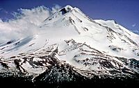
Bodies of Water Shasta Lake • Trinity Lake • Lake Almanor • Eagle Lake • Lake Oroville • Lake Siskiyou • Castle Lake • Lake McCloud • Manzanita Lake • Lake Britton • Whiskeytown LakeRivers Incorporated Cities Counties Parks Lassen Volcanic NP • Whiskeytown-Shasta-Trinity NRA • Lava Beds NM • Castle Crags Wilderness • Mount Shasta Wilderness • South Warner Wilderness • Ahjumawi Lava Springs SP • Bidwell-Sacramento River SP • McArthur-Burney Falls Memorial SP • Plumas-Eureka SP • Bidwell Mansion SHP • William B. Ide Adobe SHP • Woodson Bridge SRAMunicipalities and communities of Siskiyou County, California Cities Dorris | Dunsmuir | Etna | Fort Jones | Montague | Mount Shasta | Tulelake | Weed | Yreka
CDPs Unincorporated
communitiesBlack Butte | Callahan | Cecilville | Forks of Salmon | Klamath River | Horse Creek | Pondosa | Sawyers Bar | Scott Bar | Seiad Valley | Somes Bar
Indian reservation Categories:- Mount Shasta
- Incorporated cities and towns in California
- Cities in Siskiyou County, California


Wikimedia Foundation. 2010.