- Wind River Range
Geobox|Range
name=Wind River Range

image_caption=Wind River Range highcountry
country=United States
state=Wyoming
parent=Rocky Mountains
area_imperial=2800
length_imperial=100
length_orientation=NW/SE
width_imperial=30
width_orientation=SW/NE
highest=Gannett Peak
highest_elevation_imperial=13804
highest_lat_d=43|highest_lat_m=11|highest_lat_s=04|highest_lat_NS=N
highest_long_d=109|highest_long_m=39|highest_long_s=12|highest_long_EW=W
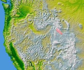
map_caption=The Wind River Range highlighted in pinkThe Wind River Range (or "Winds" for short), is amountain range of theRocky Mountains in westernWyoming in theUnited States . The range runs roughly NW-SE for approximately 100 miles (161 km). TheContinental Divide follows the crest of the range and includesGannett Peak , which at 13,804 feet (4,207 m), is the highest peak in Wyoming. There are more than 40 other named peaks in excess of 13,000 feet (3,962 m).cite web| title =Wyoming 13,000-foot Peaks| publisher =Peakbagger| url =http://www.peakbagger.com/list.aspx?lid=21344| accessdate = 2007-04-06 ] Two largeNational Forests including threewilderness areas encompass most of the mountain range.Shoshone National Forest is on the eastern side of the continental divide whileBridger-Teton National Forest is on the west. Both National Forests and the entire mountain range are an integral part of theGreater Yellowstone Ecosystem . Portions of the range are also inside theWind River Indian Reservation .Geology
The Winds are composed primarily of a granitic
batholith which isgranite rock formed deep under the surface of theEarth , over one billion years ago. Over hundreds of millions of years, rocks that were once covering this batholith eroded away. As the land continued to rise during theLaramide orogeny , further erosion occurred until all that remained were the granitic rocks. Theice age s beginning 500,000 years ago began carving the rocks into their present shapes. Within the Winds, numerous lakes were formed by theglacier s and numerous cirques, or circular valleys, were carved out of the rocks, the most well known being theCirque of the Towers , in the southern section of the range. Shoshone National Forest claims that there are 16 named and 140 unnamed glaciers just on the east side of the range for a total of 156, with another 27 reported by Bridger-Teton National Forest for the western slopes of the range. Several of these are the largest glaciers in the U.S. Rocky Mountains.Gannett Glacier which flows down the north slope of Gannett Peak, is the largest single glacier in the Rocky Mountains of the U.S., and is located in theFitzpatrick Wilderness in Shoshone National Forest.Hydrology
Several major rivers have headwaters on either side of the range. The Green and Big Sandy rivers drain southward from the west side of the range, while the Wind River drains eastward through the
Shoshone Basin . The Green is the largest fork of theColorado River while the Wind River, after changing its name to theBighorn River , is the largest fork of theYellowstone River Ecology
The Winds are known to have a small
Grizzly Bear population, primarily in the northernmost areas. Othermammal s include the black bear,elk ,moose ,mule deer ,pronghorn ,bighorn sheep , andwolverine .Bald eagle s,falcon s andhawk s are just a few of the 300 species ofbird s known to inhabit the region. The streams and lakes are home tocutthroat trout ,brown trout , Mackinaw Trout (Lake Trout), and Golden Trout. The forests are dominated bylodgepole pine ,whitebark pine ,fir andspruce .The range sits alongside many of the animal migration routes in the United States and contains several important passes, notably
South Pass , (7,412 ft / 2,301 m), at the south end of the range, which was one of the more important passes on theOregon Trail as it passed through the Rockies. Aside from South Pass, which is at the southernmost tip of the range, no roads cross the mountains until Union Pass, (9,210 ft / 2,807 m) at the northern terminus of the range.References
Cited references
External links
* [http://www.fs.fed.us/r2/shoshone/ Shoshone National Forest Federal website]
* [http://www.fs.fed.us/outernet/btnf/ Bridger-Teton National Forest Federal website]
* [http://www.mountainmancountry.com/attractions/destinations/wind-river-mountians.html General Information on the Wind River Mountains]
* [http://www.wyomingtourism.org/cms/index.php?id=53 Wyoming Tourism information]
* [http://www.cdtrail.org/ Continental Divide Trail information]
* [http://www.wyomingoutdoorcouncil.org/news/newsletter/docs/2003a/ Article discussing glacial retreat in the Wind River Range]
* [http://www.sublette.com/examiner/v5n23/v5n23s3.htm Glaciers shrinking]
Wikimedia Foundation. 2010.