- Market Street (San Francisco)
-
Coordinates: 37°46′25″N 122°25′17″W / 37.77361°N 122.42139°W
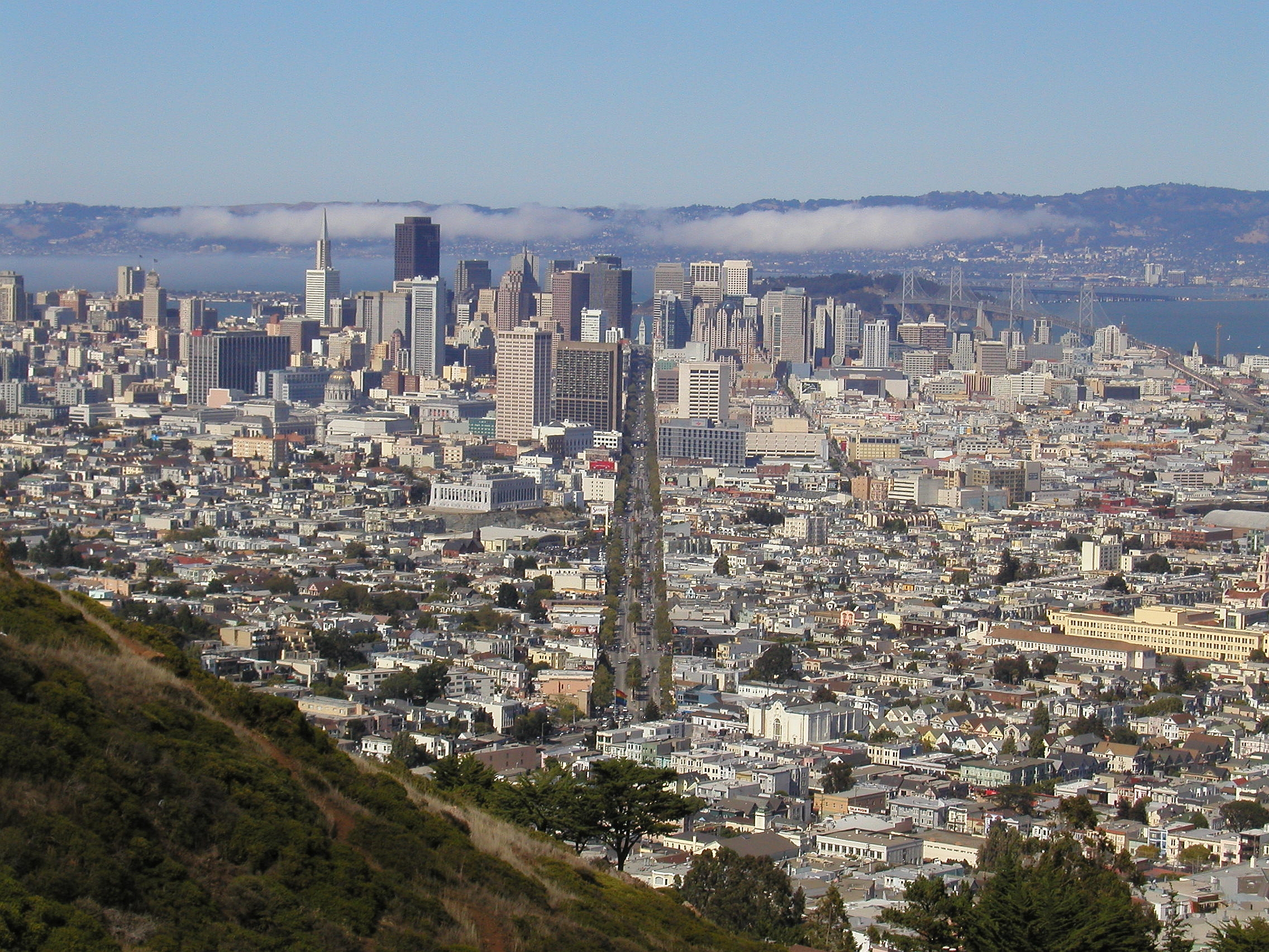
 Market Street is conspicuous in the view from Twin Peaks.
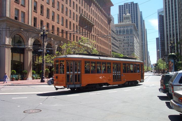
 An F Market streetcar turns around at the foot of Market Street, in front of the Ferry Building.
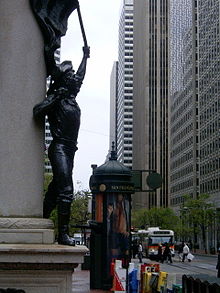 Another view of Market Street in downtown San Francisco, taken near the intersection with Montgomery Street, looking northeast towards the Ferry Building.
Market Street is an important thoroughfare in San Francisco, California. It begins at The Embarcadero in front of the Ferry Building at the northeastern edge of the city and runs southwest through downtown, passing the Civic Center and the Castro District, to the intersection with Corbett Avenue in the Twin Peaks neighborhood. Beyond this point, the roadway continues as Portola Drive into the southwestern quadrant of San Francisco.
Market Street is the boundary of two street grids. Streets on its southeast side are parallel or perpendicular to Market Street, while those on the northwest are nine degrees off from the cardinal directions.
Market Street is a major transit artery for the city of San Francisco, and has carried in turn horse-drawn streetcars, cable cars, electric streetcars, electric trolleybuses, and diesel buses. Today Muni's buses, trolleybuses, and heritage streetcars (on the F Market line) share the street, while below the street the two-level Market Street Subway carries Muni Metro and BART. While cable cars no longer operate on Market Street, the surviving cable car lines terminate to the side of the street at its intersections with California Street and Powell Street.
Market Street has been compared to Fifth Avenue, the Champs-Élysées, or the Great White Way.
Contents
History
Construction
Market Street cuts across the city for three miles (5 km) from the waterfront to the hills of Twin Peaks. It was laid out originally by Jasper O'Farrell, a 26-year old trained civil engineer who emigrated to Yerba Buena, as the town was then known. The town was renamed San Francisco in 1847 after it was captured by Americans during the Mexican-American War. O'Farrell first repaired the original layout of the settlement around Portsmouth Square and then established Market Street as the widest street in town, 120 feet between property lines. (Van Ness now beats it with 125 feet.) It was described at the time as an arrow aimed straight at "Los Pechos de la Choca" (the Breasts of the Maiden), now called Twin Peaks. Writing in Forgotten Pioneers, T.F. Pendergast wrote:
"When the engineer had completed his map of Market Street and the southern part of the city, what was regarded as the abnormal width of the proposed street excited part of the populace, and an indignation meeting was held to protest against the plan as wanton disregard for rights of landowners; and the mob, for such it was, decided for lynch law. A friend warned O'Farrell, before the crowd had dispersed. He rode with all haste to North Beach, took a boat for Sausalito, and thence put distance behind him on fast horses in relay until he reached his retreat in Sonoma. He found it discreet to remain some time in the country before venturing to return to the city."
At the time, the right-of-way of Market Street was blocked by a sixty-foot sand dune where the Palace Hotel is now, and a hundred yards further west stood a sand hill nearly ninety feet tall. The city soon filled in the ground between Portsmouth Square and Happy Valley at First and Mission Street. The dunes were leveled and the sand used for fill.
Reconstruction
Market Street underwent major changes in the late 1970s and early 1980s, when Muni Metro service was moved underground in concert with the construction of the Bay Area Rapid Transit system.
Festivities
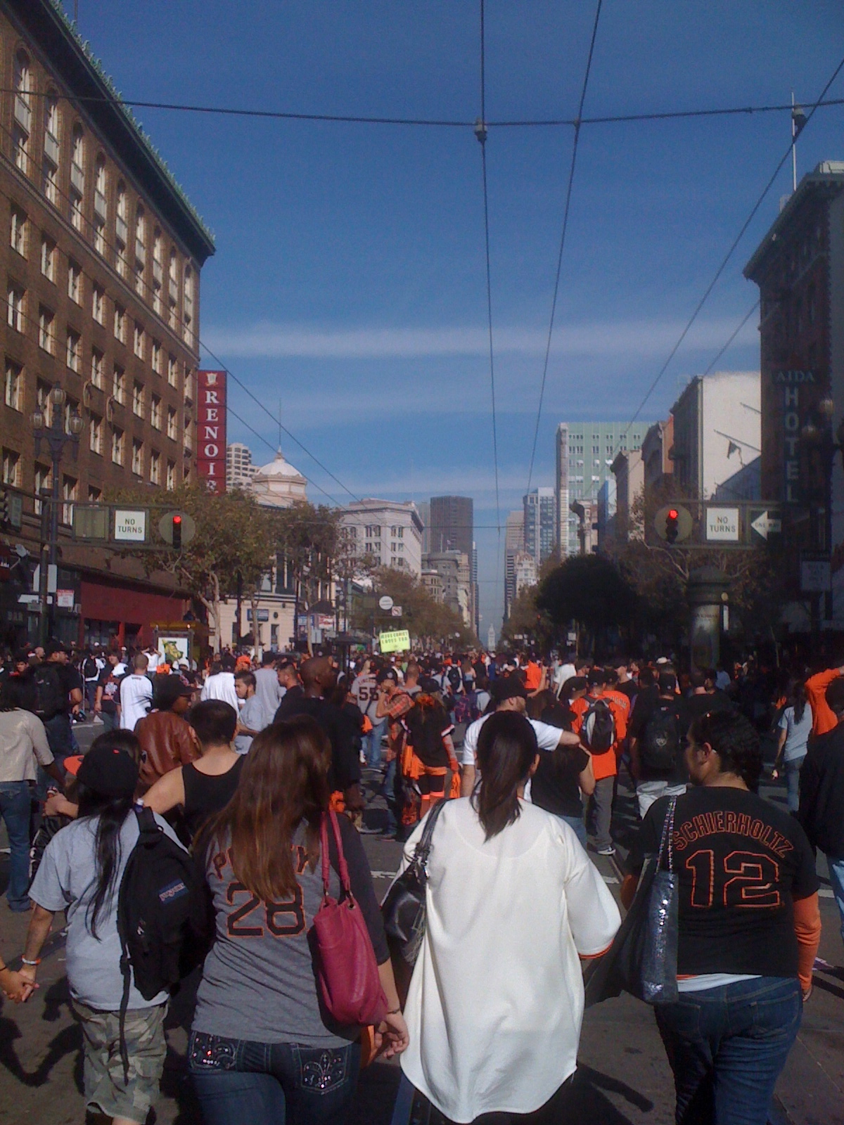
 Market Street after the San Francisco Giants World Series win
Market Street parades have long marked global events, such as the Panama-Pacific International Exposition, the Preparedness Day bombing of 1916, the parade of the influenza-masked revelers of the first Armistice Day, the 1934 general strike that paralyzed the ports of the Pacific Coast, the end of World War II. In the days of the first United Nations conferences, Anthony Eden, Molotov, Stettinius, and Bidault sped up Market street, waving to the crowds of hopefuls.
Market Street enjoyed a fine moment on Christmas Eve in 1910, when opera singer Luisa Tetrazzini (for whom the dish Tetrazzini was named) sang to the city she loved. Another historic Market Street memory was the New Year's Eve celebration at the Ferry Building on December 31, 1999. Over 1.2 million people jammed Market Street and its intersecting streets for the raucous and peaceful turn-of-the-century celebration.
Redevelopment
Central Market Community Benefit District[1] extends from Fifth to Ninth Streets,[2] and is considered part of either the "Mid Market" or "South of Market" areas.
On September 29, 2009, traffic-calming efforts took effect for a six-week test in which private automobiles would be restricted in travelling east from Sixth Street towards the Ferry Building. All eastbound traffic will be encouraged to turn right onto 10th Steet and then required to do so at 8th Street. Eastbound traffic entering Market from Seventh Street will be required to exit Market at Sixth. These traffic-calming efforts are following recent urban planning trends seeking to make streets safer and more pleasant. Drivers failing to comply would face fines.[3]
References
External links
- Photo tour of Market Street A photo tour of Market Street complete with narrative text.
- Virtual tour An aerial photo with links to buildings along Market Street
- JB Monaco Market Street Photo Gallery
- City Place, a proposed development on the 900 block of Market Street
- Short film shot from the front of a cable-car descending Market Street in 1906, days before the earthquake
 Lincoln Highway
Previous state:
TerminusCalifornia Next state:
CaliforniaStreets in San Francisco Numbered streets 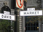
North-south streets Castro Street · Fillmore Street · Grant Avenue · Great Highway · Junipero Serra Boulevard · Kearny Street · Mission Street · Montgomery Street · Octavia Boulevard · Polk Street · Skyline Boulevard · Stockton Street · Van Ness Avenue · Vermont Street
East-west streets Diagonal streets The Embarcadero · Market Street · Columbus Avenue
Alleyways Belden Place · Jack Kerouac Alley · Macondray Lane · Maiden Lane · Balmy Alley
see also: San Francisco street toponymy Categories:- Busking venues
- Lincoln Highway
- Shopping districts and streets in the United States
- Streets in San Francisco, California
- History of San Francisco, California
- Economy of San Francisco, California

Wikimedia Foundation. 2010.