- McLaren Park
-
For the suburb of Auckland, see McLaren Park, New Zealand.
McLaren Park 
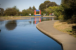
McNab Lake with PlaygroundType Municipal (San Francisco) Location San Francisco Area 317 acres (1.28 km2; 0.495 sq mi) Created 1926 Status Open all year McLaren Park is a park in south-eastern San Francisco. McLaren Park is the second largest park in San Francisco after Golden Gate Park. The park is surrounded mostly by the Excelsior, Crocker-Amazon, Visitacion Valley, Portola and University Mound neighborhoods.
Contents
History
McLaren Park was once a part of Rancho Cañada de Guadalupe la Visitación y Rodeo_Viejo. When California was part of Mexico, its then governor Juan Bautista Alvarado granted what is now known as McLaren Park to the local authorities in 1840.
In 1905, subdivisions of the land grant were drawn up and Daniel Burham recommended that the land where McLaren Park is today be a park. The land was purchased anyway by the Board of Supervisors in 1928 despite the bond measure being defeated. In 1934, John McLaren organized a dedication flag ceremony in the park, which had its name, and it is currently the second-largest park in the city.
Amenities
Coffman Pool was McLaren Park's first recreation facility constructed near Herz Playground, also in McLaren Park in 1958. A master plan for the park was published in 1959 which called for the creation of more recreational facilities. Construction of the facilities included in the Master Plan: The Gleneagles Golf Course, McNab Lake, Louis Sutter, Herz, and Mansfield-Burrows Playground, the Wilde Overlook, and the amphitheater (later to be renamed the Jerry Garcia Amphitheater), began in the 1960s, and also included new trails, picnic and parking areas, community gardens, and an irrigation system.
In the northeast corner of the park is Yosemite Marsh, a habitat for native species that include the forktail damselfly and flowering quillwort. Named a "significant natural resource area" by the city in 1995, the marsh marks the origin of Yosemite Creek, a body of water that flows through underground culverts towards Candlestick Point.[1]
External links
References
- ^ Kathleen Sullivan (March 4, 2005). "MCLAREN PARK / Competing proposals put forth to preserve marsh". The San Francisco Chronicle. http://articles.sfgate.com/2005-03-04/news/17363534_1_silt-herons-pond.
Coordinates: 37°43′05″N 122°25′08″W / 37.718°N 122.419°W
Categories:- Parks in San Francisco, California
- San Francisco County, California geography stubs
Wikimedia Foundation. 2010.

