- Mission District, San Francisco
-
This article is about a neighborhood in the United States. For the Mission District in Canada, see Mission, Calgary.
Mission District
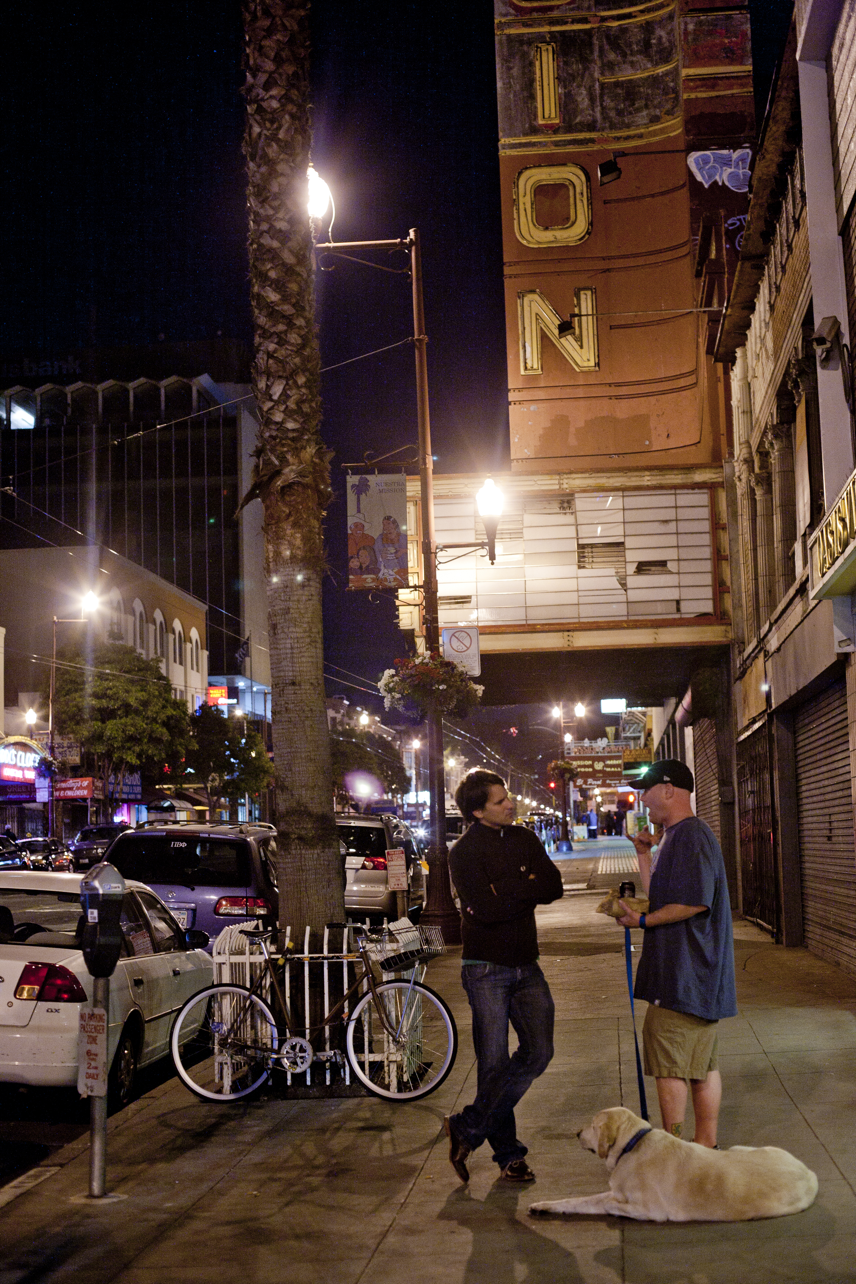
The Mission— Neighborhood of San Francisco — New Mission Theatre on Mission Street at night.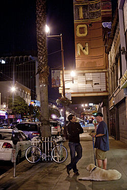 Location within Central San Francisco
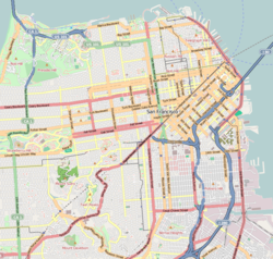
 Mission District
Coordinates: 37°45′36″N 122°24′53″W / 37.76001°N 122.41482°W Government – Board of Supervisors David Campos – State Assembly Tom Ammiano(D) – State Senate Mark Leno (D) – U.S. House Nancy Pelosi (D) Area[1] – Land 4.8 km2 (1.865 sq mi) Population (2008)[1] – Total 47,234 – Density 9,779.6/km2 (25,329/sq mi) ZIP Code 94103, 94110 Area code(s) 415 The Mission District, also commonly called "The Mission", is a neighborhood in San Francisco, California, USA, originally known as "the Mission lands"[2] meaning the lands belonging to the sixth Alta California mission, Mission San Francisco de Asis. This mission, San Francisco's oldest standing building, is located in the neighborhood.
Contents
Location and climate
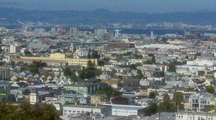 Mission District as viewed from Kite Hill.
The principal thoroughfare of the Mission District of San Francisco is Mission Street. Its borders are U.S. Route 101 to the east which forms the boundary between the eastern portion of the district, known as "Inner Mission" and its eastern neighbor, Potrero Hill, while Sanchez Street separates the neighborhoods from Eureka Valley (also known as "The Castro") and Noe Valley to the west. The part of the neighborhood from Valencia Street to Sanchez Street, north of 20th, is known as Mission Dolores. South of 20th towards 22nd, and between Valencia and Dolores Streets is a distinct sub-neighborhood known as Liberty Hill.[3] Cesar Chavez Street (formerly Army Street) is the southern border which lies next to Bernal Heights, while to the north the neighborhood is separated from South of Market roughly by Duboce Avenue and the elevated highway of the Central Freeway which runs above 13th Street. Also along Mission Street, further south-central are the Excelsior and Crocker-Amazon neighborhoods, sometimes referred to as the "Outer Mission" (not to be confused with the actual Outer Mission neighborhood). The Mission District is part of San Francisco's supervisorial districts 5, 9 and 10.
The microclimates of San Francisco create a system by which each neighborhood can have radically different weather at any given time. The Mission's geographical location insulates it from the fog and wind from the west. As a result, the Mission has a tendency to be warmer and sunnier than the rest of the city. This climatic phenomenon becomes apparent to visitors who walk downhill from 24th Street in the west from Noe Valley (where clouds from Twin Peaks in the west tend to accumulate on foggy days) towards Mission Street in the east, partly because Noe Valley is on higher ground whereas the Inner Mission is at a lower elevation.[4]
History
Prior to 1900
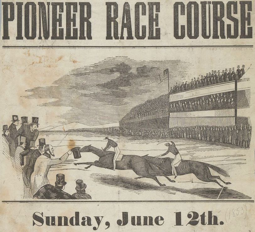
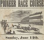 Pioneer Race Course 1853, the grandstands shown were located just south of 24th and Shotwell St.
The Yelamu Indians inhabited the region that is now known as the Mission District for over 2,000 years. Spanish missionaries arrived in the area during the late 18th century. They found these people living in two villages on Mission Creek. It was here that a Spanish priest named Father Francisco Palóu founded Mission San Francisco de Asis on June 29, 1776. The Mission was moved from the shore of Laguna Dolores to its current location in 1783.[5] Franciscan friars are reported to have used Ohlone slave labor to complete the Mission in 1791.[6] This period marked the beginning of the end of the Yelamu culture. The Indian population at Mission Dolores dropped from 400 to 50 between 1833 and 1841. Ranchos owned by Spanish-Mexican families such as the Valenciano, Guerrero, Dolores, Bernal, Noe and De Haro continued in the area, separated from the town of Yerba Buena, later renamed San Francisco (centered around Portsmouth Square) by a two mile wooden plank road (later paved and renamed Mission Street).
The lands around the nearly abandoned mission church became a focal point of raffish attractions[7] including bull and bear fighting, horse racing, baseball and dueling. A famous beer parlor resort known as The Willows was located along Mission Creek just south of 18th Street between Mission Street and San Carlos Street.[8] From 1865 to 1891 a large conservatory and zoo known as Woodward's Gardens was located along the west side of Mission Street between 13th and 15th Streets.[9] In the decades after the Gold Rush, the town of San Francisco quickly expanded, and the Mission lands were developed and subdivided into housing plots for working class immigrants, largely German, Irish and Italian,[7] and also for industrial uses.
Baseball 1868–1959
As the city grew in the decades following the Gold Rush, the Mission District became home to the first professional baseball stadium in California, opened in 1868 and known as Recreation Grounds seating 17,000 people which was located at Folsom and 25th Streets, a portion of the grounds remain as present day Garfield Square.[10] Also, in the 20th century, the Mission District was home to two other baseball stadiums, Recreation Park located at 14th and Valencia and Seals Stadium located at 16th and Bryant with both these stadiums being used by the baseball team named after the Mission District known as the Mission Reds and the San Francisco Seals.
Ethnicity trends
During European settlement of the City in the 19th and 20th century, large numbers of Irish and German immigrant workers moved into the area. Development and settlement intensified after the 1906 earthquake, as many displaced businesses and residents moved into the area, making Mission Street a major commercial thoroughfare. In 1926, the Polish Community of San Francisco converted a church on 22nd Street and Shotwell Street and opened its doors as the Polish Club of San Francisco, referred to today as the "Dom Polski", or Polish Home. The Irish American community made their mark during this time, with notable people like etymologist Peter Tamony calling the Mission home. During the 1940-1960s, large numbers of Mexican immigrants moved into the area, initiating white flight, giving the Mission the Latin character it is known for today. During the 1980s and into the 1990s, the neighborhood received a higher influx of immigrants and refugees from Central and South America fleeing civil wars and political instability at the time. These immigrants brought in many Central American banks and companies which would set up branches, offices, and regional headquarters on Mission Street.
Recent history
In the late 1970s and early 1980s the Valencia Street corridor had a lively punk night life with several clubs including The Offensive, The Deaf Club and Valencia Tool & Die and the former fire station on 16th Street, called the Compound, sported what was commonly referred to as "the punk mall", an establishment that catered to punk style and culture. On South Van Ness, Target Video and Damage Magazine were located in a three-story warehouse. The neighborhood was dubbed "the New Bohemia" by the San Francisco Chronicle in 1995.
Since at least the 1980s, a wave of gang affiliation appeared in the Mission. Branches of the Sureño and Norteño gangs settled in and engaged in criminal activities and open violence over territorial boundaries in the neighborhood, northwest and southeast respectively.[11] Also, the notorious international gang MS-13 who was originated in LA,[12] become active at the time. Although during the late 1990s and into the 2000s gang prevention programs, including a 2007 injunction,[13] have attempted to reduce the associated violence from these gangs, these kind of activities still continue to be a persistent problem for the neighborhood, resulting in uncomfortable socio-economic overlaps of a neighborhood in transision.[14][15]
Following that decade in the late 1990s and into the 2000s, and especially during the dot-com boom, young urban professionals, to twentysomethings and thirtysomethings living the hipster lifestyle moved into the area, initiating gentrification, and raising rent and housing prices, forcing many Latino middle-class families as well as artists to the Outer Mission area, or out of the city entirely to the suburbs of East Bay and South Bay area. Despite rising rent and housing prices, many Mexican and Central American immigrants continue to reside in the Mission. Although the neighborhood's high rents and home prices have led to the Latino population dropping by 20% over the last decade.[16] Most recently, the Mission has a reputation of being edgy and artsy.[17]
Landmarks and features
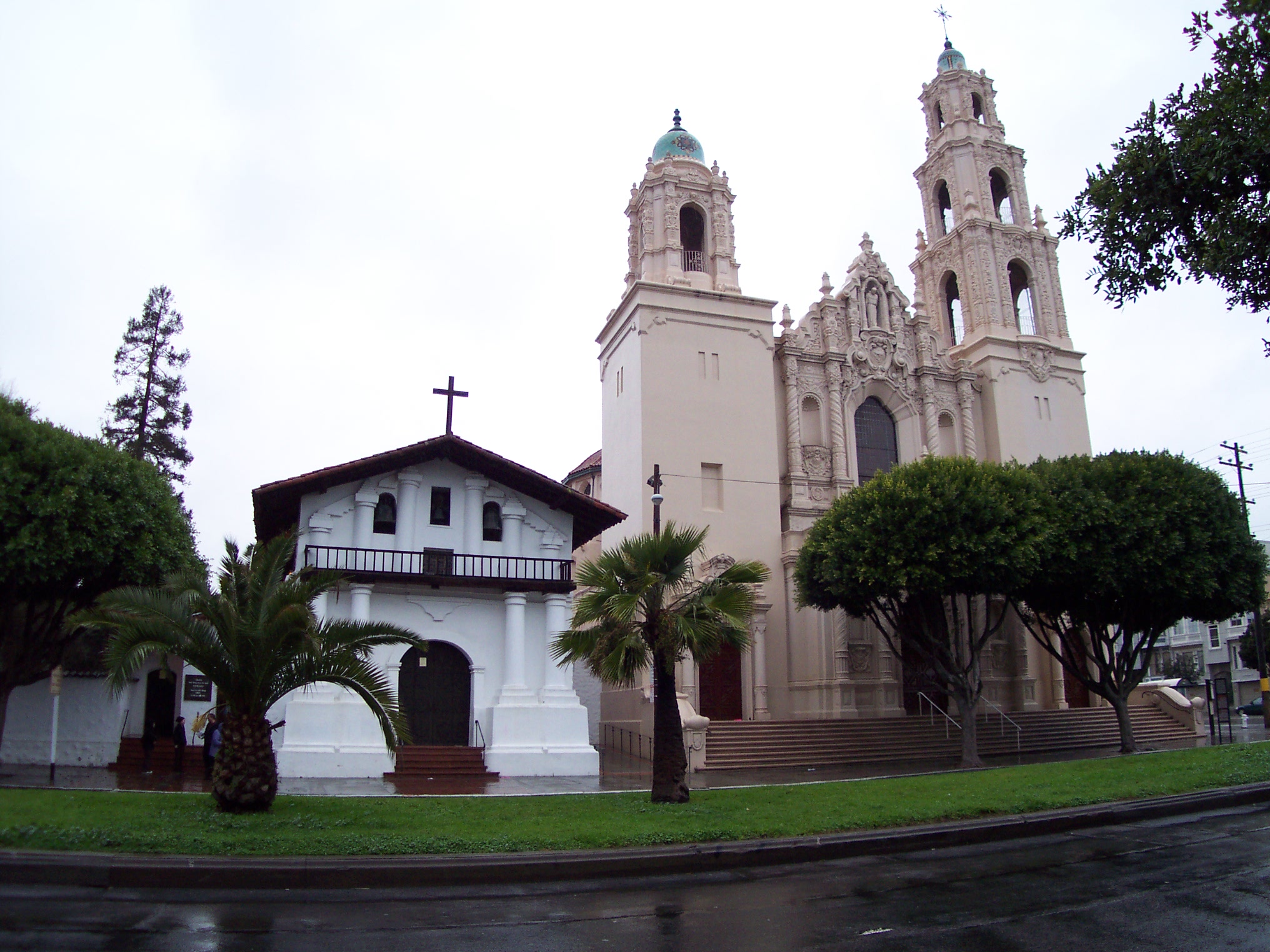
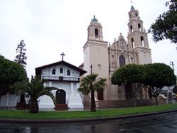 Alta California mission, Mission San Francisco de Asis, the namesake of the neighborhood, and the oldest building in the city located in the far western end of the neighborhood on Dolores Street.
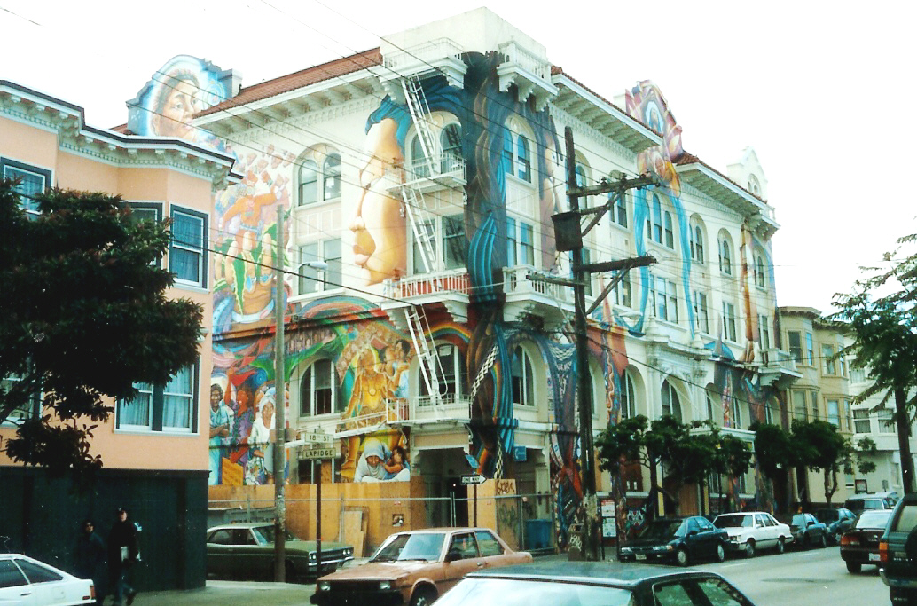
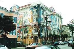 The Women's Building. Street murals and paintings of Latin American culture by local artists are a common feature and attraction
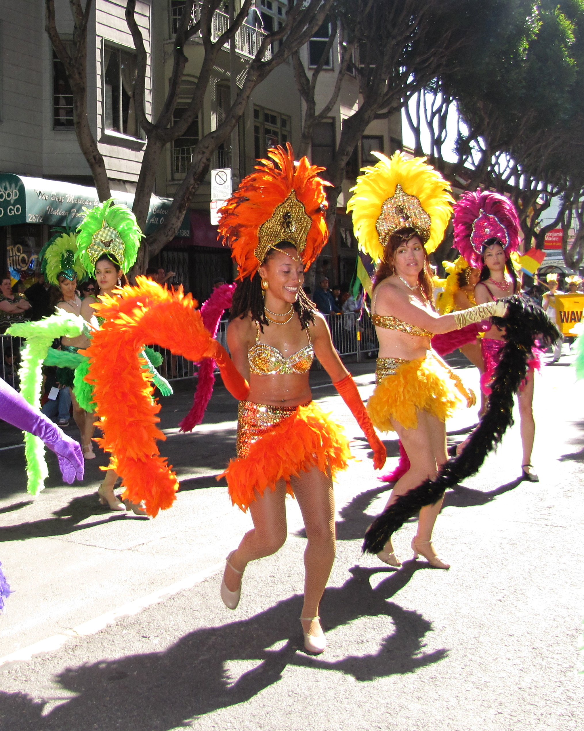
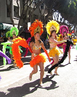 Carnival dancers, 24th Street
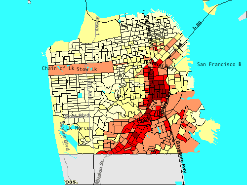
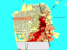 The large Latino population in the Mission District can be seen highlighted in this thematic map of San Francisco
Mission Dolores, the eponymous former mission located the far western border of the neighborhood on Dolores Street, continues to operate as a museum and as a California Historical Landmark, while the newer basilica built and opened next to it in 1913 continues to have an active congregation.
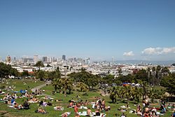
Near Mission Dolores, Dolores Park, officially Mission Dolores Park, bounded by Dolores Street, Church Street, 18th Street, and 20th Street, the largest park in the neighborhood, and one of the most popular parks in the city. Across from Dolores Park is Mission High School, built in 1927 in the Mediterranean Revival / Baroque Churrigueresque style.
Although gentrification during the 1990s and 2000s shifted the demographics and culture of the neighborhood, to account for a large younger, more White American, the Mission remains the cultural nexus and epicenter of San Francisco's, and to a lesser extent, the Bay Area's Latino, Chicano, Nicaraguan Salvadorian and Guatemalan community. While Mexican, Salvadorian, and other Latin American businesses are pervasive throughout the neighborhood, residences are not evenly distributed. Most of the neighborhood's Hispanic residents live on the eastern and southern sides. The western and northern sides of the neighborhood are more affluent and less diverse.[18]
Food
The Mission district is also famous and influential for its restaurants. Literally dozens of Taquerías are located throughout the neighborhood, showcasing a localized styling of Mexican food and is the original home of the San Francisco burrito.[19] There are also a high concentration of Salvadorean, Guatemalan, Nicaraguan, restaurants there as well as a large number of street food vendors.[20] In the last couple decades a number of high caliber of multi-ethnic specialty restaurants have gained national attention, most notably the Michelin two-star rated French restaurant Sai'son on Folsom Street. A large number of other restaurants are also popular, including: Mission Chinese Food and Foreign Cinema on Mission Street, Delfina on 18th and Alma, the Slated Door and Luna Park on Valencia.[21][22]
Art scene
Due to the existing cultural attractions, less expensive housing and commercial space, and the high density of restaurants and drinking establishments, the Mission is a magnet for young people. An independent arts community also arose and, since the 1990s, the area has been home to the Mission School art movement. Many studios, galleries, performance spaces, and public art projects are located in the Mission, including the Project Artaud, First Exposures, Southern Exposure, Art Explosion Studios, Artist Xchange, Artists' Television Access, and the oldest, alternative, not-for profit art space in the city of San Francisco, Intersection for the Arts. The Roxie Theater, the oldest continuously-operating movie theater in San Francisco, is host to repertory and independent films as well as local film festivals. Poets, musicians, emcees, and other artists sometimes gather on the southwest corner of the 16th & Mission intersection to perform.[23]
Numerous Latino artistic and cultural institutions are based in the Mission. The Mission Cultural Center for the Latino Arts, established by Latino artists and activists, is an art space. The local bilingual newspaper, El Tecolote, was founded in 1970. The Mission's Galería de la Raza, founded by local artists active in el Movimiento (the Chicano civil rights moment), is a nationally recognized arts organization. Late May, the city's annual Carnaval festival and parade marches down Mission Street. Meant to mimic the festival in Rio de Janeiro, it is held in late May instead of the traditional late February to take advantage of better weather.
Murals
Throughout the Mission walls and fences are decorated with murals initiated by the Chicano Art Mural Movement of the 1970s[24] and inspired by the traditional Mexican paintings made famous by Diego Rivera. Some of the more significant mural installations are located on Balmy Alley, and Clarion Alley.
Transit
The neighborhood is served by the BART rail system with stations on Mission Street at 16th Street and 24th Street, by Muni bus numbers 9, 12, 14, 14L, 22, 27, 33, 48, 49, 67, and along the western edge by the J Church Muni Metro line, which runs down Church Street and San Jose Avenue.
Festivals, parades and fairs
- Carnival The major event of the year occurring each Memorial Day weekend is the Mission's Carnaval celebration.[25]
- 24th Street Fair In March of each year a street fair is held along the 24th Street corridor.
- San Francisco Food Fair Annually, for several years recently, food trucks and vendor booths have sold food to tens of thousands of people along Folsom Street adjacent to La Cochina on the third weekend in September.[26]
- Cesar Chavez Holiday Parade The second weekend of April is marked by a parade and celebration along 24th Street in honor of Cesar Chavez.[27]
- Transgender and Dyke Marches. On the Fridays and Saturdays of the fourth weekend of June there are major celebrations of the Transgender and Dyke communities located at Dolores Park, followed by a march in the evenings along 18th Streets and Valencia Streets.[28][29]
- Sunday Streets Twice each year, typically in May and October, Valencia, Harrision and 24th Streets are closed to automobile traffic and opened to pedestrians and bicyclists on Sunday as part of the Sunday Streets program.[30]
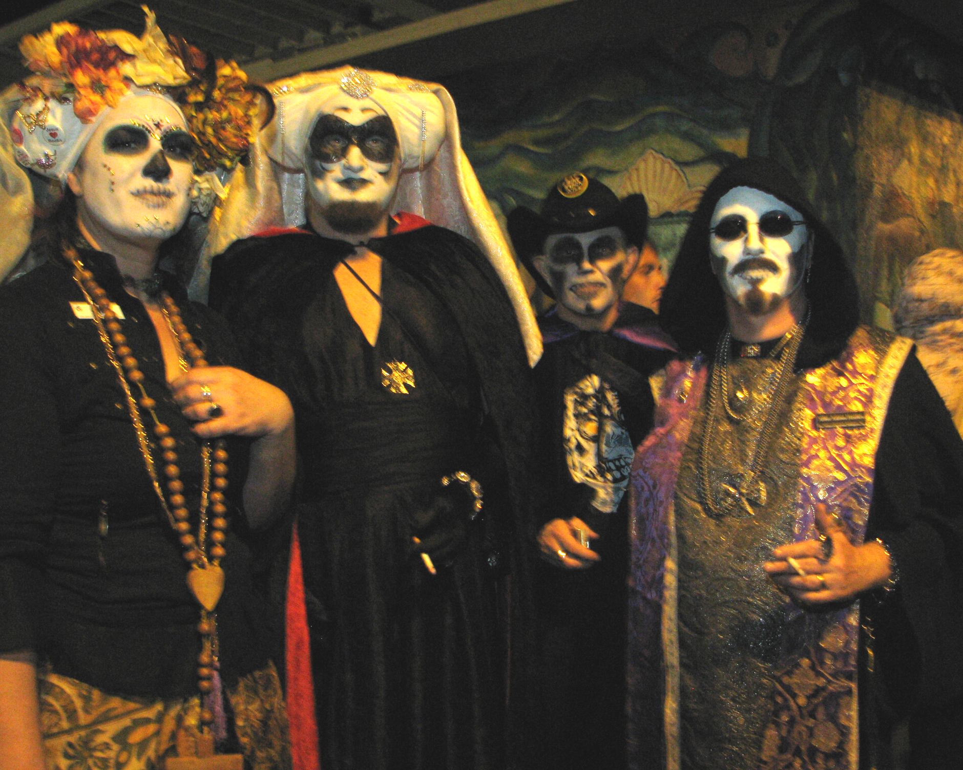
- Day of the Dead Each year on November 2, a memorial procession and celebration of the dead occurs on Harrison and 24th Street with a gathering of memorials in Garfield Square.[31]
- First Friday Monthly on the evening of the first Friday, a food and art crawl including a procession of low rider car clubs and samba dancers occurs along 24th Street from Potrero to Mission Streets.[32]
- Open Studios On the first weekend of October, the ArtSpan organization arranges a district wide exhibit of Mission District artists studios.[33]
- Hunky Jesus Contest Annually for 32 years on Easter Sunday the Sister's of Perpetual Indulgence hold an Easter Sunday celebration including a Hunky Jesus Contest in Dolores Park.[34]
- Rock Make Street Festival Annually for four years the Rock Make organization sponsors a music and arts festival in September on Treat and 18th Streets in the Mission.[35]
- LitCrawl Annually on the third Saturday of October as part of the LitQuake, a literature festival, hundreds of book and poetry readings are held at bars and bookstores throughout the Mission.[36]
- Party on Block 18 The Woman's Building organization annually, typically in August, has held a street party on 18th Street between Valencia and Guerrero streets.[37][38]
- Clarion Alley Block Party Eleven years annually, a block party on the Clarion mural alley, fourth weekend in October.[39][40]
- Remembering 1906 Annually for 105 years there has been a gathering and ceremonial gold repainting ceremony of the fire hydrant located at Church and 20th streets in honor of the only working fire hydrant that allowed the cessation of the fire following the 1906 earth quake.[41]
Music scene
The Mission is rich in musical groups and performances. Roving Mariachi bands play in restaurants throughout the district, especially in the restaurants congregated around Valencia and Mission in the northeast portion of the district. Carlos Santana spent his teenage years in the Mission, graduating from Mission High School in 1965. He has often returned to the neighborhood, including for a live concert with his band Santana that was recorded in 1969,[42] and for the KQED documentary "The Mission" filmed in 1994.[43]
The locally-inspired song "Mission in the Rain" by Robert Hunter and Jerry Garcia appeared on Garcia's solo album "Reflections", and was played by the Grateful Dead five times in concert in 1976.[44]
Classical music is heard in the concert hall of the Community Music Center on Capp Street.[45]
Elbo Room, a bar/live music venue on Valencia Street, is home to Dub Mission, a weekly reggae/dub party started in 1996 by DJ Sep and over the years has brought many luminaries of reggae and dub music to perform there.
The Mission District is also very popular for its influencing Hip-Hop/Rap music scene. Record labels like Black N Brown/ Thizz Latin and Hometeam Ent. help put Mission District rappers, like Goldtoes, mousie, Gangsta Flea, Mr. Kee, Friscasso, 10sion, The Goodfelonz, and Don Louis & Colicious, get exposure through various compilations such as 17 Reasons, 18 Wit A Bullet, Organized Crime, Filthy Livin' In The Mission, The Daily Grind 'Fillmoe 2 Da Mission,' and many others. There is a new generation of young and upcoming rappers who are emerging from this neighborhood such as G-One (R.I.P.), Los Da Rockstar, DJ Blaze, Rob Baysicc, Loco C, Young Mix and Yung Dunn to name a few.
Some other prominent musicians and musical personalities include:
- Luscious Jackson (alternative rock)
- Los Mocosos (cutting-edge salsa)
- Faith No More (alternative rock)
- Cesar Ascarrunz[46] (Salsa pianist, impresario, politician, owner of the late Cesar's Latin Palace dance club)
- The Looters
- Primus
- Chuck Prophet & The Mission Express (alternative rock)
- Beck (alternative rock)
- Jawbreaker (alternative rock)
Artists
Some well-known artists associated with the Mission District include:
- Ricardo Gouveia (a.k.a. "Rigo 23", painter, sculptor, and muralist)
- Chris Johanson (painter and street artist)
- Xiani Yngojo-Wang (painter, sculptor, and visionary)
- Eth-Noh-Tec, Kinetic Story Theater Eth-Noh-Tec (storytelling kinetic theater)
- Margaret Kilgallen (painter, printmaker, and graffiti artist)
- Barry McGee (a.k.a. "Twist", painter and graffiti artist)
- Ruby Neri (painter, sculptor, and graffiti artist)
- Michael V. Rios[47] (painter, designer, and muralist)
- Xavier Viramontes[48] (printmaker)
- Scott Williams[49]
- Craig Baldwin (filmmaker, archivist, curator)
- Dori Seda (cartoonist, painter)
- Laurie Toby Edison[50] (photographer)
- Dan Plasma (muralist)
- Whittles Graham (curator and street performer)
- The Hooks (Rock'n'Roll Group)
- Carlos Loarca (painter, muralist)
- Pico Sanchez (painter, printmaker)
See also
- 826 Valencia
- Intersection for the Arts
- Southern Exposure (art space)
- Precita Eyes – Mission Mural Project
- Garfield Square – Popular soccer field, swimming pool, playground and annual Day of the Dead shrines.
- Tartine – local bakery
- The Deaf Club
- San Francisco burrito
- The Redstone Building
- Dolores Park (includes list of neighborhood associations)
Further reading
- Hooper, Bernadette (2006). San Francisco's Mission District. Arcadia Publishing. ISBN 0-7385-4657-7.
- Mirabal, Nancy Raquel, “Geographies of Displacement: Latinas/os, Oral History, and the Politics of Gentrification in San Francisco’s Mission District,” Public Historian, 31 (May 2009), 7–31.
References
- ^ a b "Mission District (The Mission) neighborhood in San Francisco, California (CA), 94103, 94110 subdivision profile". http://www.city-data.com/neighborhood/Mission-District-San-Francisco-CA.html. Retrieved April 11, 2010.
- ^ Daily Alta California newspaper, Oct 7, 1854, page 1 column 4
- ^ Liberty Hill Neighborhood Association
- ^ San Francisco Planning Department (2005). "Inner Mission North 1853–1943 Context Statement, 2005" (PDF). Cultural Resources Survey. pp. 9, 10, 40. http://www.bicycle.sfgov.org/site/uploadedfiles/planning/preservation/InnerMiss.pdf. Retrieved November 27, 2006.
- ^ Alejandrino, Simon Velasquez (Summer, 2000). "Gentrification in San Francisco's Mission District: Indicators and Policy Recommendations" (PDF). Chapter 3: An Overview of the Mission District; History. Mission Economic Development Association. pp. 16. Archived from the original on November 12, 2006. http://web.archive.org/web/20061112235201/http://www.medasf.org/reports/mission_gentrification.pdf. Retrieved November 27, 2006.
- ^ Nolte, Carl (January 29, 2004). "Centuries-old murals revealed in Mission Dolores Indians' hidden paintings open window into S.F.'s sacred past". San Francisco Chronicle: p. A-1. http://www.sfgate.com/cgi-bin/article.cgi?file=/c/a/2004/01/29/MNGC74KEA71.DTL. Retrieved November 27, 2006.
- ^ a b VIA magazine, April 2003
- ^ BurritoJustice, March 3, 2010
- ^ SF History Encyclopedia
- ^ “The Mission Has Always Been The Home of Baseball” February 17, 2010, BurritoJustice.com [1]
- ^ Bulwa, Demian (May 27, 2005). "5 inmate gangs dominate California's prison system". The San Francisco Chronicle. http://articles.sfgate.com/2005-05-27/bay-area/17374509_1_prison-gang-mexican-mafia-gang-members-nuestra-familia.
- ^ http://www.altereddimensions.net/crime/MS13Gang.aspx
- ^ San Francisco City Attorney, 2007
- ^ http://www.thirdworldtraveler.com/Prison_System/CrimePunish_Pelican.html
- ^ Gangs and Cupcakes, The Atlantic, March 10, 2011
- ^ Los Angeles Times, Sept 21, 2011
- ^ New York Times, Sept. 14, 2008
- ^ http://www.sfgate.com/travel/neighborhoods/sf/mission_24thstreet/ sfgate.com
- ^ New York Times, May 11, 2010
- ^ Woo, Stu (November 9, 2011). "Mission Munchers Bite 'Danger Dogs' - WSJ.com". The Wall Street Journal (New York: Dow Jones). ISSN 0099-9660. http://online.wsj.com/article/SB10001424052970204190704577026243748973510.html?mod=googlenews_wsj. Retrieved 9 November 9, 2011.
- ^ New York Times, May 29, 2011
- ^ New York Times, Dec. 9, 2001
- ^ "'16th & Mission' gatherings offer raw performances and rowdy audiences – Bay Voices". http://xpress.sfsu.edu/bayvoices/2008/08/16th-mission-gatherings-offer.html. Retrieved August 18, 2009.
- ^ Latorre, Guisela (2008). Walls of empowerment: Chicana/o indigenist murals of California. Austin: University of Texas Press. pp. 30–31. ISBN 0-292-71906-X.
- ^ San Francisco Carnaval
- ^ Mission Local
- ^ [2]
- ^ Transmarch.org
- ^ The Dyke March.org
- ^ Sunday Streets SF
- ^ Day of Dead SF
- ^ First Friday, SFFunCheap
- ^ ArtSpan
- ^ SF Fun Cheap
- ^ Rock Make
- ^ LitCrawl
- ^ The Women's Building
- ^ Yelp
- ^ Fecal Face
- ^ SF Station
- ^ Guardian's of the City
- ^ CD Universe, Santana S.F. Mission District Live '69 CD
- ^ KQED, "The Mission"
- ^ David Dodd, The Annotated "Mission in the Rain"
- ^ Community Music Center San Francisco: Mission District Branch
- ^ "Cesars Productions website". http://www.cesarsproductions.com/. Retrieved April 11, 2010.
- ^ The Art of Michael Rios
- ^ Documentary, A Life in Print: Xavier Viramontes Printmaker
- ^ http://artscenecal.com/ArticlesFile/Archive/Articles2005/Articles1105/ScWilliamsA.html artscenecal.com
- ^ Laurie Toby Edison – Wikipedia
External links
- WikiTravel – overview of the district
- Western Half of The Mission – Guided photographic tour
- Eastern Half of The Mission – Guided photographic tour
- Mission Street Itself – Guided photo tour
- The Mission – Neighborhoods: The Hidden Cities of San Francisco
- Mission Dolores Neighborhood Association
- North Mission Neighborhood Association
- Project Artaud
- Artists' Television Access (ATA)
- The history of ATA – documented and created by Lex Lonehood
- Polish Club Inc. – Polish Community center in the Mission District since 1926
- San Francisco Chronicle, November 26, 1995: 'Neo-Hipsters Keep the Beat in the Mission'
- Sureño and Norteño gangs in the Mission
- New York Times, September 14, 2008: '36 Hours in San Francisco's Mission District'
- New York Times, November 20, 2005: 'San Francisco's Mission District: Eclectic, Eccentric, Electric'
- New York Times, November 5, 2000: "Mission District Fights Dot-Com Fever'
- New York Times, January 16, 1999: 'In Old Mission District: Changing Grit to Gold'
Coordinates: 37°46′N 122°25′W / 37.76°N 122.42°W
Neighborhoods of San Francisco, California Downtown Chinatown · Civic Center · Financial District · Mid-Market · Nob Hill · North Beach · Mission Bay · South of Market · Telegraph Hill · Tenderloin · Union Square
North of Downtown Cow Hollow · Fisherman's Wharf · Marina District · Pacific Heights · Presidio · Russian Hill · Treasure Island · Yerba Buena Island
Outside Lands Forest Hill · Ingleside · Ingleside Terraces · Ocean View · Parkside · Richmond · Sea Cliff · St. Francis Wood · Sunset District · West Portal · Westwood Highlands · Westwood Park
Western Addition Alamo Square · Anza Vista · Cathedral Hill · Cole Valley · Corona Heights · Duboce Triangle · Fillmore · Haight-Ashbury · Hayes Valley · Japantown · Laurel Heights · Lower Haight · Pacific Heights · Presidio · Western Addition
Southern Bayview-Hunters Point · Bernal Heights · Castro · Crocker-Amazon · Diamond Heights · Dogpatch · Eureka Valley · Excelsior District · Glen Park · Mission District · Noe Valley · Outer Mission · Portola · Potrero Hill · Visitacion Valley

Lower Haight and Duboce Triangle South of Market Mission Bay The Castro and Noe Valley 
Potrero Hill  Mission District

Glen Park and Mission Terrace Bernal Heights Islais Creek/Butchertown and Silver Terrace Categories:


Wikimedia Foundation. 2010.