- Diamond Heights, San Francisco
-
Diamond Heights — Neighborhood of San Francisco — Diamond Heights and Glen Canyon Park Location within Central San Francisco
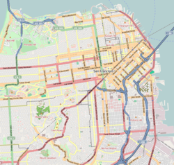
 Diamond Heights
Coordinates: 37°44′45″N 122°26′30″W / 37.7457639°N 122.4416379°W Government – Board of Supervisors Scott Wiener – State Assembly Fiona Ma (D) – State Senate Leland Yee (D) – U.S. House Jackie Speier (D) Area[1] – Total 1.1 km2 (0.436 sq mi) – Land 1.1 km2 (0.436 sq mi) Population [1] – Total 2,332 – Density 2,063.7/km2 (5,345/sq mi) 2008 ZIP Code 94131 Area code(s) 415 [2] Diamond Heights is a neighborhood in San Francisco, California.
Contents
Location
Diamond Heights is located in San Francisco, in the middle part of the city, roughly bordered by Diamond Heights Boulevard and Noe Valley on the east side and Glen Canyon Park on the west side.
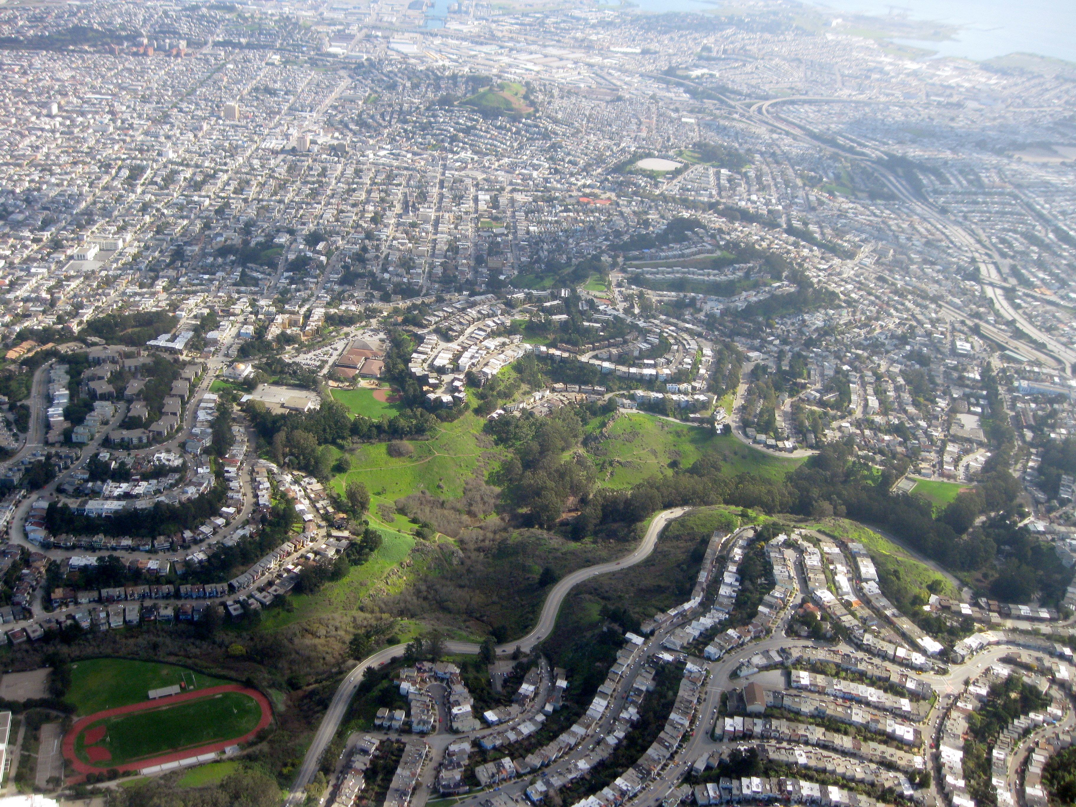
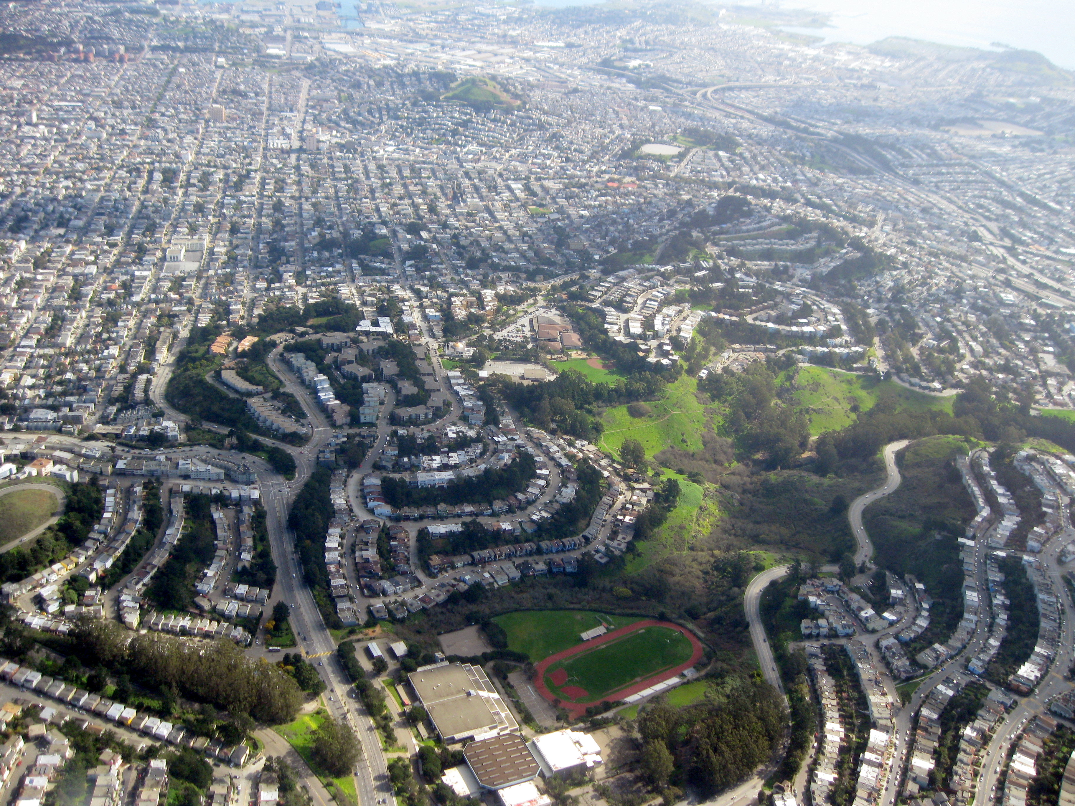
 Diamond Heights looking southeast
History
Diamond Heights was the first project of the San Francisco Planning and Urban Research Association, intended to use redevelopment powers to use land on the hills in the center of the city to be developed with, rather than against, the topography. Few existing residents needed to be relocated for the redevelopment program, which included housing for a range of incomes, churches, schools, parks, and a commercial center.
This type of redevelopment came under the California Redevelopment Law, passed in 1951, a codified version of the California Redevelopment Act which had passed in 1941.
More than half a million dollars was appropriated by the Water Department just for a water system for the redevelopment.[3] The "Diamond Heights Redevelopment Project Area B-1" plan was debated between the Board of Supervisors and the Diamond Heights Property Owners' Association. In 1955 alternative proposals to the Supervisors' plan were presented in an effort to protect the property rights of existing property owners, and to give them preference to exchange their property for other sites. The motion to add these alternative plans to the legislation were rejected by the Board. The final plan was approved on October 24, 1955.[3]
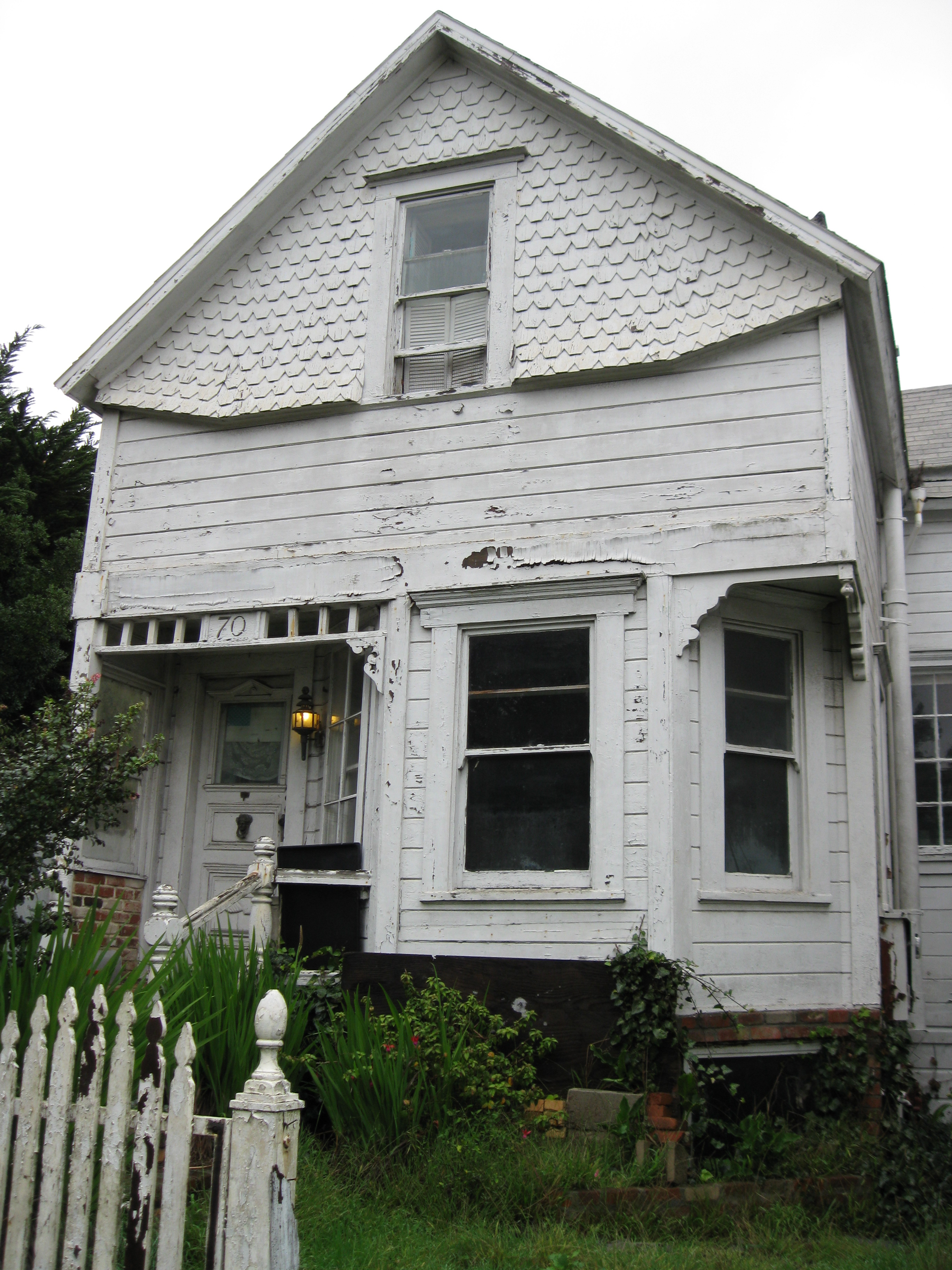
Some houses survived the redevelopment. A wood frame house with separate garage stands at 70 Gold Mine Drive, just downhill from Diamond Heights Boulevard.
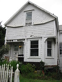 1895 House at 70 Gold Mine Dr.
According to the San Francisco Office of the Assessor, this house was built in 1895.[4]
Attractions and characteristics
Notable features of Diamond Heights include Diamond Heights Shopping Center on Diamond Heights Boulevard between Duncan Street and Gold Mine Drive, and the San Francisco Police Department's police academy on Turquoise Way. George Christopher Playground is located behind the shopping center, and Walter Haas Playground is at the intersection of Diamond Heights Boulevard and Addison Street. School of the Arts high school and the San Francisco Juvenile Probation Department's Juvenile Justice Center are both just northwest of Diamond Heights, at the intersection of Portola and Woodside.
St. Nicholas Orthodox Christian Church is at the top of Diamond Heights Boulevard, at the corner of Duncan Street.
Public transportation in Diamond Heights is provided by Muni's 35 Eureka, 48 Quintara, and 52 Excelsior lines. All connect to the Muni Metro system; the 35 goes to Castro Street Station, the 48 goes to West Portal Station, and the 52 goes to Forest Hill Station. Additionally, the 52 connects to the Bay Area Rapid Transit system at the Glen Park Station.
References
- ^ a b [1]
- ^ http://www.zipmap.net/California/San_Francisco_County/Z_Diamond_Heights.htm
- ^ a b "Proceedings of May 2, 1955 Board of Supervisors meeting". City of San Francisco. http://www.archive.org/stream/journalofproceed50sanfrich/journalofproceed50sanfrich_djvu.txt. Retrieved 2010-02-13.
- ^ "Assessor Listing 2006". City of San Francisco. http://gispubweb.sfgov.org/website/sfparcel/showlotinfo.asp?LotIDValue=7520033. Retrieved 2010-02-13.
External links
- San Francisco Planning and Urban Research Website
- Diamond Heights mid-century modern housing tract developed by architect Claude Oakland for Eichler Homes
Neighborhoods of San Francisco, California Downtown Chinatown · Civic Center · Financial District · Mid-Market · Nob Hill · North Beach · Mission Bay · South of Market · Telegraph Hill · Tenderloin · Union Square
North of Downtown Cow Hollow · Fisherman's Wharf · Marina District · Pacific Heights · Presidio · Russian Hill · Treasure Island · Yerba Buena Island
Outside Lands Forest Hill · Ingleside · Ingleside Terraces · Ocean View · Parkside · Richmond · Sea Cliff · St. Francis Wood · Sunset District · West Portal · Westwood Highlands · Westwood Park
Western Addition Alamo Square · Anza Vista · Cathedral Hill · Cole Valley · Corona Heights · Duboce Triangle · Fillmore · Haight-Ashbury · Hayes Valley · Japantown · Laurel Heights · Lower Haight · Pacific Heights · Presidio · Western Addition
Southern Bayview-Hunters Point · Bernal Heights · Castro · Crocker-Amazon · Diamond Heights · Dogpatch · Eureka Valley · Excelsior District · Glen Park · Mission District · Noe Valley · Outer Mission · Portola · Potrero Hill · Visitacion Valley
Coordinates: 37°44′45″N 122°26′30″W / 37.7457639°N 122.4416379°W
Categories:

Wikimedia Foundation. 2010.