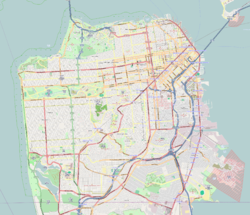
- Crocker-Amazon, San Francisco
-
Crocker Amazon — Neighborhood of San Francisco — Location within San Francisco Coordinates: 37°42′46″N 122°26′22″W / 37.71282°N 122.43945°W Government - Board of Supervisors John Avalos - State Assembly Fiona Ma (D) - State Senate Leland Yee (D) - U.S. House Nancy Pelosi (D) Area[1] - Total 1.5 km2 (0.568 sq mi) - Land 1.5 km2 (0.568 sq mi) Population (2008) - Total 11,902 - Density 8,091.5/km2 (20,957/sq mi) [2] ZIP Code 94112 Area code(s) 415 Crocker-Amazon is a neighborhood in San Francisco.
Location
Crocker-Amazon borders the Excelsior District. Crocker-Amazon covers the area south of Mission Street and Geneva Avenue, extending toward suburban Daly City. The neighborhood is adjacent to Crocker-Amazon Park, named after the Charles Crocker land holdings that once made up the area, and Amazon Street in the Excelsior. The winding streets of the neighborhood straddle the border between San Francisco and Daly City and largely blend in with the adjacent Daly City neighborhoods of Crocker and Southern Hills.
Attractions and characteristics
Crocker-Amazon neighborhood is slightly more affluent than the Excelsior, but retains much of the same racial diversity, including a large Filipino community. The majority of the neighborhood consists of single family homes. Since many San Franciscans are unaware of its existence[citation needed], home prices in Crocker-Amazon tend to be more reasonable than in other, better known neighborhoods.
McLaren Park, San Francisco's second largest park after Golden Gate, borders Crocker-Amazon to the north. It has four playgrounds, recently renovated and lighted soccer and baseball fields, a golf course, two lakes, jogging and hiking trails, a public pool, an old reservoir that is used as a dog swimming area, and the Jerry Garcia Amphitheater which houses concerts and festivals.
The neighborhood benefits from some of the most varied weather in the city, with a balance of sun and fog. The top of the neighborhood boasts outstanding views of downtown San Francisco in the gap between McLaren Park and Twin Peaks. Parts of the neighborhood, particularly heading toward Southern Hills, feature free-standing single-family homes with at least 10 feet on either side (in many San Francisco neighborhoods, there is a gap of no more than a few inches between homes). The diverse architecture of the homes throughout the neighborhood include Marina, Arts & Crafts, Victorian, Edwardian, and Mid-Century Modern styles.
The area is well-served by public transportation. MUNI Routes 8X, 8BX, and 54 serve the Geneva Avenue corridor and the 43 bus also serves Geneva Avenue, as well as Naples, Cordova, and Munich Streets. During rush hour, the Balboa Park Bart Station is only about a five minute drive, an eight minute bus ride, or a 15 minute walk. The neighborhood is convenient to nearby Interstate 280, and to the Alemany Boulevard thoroughfare. Crocker-Amazon is served by two elementary schools, Guadalupe and Longfellow.
Geneva Avenue and Mission Street, which bound the neighborhood, feature commercial businesses, including a barber shop, pizzerias, pharmacies, a hardware store and a vegetable market, as well as a growing number of restaurants and cafes.
References
Neighborhoods of San Francisco, California Downtown Chinatown · Civic Center · Financial District · Mid-Market · Nob Hill · North Beach · Mission Bay · South of Market · Telegraph Hill · Tenderloin · Union Square
North of Downtown Cow Hollow · Fisherman's Wharf · Marina District · Pacific Heights · Presidio · Russian Hill · Treasure Island · Yerba Buena Island
Outside Lands Forest Hill · Ingleside · Ingleside Terraces · Ocean View · Parkside · Richmond · Sea Cliff · St. Francis Wood · Sunset District · West Portal · Westwood Highlands · Westwood Park
Western Addition Alamo Square · Anza Vista · Cathedral Hill · Cole Valley · Corona Heights · Duboce Triangle · Fillmore · Haight-Ashbury · Hayes Valley · Japantown · Laurel Heights · Lower Haight · Pacific Heights · Presidio · Western Addition
Southern Bayview-Hunters Point · Bernal Heights · Castro · Crocker-Amazon · Diamond Heights · Dogpatch · Eureka Valley · Excelsior District · Glen Park · Mission District · Noe Valley · Outer Mission · Portola · Potrero Hill · Visitacion Valley
List · Category · Portal Coordinates: 37°42′46″N 122°26′22″W / 37.71282°N 122.43945°W
Categories:- Neighborhoods in San Francisco, California
- San Francisco, California stubs
Wikimedia Foundation. 2010.

