- Cole Valley, San Francisco
-
Cole Valley — Neighborhood of San Francisco — Location within Central San Francisco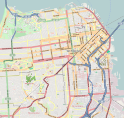
 Cole Valley
Coordinates: 37°45′53″N 122°26′59″W / 37.76485°N 122.44975°W Government - Board of Supervisors Ross Mirkarimi - State Assembly Tom Ammiano (D) - State Senate Mark Leno (D) - U.S. House Nancy Pelosi (D) Area[1] - Total 0.4 km2 (0.169 sq mi) - Land 0.4 km2 (0.169 sq mi) Population (2008)[2] - Total 4,192 - Density 9,552.2/km2 (24,740/sq mi) ZIP Code 94117 Area code(s) 415 [3] Cole Valley is a small neighborhood in San Francisco.
Contents
Location
Its boundaries are usually considered to be Stanyan Street to the west, Carmel Street to the south, Clayton Street to the east, and Waller Street to the north. The main commercial strip is condensed into two blocks along Cole Street, between Parnassus Avenue to the south and Frederick Street to the north.
It is very close to Haight-Ashbury, and is sometimes considered a sub-area of that district. It is also close to the Inner Sunset.
History
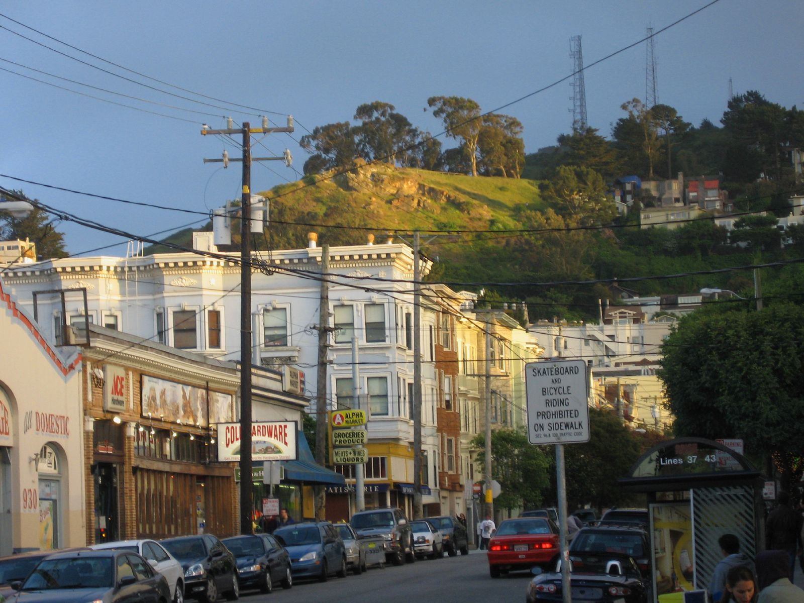
 Cole Valley from below
Cole Valley grew up around the streetcar stop at the entrance to the Sunset Tunnel at the intersection of Carl and Cole Streets. That intersection is still the center of the neighborhood's small business district, and the N Judah light rail line still stops there.
Cole Valley was popular with dot-commers during the late 1990s dot-com bubble. Craig Newmark, founder of Craigslist, is a recent former resident, and still an habitué of Cole Valley's cafes. Today the neighborhood is home to a mix of young professionals and some University of California, San Francisco residents and staff.
References
External links
- ColeValleySF.com
- San Francisco Neighborhoods (Cole Valley)
- Cole Valley Home Page
- colevalley.org
- Cole Valley Improvement Association (CVIA): includes information on the annual Cole Valley Street Fair, in September.
- SF Station - Cole Valley
Related information
Neighborhoods of San Francisco, California Downtown Chinatown · Civic Center · Financial District · Mid-Market · Nob Hill · North Beach · Mission Bay · South of Market · Telegraph Hill · Tenderloin · Union Square
North of Downtown Cow Hollow · Fisherman's Wharf · Marina District · Pacific Heights · Presidio · Russian Hill · Treasure Island · Yerba Buena Island
Outside Lands Forest Hill · Ingleside · Ingleside Terraces · Ocean View · Parkside · Richmond · Sea Cliff · St. Francis Wood · Sunset District · West Portal · Westwood Highlands · Westwood Park
Western Addition Alamo Square · Anza Vista · Cathedral Hill · Cole Valley · Corona Heights · Duboce Triangle · Fillmore · Haight-Ashbury · Hayes Valley · Japantown · Laurel Heights · Lower Haight · Pacific Heights · Presidio · Western Addition
Southern Bayview-Hunters Point · Bernal Heights · Castro · Crocker-Amazon · Diamond Heights · Dogpatch · Eureka Valley · Excelsior District · Glen Park · Mission District · Noe Valley · Outer Mission · Portola · Potrero Hill · Visitacion Valley
List · Category · Portal Coordinates: 37°45′53″N 122°26′59″W / 37.76485°N 122.44975°W
Categories:- Neighborhoods in San Francisco, California
- San Francisco County, California geography stubs

Wikimedia Foundation. 2010.